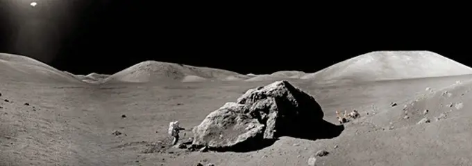
My Boards
View Pictures
  • My Boards

Mars Landscape Photography

Black-and-white images of the Martian landscape captured by rovers, showcasing rocky terrains and panoramic views of the Martian surface.

This image shows a sweeping black-and-white panorama of the rounded, knob-like peak of Husband
161 assets in this story
6145-44664970
Chasma Boreale Scarp
6145-44688323
Spirit Begins Third Martian Year
6145-44966136
NASA's Opportunity used its Pancam to record this view of the rise in the foreground, called 'Nobbys Head.' This view is centered toward the south-southeast, with Opportunity's next destination, 'Solander Point,' toward the right edge of the view.
6145-44606906
Spirit Looks Back
6145-45008423
On Feb. 19, 2014, NASA's Curiosity Mars rover looked back after finishing a long drive. The rows of rocks just to the right of the fresh wheel tracks in this view are an outcrop called 'Junda.' This view is looking toward the east-northeast.
6145-45086233
This view NASA's Curiosity Mars Rover shows the rover's drill in position for a mini-drill test to assess whether a rock target called 'Mojave' is appropriate for full-depth drilling to collect a sample. It was taken on Jan. 13, 2015.
6145-44709200
Digging of 'Snow White' Begins
6145-44911415
This 360-degree panorama from NASA's Mars rover Curiosity shows the rocky terrain of 'Rocknest' surrounding it as of its 55th Martian day, or sol, of the mission (Oct. 1, 2012).
6145-58967708
NASA's Mars Exploration Rover Opportunity recorded this view of the western edge of 'Cape York,' a segment of the rim of Endeavour Crater. A bright vein, informally named 'Homestake,' is visible on the right side of the image.
6145-45240042
AS14-64-9099 (6 Feb. 1971) --- An Apollo 14 crew member (note shadow) photographs this field of boulders located on the flank of Cone Crater during the second extravehicular activity (EVA). This view is looking just north of west. While astronauts Alan B. Shepard Jr., commander, and Edgar D. Mitchell, lunar module pilot, were exploring the moon, astronaut Stuart A. Roosa, command module pilot, was maneuvering the Apollo 14 Command and Service Modules (CSM) in lunar orbit.
6145-44620958
In this Apollo 17 onboard photo, a Lunar Roving Vehicle (LRV) is parked beside a huge boulder near the Valley of Tourus-Litttrow on the lunar surface. The seventh and last manned lunar landing and return to Earth mission, the Apollo 17, carrying a crew of three astronauts Mission Commander Eugene A. Cernan; Lunar Module pilot Harrison H. Schmitt; and Command Module pilot Ronald E. Evans, lifted off on December 7, 1972 from the Kennedy Space Flight Center (KSC). Scientific objectives of the Apollo 17 mission included geological surveying and sampling of materials and surface features in a preselected area of the Taurus-Littrow region, deploying and activating surface experiments, and conducting in-flight experiments and photographic tasks during lunar orbit and transearth coast (TEC). These objectives included Deployed experiments such as the Apollo lunar surface experiment package (ALSEP) with a Heat Flow experiment, Lunar seismic profiling (LSP), Lunar surface gravimeter (LSG), Lunar
4389-181
Photo Mosaic 180 Degree Panorama of Bonneville Crater, Mars from Spirit Rover
6145-44554434
Sojourner Does a Wheelie on Yogi
6145-45072220
This image from NASA's Mars Curiosity rover shows the 'Amargosa Valley,' on the slopes leading up to Mount Sharp on Mars. The rover is headed toward the 'Pahrump Hills' outcrop.
6145-44608596
At Home in the Crater
6145-44624848
This stereo view is from NASA's Mars Exploration Rover Spirit as it was investigating a rock called 'Mazatzal' on the rim of 'Bonneville Crater.' 3D glasses are necessary to view this image.
6145-44749656
Spirit Near Stapledon on Sol 1802 (Stereo)
6145-45245126
This enhanced color image of the Pathfinder landing site shows the eastern horizon. The elongated, reddish, low contrast region in the distance is Roadrunner Flats. This image was taken by the Imager for Mars Pathfinder (IMP). Sojourner spent 83 days of a planned seven-day mission exploring the Martian terrain, acquiring images, and taking chemical, atmospheric and other measurements. The final data transmission received from Pathfinder was at 10 23 UTC on September 27, 1997. Although mission managers tried to restore full communications during the following five months, the successful mission was terminated on March 10, 1998. http //photojournal.jpl.nasa.gov/catalog/PIA00979
6145-44904747
NASA's Mars Exploration Rover Opportunity captured this view of its afternoon shadow stretching into Endeavour Crater during the 3,051st Martian day, or sol, of Opportunity's work on Mars (Aug. 23, 2012).
6145-51409970
Moa bone hollow, 19 January 1933, by Leslie Adkin.
6145-44608591
Peeling Back the Layers of Mars
6145-44903450
The Chemistry and Camera (ChemCam) instrument on NASA's Mars rover Curiosity used its laser to examine side-by-side points in a target patch of soil, leaving the marks apparent in this before-and-after comparison.
6145-44483884
NASA's Perseverance Mars rover looks out at an expanse of boulders on the landscape in front of a location nicknamed Santa Cruz on Feb. 16, 2022, the 353rd Martian day, or sol, of the mission. This panorama is made up 24 individual images from the rover's Mastcam-Z camera system stitched together after they were sent back from Mars. Figure 1 shows a cropped version of the same image. A key objective for Perseverance's mission on Mars is astrobiology, including the search for signs of ancient microbial life. The rover will characterize the planet's geology and past climate, pave the way for human exploration of the Red Planet, and be the first mission to collect and cache Martian rock and regolith (broken rock and dust). Subsequent NASA missions, in cooperation with ESA (European Space Agency), would send spacecraft to Mars to collect these sealed samples from the surface and return them to Earth for in-depth analysis. The Mars 2020 Perseverance mission is part of NASA's Moon to Mars ex
6145-44495141
Sojourner's APXS at Moe - Left Eye
6145-44628757
Heat Shield Flank Close Up
6145-44685105
After Opportunity's First Drive in Six Weeks
6145-44646611
This image was taken with Opportunity's navigation camera of a large dune on the way to Victoria
6145-45054383
This image from the Navigation Camera (Navcam) on NASA's Curiosity Mars rover shows two holes at top center drilled into a sandstone target called 'Windjana.' The farther hole, with larger pile of tailings around it, is a full-depth sampling hole.
6145-44705990
On Solid Ground
6145-44620969
Deep Hole in 'Clovis'
6145-44607010
They
6145-44608315
Stone Mountain in Context
6145-44619410
'Endurance' All Around (cylindrical)
6145-51410597
Midden number 4, 11 September 1932, by Leslie Adkin.
6145-44713189
This anaglyph, acquired by NASA's Phoenix Lander's Surface Stereo Imager on June 19, 2008, shows a view of the Martian surface near the lander. The trench shown here is informally called 'Snow White 1.' 3D glasses are necessary.
6145-44557352
Sojourner's APXS at Moe - Right Eye
1746-19671201
This full-resolution image from NASA's Curiosity shows the turret of tools at the end of the rover's extended robotic arm.
6145-52961044
. Curiosity's Navcams View Its Wheels. NASA's Curiosity Mars rover captured this image of its right rear wheels using its navigation cameras on June 1, the 3,846th Martian day, or sol, of the mission. The image was taken while the rover was attempting to climb a 23-degree slope covered with slippery sand and wheel-size boulders. Rover tracks from the approach to this location can be seen in the sand at the top of the image. The rover slipped in the sand, causing it to veer off its intended route and prompting its right middle wheel to drive up on to the bright, long rock seen at the left of the image. Driving over this rock was not intended, and the large movement of the suspension triggered a safety fault, stopping the drive. In response, rover planners chose to back away from this spot and try climbing the slope a few feet from here. Curiosity experienced several more faulted drives before a decision was made to pursue a detour on less difficult terrain about 492 feet (150 meters) aw
6145-45099013
This self-portrait of NASA's Curiosity Mars rover shows the vehicle at the 'Big Sky' site, where its drill collected the mission's fifth taste of Mount Sharp.
6145-45235459
AS15-84-11250 (31 July-2 Aug. 1971) --- A telephoto lens view of the prominent feature called Silver Spur in the Hadley Delta region, photographed during the Apollo 15 lunar surface extravehicular activity (EVA) at the Hadley-Apennine landing site. The distance from the camera to the spur is about 10 miles. The field of view across the bottom is about one mile. Structural formations in the mountain are clearly visible. There are two major units. The upper unit is characterized by massive subunits, each one of which is approximately 200 feet deep. The lower major unit is characterized by thinner bedding and cross bedding.
6145-44831452
During a long drive on Labor Day, NASA's Mars Exploration Rover Opportunity reached the estimated halfway point of its journey from Victoria Crater to Endeavour Crater.
6145-45135169
This 360-degree mosaic from the Mastcam on NASA's Curiosity Mars rover looks out over a portion of the Bagnold Dunes, which stretch for several miles.
6145-45260181
Vera Rubin Ridge, a favored destination for NASA's Curiosity Mars rover even before the rover landed in 2012, rises near the rover nearly five years later in this panorama from Curiosity's Mast Camera (Mastcam). The scene combines 23 images taken with the Mastcam's right-eye, telephoto-lens camera, on June 22, 2017, during the 1,734th Martian day, or sol, of Curiosity's work on Mars. The rover began ascending the ridge in September 2017. This and other Mastcam panoramas show details of the sedimentary rocks that make up the Vera Rubin Ridge. This distinct topographic feature located on the lower slopes of Mount Sharp (Aeolis Mons) is characterized by the presence of hematite, an iron-oxide mineral, which has been detected from orbit. The Mastcam images show that the rocks making up the lower part of the ridge are characterized by distinct horizontal stratification with individual rock layers of the order of several inches (tens of centimeters) thick. Scientists on the mission are using
6145-44610735
Patches of Hematite
4389-340
Apollo 17 - Working in the Moon's Taurus-Littrow Valley
6145-44610738
Observing the sky with the green filter of it panoramic camera, NASA's Mars Exploration Rover Spirit came across a surprise: a streak across the sky, probably the brightest object in the sky at the time.
6145-44607540
NASA Dedicates Martian Landmarks To Apollo 1 Crew
6145-44620492
Window to 'Clovis's' Altered Past
6145-44945265
These three versions of the same image taken by the Mast Camera (Mastcam) on NASA's Mars rover Curiosity illustrate different choices that scientists can make in presenting the colors recorded by the camera.
6145-45093116
NASA's Curiosity Mars rover recorded this view of the sun setting at the close of the mission's 956th Martian day, or sol (April 15, 2015), from the rover's location in Gale Crater.
6145-44859135
NASA's Mars Exploration Rover Opportunity took this stereo view of a crater informally named 'Freedom 7' shortly before the 50th anniversary of the first American in space: astronaut Alan Shepard's flight in the Freedom 7 spacecraft. You need 3D glasses.
6145-44722184
Ice Cold Sunrise on Mars
6145-44936417
From a position in the shallow 'Yellowknife Bay' depression, NASA's Mars rover Curiosity used its right Mast Camera (Mastcam) to take the telephoto images combined into this panorama of geological diversity.
6145-58981792
Moa bone hollow gelatin silver negatives, black-and-white negatives
6145-44557590
Wind Drifts at Viking 1 Landing Site
6145-44558089
Big Crater as Viewed by Pathfinder Lander
6145-44713182
This anaglyph, acquired by NASA's Phoenix Lander on Jun. 15, 2008, shows the largest rock informally called 'Midgard.' 3D glasses are necessary to view this image.
6145-58983940
Whaling in the Ross sea Nitrate negatives, black-and-white negatives
6145-44483354
This video shows NASA's Perseverance Mars rover using its auto-navigation, or AutoNav, technology to guide it during its drive to the delta. The video combines imagery taken on April 9, 2022, the 404th Martian day, or sol, of the mission, when Perseverance drove 841.7 feet (256.55 meters), with imagery taken on the following Martian day (sol 405), when it travelled 869.35 feet (264.98 meters). AutoNav allows the rover to autonomously re-plan its route around rocks or other obstacles on its way to a pre-established destination. The video was taken by the rover's navigation cameras; they are capable of color, but black-and-white images are better for navigation. The video has been sped up by roughly 200 times with about 30 seconds between frames. A key objective for Perseverance's mission on Mars is astrobiology, including the search for signs of ancient microbial life. The rover will characterize the planet's geology and past climate, pave the way for human exploration of the Red Planet
6145-45072781
This annotated image depicts the backup landing site (Site C) chosen for ESA's Rosetta spacecraft's Philae lander.
6145-44627736
Dust on Mars: Before and After (Spirit)
PREVIOUS
of 2
NEXT
2401 S. Ervay, Suite 206
Dallas, Texas 75215
United States
Get Started
Free ResearchMy BoardsMy Cart
For Creators
How To License Your ContentContributor PortalFrame of Mind
Resources
API accessPricing
Contact
+1 866 236 0087help@viewpictures.co.uk Contact form
©2026 View Pictures. All Rights Reserved. -A
This site is protected by reCAPTCHA and Google Privacy Policy and Terms of Service apply.