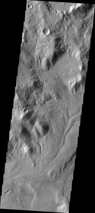
My Boards
View Pictures
  • My Boards

Mars Terrain Exploration

High-resolution images from Mars showcasing diverse geological features like valleys, craters, and chaotic terrains captured by spacecraft.

Channels
Channels
365 assets in this story
6145-44606768
Central Gusev
6145-44602465
Terra Sirenum
6145-58967764
This image from NASA's 2001 Mars Odyssey spacecraft of the eastern flank of Ascraeus Mons shows multiple collapse features.
6145-45298497
This false color image shows part of the floor of an unnamed crater in Terra Sabaea. The material in part of the crater floor has been eroded by the wind. The small blue dots are sand dunes. In this false color combination basaltic sand is typically a dark blue. The THEMIS VIS camera contains 5 filters. The data from different filters can be combined in multiple ways to create a false color image. These false color images may reveal subtle variations of the surface not easily identified in a single band image. Orbit Number 64281 Latitude -24.9701 Longitude 46.0487 Instrument VIS Captured 2016-06-10 17 03
6145-44493041
Mangala Fossae. The complex channel at the top of the image is part of Mangala Fossae. At the top of this image the main graben is interacting with a preexisting impact creater. Other depression towards the bottom of the image are simple linear features. Mangala Fossae are long linear depressions called a graben and were formed by extension of the crust and faulting. When large amounts of pressure or tension are applied to rocks on timescales that are fast enough that the rock cannot respond by deforming, the rock breaks along faults. In the case of a graben, two parallel faults are formed by extension of the crust and the rock in between the faults drops downward into the space created by the extension. Mangala Fossae is 828 km long (514 miles). Orbit Number 91348 Latitude -20.1261 Longitude 207.108 Instrument VIS Captured 2022-07-18 21 30
6145-44601418
Concentric Crater Floor Deposits in Daedalia Planum
6145-44839545
This image from NASA's Mars Odyssey shows lava flows of Alba Mons and windstreaks behind craters in the area. Windstreak tail directions indicate winds from the East and East-Northeast.
6145-44665483
Deposits in Electris Region
6145-44648488
Back by popular demand: THEMIS ART IMAGE #64 Give me a kiss, this depression looks like lips. And could it be a bug in the upper left
6145-44700977
Small Volcano
6145-44484427
This region of arcuate fractures and chaos on the highland/lowland boundary is called Avernus Colles. Orbit Number 88691 Latitude 2.44735 Longitude 178.064 Instrument VIS Captured 2021-12-12 02 56
6145-44483219
Today's VIS image shows a section of Bahram Vallis. This channel is located in northern Lunae Planum, south of Kasei Valles. Bharam Vallis drains from the higher elevations of Lunae Planum towards the Chryse Planitia basin. This channel is over 300km long (186miles). Orbit Number 88175 Latitude 20.6178 Longitude 302.162 Instrument VIS Captured 2021-10-30 15 19
6145-58971906
Today's VIS image shows a small section of Nirgal Valles. Located in Noachis Terra, Nirgal Valles is 610km long (379 miles). Orbit Number 82110 Latitude -27.3723 Longitude 316.499 Instrument VIS Captured 2020-06-18 05 57
6145-44665481
Cratered Cones near Hephaestus Fossae
6145-44593655
The remarkable terrain at the 'center' of Mars (0 degrees latitude and longitude), as seen in this NASA Mars Odyssey image, is called Meridiani Planum. It hosts a rare occurrence of gray crystalline hematite.
6145-45088553
This image captured by NASA's 2001 Mars Odyssey spacecraft shows an example of a central peak crater. This unnamed crater is located on the floor of Newton Crater in Terra Sirenum.
6145-44665727
This image from the Deuteronilus Mensae region shows an interesting portion of the martian dichotomy. It appears that the crater in the upper part of the image is being re-exposed after burial
6145-44666819
Slope Streaks in Terra Sabaea
6145-45264381
The large complex dune form in this VIS image is located on the floor of Russell Crater. Russell Crater is in Noachis Terra. Orbit Number 73050 Latitude -54.0257 Longitude 12.7518 Instrument VIS Captured 2018-06-03 03 20
6145-44758381
Dust Devil Tracks
6145-44697738
Wind Action
6145-45111914
This image captured by NASA's 2001 Mars Odyssey spacecraft shows a small portion of the extensive lava flows of the Tharsis volcanic region.
6145-44673278
Dissected Mantled Terrain
6145-44653742
The curved ridges and hills in this image are located at high southern latitude. Ice and other polar actions have created this interesting surface
6145-44694345
Polar Outliers
6145-44668142
Portion of Beagle 2 Landing Ellipse in Isidis Planitia
6145-44700161
Resistance
6145-44585775
The channels and impact crater rim shown in this NASA Mars Odyssey image provide insight to the forces that have sculpted the surface within the extensive Reull Vallis network.
6145-44695386
Wirtz Crater
6145-45292471
The THEMIS VIS camera contains 5 filters. The data from different filters can be combined in multiple ways to create a false color image. These false color images may reveal subtle variations of the surface not easily identified in a single band image. Today's false color image shows a small section of Cydonia Colles, a group of hills located in southeastern Acidalia Planitia. Orbit Number 70032 Latitude 40.3719 Longitude 350.125 Instrument VIS Captured 2017-09-27 12 46
6145-44730584
Dark Slope Streaks
6145-45021106
Why Not
6145-52960794
. Dark Slope Streaks. This VIS image shows part of two unnamed craters in Terra Sabaea. Numerous dark streaks mark the slopes of the inner rims. There are several suggested mechanisms to form these features. Two of the mechanisms are that the dusty surface has been altered to reveal darker rock beneath from motion of downward moving dust, or the surface is darkening by fluid or other surface staining. Orbit Number 94648 Latitude 7.06669 Longitude 40.9664 Instrument VIS Captured 2023-04-16 14 54
6145-44647927
Linear ridges cover this entire image - except for the interior of the craters
6145-45262550
The feature that crosses this VIS image is a graben. Graben are formed by tectonic action, where a block of material moves downward between a pair of faults. The northern part of the Tharsis plateau is full of graben, most notably surrounding Alba Mons. The section of Labeatis Fossae seen in this image is directly south of Uranius Mons. Orbit Number 71332 Latitude 23.3233 Longitude 267.467 Instrument VIS Captured 2018-01-12 15 07
6145-45039883
This image from NASA's Dawn spacecraft shows a surface with craters buried under thick ejected material that displays a grooved texture on the giant asteroid Vesta.
6145-44667882
Slope Streaks in Acheron Fossae
6145-44632000
Tikhonravov Crater Dust Avalanches
6145-44637395
The lava flows in this image captured by NASA's 2001 Mars Odyssey spacecraft are only a very small part of the voluminous lava erupted from the Arsia Mons volcano.
6145-44885512
Sneek Peek at a Peak
6145-45001643
This image from NASA's 2001 Mars Odyssey spacecraft shows a portion of Alba Fossae, located on the northwestern margin of Alba Mons. Small channels are also visible.
6145-45086232
Alver is the Centerfold
6145-58971994
The Dawn spacecraft captured these stereo images of Occator crater on the dwarf planet Ceres in 2018. Framing camera images were used to construct this anaglyph view (which requires red-blue stereo glasses for viewing) of part of the northeastern rim of the crater. This area is approximately 4 miles (7 kilometers) wide and features a thin mantling layer of impact melt draped over faulted terrace blocks. Impact melt flowed through a gap in the blocks in the center of the frame. The spatial resolution of the stereo images is about 11 feet (3.5 meters) per pixel. Occator Crater, named after the Roman god of the agricultural practice of harrowing, is about 57 miles (92 kilometers) in diameter. The conclusion of Dawn's mission operations was Oct. 31, 2018, when the spacecraft depleted its hydrazine used for attitude control. This image was produced by Dr. Paul Schenk at the Lunar and Planetary Institute in Houston.
6145-44687741
Closest View of Iapetus
6145-58964166
At the bottom of this image from NASA's Mars Odyssey is the cliff-face that is the sidewall of Ophir Chasma. Layering is easily visible in the upper cliff wall, with the thickness of the surface clearly visible.
6145-45097972
This image captured by NASA's 2001 Mars Odyssey spacecraft shows a relatively young crater located on the northern plains of Arcadia Planitia.
6145-45057602
Regions of mesas and channels are termed chaos. This region on the margin of Terra Sabaea has several areas of chaos, as shown in this image from NASA's 2001 Mars Odyssey spacecraft.
6145-45258900
This image shows part of the dune field near Meroe Patera. High resolution imaging by other spacecraft has revealed that the dunes in this region are moving. Winds are blowing the dunes across a rough surface of regional volcanic lava flows. The paterae are calderas on the volcanic complex called Syrtis Major Planum. Dunes are found in both Nili and Meroe Paterae and in the region between the two calderas. The Odyssey spacecraft has spent over 15 years in orbit around Mars, circling the planet more than 69000 times. It holds the record for longest working spacecraft at Mars. THEMIS, the IR/VIS camera system, has collected data for the entire mission and provides images covering all seasons and lighting conditions. Over the years many features of interest have received repeated imaging, building up a suite of images covering the entire feature. From the deepest chasma to the tallest volcano, individual dunes inside craters and dune fields that encircle the north pole, channels carved by
6145-45087410
The THEMIS VIS camera contains 5 filters. The data from different filters can be combined in multiple ways to create a false color image. This false color image from NASA's 2001 Mars Odyssey spacecraft shows Makhambet Crater.
6145-45111363
The THEMIS camera contains 5 filters. The data from different filters can be combined in multiple ways to create a false color image. This image from NASA's 2001 Mars Odyssey spacecraft shows part of Eridania Planitia.
6145-44643310
This crater has a layered ejecta blanket.
6145-44576467
These layered deposits are located on the floor of a large canyon called Ganges Chasma which is a part of the Valles Marineris in this image captured by NASA's 2001 Mars Odyssey spacecraft.
6145-44627216
Channel Wall Landslides
6145-45110878
This image captured by NASA's 2001 Mars Odyssey spacecraft shows a portion of Hebrus Valles.
6145-52961091
. Terra Sabaea - False Color. The THEMIS VIS camera contains 5 filters. The data from different filters can be combined in multiple ways to create a false color image. These false color images may reveal subtle variations of the surface not easily identified in a single band image. Today's false color image shows part of Terra Sabaea. The THEMIS VIS camera is capable of capturing color images of the Martian surface using five different color filters. In this mode of operation, the spatial resolution and coverage of the image must be reduced to accommodate the additional data volume produced from using multiple filters. To make a color image, three of the five filter images (each in grayscale) are selected. Each is contrast enhanced and then converted to a red, green, or blue intensity image. These three images are then combined to produce a full color, single image. Because the THEMIS color filters don't span the full range of colors seen by the human eye, a color THEMIS image does not
6145-52930390
Daedalia Planum. Today's VIS image shows a small portion of the immense lava flows that originated from Arsia Mons. Arsia Mons is the southernmost of the three large aligned volcanoes in the Tharsis region. Arsia Mons' last eruption was 10s of million years ago. The different surface textures are created by differences in the lava viscosity and cooling rates. The lobate margins of each flow can be traced back to the start of each flow  or to the point where they are covered by younger flows. Flows in Daedalia Planum can be as long as 180 km (111 miles). For comparison the longest Hawaiian lava flow is only 51 km (˜31 miles) long. The total area of Daedalia Planum is 2.9 million square km - more than four times the size of Texas. Orbit Number 92489 Latitude -22.5933 Longitude 238.293 Instrument VIS Captured 2022-10-20 19 34 https //photojournal.jpl.nasa.gov/catalog/PIA25763
6145-44669737
Ancient Terrain Near Tyrrhena Patera
6145-44869947
The Crater Who Must Not be Named
6145-44484433
Today's VIS image shows a section of Mamers Valles. The channel is nearly 1000 km long (600 miles). Mamers Valles originates near Cerulli Crater in northern Arabia Terra, and after a short section near the crater where flow is to the south, flows northward to empty in Deuteronilus Mensae. The steep walls of Mamers Valles can reach heights of 1200 m (4000 feet). Orbit Number 88896 Latitude 31.184 Longitude 19.9349 Instrument VIS Captured 2021-12-29 00 12
6145-45132208
The THEMIS camera contains 5 filters. The data from different filters can be combined in multiple ways to create a false color image. This image from NASA's 2001 Mars Odyssey spacecraft shows a small portion of Daedalia Planum.
6145-45111356
This image captured by NASA's 2001 Mars Odyssey spacecraft shows part of the interior of Milankovic Crater.
6145-44645581
This layered region is between Aonia Planum and the south pole. The edges of the top layer have a 'smoothed' appearance that may be due to ice melting.
6145-44662581
Mars Exploration Rover Landing Site at Meridiani Planum
6145-44918361
This image shows a close-up of long, narrow, sinuous gullies that scientists on NASA's Dawn mission have found on the giant asteroid Vesta. The crater shown here is called Cornelia.
6145-45097998
This image of Pluto from NASA's New Horizons spacecraft, processed in two different ways, shows how Pluto's bright, high-altitude atmospheric haze produces a twilight that softly illuminates the surface before sunrise and after sunset.
PREVIOUS
of 4
NEXT
2401 S. Ervay, Suite 206
Dallas, Texas 75215
United States
Get Started
Free ResearchMy BoardsMy Cart
For Creators
How To License Your ContentContributor PortalFrame of Mind
Resources
API accessPricing
Contact
+1 866 236 0087help@viewpictures.co.uk Contact form
©2026 View Pictures. All Rights Reserved. -A
This site is protected by reCAPTCHA and Google Privacy Policy and Terms of Service apply.