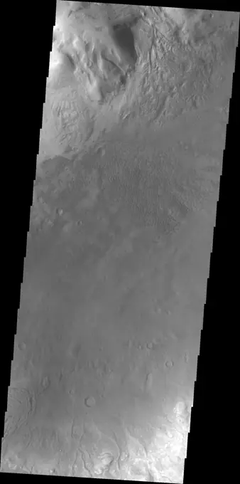
My Boards
View Pictures
  • My Boards

Martian Crater Topography

Images of various Martian craters showing intricate landscapes, including gullies, landslides, and channel formations as captured by NASA's Mars Odyssey.

This unnamed crater near Timoshenko Crater has been breached by a channel
291 assets in this story
6145-45258358
This image shows part of the southern flank of Ascraeus Mons. The feature at the bottom of the image is a collapse feature. These features can be caused by several processes. The ceiling of lava tubes can collapse into the open space left after the last flow. Tectonic activity can occur, and blocks of material can drop down between faults. The tectonic features are called graben. All three of the Tharsis volcanoes (Ascraeus, Pavonis and Arsia mons) are aligned along a northeast/southwest trend. The largest region of collapse features on each of the three volcanoes are located along this trend. The Odyssey spacecraft has spent over 15 years in orbit around Mars, circling the planet more than 69000 times. It holds the record for longest working spacecraft at Mars. THEMIS, the IR/VIS camera system, has collected data for the entire mission and provides images covering all seasons and lighting conditions. Over the years many features of interest have received repeated imaging, building up
6145-44653271
This region of Terra Sabaea contains areas with high densities of small craters
6145-44578901
Off the western flank of Elysium are the Hephaestus Fossae, seen in this image from NASA's Mars Odyssey, with linear arrangements of small, round pits. These features are commonly called 'pit chains' and most likely represent the collapse of lava tubes.
6145-45264068
The lava flows seen in the VIS image are located on the northeastern flank of Olympus Mons. The lavas flowed from the lower left side of the image to the upper right. Orbit Number 72356 Latitude 19.9937 Longitude 231.845 Instrument VIS Captured 2018-04-06 23 41
6145-44589454
The impact crater observed in this NASA Mars Odyssey image taken in Terra Cimmeria suggests sediments have filled the crater due to the flat and smooth nature of the floor compared to rougher surfaces at higher elevations.
6145-45100011
The steep sided depressions in this image captured by NASA's 2001 Mars Odyssey spacecraft are fault bounded tectonic features called graben.
6145-45071172
The lava flows in this image captured by NASA's 2001 Mars Odyssey spacecraft are located on the eastern flank of Olympus Mons.
6145-45089539
This image captured by NASA's 2001 Mars Odyssey spacecraft shows a section of Reull Vallis, a major channel that empties into Hellas Planitia.
6145-44967066
Do you see what I see in this image captured by NASA's 2001 Mars Odyssey spacecraft The head of an eagle, with it's sharp beak, looks towards the bottom of the image.
6145-44832511
This image captured by NASA's Mars Odyssey shows dark slope streaks in an unnamed crater in Terra Sabaea.
6145-44840284
Located in Solis Planum, this unusual volcanic flow has margins darker than the surroundings. It appears that the flow originated in the linear fracture or vent that bisects the flow deposit. This image was captured by NASA's Mars Odyssey.
6145-44647419
These curved fractures are located on the margin between Memnonia Fossae and Elysium Planitia
6145-44827347
What appear to be channels in this image from NASA's Mars Odyssey is the dissection of the higher elevations on the margin of Chryse Chaos. Continued dissection eventually creates the block/mesa forms termed chaos on Mars.
6145-45046446
Dark slope streaks are found everywhere on the inner rim of this unnamed crater in Arabia Terra in this image captured by NASA's 2001 Mars Odyssey spacecraft.
6145-45106501
The channels in this image captured by NASA's 2001 Mars Odyssey spacecraft are part of Hebrus Valles.
6145-44578311
The movement pathways of molten rock, or lava, is demonstrated in this image from NASA's Mars Odyssey spacecraft of a portion of Olympus Mons, the largest volcano in our solar system.
6145-45122758
This image captured by NASA's 2001 Mars Odyssey spacecraft is located in Noachis Terra. The unnamed crater at the bottom of the image contains a central pit.
6145-44825491
The region southwest of Olympus Mons is covered with materials that have been eroded by the wind. Surface materials in this area indicate wind action in many different directions as shown in this image from NASA's Mars Odyssey.
6145-44664391
Dusty Top of Alba Patera Volcano
6145-44893039
The pits in this image from NASA's 2001 Mars Odyssey spacecraft are collapse features on the northern flank of Ascraeus Mons.
6145-58967617
This image from NASA's 2001 Mars Odyssey spacecraft shows two small tributaries, just east of where they join Shalbatana Vallis.
6145-44628252
THEMIS Images as Art #37
6145-44596104
Crater Deformation
6145-44823920
This image from NASA's 2001 Mars Odyssey image shows a small portion of the southern flank of Alba Mons.
6145-45264100
Today's VIS image shows a small section of Nirgal Vallis. Nirgal Vallis is located in Noachis Terra. Orbit Number 74561 Latitude -27.9987 Longitude 319.355 Instrument VIS Captured 2018-10-05 14 39
6145-44627472
Isidis Crater Landslide
6145-44679168
Samara Vallis
6145-44699896
Newton Crater
6145-44606462
Western Gusev
6145-44652707
These arcuate ridges are appearing as wind erosion removes the less resistant surface materials. This terrain is located on the northern end of Gordii Dorsum
6145-44674311
Valleys on the Ejecta Blanket from Cerulli Crater
6145-44676451
Crater Dunes
6145-45044167
The cliff face in this image from NASA's 2001 Mars Odyssey spacecraft was created by tectonic activity and is located in a region of Tempe Terra that is complexly fractured.
6145-44868419
Channels dissect the hillside of Terra Sirenum in this image from NASA's 2001 Mars Odyssey spacecraft.
6145-45113692
This image captured by NASA's 2001 Mars Odyssey spacecraft shows part of an unnamed crater in Arabia Terra.
6145-44959328
Moving eastward across the southern part of Gale Crater, this image from NASA's Mars Odyssey spacecraft shows the easternmost arc of the channel deposit at the far left edge. Towards the bottom of the frame are sand dunes.
6145-44968492
Do you see what I see in this image from NASA's Mars Odyssey spacecraft The group of craters at the bottom of the image look like a muppet.
6145-44675634
Faults and Folds in Western Candor Chasma
6145-44631792
Wind Streaks in Syrtis Major
6145-58971824
This unnamed crater in Utopia Planitia is shaped like a peanut shell, with an indentation in the crater rim at the middle of the crater. It is likely that this crater was created by a dual impact. In a dual (or double) impact the incoming meteor is broken into two or more pieces which impact together into the surface. This type of impact often has a unique ejecta blanket shape, pinched at the center making a butterfly shape, and a pronounced inner rim jutting out at the center. The ejecta blanket in this case does not show the butterfly shape, and the middle rim is on slightly visible on the left side of the crater. These irregularities may indicate the the meteor pieces were still very close together when they hit the surface. Orbit Number 95144 Latitude 31.6611 Longitude 128.303 Instrument VIS Captured 2023-05-27 11 12
6145-44726091
Ascraeus Mons
6145-44656367
This image shows a small part of Meridiani Planum, the site of the Opportunity Rover
6145-44913981
The windstreaks in this image from NASA's 2001 Mars Odyssey spacecraft are located on the volcanic plains of Daedalia Planum.
6145-44813671
This image from NASA's 2001 Mars Odyssey shows a section of Sabis Vallis.
6145-44620726
Apollinaris Patera
6145-44484408
This VIS image is located in the northern portion of Hephaestus Fossae. Hephaestus Fossae is a complex channel system in Utopia Planitia near Elysium Mons. It has been proposed that the channels formed by the release of melted subsurface ice during the impact event that created a large crater southeast of this image. Additionally, the nearby Elysium volcanic center created subsurface heating that may have played a part in creating both Hephaestus Fossae and Hebrus Valles to the north. The right angle intersections indicate there is some tectonic activity in the region, and the circular depressions indicate surface collapse into subsurface voids. Hephaestus Fossae is a very complex set of features. Orbit Number 88618 Latitude 22.2991 Longitude 121.441 Instrument VIS Captured 2021-12-06 02 47
6145-44578630
This positive relief feature in the ancient highlands of Mars, imaged by NASA's Mars Odyssey spacecraft, appears to be a heavily eroded volcanic center. The top of the feature appears to be under attack by the erosive forces of the Martian wind.
6145-44648472
Back by popular demand: THEMIS ART IMAGE #63 Seattle Seahawk fans may recognize their team emblem in the collapse region around this crater
6145-45264360
Today's VIS image shows a small portion of the immense lava flows that originated from Arsia Mons. Arsia Mons is the southernmost of the three large aligned volcanoes in the Tharsis region. Arsia Mons last eruption was 10s of million years ago. The youngest volcano in the region is Olympus Mons, the largest volcano in our solar system. Orbit Number 74945 Latitude -18.9808 Longitude 225.731 Instrument VIS Captured 2018-11-06 05 00
6145-44665494
Plains West of Viking Lander 2
6145-44968112
Do you see what I see in this image from NASA's Mars Odyssey spacecraft These three side-by-side craters increase in size toward the bottom of the image. Looks like a snowman, only his eyes are missing.
6145-44532313
This VIS image shows Gasa Crater located on the floor of a larger unnamed crater Eridania Planitia. Gullies dissect the rims of both craters. Orbit Number 83302 Latitude -35.6906 Longitude 129.494 Instrument VIS Captured 2020-09-24 09 28
6145-44941848
The parallel sides and low interior seen in this image from NASA's 2001 Mars Odyssey spacecraft are faults and down-dropped material between the faults. This tectonic feature is called a graben. The graben in this image is located in Daedalia Planum.
6145-44599305
Gusev Crater
6145-44594748
The predominant feature in this image from NASA's Mars Odyssey spacecraft is a large flooded crater. Are the flows lava or mud Scientists don't agree.
6145-45093361
This image captured by NASA's 2001 Mars Odyssey spacecraft shows dust devil tracks in Noachis Terra. The dark tracks show where the whirlwind was in contact with the surface and removed dust to expose the darker rocky surface.
6145-44857986
String Section
6145-44673325
Mantling Material on Crater Floor
6145-44596105
Kasei Valles
6145-45299308
The linear depressions in this VIS image are part of Sirenum Fossae. These depressions are called graben, which form by the down drop of material between two parallel faults. The faults are caused by tectonic stresses in the region. The Sirenum Fossae graben are 2735km (1700 miles) long. Orbit Number 83493 Latitude -32.8399 Longitude 204.159 Instrument VIS Captured 2020-10-10 02 18
6145-44930311
This image from NASA's 2001 Mars Odyssey spacecraft of the Claritas Fossae region illustrates how fractures affect other features. In this instance, the fractures control the path of several channels (from upper right towards lower left).
6145-44578319
This image taken by NASA's Mars Odyssey spacecraft shows a classic example of a Martian impact crater with a central peak. Central peaks are common in large, fresh craters on both Mars and the Moon.
6145-44688535
Crater Low
6145-45080858
The linear features in this image from NASA's 2001 Mars Odyssey spacecraft are graben (fault bounded depressions). The graben are part of Sirenum Fossae.
6145-44625089
Reull Vallis
6145-44483906
This VIS image shows a section of Nanedi Valles. Located In Xanthe Terra, the channel system is 508 km (315 miles) long. Nanedi Valles contains two large channels that join together as the elevation drops near Chryse Planitia. Orbit Number 87763 Latitude 1.08634 Longitude 310.73 Instrument VIS Captured 2021-09-26 17 02
6145-44746958
Channel
6145-44844479
Located on the southern part of the Elysium Mons Volcanic region the channels in this image captured by NASA's Mars Odyssey were likely formed by the flow of lava.
6145-44745234
Granicus Valles
6145-44679916
Crater Dunes
6145-44586310
Like drippings from a candle, these lava flows on the flank of Olympus Mons volcano, seen in this image from NASA's Mars Odyssey spacecraft, demonstrate how it became the largest volcano in the solar system.
6145-44671726
This doublet crater looks like a melting snowman tipped on his side.Warmth is in the air, as the southern hemisphere of Mars enters spring
6145-44668642
The teardrop-shaped 'island' in this image was formed by the flow of fluid lava rather than liquid water
6145-44970664
This image from NASA's 2001 Mars Odyssey spacecraft shows part of the extensive lava flows that make up Daedalia Planum.
6145-44818133
This image from NASA's 2001 Mars Odyssey shows a lava flow that topped the rim of an impact crater and flowed down to the floor of the crater.
6145-44670231
Gullies and Arcuate Ridges
6145-45258911
This image shows part of the southeastern flank of Arsia Mons, including the flat lying flows around the base of the volcano. These flows are located at the bottom of the image. Numerous small lava channels are visible aligned sub-parallel to the base of the volcano. Several narrow, lobate flows show the downslope direction from the top left of the image towards the bottom right. Running against this elevation change are large paired faults called graben. Graben form by faults that have allowed the material between them to slide down. The resultant topography is a linear depression. None of the lobate flows enter and then run along the fault valley, indicating that the faulting occurred after the lava flows. Arsia Mons is the southernmost of the Tharsis volcanoes. It is 270 miles (450km) in diameter, almost 12 miles (20km) high, and the summit caldera is 72 miles (120km) wide. For comparison, the largest volcano on Earth is Mauna Loa. From its base on the sea floor, Mauna Loa measures
6145-45100801
Located east of Elysium Mons, Elysium Fossae is a large tectonic graben. This image from NASA's 2001 Mars Odyssey spacecraft shows that lava may have flowed in the channel feature.
6145-44994950
Numerous dark slope streaks mark the complex inner rim of this unnamed crater in Terra Sabaea in this image from NASA's 2001 Mars Odyssey spacecraft.
6145-44832251
This image from NASA's Mars Odyssey shows some of the dunes of the floor of Moreux Crater.
6145-44814444
This image taken by NASA's 2001 Mars Odyssey shows the southeastern flank of Hecates Tholus, the northernmost volcano of the Elysium Volcanic complex.
6145-44576481
Bosporus Planum, seen in this image from NASA's Mars Odyssey spacecraft, is located in a region of smooth plains that appear to have formed from lava flows.
6145-44646080
This small, unnamed channel is located in Arabia Terra
6145-45016547
This anaglyph image from NASA's Dawn spacecraft shows the topography of asteroid Vesta's south polar region. The material at the base of the scarp (right side) is probably due to landsliding.
6145-45102699
This image captured by NASA's 2001 Mars Odyssey spacecraft shows one of the many graben that make up Labeatis Fossae.
6145-44674312
Pedestal Crater in the Medusa Fossae Formation
6145-45264597
Scientists created this stereo view, called an anaglyph, with two images of the same part of Ceres's surface taken by Dawn on different orbits and from different viewing angles. The images were artificially colored and combined so that when viewed through glasses with a red filter on the left and blue on the right, they provide a 3-D view. The images used in this anaglyph were obtained by NASA's Dawn spacecraft from an altitude of about 22 miles (35 kilometers). The center of this image is located at about 18.9 degrees north latitude and 239.4 degrees east longitude.
6145-44538964
Today's VIS images shows part of the south polar cap. The cap was created over millions of years with deposition of ice and dust during different seasons, creating the layers seen in this image. This image was collected during summer at the south pole. The south polar cap is called Australe Planum. Orbit Number 83915 Latitude -86.5552 Longitude 149.181 Instrument VIS Captured 2020-11-13 20 32
6145-45298000
This VIS image shows part of Athabasca Valles. Arising from Cerberus Fossae, the formation mode of this channel is still being debated. While the channel features are similar to water flow, other features are similar to lava flows, and then other features have an appearance of slabs of material that floated on a underlying fluid. This is just one of the complex channel formations in the Elysium Planitia region. Orbit Number 78297 Latitude 8.93976 Longitude 155.611 Instrument VIS Captured 2019-08-09 06 58
6145-45033581
Shalbatana Vallis dominates this image captured by NASA's 2001 Mars Odyssey spacecraft.
6145-44675914
Candidate Cavern Entrance Northeast of Arsia Mons
PREVIOUS
of 3
NEXT
2401 S. Ervay, Suite 206
Dallas, Texas 75215
United States
Get Started
Free ResearchMy BoardsMy Cart
For Creators
How To License Your ContentContributor PortalFrame of Mind
Resources
API accessPricing
Contact
+1 866 236 0087help@viewpictures.co.uk Contact form
©2026 View Pictures. All Rights Reserved. -A
This site is protected by reCAPTCHA and Google Privacy Policy and Terms of Service apply.