My Boards
View Pictures
  • My Boards

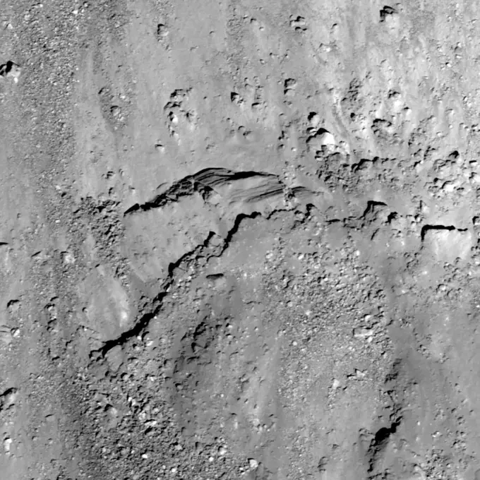
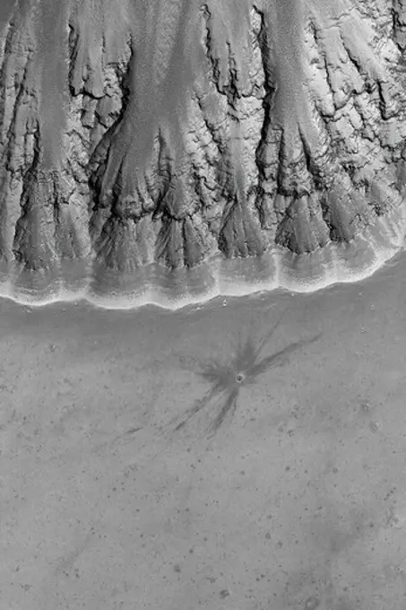
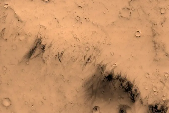
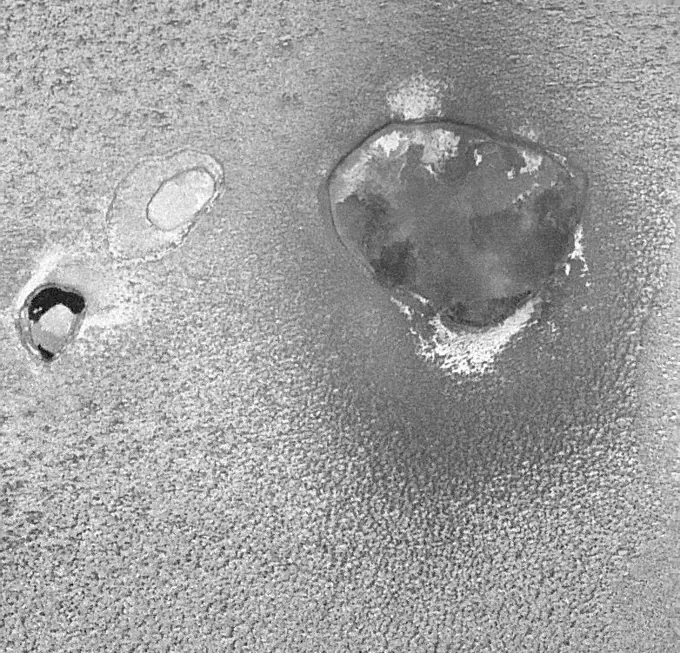
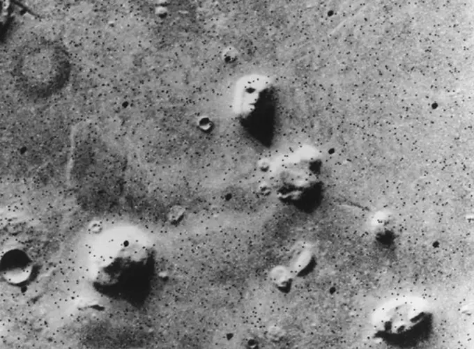
Martian Geological Features

Images depicting the surface of Mars, including lava flows, cracks, and geological formations.

Cracks in Utopia
Cracks in Utopia
186 assets in this story
6145-44620463
South Polar Crater
6145-44643289
Utopia Plain
6145-44558647
Fractured Craters on Ganymede
6145-44614418
Wind Streak in Acidalia
1746-19670904
A stratified ejecta block around an unnamed Copernican crater on the far side of the Moon.
6145-44702036
Noachis Dunes
6145-45064363
This June 27, 2014, image from the HiRISE camera on NASA's Mars Reconnaissance Orbiter shows NASA's Curiosity Mars rover on the rover's landing-ellipse boundary, which is superimposed on the image.
6145-45262767
This image was obtained by NASA's Dawn spacecraft on July 5, 2018 from an altitude of about 34 miles (55 kilometers). The center of this picture is located at about 20.9 degrees north latitude and 240.5 degrees east longitude.
6145-44632152
Inverted Channels
6145-44644099
This image shows a relatively fresh crater with dark, rayed ejecta on an upland plain above one of the many depressions in the eastern Labyrinthus Noctis region
6145-44594749
Sedimentary Rock Layers
6145-44786775
Dunes Southeast of Proctor Crater
6145-44595839
Layers, Boulders, and Dust
6145-44659447
New Mars Camera's First Image of Mars from Mapping Orbit
6145-44558119
Western Tithonium Chasma/Ius Chasma, Valles Marineris - High Resolution Image
6145-44621705
September Dust Devil
6145-44600114
Dust-Raising Event in Noachis
6145-44506493
On the Edge: The Retreating Mars Polar Ice Cap
6145-58960169
Fragmented Impact Melt
6145-44608844
Gullied Crater Wall
6145-44575159
This X-band image of the volcano Kilauea was taken on October 4, 1994, by NASA's Spaceborne Imaging Radar-C/X-band Synthetic Aperture Radar.
6145-44648473
This MOC image shows blocky remnants of a material that was once more laterally extensive on the floor of an impact crater located northwest of Herschel Crater on Mars. Large ripples of windblown sediment have accumulated around and between the blocks
6145-44628787
Melas Chasma
6145-44627242
Argyre Planitia Scene
6145-44647676
This MOC image shows outcrops of light-toned rock, interpreted to be sedimentary in origin, in east Candor Chasma. The exposures of light-toned rock are separated by areas of windblown ripples and dark sand
6145-44493012
Osuga Valles. Today's VIS image shows a small section of Osuga Valles. Osuga Valles is a complex set of channels located near Eos Chasma. The channels were likely cut by multiple episodes of flowing water. Osuga Valles is 164km (101 miles) long. Orbit Number 91057 Latitude -14.717 Longitude 321.586 Instrument VIS Captured 2022-06-24 22 29
6145-44824964
This observation from NASA's Mars Reconnaissance Orbiter shows the very steep side of a plateau, part of the northern limit of the Kasei Valles system, which is one of the largest outflow channel systems on Mars.
6145-44626165
Leveed Channel in Lava Flow
6145-44706004
Phoenix Makes a Grand Entrance
6145-45069310
Hellas Crater in the ancient highlands contains some of the clearest evidence on Mars for glacial processes. This image from NASA's Mars Reconnaissance Orbiter shows a number of features consistent with glaciation.
1746-19671094
A group of dunes in Aonia Terra. THEMIS.
1746-19671171
The two depression crossing this image are called Pavonis Fossae and are located just north of the volcano.
6145-44645835
This MOC image shows the margin of an ancient, cratered, hummocky (rough) lava flow at just the point where it encroached upon a small impact crater east of the volcano, Tharsis Tholus
6145-44972398
This daytime IR image shows part of Nanedi Vallis as seen by NASA's 2001 Mars Odyssey spacecraft.
6145-44817327
Ius Chasma is one of several canyons that make up Valles Marineris, the largest canyon system in the Solar System as seen by NASA's Mars Reconnaissance Orbiter.
6145-45053863
Hollows on Northern Walls
6145-44600119
Dark Slope Streaks
6145-44565910
Fresh Impact Craters on Ganymede
6145-44628534
Pavonis Mons Features
6145-44632976
THEMIS Images as Art #60
6145-44667881
Gullies and... Gullies in Terra Sirenum
6145-44847116
This pair of images shows the before-and-after comparison of the part of comet Tempel 1 that was hit by the impactor from NASA's Deep Impact spacecraft.
6145-44615249
Channel on Ascraeus Mons
6145-44596125
Gullied Crater Wall
6145-44789865
NASA's 2001 Mars Odyssey infrared image shows a group of dunes in Aonia Terra.
6145-44597712
Impact on Arsia Mons
4389-1546
New Crater in Labyrinthus Noctis Seen By Mars Global Surveyor
6145-44605679
Crater in Marte Vallis
4389-1961
Spring on Mars
6145-45069308
The north end of this long image from NASA's Mars Reconnaissance Orbiter shows a lava surface in southern Elysium Planitia. Small cones are common on the extensive young flood lavas in this region.
6145-45098462
Sputnik Planum is the informal name of the smooth, light-bulb shaped region on the left of this composite of several of NASA's New Horizons images of Pluto.
6145-44968158
This observation from NASA's Mars Reconnaissance Orbiter shows the end of a small channel near Athabasca Valles on Mars. Athabasca is an example of a Martian 'outflow channel,' likely carved by a massive flood of groundwater.
6145-44718024
Enceladus Rev 80 Flyby Skeet Shoot #7
6145-44565340
Lava Flows On Ascraeus Mons Volcano
6145-45292440
NASA has named the landing site of the agency's Perseverance rover Octavia E. Butler Landing, after the science fiction author Octavia E. Butler. The landing location is marked with a star in this image from the High Resolution Imaging Experiment (HiRISE) camera aboard NASA's Mars Reconnaissance Orbiter (MRO). MRO's mission is managed by NASA's Jet Propulsion Laboratory, a division of Caltech in Pasadena, California, for NASA's Science Mission Directorate. Lockheed Martin Space in Denver built the spacecraft. The University of Arizona in Tucson provided and operates HiRISE. A key objective for Perseverance's mission on Mars is astrobiology, including the search for signs of ancient microbial life. The rover will characterize the planet's geology and past climate, pave the way for human exploration of the Red Planet, and be the first mission to collect and cache Martian rock and regolith (broken rock and dust). Subsequent NASA missions, in cooperation with ESA (European Space Agency), w
6145-44633005
Triple Impact
6145-44900088
This image from an animation is from NASA's Mars Reconnaissance Orbiter (MRO) showing the landing effects of the descent stage, the rover lander, the back shell and parachute, and the heat shield, all found on the left side of the image.
6145-44869196
Nabro volcano in the African nation of Eritrea began erupting June 12, 2011, the first-ever recorded eruption of this stratovolcano. This image was acquired by NASA's Terra spacecraft on July 5, 2011.
6145-45265656
This VIS image of the south polar cap was taken during the middle of southern hemisphere summer. The surface is free of frost and the layering that makes up the cap is visible. The layers formed over thousands of years, with the seasonal influx of dust and ice. Orbit Number 75229 Latitude -84.5325 Longitude 158.478 Instrument VIS Captured 2018-11-29 14 47
6145-45110356
This image from NASA's Mars Reconnaissance Orbiter spacecraft shows a roughly 3-kilometer impact crater, formed on the sloping walls of Tithonium Chasma, part of the large Valles Marineris canyon system.
6145-44663096
Other Martian Gullies with Light-Toned Deposits
4389-1109
Dust-Devil Tracks in Southern Schiaparelli Basin Seen by Mars Reconnaissance Orbiter
6145-44900052
Late last night, in the morning hours of Aug. 6, as NASA's Curiosity rover fell to the surface of Mars, NASA's Mars Reconnaissance Orbiter (MRO) captured an image of the rover gliding on its parachute.
6145-44512417
Camaxtli Patera, An Active Volcanic Center on Io
6145-44632705
Small Dusty Volcano
4413-35528054
Footprint of a glaucous gull (Larus hyperboreus) on the fresh snow covering the ice pack at Bellsund in Spitsbergen, Svalbard archipelago.
6145-44631916
Exhuming Crater
6145-45116254
This image captured by NASA's 2001 Mars Odyssey spacecraft shows part of the South Polar cap.
6145-44598487
Fresh, Rayed Impact Crater
6145-44795352
NASA's 2001 Mars Odyssey shows part of the floor of Coprates Chasma which contains various deposits, including dune fields.
6145-44615746
Ares Vallis Dust Devil
6145-45264861
We have been monitoring the slope streaks on this hill for several years. There are definitive changes between this September 2018 image and a previous one in December 2016. Earlier streaks have since faded and new, darker streaks are visible. These streaks are tens of meters wide. These features are small avalanches of dust and sand from the hillsides. The surface dust is lighter in color, but when it avalanches away, it reveals underlying larger-grained sand particles that are much darker. Over time, the dust slowly rains down from the atmosphere and the streaks fade as they are coated with dust.
6145-44562583
Geologic 'Face on Mars' Formation
6145-44611498
Ejecta Craters
1746-19663307
Viking orbiter image of the Face on Mars, taken 25 July 1976 On 22 July 2006, the DLR-operated High Resolution Stereo Camera (HRSC) on-board ESAs Mars Express obtained images of the Cydonia region, site of the famous Face on Mars. The HRSC images include some of the most spectacular views of the Red Planet ever seen. The HRSC obtained image data in orbit 3253 with a ground resolution of approximately 13.7 metres per pixel. The data were acquired at a latitude of approximately 40.75 degrees North and about 350.54 East longitude. Triggered by a photo of the Cydonia region taken on 25 July 1976 by the American Viking 1 Orbiter, one of the visible remnant massifs has become famous during the last 30 years as the Face on Mars. It was first publicly labelled as resembling a human head in the NASA press release on 31 July 1976. Even then, NASA scientists interpreted the formation as an optical illusion caused by the illumination angle of the Sun and the surface morphology, with the r
6145-44617852
'Cobble Hill' Profile
6145-45110620
This mosaic strip, extending across the hemisphere that faced the New Horizons spacecraft as it flew past Pluto on July 14, 2015, now includes all of the highest-resolution images taken by the NASA probe.
6145-44585480
This collage of six images taken by NASA's Mars Odyssey spacecraft, shows examples of the daytime temperature patterns of Martian dunes.
6145-44723477
Deepest Trenching at Phoenix Site on Mars
6145-44642258
A Matter of Time
6145-44611506
Grain Size Variability in Rock Layers
6145-44634567
Saturn's Anti-Hurricanes
6145-44657343
This MOC image shows light-toned ripples covering the floors of troughs in the Adamas Labyrinthus region of northern Elysium Planitia
6145-45298755
Popocatepetl, Mexico's most active volcano, erupted on February 23, sending blocks and bombs down the volcano's flanks, and emitting an ash column 1 km above the summit. Two days later, an ash cloud was still seen coming from the volcano. The thermal infrared color composite reveals a hot spot (red) at the summit crater. The dark red color near the vent of the east-blowing ash cloud suggests that its composition is dominantly ash material; further downwind, the color changes to purple, suggesting that some of the ash particles may be ice-covered. The images were acquired February 25, 2020, cover an area of 18 by 22.5 km, and are located at 19 degrees north, 98.6 degrees west.
6145-44616278
South Polar Wind Streak
6145-44878393
The soil at this location has a different texture than any that NASA's Mars rover Opportunity has seen earlier. The largest features on the ground in this image are a few inches or centimeters across.
PREVIOUS
of 2
NEXT
2401 S. Ervay, Suite 206
Dallas, Texas 75215
United States
Get Started
Free ResearchMy BoardsMy Cart
For Creators
How To License Your ContentContributor PortalFrame of Mind
Resources
API accessPricing
Contact
+1 866 236 0087help@viewpictures.co.uk Contact form
©2026 View Pictures. All Rights Reserved. -A
This site is protected by reCAPTCHA and Google Privacy Policy and Terms of Service apply.