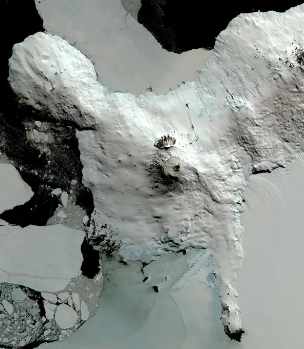
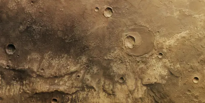
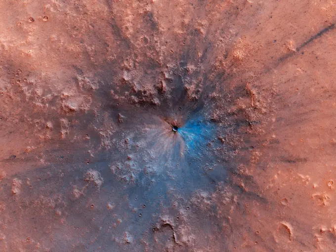
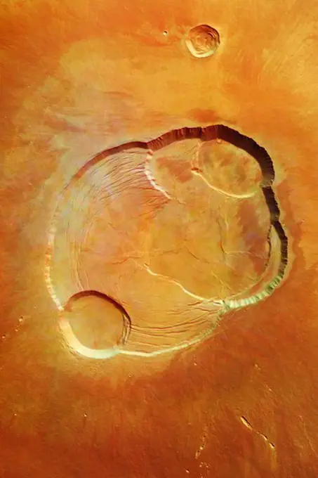
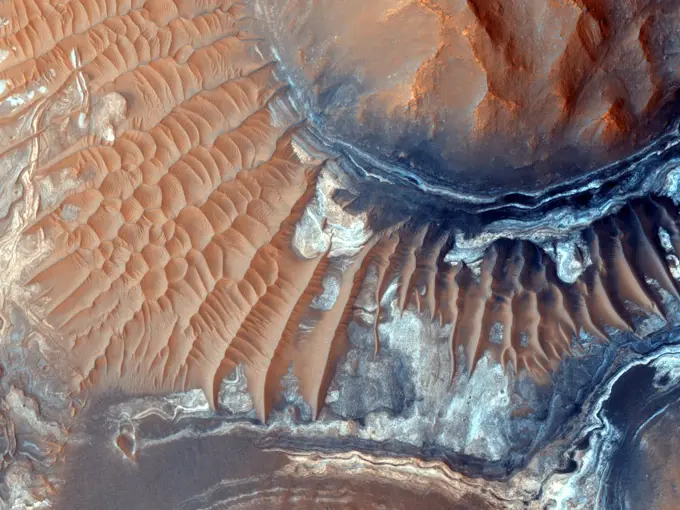
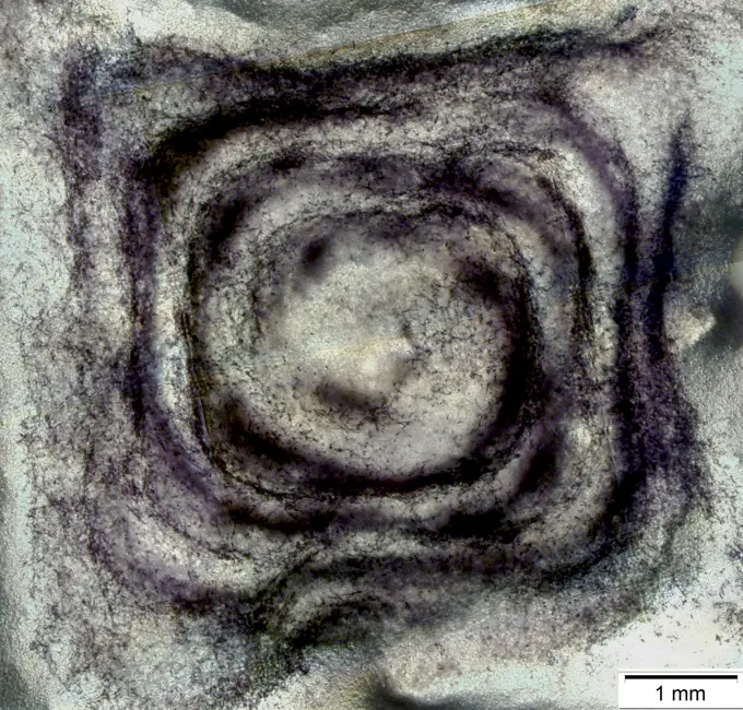
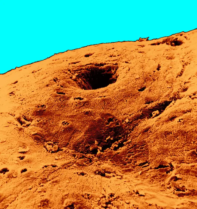
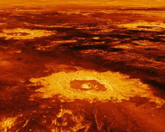
My Boards
View Pictures
  • My Boards

Martian Surface Geology

A collection of images showcasing various features of Mars' surface, including craters, sedimentary rocks, and seasonal frost formations, highlighting its geological history.

Streaked Slope in a Valley Seen by Mars Reconnaissance Orbiter
190 assets in this story
6145-45102720
This image from NASA's Terra spacecraft shows Mount Erebus, the world's southernmost historically active volcano.
6145-44705462
This image from NASA's Mars Reconnaissance Rover shows the north polar region of Mars is surrounded by a large sea of dark sand dunes that become covered by seasonal carbon dioxide frost.
6145-45264108
Asimov is an 84-kilometer diameter crater located in the southern ancient highlands of Mars. It is distinguished from other craters in this region in that it contains both a ring-depression just within the crater rim and a pit near the center. Gullies have formed along slopes both in the ring-depression and within the central pit. A closeup shows gullies and recurring slope lineae (RSL) along the eastern slope of the pit. These features continue to form seasonally in this region and the HiRISE team monitors this and other sites to look for changes. Another closeup shows new RSL forming during the summer just after the recent global dust storm. How these features form is still under investigation. Additional changes documented here and at other locations as a result of the dust storm may provide some insight into their formation.
6145-45005736
NASA's Mars Reconnaissance Orbiter caught this view of NASA's Mars Exploration Rover Opportunity on Feb. 14, 2014. The red arrow points to Opportunity at the center of the image. Blue arrows point to tracks left by the rover in October 2013.
6145-44551011
This image from NASA's Kidsat electronic still camera was requested by Buist Academy for the purpose of studying the coast of Israel and the Mediterranean Sea.
6145-44912147
This image shows the wall of a scuffmark NASA's Curiosity made in a windblown ripple of Martian sand with its wheel. The upper half of the image shows a small portion of the side wall of the scuff and a little bit of the floor of the scuff.
6145-44484400
On this part of Mars there is an extensive surface brightness (albedo) boundary. One hypothesis is that this boundary marks a shoreline, from a time long ago when liquid water could have been stable on the surface of Mars. With the resolution of HiRISE we can see that the reason one side of the boundary is darker than the other is due to the many boulders strewn across the darker side.
6145-44904525
After a rocket-powered descent stage, also known as the sky crane, delivered NASA's Curiosity rover to Mars on Aug. 5 PDT (Aug. 6 EDT), 2012, it flew away and fell to the surface.
6145-44958413
'Cumberland' has been selected as the second target for drilling by NASA's Mars rover Curiosity. The rover has the capability to collect powdered material from inside the target rock and analyze that powder with laboratory instruments.
6145-45053331
This image from an animation shows a patch of sandstone scrubbed with the Dust Removal Tool, a wire-bristle brush, on NASA's Curiosity Mars rover. This rock target is called 'Windjana,' after a gorge in Western Australia.
6145-44659229
This MOC image shows dark-toned, windblown sands and ripples, surrounding a light-toned hill, interpreted to be sedimentary rock, in Ganges Chasma. Ganges Chasma is part of the giant Valles Marineris trough system on Mars
6145-45098759
This image from NASA's Mars Reconnaissance Orbiter spacecraft shows the nature of the terrain at the rim of Marth Crater just as a dust storm arrives.
6145-45075066
This image from the Mars Hand Lens Imager (MAHLI) camera on NASA's Curiosity Mars rover shows an example of a type of geometrically distinctive feature that researchers are using Curiosity to examine at a mudstone outcrop at the base of Mount Sharp.
6145-44923304
ISS034 Russian Return - Part 265
6145-44483119
The crater in the center of this HiRISE image defines where zero longitude is on Mars, like the Greenwich Observatory does for the Earth. Originally, the larger crater that this crater sits within, called Airy Crater, defined zero longitude for the Red Planet. But as higher resolution images became available, a smaller feature was needed. This crater, called Airy-0 (zero), was selected because it would require no adjustment of existing maps. These days, longitude on Mars is measured even more precisely using radio tracking of landers such as InSight, but everything is still defined to keep zero longitude centered on this crater.
6145-44653470
Peering at Pesky 'Jammerbugt' (False Color)
6145-45098887
This image from NASA's Mars Reconnaissance Orbiter spacecraft shows modified barchan dunes with shapes that resemble 'raptor claws.' The unusual morphology of these dunes suggests a limited supply of windblown sand.
6145-44614689
Similar on the Inside (post-grinding)
6145-44912127
This stereo anaglyph shows the parachute and back shell that helped guide NASA's Curiosity to the surface of Mars. You need 3-D glasses to view this image.
6145-44513750
The Frosted Craters of Northern Spring and Southern Autumn - Unnamed Crater
6188-68372055
Marsoberfläche mit Kratern und geologischen Formationen Close-up view of the surface of mars, revealing craters, impact marks, and unique geological formations LicenseRF Copyright: xZoonar.com/IharxIvanouskix 23271479
1848-20193767
Cracked earth at the bank of the Rio Tinto (Red river) with its deep reddish hue due to oxidised iron minerals in its water, aerial view, drone shot, ...
6145-44614926
Colored Crater in Vastitas Borealis
6145-45266567
An impressionist painting No, it's a new impact crater that has appeared on the surface of Mars, formed at most between September 2016 and February 2019. What makes this stand out is the darker material exposed beneath the reddish dust. It looks blue because its a false color image, which combines several color filters to enhance differences between material compositions. The light blue indicates an absence of brighter, redder dust where the impact blast scoured the surface, revealing bedrock below. The very bright blue could be ejecta with a different composition that was thrown by the impact. The blue color isnt ice. This impact was near the equator, not in a region where wed expect shallow ice below the surface.
6145-44502997
The first images taken by NASA's Multi-angle Imaging SpectroRadiometer (MISR) on February 24, 2000, show the winter landscape of James Bay, Ontario, Canada from three of the instrument's nine cameras.
6145-44546390
STS072-709-063 (11-20 Jan. 1996) --- The astronauts aboard the Space Shuttle Endeavour exposed this 70mm frame of the Air Mountains, located in the country of Niger.  These Sahara Desert structures are granitic intrusions.  They are resistant to erosion and are very prominent in the lighter colored sands of the area.  According to NASA geologists studying the photo collection, the ring-like structure on the lower left-hand edge of the photograph is probably a Quaternary volcanic feature.  The highest peaks in the range approach 1,800 meters (6,000 feet).  Deep valleys in the range are used by the Tuaregs for pasturage.  Uranium and other minerals are being mined in the massif.
6145-44505087
Eros in Color
6145-44575148
This is a radar image of the Rabaul volcano on the island of New Britain, Papua, New Guinea taken almost a month after its September 19, 1994.
6145-45099759
Ophir Chasma forms the northern portion of Valles Marineris, and this image from NASA's Mars Reconnaissance Orbiter spacecraft features a small part of its wall and floor.
6145-45244098
(PCG) Protein Crystal Growth C-reactive Protein. Plays a major role in human immune system response. Principal Investigator on STS-26 was Charles Bugg.
6145-45048433
This pair of before (left) and after (right) images from NASA's Mars Reconnaissance Orbiter documents formation of a new channel on a Martian slope between 2010 and 2013, likely resulting from activity of carbon-dioxide frost.
4197-62718915
Space, water on mars and satellite footage of a landscape on a planet in our solar system for surveillance. Map, desert and science with a river on the ground from above in the galaxy or cosmos
6145-45061733
This image NASA's Mars Reconnaissance Orbiter shows dozens of dark-toned dunes in and around several craters within the rugged terrain of Terra Cimmeria.
1848-49323650
Chocolate Truffle Falling in Powdered Chocolate
6145-54676595
. iss068e029498 (Dec. 13, 2022) - Emi Koussi, a volcano and the highest peak in the Tibesti Mountains of Chad, was photographed from the International Space Station as it orbited 257 miles above Africa.
6145-45105418
This enhanced color view from NASA's New Horizons is of Pluto's surface diversity At lower right, ancient, heavily cratered terrain is coated with dark, reddish tholins. At upper right, volatile ices fill the informally named Sputnik Planum.
4389-1120
Ridges and Dark Patches Seen by Mars Reconnaissance Orbiter
6145-44995810
Low lying areas in the Hellas region, which is the largest impact basin on Mars, often show complex groups of banded ridges, furrows, and pits as seen in this observation from NASA's Mars Reconnaissance Orbiter.
6145-44817080
STS054-95-042 (13-19 Jan 1993) --- The Equatorial Pacific Ocean is represented in this 70mm view. The international oceanographic research community is presently conducting a program called Joint Global Ocean Flux Study (JGOFS) to study the global ocean carbon budget. A considerable amount of effort within this program is presently being focused on the Equatorial Pacific Ocean because of the high annual average biological productivity. The high productivity is the result of nearly constant easterly winds causing cool, nutrient-rich water to well up at the equator. In this view of the sun glint pattern was photographed at about 2 degrees north latitude, 103 degrees west longitude, as the Space Shuttle passed over the Equatorial Pacific. The long narrow line is the equatorial front, which defines the boundary between warm surface equatorial water and cool, recently upwelled water. Such features are of interest to the JGOFS researchers and it is anticipated that photographs such as this w
4220-20060509
Fossil Fish - Holzmaden - Germany - Jurassic (Dapedium punctatus)
4389-1555
Olympus Mons Seen by Mars Express
6145-44574602
This spaceborne radar image of a mineral-rich region in southern China is being used by geologists to identify potential new areas for mineral exploration.
6145-44964075
This observation from NASA's Mars Reconnaissance Orbiter shows the central hills in Hale Crater with thousands of seasonal flows on steep slopes below bedrock outcrops.
6145-44641721
This pair of Mars Global Surveyor (MGS) Mars Orbiter Camera (MOC) color images shows early autumn clouds over the Arsia Mons volcano, plus the shadow of the innermost of the two martain moons, Phobos
1746-19663314
Scientists have found evidence of iron-bearing sulphates and clay minerals in the exposed areas of this region of the Noctis Labyrinthus formation. A dune field covers some of the ground. Below is an image of the floor of a 600-mile long canyon called Ius Chasma, which is part of the Valles Marineris, the largest known canyon system in the solar system. The dark rock is an old lava flow, and the lighter areas are mega ripples. Both images were taken by the High Resolution Imaging Science Experiment (HI RISE) camera on the Mars Reconnaissance Orbiter.
6145-44493264
A Crater in Scalloped Terrain. Sublimation (ice vaporizing without passing through a liquid stage) is an important process affecting water ice in the mid-latitudes of Mars. This might be responsible for creating two different landforms scalloped depressions and expanded craters. Scalloped depressions are oval or irregular pits with relatively steep pole-facing slopes, and expanded craters appear to be impact craters that have grown larger as the upper slopes sublimate, while dust and debris protect the bottom. The two usually do not occur together, but here we see what appears to be a slightly expanded crater in a field of scalloped depressions. It's possible that it will evolve over time to look more like the scallops. Unfortunately, this process is too slow to see with before-and-after HiRISE images, even if they were spaced years apart.
6145-45093903
Researchers have found deposits of impact glass preserved in Martian craters, including Alga Crater, shown here. The detection is based on data from the Compact Reconnaissance Imaging Spectrometer for Mars (CRISM) on NASA's Mars Reconnaissance Orbiter.
6145-44514273
Sediment History Preserved in Gale Crater Central Mound
6145-44650834
Spirit Examines Light-Toned 'Halley' (False Color)
6145-44778506
This telescopic view from orbit around Mars catches a Martian dust devil in action in the planet's southern hemisphere. The swirling vortex of dust can be seen near the center of the image.
6145-44625347
This image shows two holes created by NASA Spirit's rock abrasion tool in a rock dubbed 'Wooly Patch' near the base of the 'Columbia Hills' inside Gusev Crater. 3D glasses are necessary to view this image.
6145-44899267
This close-up image of a dust storm on Mars was acquired by the Mars Color Imager instrument on NASA's Mars Reconnaissance Orbiter on Nov. 7, 2007. This image is centered on Utopia Planitia.
1746-57662195
NASA's Curiosity rover aimed two different instruments to study a rock known as Jake Matijevic 2004 Mars
6145-44514268
Layered Material in West Arabia Terra Crater
6145-54588751
Subjects: Volcano; Geology.  . 1998 - 2011.
1801-62836650
Wayfinding symbols. Eden, Singapore, Singapore. Architect: Heatherwick Studio, 2020.
6145-44706224
This is an enhanced-color image from Mars Reconnaissance Orbiter's High Resolution Imaging Science Experiment (HiRISE) camera. It shows the NASA's Mars Phoenix lander with its solar panels deployed on the Mars surface
6145-45083336
This simulation depicts a lake partially filling Mars' Gale Crater, receiving runoff from snow melting on the crater's rim, showing evidence that NASA's Curiosity rover has found ancient streams, deltas and lakes.
824-63200078
Photo documentary on bioprinting. Zurich University of Applied Sciences (ZHAW) is working with a bioprinter from regenHU to produce different human tissues. Bioprinting allows three dimensional tissue production in a fast and controlled manner by the precise positioning of primary cells, biomaterials and growth factors. Thereby, bioprinted tissues simulate the complex in vivo situation of our body. Tissues are produced in a layer by layer mode by alternating photopolymerized bioink and cells. Before using for substance testing the tissue are matured in a cell culture environment. In future, printed tissues could reduce animal experiments in drug development and foster regenerative medicine. The coloration show the viability of fibroplasts after two days of culture. The dark purple dots are the viable cells in the Bio-ink structure. This image shows, on the one hand, the distribution of cells in the model and, on the other, that the cells are viable and capable of surviving in the model
6145-44964749
NASA's Earth Observing-1 (EO-1) spacecraft observed Copahue volcano, a 2965 meter high volcano on the Chile-Argentina border, on Jun. 4, 2013. Having recently displayed signs of unrest, the volcano is under close scrutiny by local volcanologists.
824-63128356
Colon mucosa in SEM x 600. The colon mucosa is constituted of an epithelium, glands, a connective tissue. The glands of this mucosa (crypts of Lieberkühn) have a precise physiological function in the absorption of food (secretion of intestinal juice).
6145-44945108
NASA's rover Curiosity took this close-up view of 'Tintina' showing interesting linear textures in the bright white material on the rock.
6145-44525760
This depiction of an area south of San Martin de Los Andes, Argentina, is the first Shuttle Radar Topography Mission (SRTM) view of the Andes Mountains, the tallest mountain chain in the western hemisphere.
6145-44504485
These images from NASA's Terra spacecraft show the (nadir) view of the eastern United States, stretching from Lake Ontario to northern Georgia, and spanning the Appalachian Mountains.
1574R-019477
Yogi Rock Mars
4389-1587
Three-Dimensional Perspective View of Lavinia Planitia on Venus by Magellan (Digitally Generated)
6145-44937071
Earth Observations taken by Expedition 34 crewmember.
6145-45266141
The Mast Camera, or Mastcam, on NASA's Curiosity Mars rover captured this set of images before and after it drilled a rock nicknamed Aberlady, on Saturday, April 6, 2019 (the 2,370th Martian day, or sol, of the mission). The rock and others nearby appear to have moved when the drill was retracted. This was the first time Curiosity has drilled in the long-awaited clay-bearing unit. The scene is presented with a color adjustment that approximates white balancing to resemble how the rocks and sand would appear under daytime lighting conditions on Earth. Movie available at
6145-44910188
This map shows the path on Mars of NASA's Curiosity rover toward Glenelg, an area where three terrains of scientific interest converge. Arrows mark what appears to be an ancient Martian streambed.
6145-44751009
AS09-26A-3790A (11 March 1969) --- Color infrared photograph of the Birmingham to Gadsden area of Alabama as seen from the Apollo 9 spacecraft during its 121st revolution of Earth. This picture was taken as a part of the SO65 Multispectral Terrain Photography Experiment. Birmingham is at left center edge of picture; Gadsden is near top center edge of photograph. Note folded mountains of southern Appalachian chain extending northeast-southwest. The major river in picture which runs generally southward is the Coosa River. The Tallapoosa River, which flows into Lake Martin, is in the southeast corner of picture. Interstate 20 runs from Birmingham eastward toward Atlanta. The City of Anniston is south of Gadsden on Interstate 20.
6145-44622759
July 4th, 2002: Description: As air flows over and around objects in its path, spiraling eddies, known as Von Karman vortices, may form. The vortices in this image were created when prevailing winds sweeping east across the northern Pacific Ocean encountered Alaskas Aleutian Islands.Source: Landsat 7
6145-44623845
Hole in 'Ebenezer'
6176-67042209
Aerial view of archaeological excavations near Saqqara, Egypt, 1931 (1933). Artist: Unknown
6145-44646639
Mercator Projection of Huygens's View at Different Altitudes
6145-44575162
This is a false-color composite of Central Africa, showing the Virunga volcano chain along the borders of Rwanda, Zaire and Uganda. This area is home to the endangered mountain gorillas.
6145-44484155
The route of NASA's Perseverance Mars rover - from its landing site on the floor of Jezero Crater to the ancient river delta, which it is currently exploring - is shown in this annotated image composed of overhead views from the agency's Mars Reconnaissance Orbiter (MRO). The red star indicates the location of the rover in September 2022. Perseverance touched down at Octavia E. Butler Landing on Feb. 18, 2021, and explored formations (abbreviated fm in the annotation) known as Séítah and Máaz on the floor of Jezero Crater before driving toward the delta region. The delta, which Perseverance reached in April 2022, is a fan-shaped area where, billions of years ago, a river once flowed into a lake and deposited rocks and sediment. Scientists consider it one of the best places on Mars to search for potential signs of ancient microbial life. For this image, the Perseverance team and the U.S. Geological Survey collaborated on the base map, combining multiple images from the High Resolution I
6145-44777954
STS058-88-017 (18 Oct-1 Nov 1993) --- The eye-catching bullseye of the Richat Structure adds interest to the barren Gres de Chinguetti Plateau in central Mauretania, northwest Africa. It represents domally uplifted, layered (sedimentary) rocks that have been eroded by water and wind into the present shape. Desert sands have invaded the feature from the south. The origin of the structure is unknown. It is not an impact structure, because field work showed that strata are undisturbed and flat-lying in the middle of the feature, and no shock-altered rock could be found. There is no evidence for a salt dome or shale diapir, nor is there any geophysical evidence for an underlying dome of dense igneous rock having about the same density as the sedimentary layers.
6145-44575141
This is a digital elevation model that was geometrically coded directly onto an X-band seasonal change image of the Oetztal supersite in Austria.
1746-19664714
A portion of western Eistla Regio is shown in this three dimensional, computer-generated view of the surface of Venus. The viewpoint is at an elevation of 1.2 kilometres (0.75 mile) at a location 700 kilometres (435 miles) southeast of Gula Mons, the volcano on the right horizon. Gula Mons reaches 3 kilometres (1.8 miles) high and is located around 22 degrees north latitude and 359 degrees east longitude. Sif Mons, the volcano on the left horizon, has a diameter of 300 kilometres (186 miles) and a height of 2 kilometres (1.2 miles). Magellan imaging and altimetry data are combined to develop a three-dimensional computer view of the planets surface. Simulated colour based on colour images from the Soviet Venera 13 and 14 spacecraft is added to enhance small-scale structure.1990.
4389-1122
Canyon on Mars Seen by Mars Reconnaissance Orbiter
6145-45099771
Scientists using NASA's New Horizons images of Pluto's surface to make 3-D topographic maps have discovered that two of Pluto's mountains, informally named Wright Mons and Piccard Mons, could possibly be ice volcanoes.
6145-44772504
While the panoramic camera (Pancam) on NASA's Mars Exploration Rover Spirit was taking exposures with different color filters on May 27, 2009), dust devils moved across the field of view.
1788-21717
Italy, Spatial concept
6019-30467469
Dry earth in cracks, top view during a drought.
1890-29043309
Dinosaur tracks at a tourist attraction on the Navajo Indian Reservation near Tuba City, Arizona, United State of America, North America
6145-45125760
In the South Polar region of Mars this type of terrain may be covered by a seasonal polar cap composed of dry ice, as seen by NASA's Mars Reconnaissance Orbiter.
6145-44969333
The total distance driven by NASA's Mars rover Curiosity passed the one-mile mark a few days before the first anniversary of the rover's landing on Mars. The mapped area is within Gale Crater, and north of Mount Sharp, in the middle of the crater.
6145-44973420
Small impact craters usually have simple bowl shapes; however, when the target material has different layers of different strength, then more complicated crater shapes can emerge as shown in image captured by NASA's Mars Reconnaissance Orbiter.
6145-44910194
This set of images compares the 'Link' outcrop of rocks on Mars (left) with similar rocks seen on Earth (right). The 'Link' outcrop shows rounded gravel fragments, or clasts, up to a couple inches (few centimeters), within the rock outcrop.
6145-44483106
Smaller than a penny, the flower-like rock artifact on the left was imaged by NASA's Curiosity Mars rover using its Mars Hand Lens Imager (MAHLI) camera on the end of its robotic arm. The image was taken on Feb. 24, 2022, the 3,396th Martian day, or sol, of the mission. The flower, along with the spherical rock artifacts seen to the right, were made in the ancient past when minerals carried by water cemented the rock. Figure 1 shows a tighter view of the flower-like feature. Curiosity has in the past discovered a diverse assortment of similar small features that formed when mineralizing fluids traveled through conduits in the rock. Images of such features are helping scientists understand more about the prolonged history of liquid water in Gale Crater.
PREVIOUS
of 2
NEXT
2401 S. Ervay, Suite 206
Dallas, Texas 75215
United States
Get Started
Free ResearchMy BoardsMy Cart
For Creators
How To License Your ContentContributor PortalFrame of Mind
Resources
API accessPricing
Contact
+1 866 236 0087help@viewpictures.co.uk Contact form
©2026 View Pictures. All Rights Reserved. -A
This site is protected by reCAPTCHA and Google Privacy Policy and Terms of Service apply.