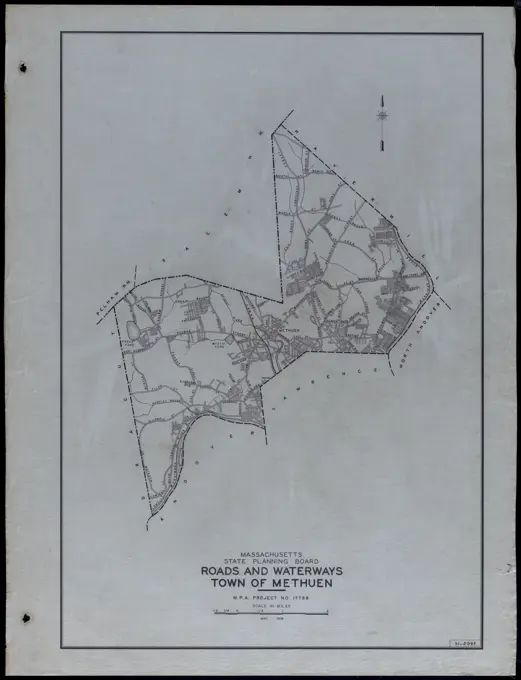
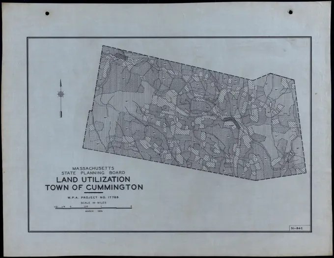
My Boards
View Pictures
  • My Boards

Massachusetts Land Utilization Maps

Detailed historical maps showing land utilization and waterways in various towns of Massachusetts, featuring clear line work and geographical outlines.

Roads and Waterways Town of Methuen. Roads and Waterways Town of Methuen
190 assets in this story
6145-51394070
Land Utilization Town of Bridgewater , Roads, Cities and towns, Land use mapping, Soil mapping, United States. Works Progress Administration, United States. Work Projects Administration. Massachusetts. State Planning Board
6145-50563567
Soil Classification Town of Mattapoisett , Roads, Cities and towns, Land use mapping, Soil mapping, United States. Works Progress Administration, United States. Work Projects Administration. Massachusetts. State Planning Board
6145-51394109
Land Utilization Town of Granby , Roads, Cities and towns, Land use mapping, Soil mapping, United States. Works Progress Administration, United States. Work Projects Administration. Massachusetts. State Planning Board
6145-50563077
Roads and Buildings Town of Kingston , Roads, Cities and towns, Land use mapping, Soil mapping, United States. Works Progress Administration, United States. Work Projects Administration. Massachusetts. State Planning Board
6145-58893197
Roads and Waterways Town of Carver. Roads and Waterways Town of Carver
6145-51387678
Soil Classification Town of Chicopee , Roads, Cities and towns, Land use mapping, Soil mapping, United States. Works Progress Administration, United States. Work Projects Administration. Massachusetts. State Planning Board
6145-51388482
Topography Town of Hanover , Roads, Cities and towns, Land use mapping, Soil mapping, United States. Works Progress Administration, United States. Work Projects Administration. Massachusetts. State Planning Board
6145-50563699
Topography Town of Dover , Roads, Cities and towns, Land use mapping, Soil mapping, United States. Works Progress Administration, United States. Work Projects Administration. Massachusetts. State Planning Board
6145-50515532
Roads and Buildings Town of Wellesley , Roads, Cities and towns, Land use mapping, Soil mapping, United States. Works Progress Administration, United States. Work Projects Administration. Massachusetts. State Planning Board
6145-50563487
Soil Classification Town of Holliston , Roads, Cities and towns, Land use mapping, Soil mapping, United States. Works Progress Administration, United States. Work Projects Administration. Massachusetts. State Planning Board
6145-51387694
Soil Classification Town of Dedham , Roads, Cities and towns, Land use mapping, Soil mapping, United States. Works Progress Administration, United States. Work Projects Administration. Massachusetts. State Planning Board
6145-51394194
Land Utilization Town of Warren , Roads, Cities and towns, Land use mapping, Soil mapping, United States. Works Progress Administration, United States. Work Projects Administration. Massachusetts. State Planning Board
6145-50563744
Topography Town of Dighton , Roads, Cities and towns, Land use mapping, Soil mapping, United States. Works Progress Administration, United States. Work Projects Administration. Massachusetts. State Planning Board
6145-58892038
Land Utilization Town of New Salem. Land Utilization Town of New Salem
6145-50563031
Roads and Buildings City of Newton , Roads, Cities and towns, Land use mapping, Soil mapping, United States. Works Progress Administration, United States. Work Projects Administration. Massachusetts. State Planning Board
6145-51387099
Roads and Waterways City of Brockton , Roads, Cities and towns, Land use mapping, Soil mapping, United States. Works Progress Administration, United States. Work Projects Administration. Massachusetts. State Planning Board
6145-51387110
Roads and Waterways Town of Chicopee , Roads, Cities and towns, Land use mapping, Soil mapping, United States. Works Progress Administration, United States. Work Projects Administration. Massachusetts. State Planning Board
6145-58892014
Land Utilization Town of Great Barrington. Land Utilization Town of Great Barrington
6145-50563171
Roads and Waterways City of Beverly , Roads, Cities and towns, Land use mapping, Soil mapping, United States. Works Progress Administration, United States. Work Projects Administration. Massachusetts. State Planning Board
6145-50563584
Soil Classification Town of Russell , Roads, Cities and towns, Land use mapping, Soil mapping, United States. Works Progress Administration, United States. Work Projects Administration. Massachusetts. State Planning Board
6145-50523621
Topography Town of Richmond , Roads, Cities and towns, Land use mapping, Soil mapping, United States. Works Progress Administration, United States. Work Projects Administration. Massachusetts. State Planning Board
6145-50563042
Roads and Buildings Town of Lancaster , Roads, Cities and towns, Land use mapping, Soil mapping, United States. Works Progress Administration, United States. Work Projects Administration. Massachusetts. State Planning Board
6145-58893634
Soil Classification Town of Washington. Soil Classification Town of Washington
6145-51388498
Topography Town of Leyden , Roads, Cities and towns, Land use mapping, Soil mapping, United States. Works Progress Administration, United States. Work Projects Administration. Massachusetts. State Planning Board
6145-51394049
Land Utilization City of Waltham , Roads, Cities and towns, Land use mapping, Soil mapping, United States. Works Progress Administration, United States. Work Projects Administration. Massachusetts. State Planning Board
6145-50564035
Land Utilization Town of Stoughton , Roads, Cities and towns, Land use mapping, Soil mapping, United States. Works Progress Administration, United States. Work Projects Administration. Massachusetts. State Planning Board
6145-50563951
Land Utilization Town of Cummington , Roads, Cities and towns, Land use mapping, Soil mapping, United States. Works Progress Administration, United States. Work Projects Administration. Massachusetts. State Planning Board
6145-50564009
Land Utilization Town of Hingham , Roads, Cities and towns, Land use mapping, Soil mapping, United States. Works Progress Administration, United States. Work Projects Administration. Massachusetts. State Planning Board
6145-50563991
Land Utilization Town of Goshen , Roads, Cities and towns, Land use mapping, Soil mapping, United States. Works Progress Administration, United States. Work Projects Administration. Massachusetts. State Planning Board
6145-50563984
Land Utilization Town of Leicester , Roads, Cities and towns, Land use mapping, Soil mapping, United States. Works Progress Administration, United States. Work Projects Administration. Massachusetts. State Planning Board
6145-50550441
Land Utilization Town of Belmont , Roads, Cities and towns, Land use mapping, Soil mapping, United States. Works Progress Administration, United States. Work Projects Administration. Massachusetts. State Planning Board
6145-50523600
Topography Town of Longmeadow , Roads, Cities and towns, Land use mapping, Soil mapping, United States. Works Progress Administration, United States. Work Projects Administration. Massachusetts. State Planning Board
6145-55917729
Wards & precincts. Inset: Harbor Islands.... , Massachusetts  , Suffolk  ,county   , Boston
6145-51394169
Land Utilization Town of Saugus , Roads, Cities and towns, Land use mapping, Soil mapping, United States. Works Progress Administration, United States. Work Projects Administration. Massachusetts. State Planning Board
6145-58892087
Land Utilization Town of Washington. Land Utilization Town of Washington
6145-50563701
Topography Town of Chicopee , Roads, Cities and towns, Land use mapping, Soil mapping, United States. Works Progress Administration, United States. Work Projects Administration. Massachusetts. State Planning Board
6145-50563794
Topography Town of Richmond , Roads, Cities and towns, Land use mapping, Soil mapping, United States. Works Progress Administration, United States. Work Projects Administration. Massachusetts. State Planning Board
6145-51394203
Land Utilization Town of Westhampton , Roads, Cities and towns, Land use mapping, Soil mapping, United States. Works Progress Administration, United States. Work Projects Administration. Massachusetts. State Planning Board
6145-50563538
Soil Classification City of Peabody , Roads, Cities and towns, Land use mapping, Soil mapping, United States. Works Progress Administration, United States. Work Projects Administration. Massachusetts. State Planning Board
6145-51388472
Topography Town of Foxborough , Roads, Cities and towns, Land use mapping, Soil mapping, United States. Works Progress Administration, United States. Work Projects Administration. Massachusetts. State Planning Board
6145-51388458
Topography Town of Chicopee , Roads, Cities and towns, Land use mapping, Soil mapping, United States. Works Progress Administration, United States. Work Projects Administration. Massachusetts. State Planning Board
6145-50563922
Land Utilization City of Newton , Roads, Cities and towns, Land use mapping, Soil mapping, United States. Works Progress Administration, United States. Work Projects Administration. Massachusetts. State Planning Board
6145-51387046
Roads and Buildings Town of Erving , Roads, Cities and towns, Land use mapping, Soil mapping, United States. Works Progress Administration, United States. Work Projects Administration. Massachusetts. State Planning Board
6145-50563186
Roads and Buildings Town of West Springfield , Roads, Cities and towns, Land use mapping, Soil mapping, United States. Works Progress Administration, United States. Work Projects Administration. Massachusetts. State Planning Board
6145-51388473
Topography Town of Easthampton , Roads, Cities and towns, Land use mapping, Soil mapping, United States. Works Progress Administration, United States. Work Projects Administration. Massachusetts. State Planning Board
6145-51394086
Land Utilization Town of Dudley , Roads, Cities and towns, Land use mapping, Soil mapping, United States. Works Progress Administration, United States. Work Projects Administration. Massachusetts. State Planning Board
6145-58892049
Land Utilization Town of Norton. Land Utilization Town of Norton
6145-51388559
Topography Town of Westford , Roads, Cities and towns, Land use mapping, Soil mapping, United States. Works Progress Administration, United States. Work Projects Administration. Massachusetts. State Planning Board
6145-50563676
Topography City of Newton , Roads, Cities and towns, Land use mapping, Soil mapping, United States. Works Progress Administration, United States. Work Projects Administration. Massachusetts. State Planning Board
6145-50563452
Soil Classification Town of Hanover , Roads, Cities and towns, Land use mapping, Soil mapping, United States. Works Progress Administration, United States. Work Projects Administration. Massachusetts. State Planning Board
6145-50563849
Topography Town of Mount Washington , Roads, Cities and towns, Land use mapping, Soil mapping, United States. Works Progress Administration, United States. Work Projects Administration. Massachusetts. State Planning Board
6145-50515648
Roads and Waterways Town of Montgomery , Roads, Cities and towns, Land use mapping, Soil mapping, United States. Works Progress Administration, United States. Work Projects Administration. Massachusetts. State Planning Board
6145-50563220
Roads and Waterways City of Newton , Roads, Cities and towns, Land use mapping, Soil mapping, United States. Works Progress Administration, United States. Work Projects Administration. Massachusetts. State Planning Board
6145-50563488
Soil Classification Town of Hamilton , Roads, Cities and towns, Land use mapping, Soil mapping, United States. Works Progress Administration, United States. Work Projects Administration. Massachusetts. State Planning Board
6145-51387707
Soil Classification Town of Erving , Roads, Cities and towns, Land use mapping, Soil mapping, United States. Works Progress Administration, United States. Work Projects Administration. Massachusetts. State Planning Board
6145-50550430
Land Utilization City of Lowell , Roads, Cities and towns, Land use mapping, Soil mapping, United States. Works Progress Administration, United States. Work Projects Administration. Massachusetts. State Planning Board
6145-50563034
Roads and Buildings Town of New Braintree , Roads, Cities and towns, Land use mapping, Soil mapping, United States. Works Progress Administration, United States. Work Projects Administration. Massachusetts. State Planning Board
6145-51388685
Umatilla National Forest, Oregon and Washington , Umatilla National Forest Or. and Wash., Maps Norman B. Leventhal Map Center Collection
6145-50563791
Topography Town of Rowe , Roads, Cities and towns, Land use mapping, Soil mapping, United States. Works Progress Administration, United States. Work Projects Administration. Massachusetts. State Planning Board
6145-51388570
Topography Town of Yarmouth , Roads, Cities and towns, Land use mapping, Soil mapping, United States. Works Progress Administration, United States. Work Projects Administration. Massachusetts. State Planning Board
6145-51388445
Topography Town of Agawam , Roads, Cities and towns, Land use mapping, Soil mapping, United States. Works Progress Administration, United States. Work Projects Administration. Massachusetts. State Planning Board
6145-50563012
Roads and Buildings Town of Chelmsford , Roads, Cities and towns, Land use mapping, Soil mapping, United States. Works Progress Administration, United States. Work Projects Administration. Massachusetts. State Planning Board
6145-50563291
Roads and Waterways Town of Easthampton , Roads, Cities and towns, Land use mapping, Soil mapping, United States. Works Progress Administration, United States. Work Projects Administration. Massachusetts. State Planning Board
6145-51387696
Soil Classification Town of Eastham , Roads, Cities and towns, Land use mapping, Soil mapping, United States. Works Progress Administration, United States. Work Projects Administration. Massachusetts. State Planning Board
6145-51387645
Soil Classification City of Lowell , Roads, Cities and towns, Land use mapping, Soil mapping, United States. Works Progress Administration, United States. Work Projects Administration. Massachusetts. State Planning Board
6145-50564071
Land Utilization Town of Rowley , Roads, Cities and towns, Land use mapping, Soil mapping, United States. Works Progress Administration, United States. Work Projects Administration. Massachusetts. State Planning Board
6145-50563334
Roads and Waterways Town of Montgomery , Roads, Cities and towns, Land use mapping, Soil mapping, United States. Works Progress Administration, United States. Work Projects Administration. Massachusetts. State Planning Board
6145-51397391
Map of Town of Wellesley, Mass. ,. Wellesley Local Historical Map Collection
6145-51388470
Topography Town of Eastham , Roads, Cities and towns, Land use mapping, Soil mapping, United States. Works Progress Administration, United States. Work Projects Administration. Massachusetts. State Planning Board
6145-50523553
Topography City of Lowell , Roads, Cities and towns, Land use mapping, Soil mapping, United States. Works Progress Administration, United States. Work Projects Administration. Massachusetts. State Planning Board
6145-51395246
Map of Town of Wellesley, Mass. ,. Wellesley Local Historical Map Collection
6145-50523581
Topography Town of Dracut , Roads, Cities and towns, Land use mapping, Soil mapping, United States. Works Progress Administration, United States. Work Projects Administration. Massachusetts. State Planning Board
6145-50515714
Roads and Waterways Town of Westhampton , Roads, Cities and towns, Land use mapping, Soil mapping, United States. Works Progress Administration, United States. Work Projects Administration. Massachusetts. State Planning Board
6145-50563924
Land Utilization City of Fitchburg , Roads, Cities and towns, Land use mapping, Soil mapping, United States. Works Progress Administration, United States. Work Projects Administration. Massachusetts. State Planning Board
6145-50563540
Soil Classification Town of Easthampton , Roads, Cities and towns, Land use mapping, Soil mapping, United States. Works Progress Administration, United States. Work Projects Administration. Massachusetts. State Planning Board
6145-50563025
Roads and Buildings Town of Clarksburg , Roads, Cities and towns, Land use mapping, Soil mapping, United States. Works Progress Administration, United States. Work Projects Administration. Massachusetts. State Planning Board
6145-50563682
Topography City of Cambridge , Roads, Cities and towns, Land use mapping, Soil mapping, United States. Works Progress Administration, United States. Work Projects Administration. Massachusetts. State Planning Board
6145-50550486
Land Utilization Town of Westborough , Roads, Cities and towns, Land use mapping, Soil mapping, United States. Works Progress Administration, United States. Work Projects Administration. Massachusetts. State Planning Board
6145-51394164
Land Utilization Town of Rowe , Roads, Cities and towns, Land use mapping, Soil mapping, United States. Works Progress Administration, United States. Work Projects Administration. Massachusetts. State Planning Board
6145-51387148
Roads and Waterways Town of South Hadley , Roads, Cities and towns, Land use mapping, Soil mapping, United States. Works Progress Administration, United States. Work Projects Administration. Massachusetts. State Planning Board
6145-51387138
Roads and Waterways Town of Norwell , Roads, Cities and towns, Land use mapping, Soil mapping, United States. Works Progress Administration, United States. Work Projects Administration. Massachusetts. State Planning Board
6145-51388506
Topography Town of Mattapoisett , Roads, Cities and towns, Land use mapping, Soil mapping, United States. Works Progress Administration, United States. Work Projects Administration. Massachusetts. State Planning Board
6145-50563875
Topography Town of Ware , Roads, Cities and towns, Land use mapping, Soil mapping, United States. Works Progress Administration, United States. Work Projects Administration. Massachusetts. State Planning Board
6145-51394061
Land Utilization Town of Buckland , Roads, Cities and towns, Land use mapping, Soil mapping, United States. Works Progress Administration, United States. Work Projects Administration. Massachusetts. State Planning Board
6145-29657058
Collection of the Dutch Heidematschappij. Maps, Haagsche Beemden. undated. Etten
6145-51388530
Topography Town of Rowley , Roads, Cities and towns, Land use mapping, Soil mapping, United States. Works Progress Administration, United States. Work Projects Administration. Massachusetts. State Planning Board
6145-55918620
1914 - 1917. National Archives at College Park - Archives II (College Park, MD). Negative. Department of the Interior. Office of Indian Affairs. Irrigation Division. (1924 - 1940). Indian Life on the Western Reservation
6145-50563690
Topography Town of Erving , Roads, Cities and towns, Land use mapping, Soil mapping, United States. Works Progress Administration, United States. Work Projects Administration. Massachusetts. State Planning Board
6145-50563885
Topography Town of South Hadley , Roads, Cities and towns, Land use mapping, Soil mapping, United States. Works Progress Administration, United States. Work Projects Administration. Massachusetts. State Planning Board
6145-51388475
Topography Town of Erving , Roads, Cities and towns, Land use mapping, Soil mapping, United States. Works Progress Administration, United States. Work Projects Administration. Massachusetts. State Planning Board
PREVIOUS
of 2
NEXT
2401 S. Ervay, Suite 206
Dallas, Texas 75215
United States
Get Started
Free ResearchMy BoardsMy Cart
For Creators
How To License Your ContentContributor PortalFrame of Mind
Resources
API accessPricing
Contact
+1 866 236 0087help@viewpictures.co.uk Contact form
©2026 View Pictures. All Rights Reserved. -A
This site is protected by reCAPTCHA and Google Privacy Policy and Terms of Service apply.