My Boards
View Pictures
  • My Boards
← Documents & Records

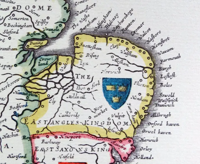
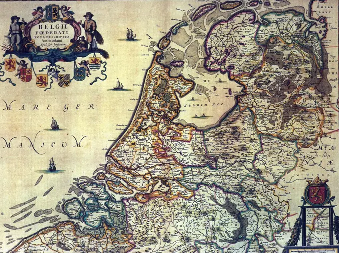
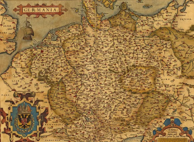
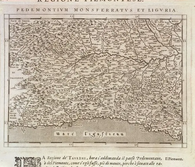
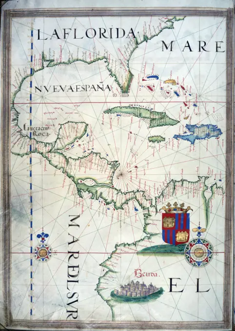
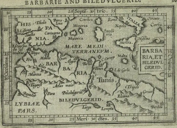
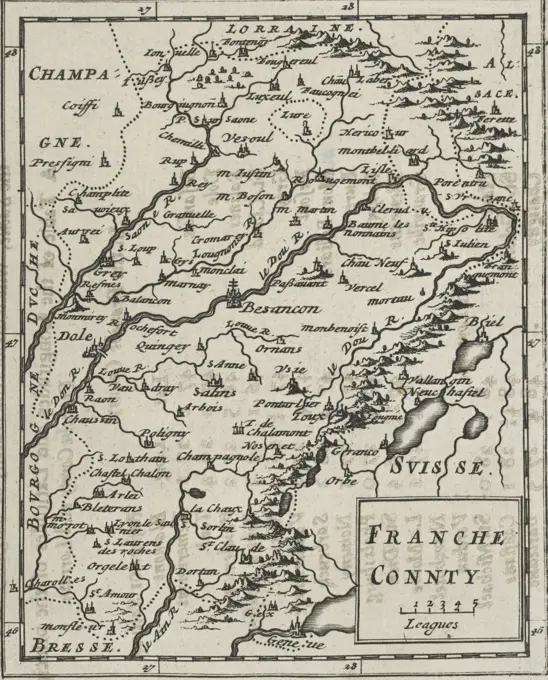
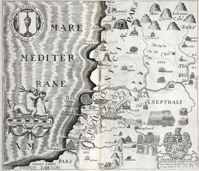
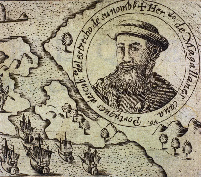
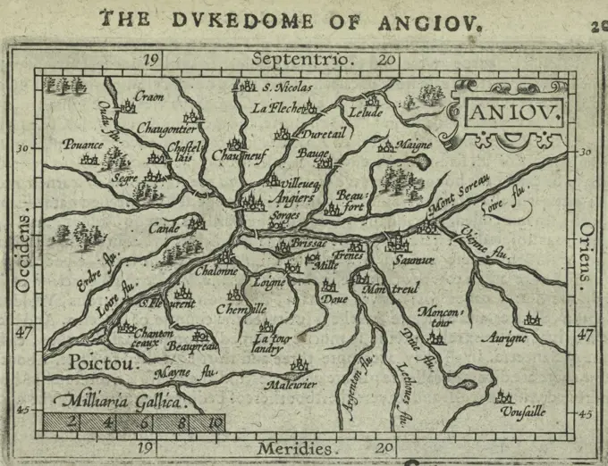
Mercator Atlas Maps from 1623

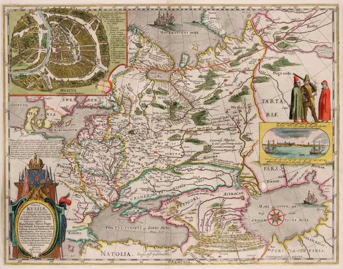
Digitally restored maps engraved by Gerhard Mercator, depicting regions in Germany, Switzerland, and Greece with detailed antiquity styles.

Map of Russia and Moscow (From: Theatrum Orbis Terrarum...) by Blaeu, Willem Janszoon (1571-1638) / Private Collection / 1645 / Holland / Copper engraving, watercolour / History /
277 assets in this story
1788-35754
Cartography, Italy, 18th century. Principality of Genoa. Map by Nicolas Sanson, Paris. Copper engraving.
4408-7961
Map of a Mediterranean Island, Theatro D'el Orbe La Tierra - Ortelius
4443-75467448
Arabia, 1681. Issued in London by A. Godbid and J. Playford for R. Scott, bookseller. Topics include Astronomy, Geography, and Mathematics
4409-64914
Netherlands and Belgium. Map. Engraving, 1843.
6145-58932665
Map - L'Asie Guillaume Danet (1670-1732)
4430-11526
cartography maps Asia coloured copper engraving ""Atlas Novus"" by Georg Matthaeus Seutter printed by Johann Peter von Behlen Vienna 1728 private collection,
6145-48719724
A map of Terra Firma Peru, Amazone-land, Brasil & the north part of La Plata , South America, Maps, Early works to 1800 Norman B. Leventhal Map Center Collection
6145-51388613
Anglesey : Wight Vectis olim ; Garnesay ; Iarsay , England, Maps, Early works to 1800, Isle of Wight England, Maps, Early works to 1800, Anglesey Wales, Maps, Early works to 1800, Jersey Channel Islands, Maps, Early works to 1800, Guernsey Channel Islands, Maps, Early works to 1800 Norman B. Leventhal Map Center Collection
6145-45628114
Large map of the siege of Den Bosch by Frederik Hendrik (leaf in the middle), 1629; Expongance Sylvae Ducis AO 1629. Large map of the Siege of Den Bosch by the state army under Frederik Hendrik, from 1 May to 17 September 1629. On either side of the map 18 small performances with details of the fortifications of the city and surrounding forts Marked iz .. Map composed of six plates and two - missing - text sheets. This is the blade in the middle with a part of the map with the omsing and the army camp at Vught. In the foreground two allegorical figures (Mars and a river god) that stop a map of the larger area.
4048-5304
Map of German States, then the Holy Roman Empire, from the early 18th century.
4409-20886703
CARTOGRAFIA. MAPA DE LOS QUIXOS O QUIJOS. BIBLIOTECA NACIONAL. MADRID.
4409-20939267
Map of Malta. Island. Mediterranean Sea. Italian engraving. 16th century.
4220-21886229
 Map of Scandinavia         Date: 1785
6145-52359390
Egypt and Barca &c. ; Abissina and Nubia &c. Cartographic. Maps, Atlases. 1701. Lionel Pincus and Princess Firyal Map Division. Geography
1746-19629194
Portuguese map of 1558 by Bastian Lopez showing Europe, British Isles and part of Africa. British Museum.
463-3838
Sedes Belli in Dauphinae et Province 1705
4430-5069
cartography maps Western Europe and Atlantic Ocean 16th century,
6176-67054347
'The Plantation of Ulster', 17th century, (1948). Creator: Unknown.
4443-75467135
Status Mutinensis in suas ditiones, 1731 - 1798, Nuremberg, Italy, Maps, Switzerland, Maps, 1 map; 50 cm
6176-66911333
Carte de la Barbarie, de la Nigritie, et de la Guinée 1718 Map of Barbary, Nigritia, and Guinea
6145-59471765
Map of Catalonia, Luggert van Anse, 1690 - 1709 print  Amsterdam paper engraving maps of separate countries or regions Catalonia
4409-20921229
CODICE TRUJILLO DEL PERU - TOMO I - CARTA TOPOGRAFICA DE LA PROVINCIA DE TRUJILLO DEL PERU - MAR DEL SUR - ACUARELA - SIGLO XVIII. Author: MARTINEZ COMPAÑON BALTASAR. Location: PALACIO REAL-BIBLIOTECA. MADRID. SPAIN.
1899-48156323
Atlas, map from 1623, Iceland, digitally restored reproduction from an engraving by Gerhard Mercator, born as Gheert Cremer, March 5, 1512 - December 2, 1594, geographer and cartographer.
1848-49453843
Atlas, map from 1623, Bohemia, Bohemia, Czech Republic, digitally restored reproduction from an engraving by Gerhard Mercator, born as Gheert Cremer, 5 March 1512, 2 December 1594, geographer and cartographer, Europe
1848-49453670
Atlas, map from 1623, Switzerland with Lake Geneva, digitally restored reproduction from an engraving by Gerhard Mercator, born as Gheert Cremer, 5 March 1512, 2 December 1594, geographer and cartographer
4443-75458540
Neuvième partie, de la carte du cours du Nil, depuis Sallaem, jusqu'à Ell Motmar, created in 1780 by Frederik Ludvig Norden. The piece measures 27 x 45 cm and was published in London by Lockyer Davis. The map focuses on Egypt, showcasing its description and travel, antiquities, archaeological sites, and features engravings
4048-5453
1655 map of South China coast by Martino Martini.
6145-29270036
Spain: map. Coloured engraving J. van Lugtenburg, ca. 1720, after G. de L'Isle.
6145-45773326
Map of the French South Coast at Toulon, ca. 1702; Les Forces de l'Europe, Asie, Afrique et Amerique, Ou Description des Principales Villes Avec Leurs Fortifications. Dessignées PAR LES MEILLEURS Engineers, private party Celles Qui Sont Sous La Domination de la France (...) Et Ornées the plusieurs Superbes Edifes. Map of the French South Coast at Toulon. Signature at the bottom right: LL. Part of the second of two parts of the picture: Les Costes de France et d'Espagne (or part 14 of: Les Forces de l'Europe, Asie, Afrique et Amerique), issued approx. 1702. It In the context, consists of a total of 43 labeled plates of the coast of France and Spain, in the context of the Spanish Succession War. These plates have been copied to anonymous French plates originally published by Nicolas de Fer in Paris. Title and inscriptions in the plate in French.
6145-54603203
Parte of Carnaruan Shyre
6145-29095915
John Pinkerton. Map of Persia. 1818.B
4435-2961
BELGIUM. Sint-Niklaas. Mercatormuseum. 'Leo Belgicus', map with the Seventeen Provinces of the Low Countries depicted in the form of a lion. Drawing by Franz Hogenberg for Michael Aitsinger, Cologne (1583-1585). Engraving.
6145-58955624
MPF1/68 Ireland, by John Goghe 1567 Our document of the month for August is this Map of Ireland from 1567. (MPF 1/68) Ireland is shown as 'Hibernia' in this map by John Goghe with additions by Sir William Cecil. Showing place-names, hills in relief, ships, fish, and a sea monster. Scale: about 1 inch to 16 miles. The map was extracted from the State Papers (SP 64/1) to be preserved as a flat map. education, documentofthemonth, ireland, tudor, williamcecil, document, map, 1567
6145-50565740
Sexta Asiae tabula , Arabian Peninsula, Maps, Early works to 1800 Norman B. Leventhal Map Center Collection
4409-20885365
CARTOGRAFIA. MAPA DE ESPAÑA. GUILLERMO BLAEU. AMSTERDAM , AÑO 1630.
4443-75467912
A map of Pennsylvania, issued in 1795, printed by F. and R. Bailey in Philadelphia. The map measures 15 x 18 cm and represents early works related to Pennsylvania's roads and geography prior to 1800
6145-52359375
Poland. Cartographic. Maps, Atlases. 1701. Lionel Pincus and Princess Firyal Map Division. Geography
6145-50557047
A new map of the Island of Barbadoes wherein every parish, plantation, watermill, windmill & cattlemill, is described with the name of the present possessor, and all things els remarkable according to a late exact survey thereof , Barbados, Maps, Early works to 1800 Norman B. Leventhal Map Center Collection
1899-40772
17th century map of Ancient Spain. From the book ""Description de L'Univers"" pubished 1683.
4409-17221453
Seven Years War (1756-1763). Map of the Battle of Reichenberg (April 21, 1757). The Prussian army, under the command of August Wilhelm, Duke of Brunswick-Bevern (1715-1781), defeated the Austrian army led by Christian Moritz Graf Königsegg und Rothenfels (1705-1778). Published in 1765 by the cartographer Jean de Beaurain (1696-1771) as an illustration of his Great Map of Germany, with the events that took place during the Seven Years War. Etching and engraving. French edition, 1765. Military Historical Library of Barcelona (Biblioteca Histórico Militar de Barcelona). Catalonia. Spain. Author: Jean de Beaurain (1696-1771). French geographer.
1746-21101619
Shield of East Anglia, from the Heptarchy; a collective name applied to the Anglo-Saxon kingdoms of south, east, and central England during late antiquity and the early Middle Ages, Detail from an antique map of Britain, by the Dutch cartographer Willem Blaeu in Atlas Novus (Amsterdam 1635)
1746-19666159
1658 map of the Dutch Republic. The Dutch Republic was known as the Republic of the Seven United Netherlands (Republiek der Zeven Verenigde Nederlanden) existed 1581 to 1795
4409-19345
PLANO DE LA CIUDAD Y HUERTA DE MURCIA - SIGLO XIX. Author: ALVAREZ DE TOLEDO JOAQUIN. Location: SERVICIO GEOGRAFICO DEL EJERCITO. MADRID. SPAIN.
1525-25129416
Antique Map of Germany by Abraham Ortelius, circa 1570
6145-59581186
Map with the wanderings of the Patriarchen, 1653 - 1654 print. text sheet Map in two parts about the wanderings of the Patriarchs. With five bets: the expulsion of Adam and Eva from Paradise (Gen. 3: 24); Noah and De Ark (Gen. 7:13, 8:16), Abraham and Lot leave for Canaan (Gen. 12: 4); the tower of Babel (Gen. 11: 8), Abraham's encounter with Melchizedek (Gen. 14:18), The sacrifice of Isaac (Gen. 22:10); Jakob's dream (Gen. 28:12), Joseph Reception of Jakob in Egypt (Gen. 46:30). The accompanying text starts with a decorated initial H. The magazine is part of an album.  paper engraving / etching / letterpress printing Old Testament. expulsion of Adam and Eve from paradise (Genesis 3:22-24). the ark ~ story of Noah. the Tower of Babel. the sacrifice of Isaac (Genesis 22). the meeting of Abraham and Melchizedek, the high priest and king of Salem, who brings bread and wine (Genesis 14:18-20). the dream of Jacob: while sleeping on the ground with a stone for pillow Jacob sees a ladder reac
6145-52359383
China. Cartographic. Maps, Atlases. 1701. Lionel Pincus and Princess Firyal Map Division. Geography
6145-54548591
A new map of Ipresent Spain & Portugal, shewing their principal divisions. cheif cities, townes, ports, rivers, mountains &c. Spain and Portugal. Cartographic. Maps, Atlases. 1700. Lionel Pincus and Princess Firyal Map Division. Atlases, British, Geography, Ancient, Maps in education , England, Maps
1788-35704
Cartography, Italy 16th century. Piedmont, Monferrato and Liguria Region. From Descrittione della Regione Piemontese (Description of Piedmont Region) by Giovanni Antonio Magini. Copper engraving.
4409-20886139
CARTOGRAFIA. PLANO DEL ARZOBISPADO DE MEXICO Y SU LAGUNA , AÑO 1767. REALIZADO POR JOSE ANTONIO DE ALZATE. BIBLIOTECA LORENZANA - BORBON. TOLEDO.
1095-128
Gulf of Mexico by Sebastiano Lopes from Portolan Atlas,  1546,  USA,  Chicago,  Newberry Library
4443-75473676
A publication titled 'Poictov.' by James Shawe, issued in 1603 in London. Published for Ieames Shawe, with sales occurring at his shop near Ludgate. The work focuses on atlases and geography, particularly pertaining to Norway and Poitou-Charentes in France
6145-52359555
Second map of Europe (Spain). Full gold border 1460. Ptolemy, 2nd cent.. Cartographic. Religious books, Manuscripts, Maps. Manuscripts and Archives Division. Spain
4443-75473127
A title page from 1603, published by James Shawe in London. The document features the title 'Barbaria, et Biledulgerid.' It is categorized under Atlases and Geography, with a focus on Norway, Africa, and North. The publisher's information notes that it was printed for Ieames Shawe and sold at his shop near Ludgate
4443-75473370
Franche County, 1681., 1681., London. Publisher, Printed by A. Godbid and J. Playford, for R. Scott, bookseller. Astronomy, Geography, Mathematics
6176-66093561
Vintage Pictorial Map: plan of the harbour of Chebucto and town of Halifax, by  Moses Harris, 1750
1746-19700375
Detail from the 'Dauphin' map by Desceliers, 1546, for Henri II, by order of Francis I
1899-19188458
Girolamo Ruscelli (1500s-1566) was an Italian cartographer, editor, humanist and polymath who primarily worked and lived in Venice during the early 16th century. Ruscelli founded an 'Academy of Secrets' in Naples in the 1540s, composed of humanists and noblemen; the academy was the first recorded example of an experimental scientific society. His best known work is a significant and important revision to Ptolemy's Geographia, published posthumously in 1574.
6145-30116861
Map of the Sevennes Mountains in the Languedoc; The Mountains of the Sevennes, although the Malcontents of Languedoc remember (...) / Les Montagnes des Sevennes Ou se Retirent Les Malcontents (& C) the Languedoc (...). Map of the Sevennes Mountains in The Languedoc Where The Malcontents Stopped, with the Large Royal Roads Laid Out On The Order Of The French King Louis XIV, CA. 1680-1699. With a Place Register in Dutch and French Under the album.
1899-19188524
Thomas Fuller (1608-1661) was an English churchman, historian and writer. Born in Aldwinker St Peter's, Northamptonshire, his father was rector of the community. He was admitted to Queens' College in Cambridge and did well academically. Fuller was a prolific author, one of the first English writers to live by his pen. He is particularly remembered for his Worthies of England, published in 1662 after his death.
1788-35742
Cartography, Italy, 17th century. Map of Western Liguria Region, by Ludovico Della Spina de Mailly, 1697. Copper engraving.
1899-20226967
Map of Lancashire, England 1611.
6145-52359417
Franconia. Cartographic. Maps, Atlases. 1603. Lionel Pincus and Princess Firyal Map Division. Geography, Franconia (Germany)
6145-52359444
Prussia. Cartographic. Maps, Atlases. 1603. Lionel Pincus and Princess Firyal Map Division. Geography, Baltic Coast, Baltic Sea
4443-73257004
States of Holland and West Friesland, Amsterdam, Allard, Carel, Noordelijke Nederlanden, 't Gebergte der Sevennes, al waar de Malcontenten van Languedoc zich houden, Les Montagnes des Sevennes Ou se retirent Les Malcontents (&c) De Languedoc, Map of the Sevennes Mountains in the Languedoc, Northern Netherlands, Map of the Sevennes Mountains in the Languedoc where the Malcontents reside, with the major royal roads constructed by order of the French king Louis XIV, ca. 1680-1699. With a place index in Dutch and French below the plate., print, prent, map, prints, Frederik Muller Historieplaten, height 541 mm, width 320 mm, print maker, printmaker, 1680 - 1699, fourth quarter 17th century, paper, papier, etching, etchings, hand coloring, Publication (Event), Publication, Dutch, 1648-01-19 - 1709-02-01, publisher, uitgever van privilege
6145-52359559
Fifth map of Europe (the Balkans), with gold border, commentary text in pink border with 4-line gold inital on pink and blue field 1460. Ptolemy, 2nd cent.. Cartographic. Religious books, Manuscripts, Maps. Manuscripts and Archives Division. Balkan Peninsula
1746-21101617
Shields of Wessex and Sussex from the Heptarchy; a collective name applied to the Anglo-Saxon kingdoms of south, east, and central England during late antiquity and the early Middle Ages, Detail from an antique map of Britain, by the Dutch cartographer Willem Blaeu in Atlas Novus (Amsterdam 1635)
6145-48725111
Pedemontivm ,. Ralph Finos Map Collection
6145-52359445
Polonia. Cartographic. Maps, Atlases. 1603. Lionel Pincus and Princess Firyal Map Division. Geography, Poland, Lithuania
4409-17221137
Heinrich Bunting, map of Europe, Europe in the Shape of a Queen,1581.
6145-51392591
Description du pais de Valois , Picardy France, Maps, Early works to 1800 Norman B. Leventhal Map Center Collection
6145-52359442
Oswiecz, et Zator. The Dukedomes of Oswitz and Zator. Cartographic. Maps, Atlases. 1603. Lionel Pincus and Princess Firyal Map Division. Geography, Poland, Vistula river (Poland)
6145-52359423
Cremae Ager. Crema. Cartographic. Maps, Atlases. 1603. Lionel Pincus and Princess Firyal Map Division. Geography, Crema (Italy)
6145-55955792
Savoy and Piedmont. Cartographic. Maps, Atlases. 1701. Lionel Pincus and Princess Firyal Map Division. Geography
4443-75472674
Iaponia Insula, 1603, by James Shawe. Additional, The Ile of Iapan., 1603., London. Publisher, Printed for Ieames Shawe, and sold at his shop near Ludgate. Atlases, Geography, Norway, Japan, Maps
4409-5879
LIBRO DE LAS DECADAS - 1601 - DETALLE DE FERNANDO DE MAGALLANES (1480-1521). Author: HERRERA Y TORDESILLAS ANTONIO. Location: BIBLIOTECA NACIONAL-COLECCION. MADRID. SPAIN. FERNANDO DE MAGALLANES. MAGALLANES HERNANDO.
6145-52359434
Sardiania. Sardegna. Cartographic. Maps, Atlases. 1603. Lionel Pincus and Princess Firyal Map Division. Geography, Sardinia (Italy)
4443-75478403
Aniov., 1603, Shawe, James. Additional, The Dukedome of Angiou., 1603., London. Publisher, Printed for Ieames Shawe, and are to be solde at his shoppe nigh Ludgate. Atlases, Geography, Norway, Anjou (France), Maine-et-Loire (France)
PREVIOUS
of 3
NEXT
2401 S. Ervay, Suite 206
Dallas, Texas 75215
United States
Get Started
Free ResearchMy BoardsMy Cart
For Creators
How To License Your ContentContributor PortalFrame of Mind
Resources
API accessPricing
Contact
+1 866 236 0087help@viewpictures.co.uk Contact form
©2026 View Pictures. All Rights Reserved. -A
This site is protected by reCAPTCHA and Google Privacy Policy and Terms of Service apply.