My Boards
View Pictures
  • My Boards
← Documents & Records

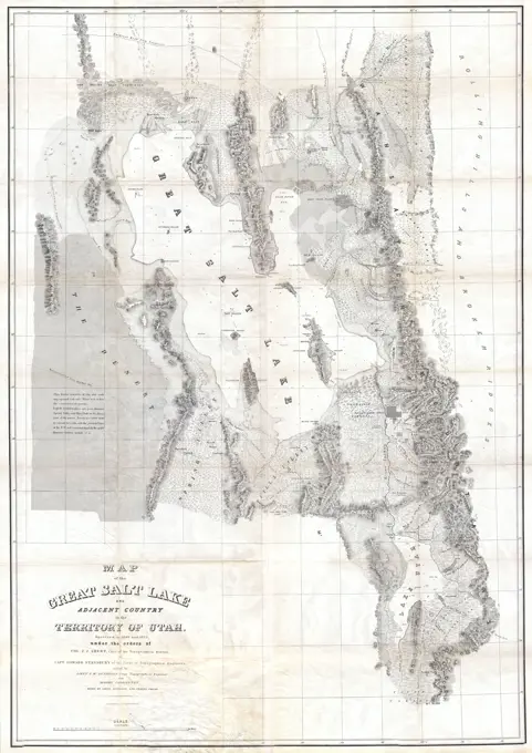
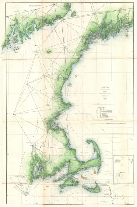
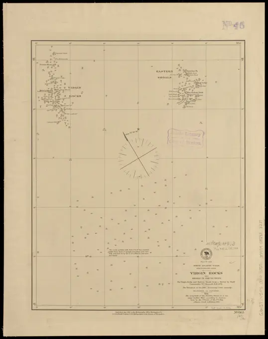
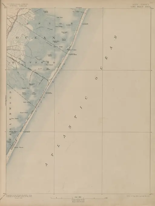
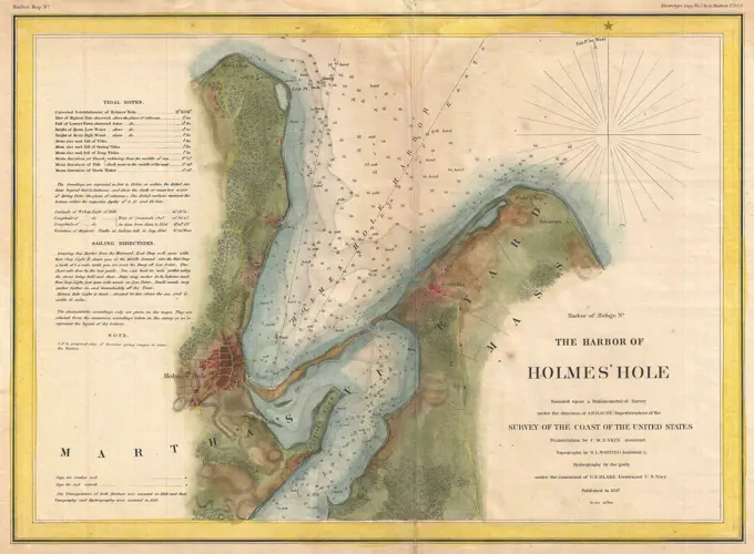
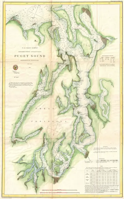
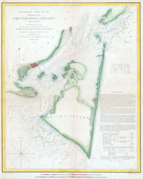
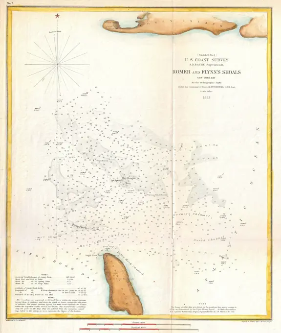
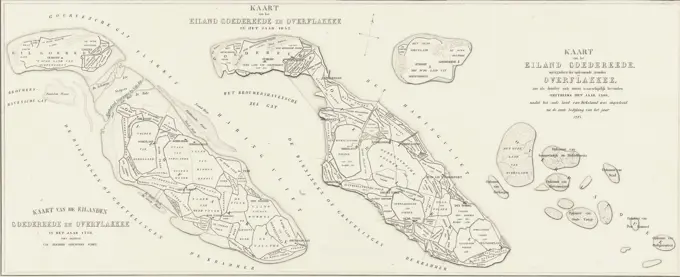
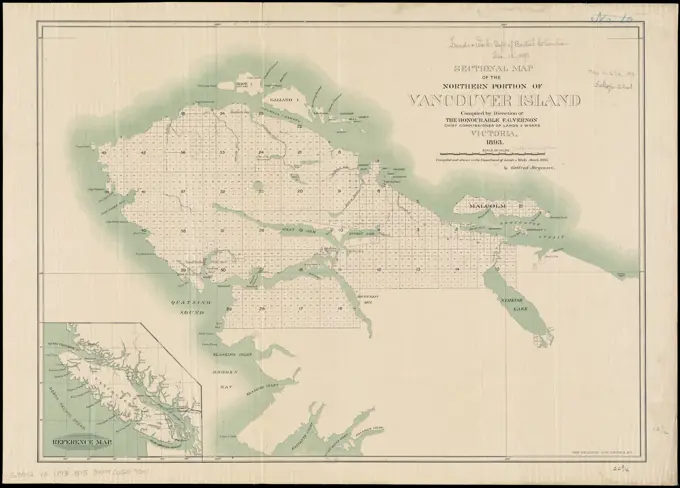
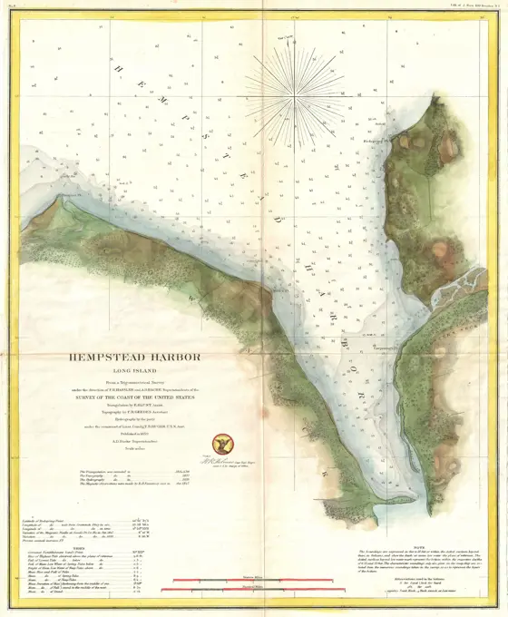
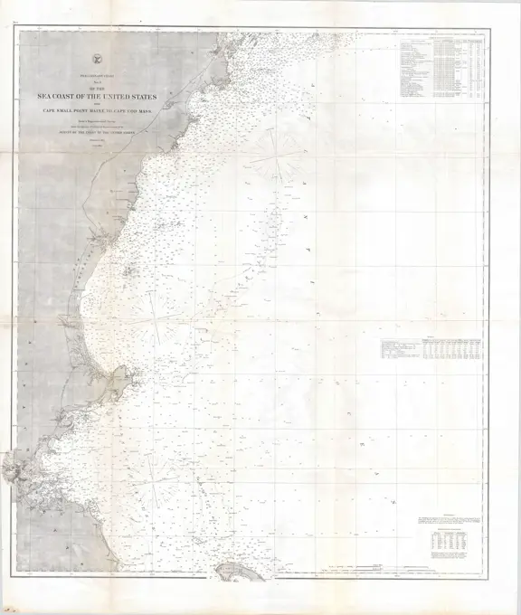
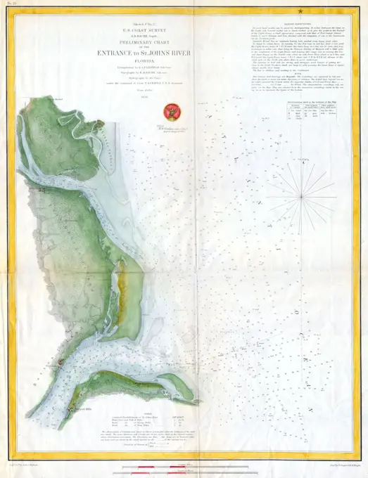
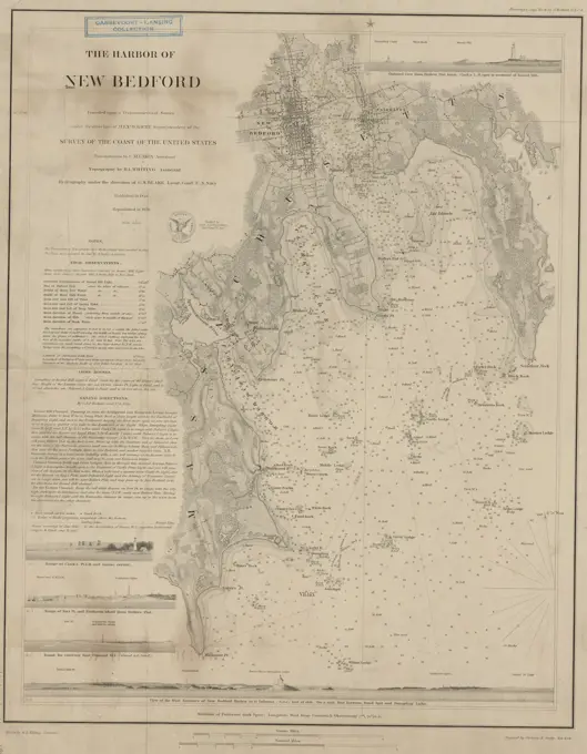
Nautical Charts of North America

Historical nautical charts detailing coastal areas of the United States and the Caribbean, highlighting maritime navigation features.

The Harbor of New Bedford, 1850, Publisher, United States Coast Survey, 1850, Washington, D.C., Nautical charts, New Bedford, Harbors, Atlantic Coast (Massachusetts), 1 map; 43 x 34 cm on sheet 54 x 43 cm
262 assets in this story
6145-55959784
A4. Sinob. Kiepert, Richard, 1846-1915. Cartographic. Maps. 1902 - 1916. Lionel Pincus and Princess Firyal Map Division. Turkey, Turkey, Maps
6145-59426273
Walk from the Scheldt from Fort Bath to Sea (upper leaf), 1832, Willem Charles Magnenat, 1833 print Map of the course of the Scheldt van Koudorp (below) to Sluis (Boven), at the time of the siege of Antwerp in December 1832. The various Sconances and Forts are indicated along the river. The legend on either side of the performance 1-28. Map in two magazines, of which this is the upper part. print maker: Netherlandspublisher: Amsterdam paper  maps of separate countries or regions Antwerp. Scheldt. Lock
6145-54267537
Anchorages on the east coast of the Korea. Relief shown by hachures. Depths shown by soundings. Insets: Chagu Chien Dogu Anchorage -- Choku Piyon Bay.... , North Korea  , Hamnam  ,province   , Sinpo Songjŏn-man Kŭmya-man
6145-55915076
Map of the towns of Gloucester and Rockport, Essex Co., Massachusetts. Relief shown by hachures. Depths shown by soundings. Includes insets of Gloucester Harbour Village, Rockport Village, Annis-Squam Village and an elevation of Front Street. Appears in J.G. Garver's Surveying the shore, historic maps of coastal Massachusetts, 1600-1930. Beverly, MA. 2006.... , Massachusetts  , Essex  ,county   , Gloucester Massachusetts  , Essex  ,county   , Rockport
6145-50444072
Jansen Hermann (1869-1945), development plan of the city expansion in Swinemünde (07.1923): Planning documents: Messischkarte 1886 (1911), partial sheet 682 (Swinemünde) 1: 25000. Colored pencil watercolored, via lithography on paper, 58.8 x 54.7 cm (including scan edges) Jansen Hermann  (1869-1945): Bebauungsplan der Stadterweiterung, Swinemünde
6145-52359899
San Francisco September 1848 Harrison, Augustus. 1853. Cartographic. Maps. The Miriam and Ira D. Wallach Division of Art, Prints and Photographs: Print Collection. San Francisco (Calif.)
6145-55956352
Plano topografico de la ciudad de Caracas, no. 16, page 65 Cartographic. Maps. 1843. Lionel Pincus and Princess Firyal Map Division
6145-29094702
1852 Stansbury Map of Utah and the Great Salt Lake
6145-29095067
1859 U.S. Coast Survey Map of the New England Coa
6145-48678418
North Atlantic Ocean, Newfoundland Bank, Virgin Rocks and shoals in the vicinity , Nautical charts, Newfoundland and Labrador, Virgin Rocks, Virgin Rocks N.L., Maps Norman B. Leventhal Map Center Collection
6145-43959950
Philippine Islands radio stations and cables , Radio stations, Philippines, Maps, Cables, Submarine, Philippines, Maps, Philippines, Maps Norman B. Leventhal Map Center Collection
6176-66093993
A topographical map of the north. part of New York island, exhibiting the plan of Fort Washington, now Fort Knyphausen.  Source William Faden, North American Atlas, 1777.
6145-55957344
Map of the route of the new Croton Aqueduct, old aqueduct and Bronx River pipe line: also the watersheds of the Croton, Bronx and Byram rivers Aqueduct Commissioners map of the route of the new Croton Aqueduct, old aqueduct and Bronx River pipe line Cartographic. Maps. 1899. Lionel Pincus and Princess Firyal Map Division. Aqueducts , New York (State) , New York, Water-supply , New York (State) , New York, Aqueducts, Water-supply, Croton Aqueduct (N.Y.), New York (State) , Croton Aqueduct, New York (State) , New York
4443-75467849
Macomb Township; Pope's Mills Business Directory; Oldsville Business Directory; Popes Mills Village, 1865, Beers, S. N., 1865, Philadelphia, Saint Lawrence County (N.Y.), Real property, New York (State), Saint Lawrence County
6145-50568290
Topographic map of Hardin County, Illinois , Hardin County Ill., Maps Norman B. Leventhal Map Center Collection
4443-75478635
Long Beach survey of 1883, edited in 1893, reprinted in 1907. Created between 1899 and 1926, published by The Survey, New Jersey
6145-29096712
1847 U.S. Coast Survey Map of Holmes' Hole (Vineyard Haven), Martha's Vineyard, Massachusetts
6145-29095483
1867 U.S. Coast Survey Chart or Map of Puget Sound, Washington
6145-46742630
Large copper mountain chronology. Mining maps.ur Carl Sahlin's mountain historical collection.
6145-50568015
Path map of the Eastern part of Mount Desert Island Maine , Forest reserves, Maine, Mount Desert Island, Maps, Trails, Maine, Mount Desert Island, Maps, Mount Desert Island Me., Maps Norman B. Leventhal Map Center Collection
6145-59601188
Map of the Kersmis Canal, Anonymous, c. 1795 print   paper etching maps, atlases South America
6145-29094767
1853 U.S.C.S. Map of Cape Fear, North Carolina
6145-54600671
Coast chart no. 186 : Choctawhatchee Inlet to Pensacola Entrance, West Florida : report of Navy Yard Site Commission, Gulf of Mexico and South Atlantic coasts
6145-50568900
Map of Mount Desert Island, Maine , Mount Desert Island Me., Maps Norman B. Leventhal Map Center Collection
6145-44199824
Testing table blade 0392 = 7: Schmelz, 1912
6145-50560360
Patagonia w.c., Gulf of Trinidad, Port Henry : from a British survey in 1879 , Nautical charts, Chile, Puerto Henry, Puerto Henry Chile, Maps Norman B. Leventhal Map Center Collection
6145-54268385
Patagonia w.c., Gulf of Trinidad, Port Henry : from a British survey in 1879. Relief shown by hachures and spot heights.Depths shown by soundings and isolines. Includes view of Port Henry, from the westward... Port Henry. Port Henry, Chile  , Magallanes y de la Antártica Chilena  ,region   , Henry, Puerto  ,harbor
4443-73154373
The Quarterly Journal of the Geological Society of London, v. 29 (1873), London, geology, periodicals, historical map, A detailed geological map showcasing the secondary strata along the Bombay coast and the surrounding regions. The map features a variety of colors delineating different geological formations, with an index provided for easy reference. Prominent geological layers are highlighted, illustrating the complexity of the region's geology. Labels indicate specific areas and features, while a directional compass rose is situated at the bottom, aiding in orientation. The title emphasizes the focus on the secondary strata, reflecting the map's purpose in geological studies and assessments.
6145-55166943
Chart of Long Pond ; Chart of Spot Pond. Map of Lake Cochituate oriented with north to the right. Map of Spot Pond oriented with north to the upper right. Depths shown by soundings. Some measurements of Long Pond taken in 1845. Shows proposed outlets for aqueduct and places where samples were taken... Chart of Spot Pond. Chart of Spot Pond, Massachusetts  , Middlesex  ,county   , Cochituate, Lake Massachusetts  , Middlesex  ,county   , Spot Pond
6145-29094756
1853 U.S. Coast Survey Map of the Romer and Flynn's Shoals near Coney Island, New York
6145-55917383
Topographic map of Hardin County, Illinois. Relief shown by contours and spot heights. Includes location map, legend and "Explanation of Topographic Map."... , Illinois  , Hardin  ,county
6145-50568876
Island of Moala, Feejee Group ; Island of Totoia, Feejee Group ; Island of Matuku, Feejee Group , Moala Group Fiji, Maps, Nautical charts, Fiji, Moala Group Norman B. Leventhal Map Center Collection
6176-66911158
Map of the defences of Charleston city and harbor, showing also the works erected by the U.S. forces in 1863 and 1864
6145-48673009
Map of the first or Southeastern district of Alaska , Alaska, Southeast, Maps Norman B. Leventhal Map Center Collection
6145-54548381
Île de New-York, partie de Long-Island ou de l'Île Longue et positions des armées américaine et britannique après le combat livré sur les hauteurs, le 27 Août, 1776. Cartographic. Maps. 1807. Lionel Pincus and Princess Firyal Map Division. New York (N.Y.), Long Island, Battle of, New York, N.Y., 1776, Manhattan (New York, N.Y.) , Maps, Brooklyn (New York, N.Y.) , Maps, Long Island (N.Y.) , Maps, New York (N.Y.) , History , Revolution, 1775-1783 , Maps
6145-48719005
The harbours of Rishibucto & Buctush : on the west shore of the Gulph of St. Lawrence , Nautical charts, Saint Lawrence, Gulf of, Early works to 1800, Coasts, New Brunswick, Maps, Early works to 1800, Nautical charts, New Brunswick, Early works to 1800, New Brunswick, Maps, Early works to 1800, Saint Lawrence, Gulf of, Maps, Early works to 1800 Norman B. Leventhal Map Center Collection
4443-75469714
Map of Little Egg Harbor, created by the United States Coast Survey in 1846. The map measures 43 x 34 cm and was published in Washington by The Survey. It includes details relevant to Little Egg Harbor, New Jersey, and features nautical charts
4443-73257485
Netherlands, Backer, Hilmar Johannes, Map of the islands of Goeree and Overflakkee in the years around 1300, 1750 and 1842, Map of the islands of Goeree, Goedereede and Overflakkee as they appeared in the years around 1300, 1750 and 1842., print, map, prints, Frederik Muller Historieplaten, height 261 mm, width 601 mm, Dutch, 1804-09-17 - 1845-05-01, print maker, printmaker, 1841 - 1843, second quarter 19th century, paper, lithography (technique)
6145-54269221
Sectional map of the northern portion of Vancouver Island. Shows Cape Scott to Robson Bight, Hope Island to Cape Cook. Inset: Reference map Vancouver Island.... , Canada  , Province of British Columbia  ,province   , Vancouver Island  ,island
6145-29095054
1859 U.S. Coast Survey Chart or Map of Hempstead Harbor, Long Island, New York
6145-50548682
Island of Moala, Feejee Group ; Island of Totoia, Feejee Group ; Island of Matuku, Feejee Group , Moala Group Fiji, Maps, Nautical charts, Fiji, Moala Group Norman B. Leventhal Map Center Collection
6145-55167095
Island of Moala, Feejee Group ; Island of Totoia, Feejee Group ; Island of Matuku, Feejee Group. Relief shown by hachures. Depths shown by soundings and pictorially. Includes 3 coastal profiles. Published in Narrative of the United States Exploring Expedition : during the years 1838, 1839, 1840, 1841, 1842.... , Fiji  , Moala Island  ,island  Fiji  , Totoya Island  ,island  Fiji  , Cakaudrove  ,province   , Matuku Island  ,island
6145-46715139
Skiopticon image from the Department of Photography at the Royal Institute of Technology. Use by Professor Helmer Bäckström as lecture material. Bäckström was Sweden's first professor in photography at the Royal Institute of Technology in Stockholm 1948-1958.The map of Australian Bourke.
6145-29095390
1865 U.S. Coast Survey Map of the New England Coast
6145-55915999
Path map of the Eastern part of Mount Desert Island Maine. Relief shown by contours, hachures and spot heights. Also shows reservations. "Copyright 1909 & 1911 by Edward L. Rand and Herbert Jaques." "Topography and hydrography adapted from the map of Mount Desert Island issued by the United States Coast and Geodetic Survey, June, 1882." "Nomenclature, revised and corrected, adapted from the map dated June, 1893, compiled for the flora of Mount Desert Island."... , Maine  , Hancock  ,county   , Mount Desert Island  ,island
6176-67043645
'Sketch between Balat and Adranos', c1915. Map showing the journey of British writer, soldier and diplomatic advisor Mark Sykes between Balat and Adranos in Turkey, (at that time part of the Ottoman Empire). Sykes (1879-1919) travelled through Palestine, Iraq, Syria, Persia and Turkey between 1905 and 1913, was honorary attaché to the British Embassy in Constantinople 1905-1906, was elected to parliament, worked in the Intelligence department of the War Office during the First World War, and died of the Spanish flu aged 39. From "The Caliphs' Last Heritage, a short history of the Tur
6145-29094776
1853 U.S.C.S. Map of St. John's River, Florida
6145-55916664
Post route map of the state of Florida showing post offices with the intermediate distances and mail routes in operation on the 1st of December, 1897. Also shows counties and railroads. Includes list of counties showing relative position.... , Florida
6145-55915223
Mapa jeografico de la Puna de Atacama. Shows roads, railroads, mines, and mineral deposits in the provinces of Antofagasta, Atacama, and part of Argentina. Relief shown by shading and spot heights. Includes legend.... , Atacama, Puna de  ,plateau
4409-17357616
History of Spain. Map of the Balearic Islands. Engraving, 19th century. Crónica General de España, Historia Ilustrada y Descriptiva de sus Provincias (General Chronicle of Spain, Illustrated and Descriptive History of its Provinces), Balearics, 1871.
6145-29094976
1856 U.S. Coast Survey Map of Mobile Bay, Alabama
6145-29873266
John Russell Pope, Study of Moldings, c 1896 Study of Moldings
4220-20432694
From granite rocks to sandy shores: the west seaboard of France, in three sections from Ushant (Brittany) to the Spanish frontier.      Date: 1944
6145-50523550
Topographische kaart der residentie Pekalongan : opgenomen ingevolge gouvernements besluit dd. 27 Mei 1863 no. 19, door de Opnemingbrigade te samengesteld uit von Ballesek 1e. Lt. Chef and 13 others , Pekalongan Dutch East Indies : Residency Norman B. Leventhal Map Center Collection
6145-48719199
Topographische kaart der residentie Pekalongan : opgenomen ingevolge gouvernements besluit dd. 27 Mei 1863 no. 19, door de Opnemingbrigade te samengesteld uit von Ballesek 1e. Lt. Chef and 13 others , Pekalongan Dutch East Indies : Residency Norman B. Leventhal Map Center Collection
6145-58975566
Plan of Upolu plans, maps
4409-17339782
Map. Province of Tarragona, 1866. Cronica General de Espa-a, Historia Ilustrada y Descriptiva de sus Provincias. Catalonia. 1866.
6145-29094696
1852 Levassuer Map of Senegal, Senegambia, and Madagascar
6145-50568677
Map of Madison County, Virginia : prepared under the direction of P.S. Michie , Madison County Va., Maps, 1866 Norman B. Leventhal Map Center Collection
6145-54549102
Clarence Township Cartographic. Atlases, Maps. 1866. Lionel Pincus and Princess Firyal Map Division. Erie County (N.Y.)
6145-51394650
Map of Madison County, Virginia : prepared under the direction of P.S. Michie , Madison County Va., Maps, 1866 Norman B. Leventhal Map Center Collection
4443-75471996
Niskayuna Township map from 1866, issued in Philadelphia by Stone & Stewart, depicting Schenectady County in New York
PREVIOUS
of 3
NEXT
2401 S. Ervay, Suite 206
Dallas, Texas 75215
United States
Get Started
Free ResearchMy BoardsMy Cart
For Creators
How To License Your ContentContributor PortalFrame of Mind
Resources
API accessPricing
Contact
+1 866 236 0087help@viewpictures.co.uk Contact form
©2026 View Pictures. All Rights Reserved. -A
This site is protected by reCAPTCHA and Google Privacy Policy and Terms of Service apply.