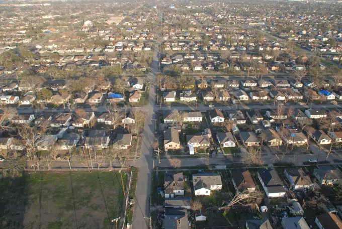
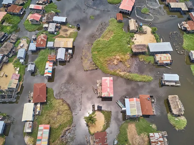
My Boards
View Pictures
  • My Boards

Post-Hurricane Katrina Impact

Aerial views depicting devastation caused by Hurricane Katrina, showcasing flooded neighborhoods and damaged infrastructure.

Hurricane Katrina
Hurricane Katrina
168 assets in this story
1899-70726708
Detroit, Michigan, The city has installed orange flood control barriers around the canals on the city's east side to protect homes from flooding expected due to record high water levels in the Great Lakes. The ""Tiger Dam"" barriers are flexible tubes, filled with water.
7228-71249513
Coconut Palms (Cocos nucifera) Georgetown area, Guyana
6145-54409701
New Orleans - Overflight - 26-HK-405-63. Hurricane Katrina
4141-35068
land settlement after clearance of rainforest manaus, north western brazil
6145-52078085
Plaquemines and St. Bernard - 26-HK-218-16. Hurricane Katrina
6145-52079718
Aftermath - Flooding - Miscellaneous - 26-HK-36-200. aerial view of flooding in residentail and commercial areas with submerged highway visible. Hurricane Katrina
6145-52065379
New Orleans - 26-HK-200-40. Hurricane Katrina
6145-54324807
Hurricane Katrina, New Orleans, LA, September 7, 2005 -- Neighborhoods throughout the area remain flooded as a result of Hurricane Katrina. Jocelyn Augustino/FEMA
6145-54409627
New Orleans - Overflight - 26-HK-405-25. Hurricane Katrina
6145-52070308
Material from Vice Admiral Allen - Principal Federal Official - 26-HK-369-27. Hurricane Katrina
1525-22234907
Aerial of suburban community, USA.
6145-54324923
Hurricane Katrina, New Orleans, LA, September 2, 2005 - Neighborhoods and roadways throughout the area remain flooded as a result of Hurricane Katrina. Jocelyn Augustino/FEMA
6145-52080280
Aftermath - Flooding - Miscellaneous - 26-HK-36-60. aerial shot of flooded neighborhood and damaged roofs, dated 9 3 2005. Hurricane Katrina
6145-54409635
ICP Documentation Profile - Electronic Systems Support Unit New Orleans - 26-HK-162-21. Hurricane Katrina
6145-52074512
Marine Safety Unit Baton Rouge - The City - 26-HK-383-15. Hurricane Katrina
4141-9701
aerial view of suburban gardens, useful bird feeding habitat, norfolk uk
6145-52069700
Salvage Engineering Response Team - New Orleans - Early October - 26-HK-351-1. Hurricane Katrina
6145-52077572
Aftermath - Aerial - 26-HK-330-40. French Quarter. Hurricane Katrina
6145-52061788
Pollution - ESU St. Louis Response - Murphy Oil - 26-HK-243-53. Neighborhood. Hurricane Katrina
6145-54316952
Wildfires,  Rancho Bernardo, CA, October 31, 2007   Aerial view of homes destroyed in Rancho Bernardo neighborhood due to the Southern California wildfires. Andrea Booher/FEMA.. Photographs Relating to Disasters and Emergency Management Programs, Activities, and Officials
4197-V64111993
1795R-14880
cucumbers, produce
6145-52073021
Disaster Assistance Response Teams (DART) - Marine Safety Office St. Louis - 26-HK-123-1. Hurricane Katrina
6188-65529253
Aerial view of Suburban neighborhood Norfolk County, Massachusetts with green forest, with big villa Aerial view of Suburban neighborhood Norfolk County, Massachusetts with green forest, with big villa Copyright: xZoonar.com/ThomasxDexWeverx 22556830
6145-52079717
Aftermath - Flooding - Miscellaneous - 26-HK-36-201. aerial view of flooding in residential and commercial areas with submerged highway. Hurricane Katrina
6145-52079684
Aftermath - Flooding - Miscellaneous - 26-HK-36-212. aerial view of residential and industrial areas. Hurricane Katrina
6145-52079677
Aftermath - Flooding - Miscellaneous - 26-HK-36-179. aerial view of flooded residential area. Hurricane Katrina
6145-52079160
Aftermath - New Orleans, Louisiana - 26-HK-283-12. Hurricane Katrina
1815-15709739
Benin, Ganvie, Aerial view of fishing village on Lake¶ÿNokoue
6145-52079787
Disaster Assistance Response Teams (DART) - Marine Safety Office St. Louis - 26-HK-120-7. Hurricane Katrina
6145-54589381
Creator: Dobert, Claire. Subjects: Aerial photography; Southern California; Scenics.  . 1998 - 2011.
6162-75581938
Aerial view of solar panels glinting on rooftops amidst industrial tanning factory buildings bisected by a long road, contrasting with surrounding greenery, Solofra, Campania, Italy.
6145-52080248
Aftermath - Flooding - Miscellaneous - 26-HK-36-153. aerial view framed by helicopter window of flooded neighborhoods. Hurricane Katrina
6145-54409702
ICP Documentation Profile - Electronic Systems Support Unit New Orleans - 26-HK-162-59. Hurricane Katrina
1558-15344095
Allotment gardens at the Futterstraße, allotment garden Aakerfährstraße at the A40, Duisburg, Ruhr area, North Rhine-Westphalia, Germany
6145-54324792
Hurricane Katrina, New Orleans, LA, September 7, 2005 -- A message on the top of a roof says "thank you" in a Neighborhood impacted as a result of Hurricane Katrina. Jocelyn Augustino/FEMA
6145-52079697
Aftermath - Miscellaneous - Aerial - 26-HK-49-207. aerial view of uprooted trees and damaged homes. Hurricane Katrina
6145-52076273
Pollution - ESU St. Louis Response - Murphy Oil - 26-HK-242-68. Hurricane Katrina
4450R-22201806
Coastal Tract Housing
6145-55892929
Aerial footage shot from near Fort Myers, Florida.
6145-55905148
Aerial footage shot from near Fort Myers, Florida.
1848-53629313
Camping site in the Rheinauen floodplains, aerial view, Grav island, Wesel, North Rhine-Westphalia, Germany, Europe
6145-51996386
Hurricane Katrina, Biloxi, Miss., December 10, 2005 -- The FEMA DuKate School Emergency Group Site (EGS) is used for temporary housing of residents displaced by Hurricane Katrina. Mark Wolfe/FEMA
5514-53893275
Farm land in the middle of the USA passes below an airplane window.
6162-75586786
Aerial view of a desolate landscape reveals the stark contrast between the charred remnants of homes and the surviving greenery, Pacific Palisades, California, United States.
1899-70726715
Detroit, Michigan, The city has installed orange flood control barriers around the canals on the city's east side to protect homes from flooding expected due to record high water levels in the Great Lakes. The ""Tiger Dam"" barriers are flexible tubes, filled with water.
6145-52060305
. close-up of flooding around houses with city buildings in background. Hurricane Katrina
6145-54324545
Hurricane Katrina, New Orleans, LA, August 30, 2005 -- A house in a neighborhood that is flooded as a result of Hurricane Katrina has markings on the roof from FEMA Urban Search and Rescue teams that have been searching for residents unable to reach dry ground. Jocelyn Augustino/FEMA
6145-52059797
Pollution - ESU St. Louis Response - Murphy Oil - 26-HK-242-34. Hurricane Katrina
6145-54402505
Aftermath - Aerial - 26-HK-296-244. Hurricane Katrina
6145-52065290
Aerial and Satellite Images - 26-HK-19-72. Hurricane Katrina
6162-49145191
Aerial view of Residential Areas Impacted by Air Pollution, Victoria, Australia.
1899-70726707
Detroit, Michigan, The city has installed orange flood control barriers around the canals on the city's east side to protect homes from flooding expected due to record high water levels in the Great Lakes. The ""Tiger Dam"" barriers are flexible tubes, filled with water.
4413-43265
Expansion urban habitat of the Bonelli's Eagle
6145-52078026
Plaquemines and St. Bernard - 26-HK-218-10. Hurricane Katrina
4286-85218
Aerial residential urban sprawl west of Phoenix Arizona
6145-51997181
Hurricane Katrina, New Orleans, LA, September 4, 2005 -- Messages on rooftops say help and tell the occupants in areas impacted by Hurricane Katrina. New Orleans is being evacuated as a result of a levee break following hurricane Katrina. Jocelyn Augustino/FEMA
1525-28138026
downtown los angeles skyline and suburbs from airplane and smoke from wild fires
6145-54402857
Aftermath - Flooding - Miscellaneous - 26-HK-36-233. close-up aerial view of flooded buildings and displaced cars. Hurricane Katrina
6145-52079103
Aftermath - New Orleans, Louisiana - 26-HK-283-5. Hurricane Katrina
1570R-22119004
Aerial view of sunny Southside Festival, Neuhausen ob Eck, Baden-Wuerttemberg, Germany
4355-170
Growth's Environmental Impact on The Everglades
6145-54402916
Aftermath - Miscellaneous - 26-HK-48-17. large group of displaced cargo containers2. Hurricane Katrina
1599R-16989
An aerial view of a housing development and wheat field
1899-76345987
Drained marsh land on San Francisco Bay, subject to liquefaction. Redwood Shores, California.
6096-20061250
France, Maine-et-Loire, summer 2022. Aerial view of the drought and heat wave in Anjou, Maine et Loire, caused by global warming and climate change. Photograph by Martin Bertrand.France, Maine-et-Loire, ete 2022. Vue aerienne de la secheresse et de la canicule en Anjou dans le Maine et Loire entrainees par le rechauffement et le dereglement climatique. Photographie de Martin Bertrand.
6145-52080276
Aftermath - Flooding - Miscellaneous - 26-HK-36-6. aerial shot framed by aircraft of flooded residential area--dated 9 3 2005. Hurricane Katrina
6145-51992288
Moore, Okla., May 25, 2013   National Geospatial Agency preliminary damage assessments displayed on FEMA's GeoPlatform.. Photographs Relating to Disasters and Emergency Management Programs, Activities, and Officials
PREVIOUS
of 2
NEXT
2401 S. Ervay, Suite 206
Dallas, Texas 75215
United States
Get Started
Free ResearchMy BoardsMy Cart
For Creators
How To License Your ContentContributor PortalFrame of Mind
Resources
API accessPricing
Contact
+1 866 236 0087help@viewpictures.co.uk Contact form
©2026 View Pictures. All Rights Reserved. -A
This site is protected by reCAPTCHA and Google Privacy Policy and Terms of Service apply.