My Boards
View Pictures
  • My Boards
← Documents & Records

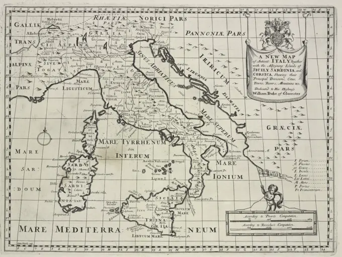
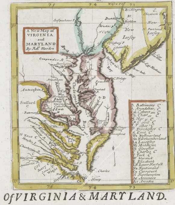
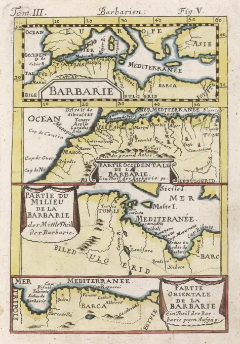
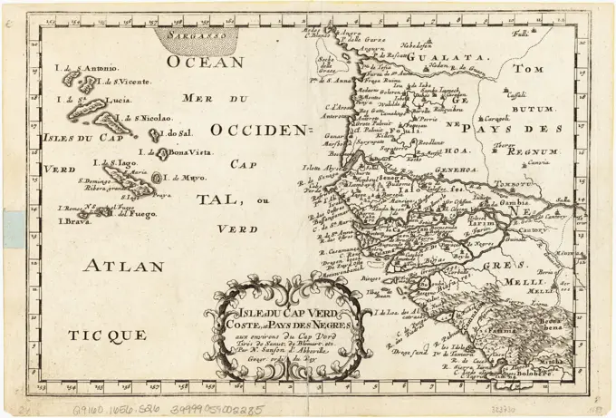
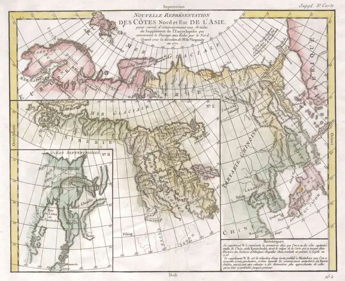
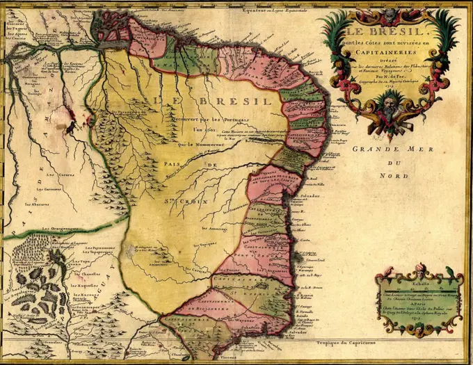
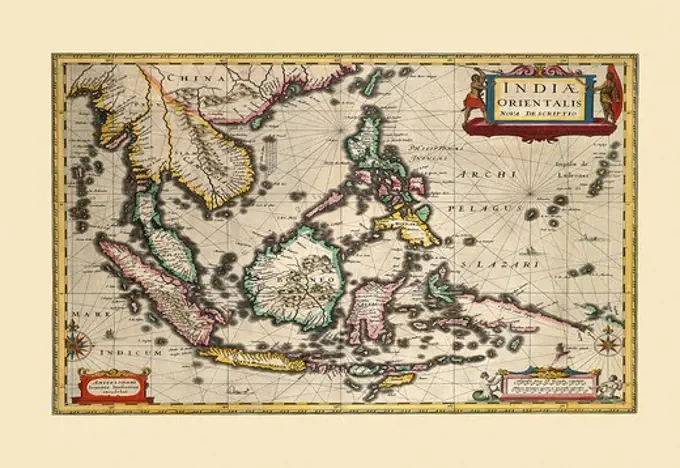
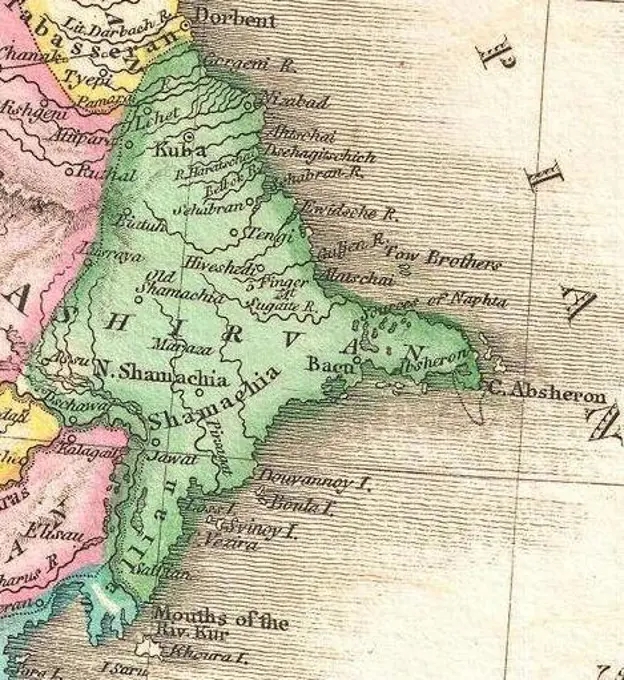
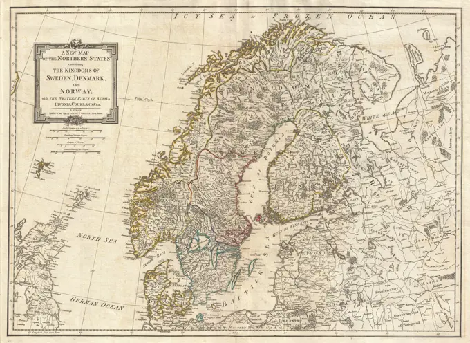
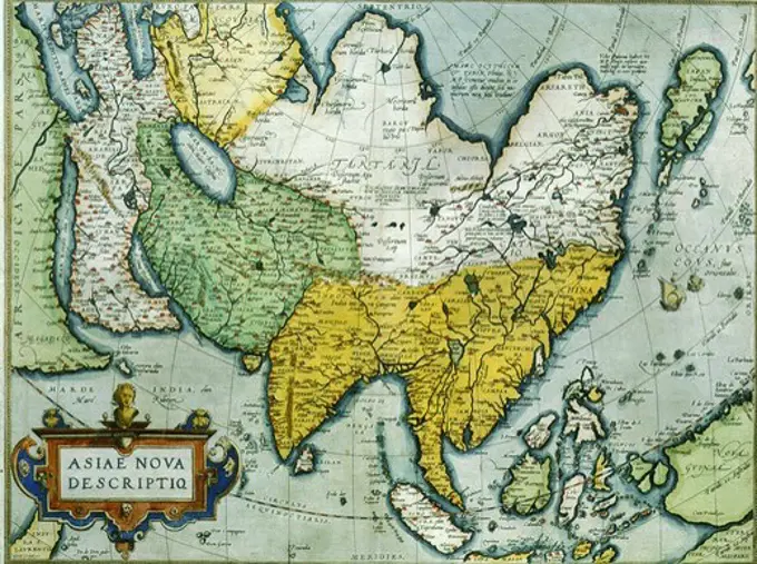
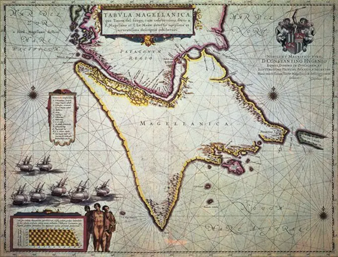
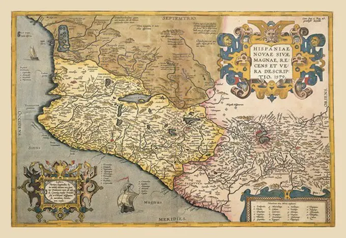
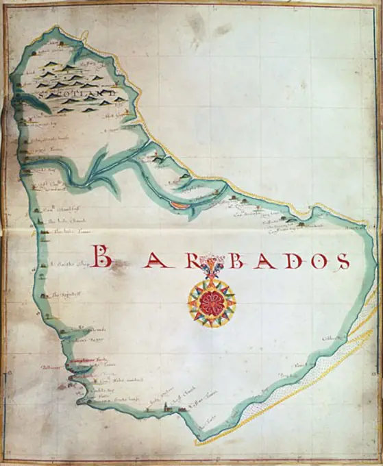
Retro Maps of Regions

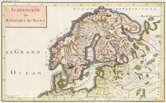
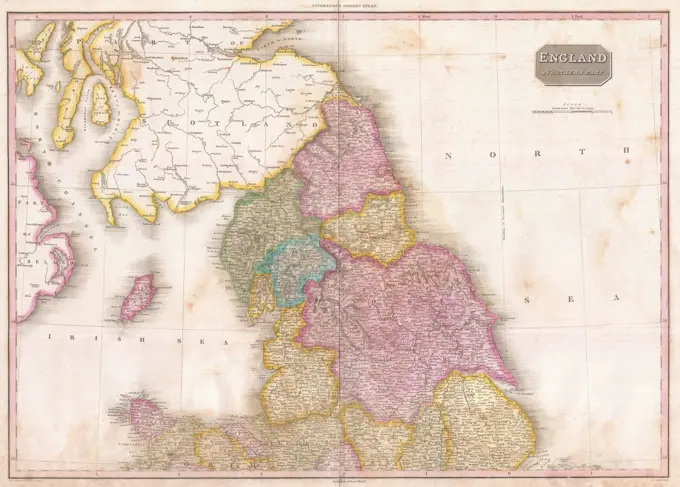
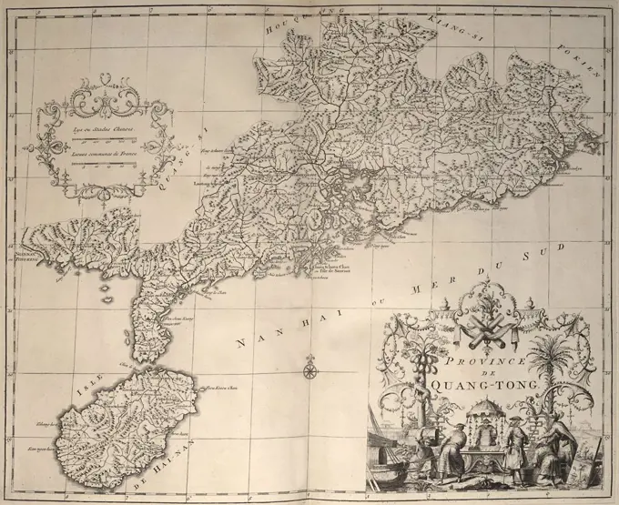
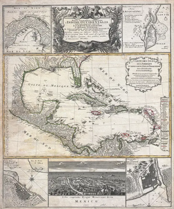
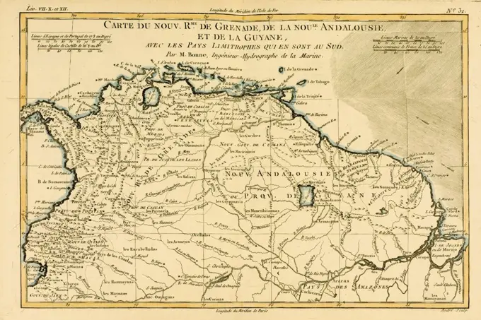
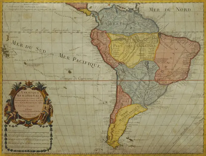
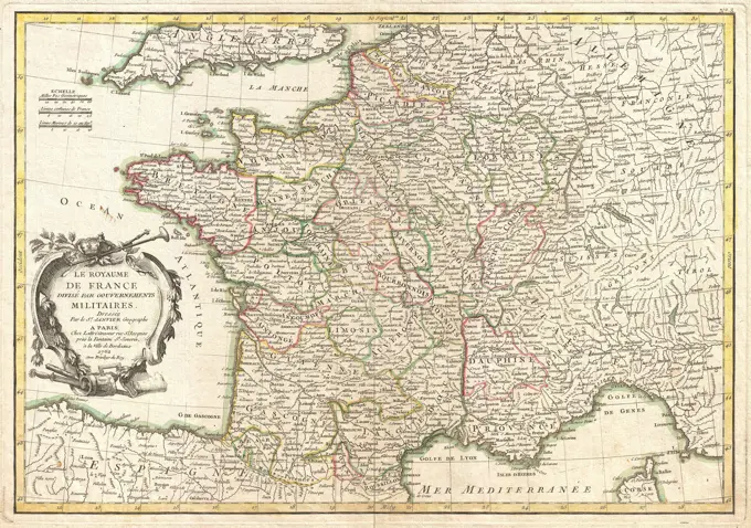
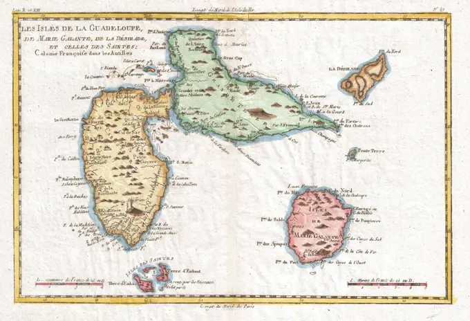
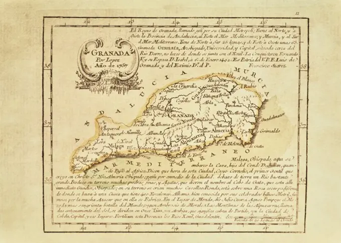
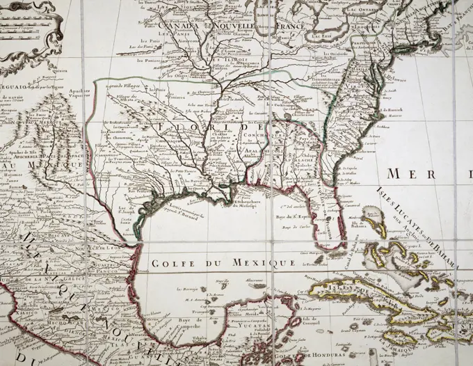
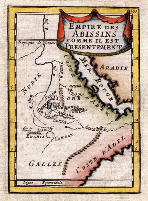
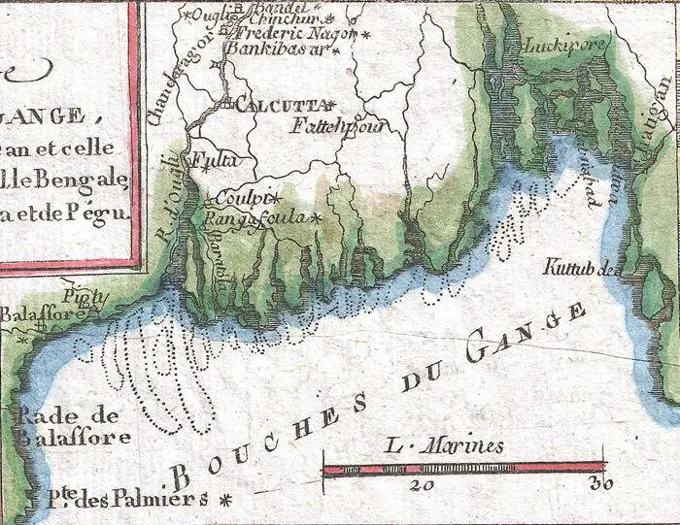
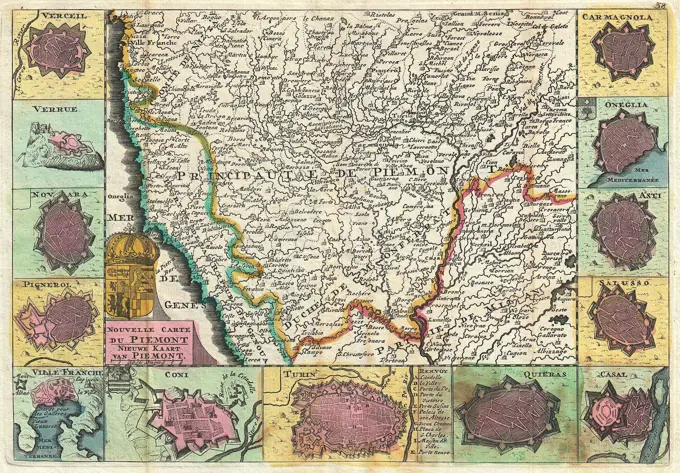
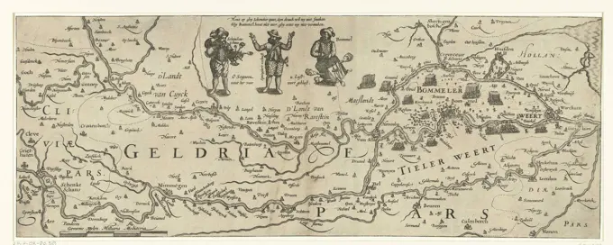
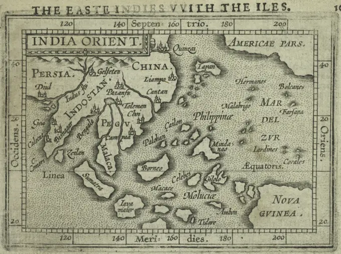
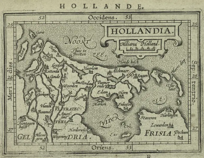
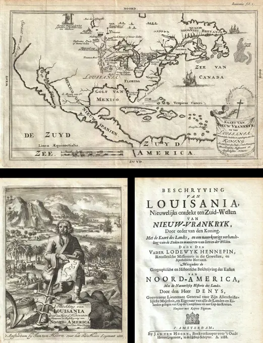
Antique maps representing various regions and countries, rich in details and historical geography, highlighting coastal and inland areas.

Massa, Isaac Abrahamsz. (1586-1643) Private Collection Graphic arts 42x54 History  Map of Russia (From: Partes Septentrionalis et Orientalis)
Massa, Isaac Abrahamsz. (1586-1643) Private Collection Graphic arts 42x54 History Map of Russia (From: Partes Septentrionalis et Orientalis)
291 assets in this story
6145-48718163
Italy, and Sardinia, from the best authorities , Corsica France, Maps, Italy, Maps, Sardinia Italy, Maps Norman B. Leventhal Map Center Collection
4220-21867864
 A map of Scandinavia.         Date: early 19th century
6145-55956316
A new map of North America shewing its principal divisions, chief cities, townes, rivers, mountains & c. North America. Burghers, M.. Cartographic. Maps, Atlases. 1700. Lionel Pincus and Princess Firyal Map Division. Atlases, British, Geography, Ancient, Maps in education , England, Maps, North America , Maps , Early works to 1800, Caribbean Area , Maps , Early works to 1800
6145-29096457
1818 Pinkerton Map of Northern England
1848-49453893
Atlas, map from 1623, South America, digitally restored reproduction from an engraving by Gerhard Mercator, born as Gheert Cremer, 5 March 1512, 2 December 1594, geographer and cartographer
4048-5420
1737 map of South China coast, including location of Hong Kong and Macao Island. Cartouche in lower right shows a European and Chinese engaging in trade.
6145-51388005
America Septentrionalis : concinnata juxta observationes Dnn Academiae Regalis Scientiarum et nonnullorum aliorum, et juxta annotationes recentissimas , North America, Maps, Early works to 1800 Norman B. Leventhal Map Center Collection
6145-50511731
Plan of Standish, made by Moses Banks, dated February 23, 1795. ,. Massachusetts. Office of the Secretary of State
6145-54548121
Leeward Islands. Flamsteed, John, 1646-1719. Godbid, A.. Cartographic. Maps, Atlases. 1681. Lionel Pincus and Princess Firyal Map Division. Astronomy, 1681, Geography, Mathematics
6145-29095244
1737 Homann Heirs - D'Anville Map of Florida and the West Indies
4443-75457924
A new map of ancient Italy, along with the adjoining islands of Sicily, Sardinia, and Corsica, showing their principal divisions, cities, towns, rivers, mountains, etc., 1700., Oxford. Publisher, Printed at the Theater. Additional, Italy, Sicily, etc. Categories include Atlases, British Geography, Ancient Maps, and Maps in Education
6145-51386942
Regni Sueciae tabula generalis, divisa in Sueciae, Gotiaeque regna Finniae ducatum Lapponiam, Livoniam Ingrianque et in omnes subiacentes provincias , Scandinavia, Maps, Early works to 1800, Finland, Maps, Early works to 1800, Russia, Maps, Early works to 1800, Baltic States, Maps, Early works to 1800, 1688 Norman B. Leventhal Map Center Collection
6145-55914528
An accurate map of North America : describing and distinguishing the British and Spanish dominions on this great continent : according to the definitive treaty concluded at Paris 10th Feby. 1763 : also all the West India Islands belonging to, and possessed by the several European princes and states. Relief shown pictorially. Hand colored. "Longit. w. from Ferro." Includes historical notes, notes on territorial claims, and insets of "A particular map of Baffin and Hudson's Bay" and "The passage by land to California." Featured in the Faces & Places Exhibit, Kravis Center, Palm Beach, FL, since 2005. MB (BRL) 3rd state.. Bowen, a leading British map seller and engraver during the mid-18th century, published his first maps of the Americas in the 1740s. This beautifully colored example, which was issued in 1772, was updated to reflect the changes in European colonial claims following the French and Indian War. As indicated in the title, a major purpose of this work was to differentiate the
6145-55955688
Yucatan Conventus Iuridici Hispaniae Novae Pars Occidentalis, et Guatimala Conventus Iuridicus Ogilby, John, 1600-1676. Cartographic. Maps, Atlases. 1671. Lionel Pincus and Princess Firyal Map Division. America, West Indies, British , History
4048-5424
1570 map of Italy  from Abraham Ortelius atlas, Theatrvm orbis terrarvm.
6145-50569276
Carte du Mexique et de la Florida : des terres angloises et des Isles Antilles, du cours et des environs de la Riviere de Mississippi , North America, Maps, Early works to 1800 Norman B. Leventhal Map Center Collection
6145-50571202
Regni Sueciae tabula generalis, divisa in Sueciae, Gotiaeque regna Finniae ducatum Lapponiam, Livoniam Ingrianque et in omnes subiacentes provincias , Scandinavia, Maps, Early works to 1800, Finland, Maps, Early works to 1800, Russia, Maps, Early works to 1800, Baltic States, Maps, Early works to 1800, 1688 Norman B. Leventhal Map Center Collection
4443-75475380
A new map of Virginia and Maryland, issued in 1680 by Thomas Cockerill and published in London for Robert Morden at the Atlas in Cornhill. The map, hand-colored, measures 12 x 11 cm and depicts both Maryland and Virginia, classified as early works to 1800
6145-51388966
Virginia Marylandia et Carolina in America septentrionali Brittannorum industria excultæ , Atlantic States, Maps, Early works to 1800, Virginia, Maps, Early works to 1800, Maryland, Maps, Early works to 1800, North Carolina, Maps, Early works to 1800 Norman B. Leventhal Map Center Collection
4220-21844032
North-west Africa, showing  portions of Barbary, land of  the Berbers, known to  Europeans as barbarians (today Morocco, Tunisia &c)      Date: 1719
1788-35254
Cartography, Italy, 18th century. Map of the Papal States, 1783
6145-51393907
Isles de Cap Verd coste, et pays des Negres , Cape Verde, Maps, Early works to 1800, Africa, West, Maps, Early works to 1800 Norman B. Leventhal Map Center Collection
6145-55914049
Isles de Cap Verd coste, et pays des Negres. Relief shown pictorially.... , West Africa  ,area  Cape Verde
6145-29096114
1772 Vaugondy - Diderot Map of Asia and the Northeast Passage
4048-5392
1719 map of Brazil, showing geographic definition on the coast.
4408-6470
Indiae Orientalis Nova Descriptio, Antique World Maps
6145-51387443
Sexta Europae tabula , Italy, Maps, Early works to 1800 Norman B. Leventhal Map Center Collection
6145-59099891
Carte des indees et de la chine dressee sur plusuts parts particulieres rectifees par quelques observations; Beauin, Jean (1696-1772); 1763 (1763-00-00-1763-00-00);
4409-17266813
CODICE TRUJILLO DEL PERU - TOMO I - CARTA TOPOGRAFICA DE LA PROVINCIA DE PIURA EN LOS VALLES DEL OBISPADO DE TRUJILLO DEL PERU - XVIII. Author: MARTINEZ COMPAÑON BALTASAR. Location: PALACIO REAL-BIBLIOTECA. MADRID. SPAIN.
6145-50571185
Terra di Otranto olim Salentina et Iapigia , Salentina Peninsula Italy, Maps, Early works to 1800 Norman B. Leventhal Map Center Collection
1848-49453876
Atlas, map from 1623, Guinease nova, New Guinea, digitally restored reproduction from an engraving by Gerhard Mercator, born as Gheert Cremer, 5 March 1512, 2 December 1594, geographer and cartographer
1848-50810898
Sri Lanka, hand-coloured woodcut by Sebastian Muenster from the Cosmographia Universalis, Basel 1550, Switzerland, Europe
6145-51388022
Americae , America, Maps, Early works to 1800, Western Hemisphere, Maps, Early works to 1800 Norman B. Leventhal Map Center Collection
6145-50568308
A new & accurate map of the islands of Hispaniola or St. Domingo, and Porto Rico , Hispaniola, Maps, Early works to 1800, Puerto Rico, Maps, Early works to 1800 Norman B. Leventhal Map Center Collection
6145-29095913
John Pinkerton. Map of Persia. 1818.E. Shirvan
160-2629
antique map
4409-17215910
Mapa de la provincia de Castilla la Vieja/1756. Colección paticular. Madrid.
6145-54548592
A new map of ancient Gaul or Gallia Transalpina, shewing the divisions thereof by Augustus Cæsar together with its principal people, cities, townes, rivers, mountains &c. Gaul, or Celtogalatia. Cartographic. Maps, Atlases. 1700. Lionel Pincus and Princess Firyal Map Division. Atlases, British, Geography, Ancient, Maps in education , England, Maps
1899-41399
Map of Grenada, New Andalucia and Guyana circa.1760. From 'Atlas de Toutes Les Parties Connues du Globe Terrestre ' by Cartographer Rigobert Bonne. Published Geneva circa. 1760.
1788-38415
South America, by Guillaume de l'Isle, Paris, 1700. Engraving.
6145-29096012
1762 Janvier Map of France
6145-29096180
1780 Raynal and Bonne Map of Guadeloupe, West Indies
6145-29096278
1794 Laurie and Whittle Map of Norway, Sweden, Denmark and Finland
6145-58837858
Map of Alicante, 1707 - 1720 Map of the province of Alicante during the Spanish Succession War. Under the performance an explanation in Dutch and Latin. Print is part of an album. print maker: Amsterdampublisher: AmsterdamThe Hague paper etching  Alicante Map of the province of Alicante during the Spanish Succession War. Under the performance an explanation in Dutch and Latin. Print is part of an album. print maker: Amsterdampublisher: AmsterdamThe Hague paper etching  Alicante
6176-61905003
Island of / Île-d'Orléans & Quebec City environs. Canada. GENTS MAG 1759 map
6145-50567726
Recens edita totius Novi Belgii, in America Septentrionali siti , East U.S., Maps, Early works to 1800 Norman B. Leventhal Map Center Collection
4069-411
Asia from Red Sea to Japan from Atlas by Abraham Ortelius Theatrum Orbis Terrarum 1570
4435-10297
MAGELLAND, Ferdinand (1480-1521). Portuguese navigator and discoverer. Map of the Magellan's Trip (Ferdinand Magellan) (1519). Southern of the Patagonia and Tierra Del Fuego.
6145-52359384
India, or the Mogul's Empire. Cartographic. Maps, Atlases. 1701. Lionel Pincus and Princess Firyal Map Division. Geography
6145-51389187
Archipelagus Atlanticus cum suis insulis Canariis, Hesperidibus et Azoribus , Azores, Maps, Early works to 1800, Cape Verde, Maps, Early works to 1800, Canary Islands, Maps, Early works to 1800, North Atlantic Ocean, Maps, Early works to 1800, Africa, West, Maps, Early works to 1800 Norman B. Leventhal Map Center Collection
6145-52359387
Persia. Cartographic. Maps, Atlases. 1701. Lionel Pincus and Princess Firyal Map Division. Geography
6145-52359449
Septentrionales. The countries and regions of the Northe. Cartographic. Maps, Atlases. 1603. Lionel Pincus and Princess Firyal Map Division. Geography, Greenland, Europe, Iceland
4408-7947
Map of South Western America and Mexico, Theatro D'el Orbe La Tierra - Ortelius
6176-66911107
Bermuda Islands, 1692
4409-17216073
Mapa de Granada,1757. Colección particular. Madrid. Author: Lopez.
1848-53967491
Historical map of Pomerania, entitled: "Le Duche de Pomeranie" by Sanson, Guillaume, 1633-1703, published in 1700 in Paris
6145-52359385
The principal islands of the East Indies. Cartographic. Maps, Atlases. 1701. Lionel Pincus and Princess Firyal Map Division. Geography
1095-202
L'isle, Guillaume De Carte Du Mexique Et Dela Floride 1703 Maps(- ) Newberry Library, Chicago, Illinois, USA
1899-18713520
A French map of the Red Sea and East African Coast dated 1683 and showing parts of Arabia, Nubia, Sudan, South Sudan, Somalia and East Africa.
6145-52360034
Tabula Africae III Ptolemy, active 2nd century. Cartographic. Maps. 1545 - 1555. Schomburg Center for Research in Black Culture, Jean Blackwell Hutson Research and Reference Division
1788-35659
Italy - Veneto Region - Venice - Palazzo Ducale (Doge's Palace). Hall of the Maps (Sala delle Mappe). Map of Tartary, by Gian Battista Ramusio (1540) and Francesco Grisellini (1761).
6145-45773327
Map of the French South Coast at Antibes, ca. 1702; Les Forces de l'Europe, Asie, Afrique et Amerique, Ou Description des Principales Villes Avec Leurs Fortifications. Dessignées PAR LES MEILLEURS Engineers, private party Celles Qui Sont Sous La Domination de la France (...) Et Ornées the plusieurs Superbes Edifes. Map of the French South Coast at Antibes. Signature at the bottom right: mn. Part of the second of two parts of the picture: Les Costes de France et d'Espagne (or part 14 from: Les Forces de l'Europe, Asie, Afrique et Amerique), issued approx. 1702. The picture work exists in total 43 labeled plates of the coast of France and Spain, in the context of the Spanish Succession War. These plates have been copied to anonymous French plates originally published by Nicolas de Fer in Paris. Title and inscriptions in the plate in French.
6145-55915230
A mapp of the Isles of Iapon. Relief shown pictorially. Inset: Mapp of Tunquin. Appears in Collections of travels through Turkey into Persia, and the East-Indies. London : Printed for Moses Pitt at the Angel in St. Pauls Church-yard, 1684. Cataloging, conservation, and digitization made possible in part by The National Endowment for the Humanities: Exploring the human endeavor. Part of composite portfolio atlas with title "Collection of old maps.".. Mapp of the Isles of Japon Collection of old maps. Mapp of the Isles of Japon Collection of old maps, Viet Nam  , North Vietnam  ,territory  Japan
6145-54269603
Zeilan Insula. Maps on p. 635; Latin text on verso, p. 636. Appears in 1628 Latin ed. of author's Atlas Minor. Map is titled incorrectly. Refer to Koeman. Maps: Cuba Insula -- Hispaniola Insula -- Ins. Iamaica -- Ins. S. Ioannis -- I.S. Margreta... Zeilan Insvla Cuba Insvla Cuba Insula. Zeilan Insvla Cuba Insvla Cuba Insula, Cuba Jamaica Hispaniola  ,island  Puerto Rico  ,territory  West Indies
6145-51386916
Recens edita totius Novi Belgii, in America Septentrionali siti , East U.S., Maps, Early works to 1800 Norman B. Leventhal Map Center Collection
4443-75464309
A publication related to Prussia issued in 1603 by James Shawe, printed in London and sold at his shop near Ludgate. It includes atlases pertaining to geography, with a focus on Norway, the Baltic Coast, and the Baltic Sea
6145-55956416
Italia. Italye. Cartographic. Maps, Atlases. 1603. Lionel Pincus and Princess Firyal Map Division. Geography, Italy
4435-2938
Map of the Kingdom of Naples. 1597-1568. Illustration from the work 'Geografia, cioŽ, Descrittione universale de la terra', edited in Venice by Giovanni Battista and Giorgio Galignani. SPAIN. CATALONIA. Barcelona. Barcelona University Library.
6145-48719209
Le Perou : et le cours de la rivière Amazone, depuis ses sources jusques à la mer , Peru, Maps, Early works to 1800, Brazil, Maps, Early works to 1800, South America, Maps, Early works to 1800 Norman B. Leventhal Map Center Collection
6145-29095896
Ganges Delta- &bouches du Gange& or mouths of the Ganges, 1780 Raynal and Bonne Map of Northern India
1525-21260002
Antique Thailand map from XVII century isolated on white
6145-58932655
Map - Americae pars Borealis, Florida, Baccalaos, Canada, Corterealis Cornelis de Jode (1568-1600)
6145-29095744
1747 La Feuille Map of Piedmont, Italy
6145-30116537
Map of the country between Maas and Waal with the fighting at Schenckenschans and in the Bommelerwaard, 1599.Map of the Country Between Maas and Waal With The Fighting at Schenckenschans and in the Bommelerwaard in 1599. At the Top Three Figures: Two State Soldiers and A shocked spaniard. Herby Two Two-Year Verses in Dutch. At The Bottom Left Of The Scale.
6145-59393699
Map of Spain and part of North Africa, Jan Luyken, 1692 print Print at the top right marked: page: 618. print maker: Amsterdampublisher: Leidenpublisher: Leiden paper etching maps of separate countries or regions Spain. Maghreb
6145-46604013
. Print at the top right labeled: Pag: 362.
1525-24839294
Beautiful old brass compass over antique Thailand map
6145-52359443
Transilvania. Cartographic. Maps, Atlases. 1603. Lionel Pincus and Princess Firyal Map Division. Geography, Transylvania (Romania)
1899-20225726
Map of Greece 1650.
6176-66094793
Vintage Illustrated  Map of Singapore, Sumatra, Malaysia, Straits of Malacca by Sebastian Münster 1580.   Large cartouche of a man riding an elephant.
4443-75478302
A title page from 'India Orient.' published in 1603 by James Shawe in London. The page features the additional title 'The Easte Indies with the iles.' The publication is associated with atlases and geography, focusing on regions such as Norway, Asia, Southeastern Asia, and India
6145-52359405
Geldria. Gelderlande. Cartographic. Maps, Atlases. 1603. Lionel Pincus and Princess Firyal Map Division. Geography, Gelderland (Netherlands)
6145-29095908
John Pinkerton. Map of Persia. 1818.G. Aderbijan
6145-55941733
Untitled Map of the United States, flanked by portraits of Washington and Franklin. T. Woodman & H. Mutlow. McAlpin, Charles Williston, 1865-1942. Prints, Portraits, Maps. 1783. The Miriam and Ira D. Wallach Division of Art, Prints and Photographs: Print Collection. Washington, George, 1732-1799, Franklin, Benjamin, 1706-1790
6145-45686676
Large map of the siege of Den Bosch by Frederik Hendrik, 1629; Expongance Sylvae Ducis AO 1629. Large map of the Siege of Den Bosch by the state army under Frederik Hendrik, from 1 May to 17 September 1629. On either side of the map 18 small performances with details of the fortifications of the city and surrounding forts Marked Iz. Map composed of six plates, without the two - missing - text sheets.
6145-29096515
1688 Hennepin First Book and Map of North America (first printed map to name Louisiana)
1848-50810908
India, by Allain Manesson Mallet from Description de L'Univers, 1684, Paris, Asia
1746-654
Map of Barbados, 1683. British Museum
6145-52359426
Bressiano. Cartographic. Maps, Atlases. 1603. Lionel Pincus and Princess Firyal Map Division. Geography, Garda, Lake (Italy), Brescia (Italy)
6145-52359409
Hollandia. Hollande. Cartographic. Maps, Atlases. 1603. Lionel Pincus and Princess Firyal Map Division. Geography, Holland (Netherlands : Province)
4443-75467609
Hollandia, 1603, by James Shawe. Additional, Hollande. Published in London by Ieames Shawe, available for sale at his shop near Ludgate. Relevant subjects include atlases, geography, Norway, and the province of Holland (Netherlands)
PREVIOUS
of 3
NEXT
2401 S. Ervay, Suite 206
Dallas, Texas 75215
United States
Get Started
Free ResearchMy BoardsMy Cart
For Creators
How To License Your ContentContributor PortalFrame of Mind
Resources
API accessPricing
Contact
+1 866 236 0087help@viewpictures.co.uk Contact form
©2026 View Pictures. All Rights Reserved. -A
This site is protected by reCAPTCHA and Google Privacy Policy and Terms of Service apply.