My Boards
View Pictures
  • My Boards

Satellite Earth Observations

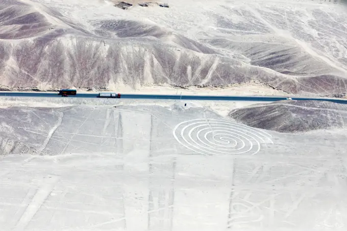
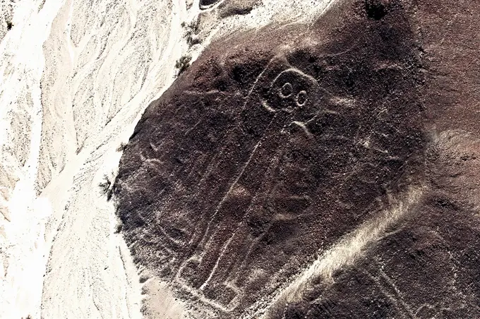
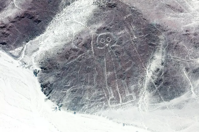
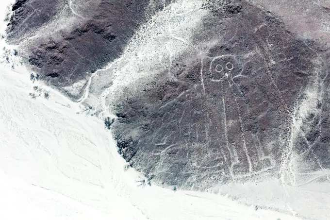
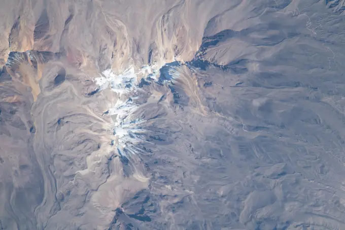
Aerial views of diverse landscapes, including craters and mountain ranges, captured from space, displaying natural topography and geological features.

Earth Observations during Expedition 69. iss069e028771 (July 4, 2023) --- The snow-covered peak of the extinct Volcano Chachani is pictured from the International Space Station as it orbited 261 miles above the Peruvian Andes on the South American continent.
255 assets in this story
6145-44626136
ISS010-E-10124 (11 December 2004) --- The Algerian desert is featured in this image photographed by an Expedition 10 crewmember on the International Space Station.
6145-54684050
. iss069e061159 (Aug. 16, 2023) --- Mount Rainier, an active volcano with an elevation of 14,400 feet, is pictured from the International Space Station as it orbited 264 miles above the Evergreen State of Washington.
6145-44922733
Earth Observations taken by Expedition 34 crewmember.
6145-44815475
ISS023-E-024574 (15 April 2010) --- The Salton Sea and Imperial Valley are in the center of  this scene photographed from the International Space Station (note solar panels, upper right).  The orbital outpost and space shuttle Discovery have been docked for several days as an aggregation of 13 astronauts and  cosmonauts continue work on the station.  The two spacecraft will undock over the weekend and the shuttle is scheduled to return its crew of seven back home on Earth on April 19.
6145-44604644
NASA's Terra spacecraft imaged Iceberg B-15A, the largest iceberg in the world (measuring about 11,000 square kilometers) when it broke away from Western Antarctica's Ross Ice Shelf in March 2000.
1848-76866025
Geometric patterns of the Nazca lines in an arid desert region, seen from the air, The geoglyphs and images in the desert near Nasca and Palpa in Peru
6145-44732213
ISS018-E-008064 (9 Nov. 2008) --- Progressive forest clearing in Bolivia is featured in this image photographed by an Expedition 18 crewmember on the International Space Station. The eastern half of Bolivia is covered with tropical rainforest. In the 1990s, Bolivia initiated a large-scale effort to increase the rate of logging and create tracts of land for commercial agriculture (primarily soy and sugar cane, but also coca) on the Amazon Basin side of the Andean highlands. Today, the commercial fields are well-established and easily mapped from space as large, rectangular clearings in the forest. The agricultural developments are still growing today. The clearings start off as small rectangles arranged perpendicular to an access road; early clearings take on a herring-bone pattern when viewed from above. The uncleared (dark forest) areas are gradually logged and cultivated, filling in the pattern to make a larger cleared area. Astronauts aboard the space station routinely observe inten
6145-45122760
iss050e013545 (12/2/2016) ---  A view of the Sío Francisco River in Brazil. Crew Earth Observations (CEO) imagery provides researchers on Earth with key data to understand the planet from the perspective of the ISS. Crew members have been photographing Earth from space since the early Mercury missions beginning in 1961. The images taken from the ISS ensure this record remains unbroken.
6145-44925984
Earth Observations taken by Expedition 34 crewmember.
6145-45174096
iss056e102524 (Aug. 2, 2018) --- Wildfires are seen to the north and east of the San Francisco Bay Area in northern California as the International Space Station orbited 251 miles above above the Pacific coastline.
6145-44702532
Ames launches ARCTAS Mission campaign to study the Arcitc atmosphere.
6145-44950305
Earth observation taken by the Expedition 35 crew aboard the ISS.
6145-45051306
Earth observation taken by the Expedition 39 crew aboard the ISS. Image was released by astronaut on Twitter and downlinked in folder Japan, etc.
6145-44699655
ISS016-E-031056 (3 March 2008) --- Cananea Copper Mine, Sonora, Mexico is featured in this image photographed by an Expedition 16 crewmember on the International Space Station. One of the largest open-pit copper mines in the world, the Cananea mine produced over 164,000 tons of copper in 2006. The mine is located approximately 40 kilometers south of the border between the USA (Arizona) and Mexico (Sonora). Copper and gold ores at Cananea are found in a porphyry copper deposit, a geological structure formed by crystal-rich magma moving upwards through pre-existing rock layers. A porphyry - an igneous rock with large crystals in a fine-grained matrix -- is formed as the magma cools and crystallizes. While crystallization is occurring, hot fluids can circulate through the magma and surrounding rocks via fractures. This hydrothermal alteration of the rocks typically forms copper-bearing and other minerals. Much of the Cananea mine's ore is concentrated in breccia pipes -- mineralized rod o
6145-44607004
Pavonis Mons
6145-44522933
ISS002-E-5661 (16 April 2001) --- As the International Space Station (ISS) recently passed over the Pacific Ocean, one of the Expedition Two crew members, using an 800mm lens on a digital still camera, photographed this high oblique image of the coastal metropolitan area of San Diego, California.  The angle of the view allows one to see quite a distance inland.
6145-59355966
Snapshot from above: in the way of 'the powers of ten', anonymous, c. 1948 - c. 1955 photograph Recording from a mast straight down. In the corner of a garden on the grass there are two people in garden chairs. United States of America photographic support   United States of America
6145-44693350
Heading for Next Winter Haven
6145-44679921
ISS015-E-17052 (5 July 2007) --- The Great Salt Lake in Utah is featured in this image photographed by an Expedition 15 crewmember on the International Space Station.
6145-45051854
ISS039-E-013569 (20 April 2014) --- This is one of an extensive series of still photos documenting the April 20 arrival and ultimate capture and berthing of the SpaceX Dragon at the International Space Station, as photographed by the Expedition 39 crew members onboard the orbital outpost. In this photo, the two orbiting spacecraft were above a point in Yemen. Part of the Gulf of Aden and the Red Sea, can be seen at left. The Dragon spacecraft was captured by the space station and successfully berthed using the Canadian-built space station remote manipulator system or Canadarm2.
5514-65780896
Microbial Mats.
6145-44827521
NASA image acquired August 9, 2010Phytoplankton are microscopic organisms that live in watery environments. When conditions are right, phytoplankton undergo explosive population growth, creating blooms visible from space. Such a bloom occurred in the North Atlantic Ocean, off the coast of Newfoundland in early August 2010. The Moderate Resolution Imaging Spectroradiometer (MODIS) on NASAs Terra satellite captured this natural-color image on August 9, 2010. The paisley pattern of peacock blue owes its color to phytoplankton...... Phytoplankton thrive at high latitudes, especially in the spring and summer when abundant sunlight spurs photosynthesis, and relatively calm seas allow the tiny organisms to congregate in sunlit waters. Blooms can last for weeks even though an individual phytoplankton lifespan may be just a few days.NASA/GSFC/Jeff Schmaltz/MODIS Land Rapid Response Team
6145-44730907
ISS018-E-006051 (29 Oct. 2008) --- Deriba Caldera in Sudan is featured in this image photographed by an Expedition 18 crewmember on the International Space Station. Deriba Caldera is a geologically young volcanic structure located at the top of the Marra Mountains of western Sudan. The Marra Mountains are part of a large geologic feature known as the Darfur Dome -- this structure is thought to be the result of a mantle plume heating the crust from below, leading to uplift of the crust and providing a magma source for the extensive volcanism observed in the region. According to scientists, the five-kilometers-wide Deriba Caldera was formed by explosive eruption of the Jebel Marra volcano approximately 3,500 years ago. The volcano is considered dormant, as hot springs and fumaroles (gas and steam vents) are still present. The caldera presents a classic crater morphology, formed as overlying rock and soil collapsed into the magma chamber after it was emptied by powerful eruptions -- shado
6145-45257129
Antarctica is the coldest, driest and windiest place on Earth - and, during the austral summer, it is also the sunniest. Due to the tilt of the Earths axis in relation of the sun, the frozen land south of the Antarctic Circle receives six months of daylight in summertime, and six months of darkness in winter. The long hours of sunshine allow for excellent imagery of the region from space. This true-color mosaic of Antarctica was created from images acquired by multiple passes of the Moderate Resolution Imaging Spectroradiometer (MODIS) aboard the Terra satellite on December 16, 2013. Because Terra is in a polar orbit, it passes over each pole approximately 14 times a day, and acquires an image on each pass. To create a mosaic, the data that are closest to the center of each swath - where edge distortion is minimized - are used to create a complete view of the region. The MODIS Rapid Response system generates complete mosaic images of Antarctica every day in austral late spring, summer
1899-21289640
Satellite view of Dubai, United Arab Emirates. The image shows Palm Jebel Ali, Palm Jumeirah and The World Islands. This image was compiled from data acquired by Landsat 8 satellite in 2014.
6145-45094154
Phytoplankton communities and sea ice limn the turbulent flow field around Iceland in this Suomi-NPP/VIIRS scene collected on June 14, 2015.
1525-22603003
Mysterious figures Nazca desert from the aircraft
6145-44518488
ISS01-E-5390 (16 February 2001) --- This high-angle image of the Space Shuttle Atlantis backdropped over the western Sahara Desert was photographed by the three-man Expedition One crew aboard the International Space Station (ISS) shortly after the shuttle and the outpost unlinked following several days of joint operations of the two crews.  The scene was recorded with a digital still camera.
1899-21289513
Satellite view of Mount Sidley, the tallest volcano in Antarctica. This image was taken on November 20, 2014 by Landsat 8 satellite.
6145-44599398
ISS007-E-11612 (2 August 2003) --- This digital still camera's view of  Glacier National Park in Montana, was captured by one of the crew members aboard the International Space Station orbiting earth at 215 nautical miles.  The area pictured is north of Flathead Lake on the southern flank of the Apgar Mountains, just across the Flathead River.
6145-45091041
This false color view from NASA's Mars Exploration Rover Opportunity shows part of 'Marathon Valley,' a destination on the western rim of Endeavour Crater, as seen from an overlook north of the valley.
6145-44921864
Earth Observations taken by Expedition 34 crewmember.
7012-69889133
South America - Peru - Nazca Lines - Mysterious line formation called The Hummingbird
6145-44861204
NASA image acquired May 17, 2011 Located in Chinas resource-rich but moisture-poor Xinjiang autonomous region, Lop Nur is an uninviting location for any kind of agriculture. It sits at the eastern end of the Taklimakan Desert, where marching sand dunes can reach heights of 200 meters (650 feet), and dust storms rage across the landscape. Yet for all it lacks in agricultural appeal, Lop Nur offers something valuable to farmers the world over potash. This potassium salt provides a major nutrient required for plant growth, making it a key ingredient in fertilizer. The discovery of potash at Lop Nur in the mid-1990s turned the area into a large-scale mining operation. The Advanced Land Imager (ALI) on NASAs Earth Observing-1 (EO-1) satellite captured this natural-color image of Lop Nur on May 17, 2011. The rectangular shapes in this image show the bright colors characteristic of solar evaporation ponds. Around the evaporation ponds are the earth tones typical of sandy desert. During the
6145-44527115
ISS002-E-9630 (22 July 2001) --- The active volcano Mt. Etna on the island of Sicily was recorded by an Expedition Two crew member with a digital still camera.
6145-44972240
ISS036-E-038117  (29 Aug. 2013) --- One of the Expedition 36 crew members aboard the Earth-orbiting International Space Station photographed massive smoke plumes from the California wildfires.  When this image was exposed on Aug. 29, the orbital outpost was approximately 220 miles above a point located at 38.6 degrees north latitude and 123.2 degrees west longitude.
6145-44755823
AS16-121-19407 (April 1972) --- An oblique view of a rim of Guyot Crater on the lunar farside, as photographed from the Apollo 16 spacecraft in lunar orbit. The coordinates of the center of Guyot Crater are 116.5 degrees east longitude and 10.5 degrees north latitude. Note the black coloration which appears to be lava flow down the side of the crater rim. While astronauts John W. Young, commander; and Charles M. Duke Jr., lunar module pilot; descended in the Apollo 16 Lunar Module (LM) Orion to explore the Descartes highlands site on the moon, astronaut Thomas K. Mattingly II, command module pilot, remained with the Command and Service Modules (CSM) Casper in lunar orbit.
6145-44490006
Earth observation taken by Expedition 68 crew. iss068e007434 (Oct. 2, 2022) --- Carteret Atoll, part of the independent nation of Papua New Guinea, is pictured from the International Space Station as it orbited 260 miles above the southwestern Pacific Ocean. Credit: ESA/Samantha Cristoforetti
6145-44583593
ISS005-E-18511 (25 October 2002) --- Mount Saint Helens, Washington, is featured in this image photographed by an Expedition 5 crewmember on the International Space Station (ISS). On May 18, 1980, Mount Saint Helens volcano erupted. A series of earthquakes preceded the eruption, triggering a collapse of the north side of the mountain into a massive landslide. This avalanche coincided with a huge explosion that destroyed over 270 square miles of forest in a few seconds, and sent a billowing cloud of ash and smoke 80,000 feet into the atmosphere. The crewmembers on the Station captured this detailed image of the volcano’s summit caldera. In the center of the crater sits a lava dome that is 876 feet above the crater floor and is about 3,500 feet in diameter. The upper slopes of the 1980 blast zone begin at the gray colored region that extends north (upper left) from the summit of the volcano. The deeply incised valley to the left (west) is the uppermost reach of the South Fork of th
1525-22340220
High angle view of Nazca lines, Nazca, Peru
6145-45091269
Eleven years and two months after its landing on Mars, the total driving distance of NASA's Mars Exploration Rover Opportunity surpassed the length of a marathon race: 26.219 miles (42.195 kilometers).
6145-44639115
S66-63486 (13 Nov. 1966) --- Iran, Trucial Coast, Oman, Zagros Mountains, and Qishm Island (large island at lower right), as seen from the Gemini-12 spacecraft during its 25th revolution of Earth. Gulf of Oman is large body of water at left and the Persian Gulf is body of water at right. View is looking east.
6145-44576190
ISS004-E-11807 (15 May 2002) --- This digital photograph, taken through the windows of the International Space Station on May 15, 2002, shows condensation trails over the Rhône Valley in the region west of  Lyon, France.  Condensation trails-or contrails-are straight lines of ice crystals that form in the wake of jet liners where air temperatures are lower than about -40 degrees Centigrade.  Scientists have observed that newer contrails are thin whereas older trails have widened with time as a result of light winds. Because of this tendency for thin contrails to cover greater areas with time, it is estimated that these “artificial clouds” cover 0.1 per cent of the planet’s surface.  Percentages are far higher in some places, say the scientists, such as southern California, the Ohio River Valley and parts of Europe, as illustrated here. The climatic impact of such clouds is poorly understood, which is why scientists continue to study them using images such as thi
1899-80254
Satellite view of Somalia (with border and mask). This image was compiled from data acquired by LANDSAT 5 & 7 satellites.
6145-44653808
ISS013-E-62714 (2 Aug. 2006) --- Mt. Etna Summit Plumes, Sicily is featured in this image photographed by an Expedition 13 crewmember on the International Space Station. One of the most consistently active volcanoes in the world is Sicily's Mt. Etna, which has a historical record of eruptions dating back to 1500 B.C. This image captures plumes of steam and possible minor ash originating from summit craters on the mountain -- the Northeast Crater and Central Crater, which includes two secondary craters (Voragine and Bocca Nuova). Explosions were heard from the rim of the Northeast Crater on July 26, and scientists suspect that these plumes are a continuation of that activity. The massive 3350 meter high volcano is located approximately 24 kilometers to the north of Catania, the second largest city in Sicily, and dominates the northern skyline. Much of Etna's surface is comprised of numerous generations of dark basaltic lava flows, as can be seen extended outwards from the summit craters
6145-44545848
STS073-727-045 (21 October 1995) --- Photographed by the astronauts aboard the Space Shuttle Columbia is this scene over Lake Powell. The lake was formed by the Glen Canyon Dam on the Colorado River. The vertical stabilizer of Columbia points northeastward.  Navaho Mountain, northwest of the tail, according to NASA geologists, was formed by an intrusion of molten rock that uplifted older, layered rocks, then cooled, and has been exposed by erosion. The rest of the landscape is dominated by faulted layers of sandstone, shale, and limestone that were formed in shallow seas and great deserts 80 to 250 million years ago. These rocks of the Colorado Plateau were uplifted a few million years ago to be dissected by the meandering Colorado River, San Juan River, and their tributaries.
6145-44601702
ISS007-E-14741 (13 September 2003) --- This close-up view of the eye of Hurricane Isabel was taken by one of the Expedition 7 crewmembers onboard the International Space Station (ISS). At the time this photo was taken, Isabel had reformed to a Category 5 storm, packing winds of 160 miles per hour.
1899-21289639
Satellite view of the Emirate of Dubai, United Arab Emirates (with country boundaries). The image shows Palm Jebel Ali, Palm Jumeirah and The World Islands. This image was compiled from data acquired by Landsat 8 satellite in 2014.
4389-1079
Bahrain, Qatar and Persian Gulf by MODIS
6145-44524504
STS100-710-182 (19 April-1 May 2001) --- Easily recognizable in this STS-100 70mm frame are phenomena known as the von Karman vortices, which were forming in the stratocumulus field downwind from the volcanic island of Rishiri-to in the northern Sea of Japan off the northwest coast of Hokkaido, Japan. According to NASA scientists studying the STS-100 photo collection, these features form when a stable atmosphere with low clouds flows past a relatively small obstacle with a height greater than the depth of the cloud layer.  Because the atmosphere is stable, a series of eddies form in the moving cloud field.
4413-84441
Thermophiles microbes living in the sources of hot water
6145-44781602
The Multi-angle Imaging SpectroRadiometer (MISR) instrument on NASA's Terra satellite captured this Aug. 30 image of smoke plumes from the Station and other wildfires burning throughout Southern California.
1525-25900606
Mysterious figures Nazca desert from the aircraft
6145-44815855
This image from NASA's Terra spacecraft shows ash plumes from Eyjafjallajkull Volcano, Iceland stretching over the North Atlantic; the volcano erupted on April 14, 2010 bringing closure to major airports in Europe.
6188-55455923
Nazca lines from the aircraft Mysterious figures Nazca desert from the aircraft Copyright: xZoonar.com/MassimoxLamax 11537383
PREVIOUS
of 3
NEXT
2401 S. Ervay, Suite 206
Dallas, Texas 75215
United States
Get Started
Free ResearchMy BoardsMy Cart
For Creators
How To License Your ContentContributor PortalFrame of Mind
Resources
API accessPricing
Contact
+1 866 236 0087help@viewpictures.co.uk Contact form
©2026 View Pictures. All Rights Reserved. -A
This site is protected by reCAPTCHA and Google Privacy Policy and Terms of Service apply.