My Boards
View Pictures
  • My Boards

Satellite Views of U.S. States

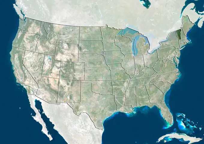
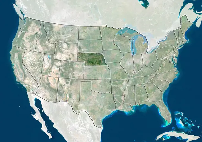
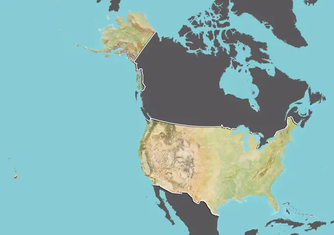
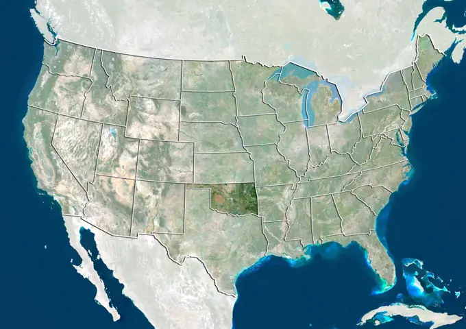
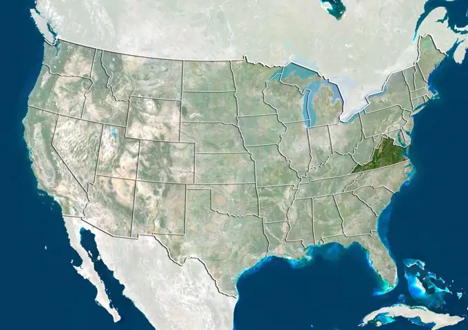
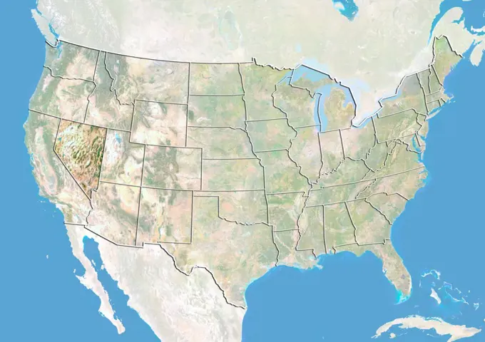
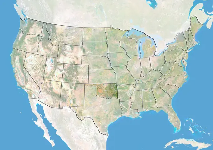
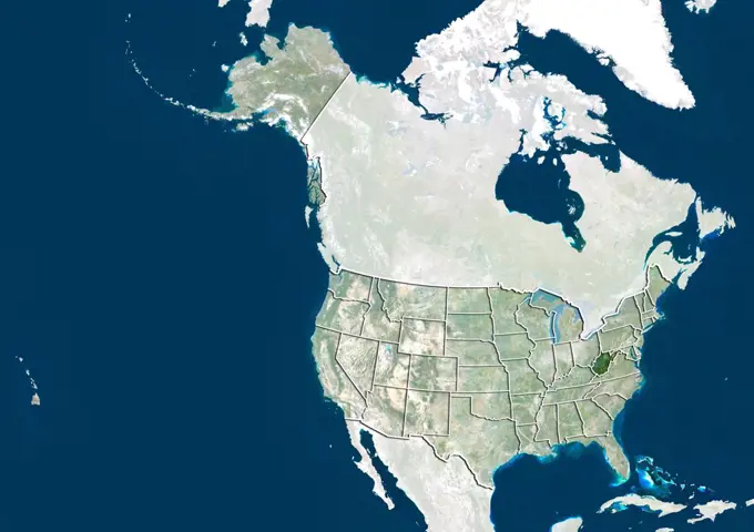
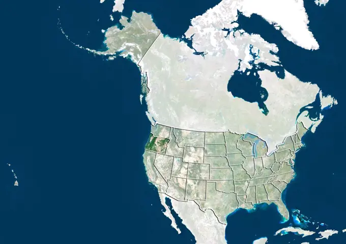
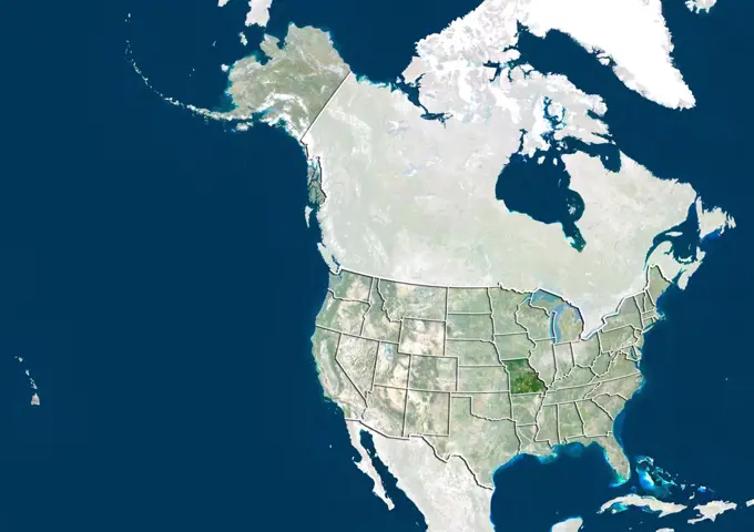
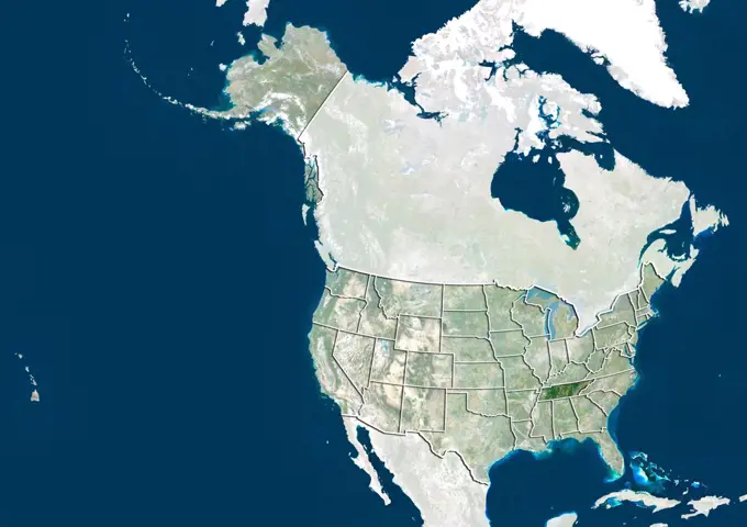
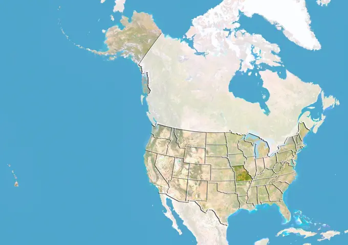
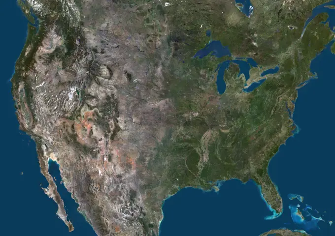
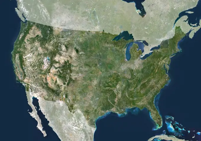
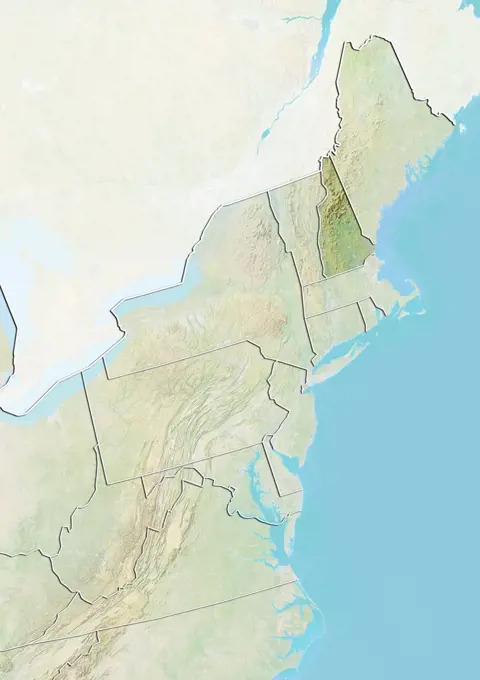
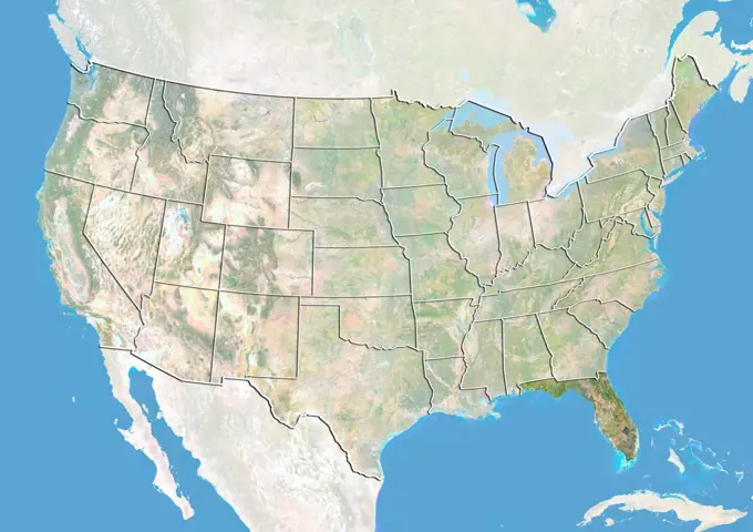
Satellite imagery of different U.S. states, showcasing geographical features in natural colors. Includes Connecticut, Vermont, and Massachusetts among others.

Satellite view of the United States with bump effect, showing the State of Florida. This image was compiled from data acquired by LANDSAT 5 & 7 satellites combined with elevation data.
141 assets in this story
1899-81216
Satellite view of the United States showing the State of Connecticut. This image was compiled from data acquired by LANDSAT 5 & 7 satellites.
1899-81321
Satellite view of the United States showing the State of Vermont. This image was compiled from data acquired by LANDSAT 5 & 7 satellites.
1899-81252
Satellite view of the United States showing the State of Massachusetts. This image was compiled from data acquired by LANDSAT 5 & 7 satellites.
1899-81300
Satellite view of the United States showing the State of South Carolina. This image was compiled from data acquired by LANDSAT 5 & 7 satellites.
1899-81264
Satellite view of the United States showing the State of Nebraska. This image was compiled from data acquired by LANDSAT 5 & 7 satellites.
1899-81649
Relief map of the United States (with border and mask). This image was compiled from data acquired by landsat 5 & 7 satellites combined with elevation data.
1899-81291
Satellite view of the United States showing the State of Oklahoma. This image was compiled from data acquired by LANDSAT 5 & 7 satellites.
1899-81324
Satellite view of the United States showing the State of Virginia. This image was compiled from data acquired by LANDSAT 5 & 7 satellites.
1899-81218
Satellite view of the United States with bump effect, showing the State of Florida. This image was compiled from data acquired by LANDSAT 5 & 7 satellites combined with elevation data.
1899-81266
Satellite view of the United States with bump effect, showing the State of Nevada. This image was compiled from data acquired by LANDSAT 5 & 7 satellites combined with elevation data.
1899-81290
Satellite view of the United States with bump effect, showing the State of Oklahoma. This image was compiled from data acquired by LANDSAT 5 & 7 satellites combined with elevation data.
1899-81413
Satellite view of the United States with bump effect, showing the State of North Dakota. This image was compiled from data acquired by LANDSAT 5 & 7 satellites combined with elevation data.
1899-81456
Satellite view of the United States showing the State of Western Virginia. This image was compiled from data acquired by LANDSAT 5 & 7 satellites.
1899-81387
Satellite view of the United States showing the State of Maine. This image was compiled from data acquired by LANDSAT 5 & 7 satellites.
1899-81423
Satellite view of the United States showing the State of Oregon. This image was compiled from data acquired by LANDSAT 5 & 7 satellites.
1899-81444
Satellite view of the United States showing the State of Missouri. This image was compiled from data acquired by LANDSAT 5 & 7 satellites.
1899-81435
Satellite view of the United States showing the State of Tennessee. This image was compiled from data acquired by LANDSAT 5 & 7 satellites.
1899-81443
Satellite view of the United States with bump effect, showing the State of Missouri. This image was compiled from data acquired by LANDSAT 5 & 7 satellites combined with elevation data.
1899-53518287
Color satellite image of United States and neighbouring countries.
1899-81244
Relief map of the United States showing the State of Maine. This image was compiled from data acquired by LANDSAT 5 & 7 satellites combined with elevation data.
1899-81346
Relief map of the United States showing the State of Arizona. This image was compiled from data acquired by LANDSAT 5 & 7 satellites combined with elevation data.
1899-81453
Satellite view of the United States showing the State of Washington. This image was compiled from data acquired by LANDSAT 5 & 7 satellites.
1899-81378
Satellite view of the United States showing the State of Kansas. This image was compiled from data acquired by LANDSAT 5 & 7 satellites.
1899-81369
Satellite view of the United States showing the State of Illinois. This image was compiled from data acquired by LANDSAT 5 & 7 satellites.
1899-81396
Satellite view of the United States showing the State of Montana. This image was compiled from data acquired by LANDSAT 5 & 7 satellites.
1899-81238
Relief map of the United States showing the State of Kentucky. This image was compiled from data acquired by LANDSAT 5 & 7 satellites combined with elevation data.
1899-81363
Satellite view of the United States showing the State of Georgia. This image was compiled from data acquired by LANDSAT 5 & 7 satellites.
1899-81347
Satellite view of the United States with bump effect, showing the State of Arizona. This image was compiled from data acquired by LANDSAT 5 & 7 satellites combined with elevation data.
1899-81407
Satellite view of the United States with bump effect, showing the State of New York. This image was compiled from data acquired by LANDSAT 5 & 7 satellites combined with elevation data.
1899-81368
Satellite view of the United States with bump effect, showing the State of Illinois. This image was compiled from data acquired by LANDSAT 5 & 7 satellites combined with elevation data.
1899-81460
Relief map of the United States showing the State of Wyoming. This image was compiled from data acquired by LANDSAT 5 & 7 satellites combined with elevation data.
1899-81274
Relief map of the United States showing the State of New Mexico. This image was compiled from data acquired by LANDSAT 5 & 7 satellites combined with elevation data.
1899-80362
Relief map of The United States (with border). This image was compiled from data acquired by LANDSAT 5 & 7 satellites combined with elevation data.
1899-81373
Relief map of the United States showing the State of Iowa. This image was compiled from data acquired by LANDSAT 5 & 7 satellites combined with elevation data.
1899-81442
Relief map of the United States showing the State of Missouri. This image was compiled from data acquired by LANDSAT 5 & 7 satellites combined with elevation data.
1899-81213
Satellite view of the United States showing the State of Colorado. This image was compiled from data acquired by LANDSAT 5 & 7 satellites.
1899-34647
United States, True Colour Satellite Image With Mask. USA, true colour satellite image with mask. This image was compiled from data acquired by LANDSAT 5 & 7 satellites.
1899-81226
Relief map of the United States showing the State of Illinois. This image was compiled from data acquired by LANDSAT 5 & 7 satellites combined with elevation data.
1899-81349
Relief map of the United States showing the State of Arkansas. This image was compiled from data acquired by LANDSAT 5 & 7 satellites combined with elevation data.
1899-81355
Relief map of the United States showing the State of Colorado. This image was compiled from data acquired by LANDSAT 5 & 7 satellites combined with elevation data.
1899-81262
Relief map of the United States showing the State of Nebraska. This image was compiled from data acquired by LANDSAT 5 & 7 satellites combined with elevation data.
1899-81461
Satellite view of the United States with bump effect, showing the State of Wyoming. This image was compiled from data acquired by LANDSAT 5 & 7 satellites combined with elevation data.
1899-81235
Relief map of the United States showing the State of Kansas. This image was compiled from data acquired by LANDSAT 5 & 7 satellites combined with elevation data.
1899-81430
Relief map of the United States showing the State of South Dakota. This image was compiled from data acquired by LANDSAT 5 & 7 satellites combined with elevation data.
1899-53518289
Color satellite image of United States, with borders and mask.
1899-81404
Satellite view of the United States with bump effect, showing the State of New Mexico. This image was compiled from data acquired by LANDSAT 5 & 7 satellites combined with elevation data.
1899-81317
Satellite view of the United States with bump effect, showing the State of Utah. This image was compiled from data acquired by LANDSAT 5 & 7 satellites combined with elevation data.
1899-53518288
Color satellite image of United States and neighbouring countries, with borders.
1899-80604
Satellite view of Canada with bump effect, showing the province of Nova Scotia. This image was compiled from data acquired by LANDSAT 5 & 7 satellites combined with elevation data.
1899-35504
Asia, True Colour Satellite Image. True colour satellite image of Asia. This image in Lambert Azimuthal Equal Area projection was compiled from data acquired by LANDSAT 5 & 7 satellites.
1899-35881
United States (Alaska Incl.) And Canada, True Colour Satellite Image. USA (Alaska incl.) and Canada, true colour satellite image. This image was compiled from data acquired by LANDSAT 5 & 7 satellites.
1899-21290013
Satellite view of the West Coast of the United States (with administrative boundaries). This image was compiled from data acquired by Landsat satellites.
1899-81491
Satellite view of the State of Western Virginia and Northeastern United States. This image was compiled from data acquired by LANDSAT 5 & 7 satellites.
1899-82296
Relief map of the State of New York, United States. This image was compiled from data acquired by LANDSAT 5 & 7 satellites combined with elevation data.
1899-81467
Satellite view of the State of Connecticut and Northeastern United States. This image was compiled from data acquired by LANDSAT 5 & 7 satellites.
1899-21290015
Satellite view of the US - Mexico Border (with country boundaries). This image was compiled from data acquired by Landsat 7 & 8 satellites.
1899-21289522
Satellite view of Asia. This image was compiled from data acquired by LANDSAT 7 & 8 satellites.
1899-66800
Relief map of Mexico (with border and mask). This image was compiled from data acquired by landsat 5 & 7 satellites combined with elevation data.
1899-81477
Satellite view of the State of New Hampshire and Northeastern United States. This image was compiled from data acquired by LANDSAT 5 & 7 satellites.
1899-82297
Relief map of the State of New York, United States. This image was compiled from data acquired by LANDSAT 5 & 7 satellites combined with elevation data.
1899-80936
Satellite view of Mexico showing the State of Durango. This image was compiled from data acquired by LANDSAT 5 & 7 satellites.
1899-81486
Relief map of the State of Vermont and Northeastern United States. This image was compiled from data acquired by LANDSAT 5 & 7 satellites combined with elevation data.
1899-21290008
Satellite view of the Eastern coast of the United States (with administrative boundaries). This image was compiled from data acquired by Landsat satellites.
1899-80974
Satellite view of Mexico showing the State of Yucatan. This image was compiled from data acquired by LANDSAT 5 & 7 satellites.
1899-81476
Relief map of the State of New Hampshire and Northeastern United States. This image was compiled from data acquired by LANDSAT 5 & 7 satellites combined with elevation data.
6145-45231898
City lights shine brighter during the holidays in the United States when compared with the rest of the year, as shown using a new analysis of daily data from the NASA-NOAA Suomi NPP satellite. Dark green pixels are areas where lights are 50 percent brighter, or more, during December. Because snow reflects so much light, the researchers could only analyze snow-free cities. They focused on the U.S. West Coast from San Francisco and Los Angeles, and cities south of a rough imaginary line from St. Louis to Washington, D.C.
1899-21290150
North America at night in 2012, showing the United States and Canada. This satellite image shows urban and industrial lights.
1899-79700
Satellite view of Canada with Bump Effect (with border). This image was compiled from data acquired by LANDSAT 5 & 7 satellites.
1899-80940
Satellite view of Mexico showing the State of Guerrero. This image was compiled from data acquired by LANDSAT 5 & 7 satellites.
1899-81767
Relief map of British Columbia, Canada. This image was compiled from data acquired by LANDSAT 5 & 7 satellites combined with elevation data.
4197-V71930028
1899-81490
Relief map of the State of Western Virginia and Northeastern United States. This image was compiled from data acquired by LANDSAT 5 & 7 satellites combined with elevation data.
1899-80959
Relief map of Mexico showing the State of Quintana Roo. This image was compiled from data acquired by LANDSAT 5 & 7 satellites combined with elevation data.
1899-81483
Satellite view of the State of Pennsylvania and Northeastern United States. This image was compiled from data acquired by LANDSAT 5 & 7 satellites.
6145-45262013
Minnesota's Northwest Angle is the northernmost point of the continental United States. The Angle became part of the US due to a map error during the 1783 Treaty of Paris. Located in the Lake of the Woods, driving there requires crossing the US-Canada border twice. The image was acquired September 22, 2013, covers an area of 40 by 55 km, and is located at 49.2 degrees north, 95.1 degrees west.
1899-80805
Relief map of India showing the State of Kerala. This image was compiled from data acquired by LANDSAT 5 & 7 satellites combined with elevation data.
6177-V53853067
1899-80929
Relief map of Mexico showing the State of Chiapas. This image was compiled from data acquired by LANDSAT 5 & 7 satellites combined with elevation data.
1899-80790
Satellite view of India showing the State of Bihar. This image was compiled from data acquired by LANDSAT 5 & 7 satellites.
1899-80787
Relief map of India showing the State of Assam. This image was compiled from data acquired by LANDSAT 5 & 7 satellites combined with elevation data.
1899-79872
Relief map of Guatemala (with border and mask). This image was compiled from data acquired by landsat 5 & 7 satellites combined with elevation data.
1899-80829
Relief map of India showing the State of Uttar Pradesh. This image was compiled from data acquired by LANDSAT 5 & 7 satellites combined with elevation data.
1899-80822
Satellite view of India showing the State of Punjab. This image was compiled from data acquired by LANDSAT 5 & 7 satellites.
1899-80605
Satellite view of Canada showing the province of Nova Scotia. This image was compiled from data acquired by LANDSAT 5 & 7 satellites.
1899-80818
Satellite view of India showing the State of Nagaland. This image was compiled from data acquired by LANDSAT 5 & 7 satellites.
1899-80811
Relief map of India showing the State of Manipur. This image was compiled from data acquired by LANDSAT 5 & 7 satellites combined with elevation data.
1899-81771
Relief map of Manitoba, Canada. This image was compiled from data acquired by LANDSAT 5 & 7 satellites combined with elevation data.
1899-82327
Relief map of the State of Tennessee, United States. This image was compiled from data acquired by LANDSAT 5 & 7 satellites combined with elevation data.
1899-80798
Satellite view of India showing the State of Himachal Pradesh. This image was compiled from data acquired by LANDSAT 5 & 7 satellites.
1899-66867
Relief map of British Columbia, Canada. This image was compiled from data acquired by LANDSAT 5 & 7 satellites combined with elevation data.
1899-80962
Satellite view of Mexico showing the State of San Luis Potosi. This image was compiled from data acquired by LANDSAT 5 & 7 satellites.
1899-21289723
Satellite view of India (with administrative boundaries and mask). This image was compiled from data acquired by Landsat 8 satellite in 2014.
1899-80797
Relief map of India showing the State of Himachal Pradesh. This image was compiled from data acquired by LANDSAT 5 & 7 satellites combined with elevation data.
1899-81484
Relief map of the State of Rhode Island and Northeastern United States. This image was compiled from data acquired by LANDSAT 5 & 7 satellites combined with elevation data.
1899-81785
Relief map of Nunavut, Canada. This image was compiled from data acquired by LANDSAT 5 & 7 satellites combined with elevation data.
1899-80827
Relief map of India showing the State of Tamil Nadu. This image was compiled from data acquired by LANDSAT 5 & 7 satellites combined with elevation data.
1899-80791
Relief map of India showing the State of Chhattisgarh. This image was compiled from data acquired by LANDSAT 5 & 7 satellites combined with elevation data.
1899-66993
Relief map of the State of Washington, United States. This image was compiled from data acquired by LANDSAT 5 & 7 satellites combined with elevation data.
1899-80802
Satellite view of India showing the State of Jharkhand. This image was compiled from data acquired by LANDSAT 5 & 7 satellites.
1899-80949
Relief map of Mexico showing the State of Nayarit. This image was compiled from data acquired by LANDSAT 5 & 7 satellites combined with elevation data.
PREVIOUS
of 2
NEXT
2401 S. Ervay, Suite 206
Dallas, Texas 75215
United States
Get Started
Free ResearchMy BoardsMy Cart
For Creators
How To License Your ContentContributor PortalFrame of Mind
Resources
API accessPricing
Contact
+1 866 236 0087help@viewpictures.co.uk Contact form
©2026 View Pictures. All Rights Reserved. -A
This site is protected by reCAPTCHA and Google Privacy Policy and Terms of Service apply.