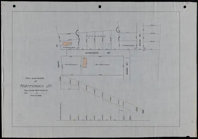
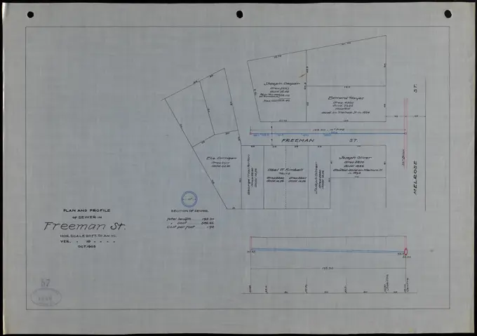
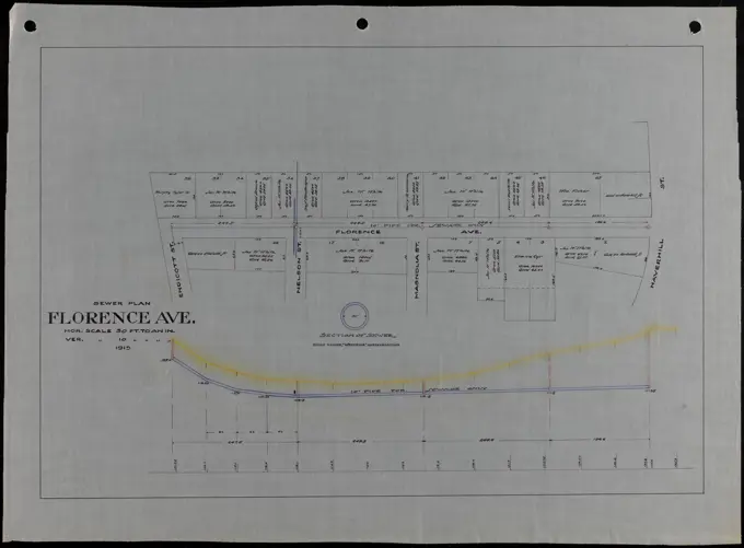
My Boards
View Pictures
  • My Boards

Sewer Construction Plans

Technical blueprints showing sewer layouts and profiles for various streets, detailing infrastructure in urban areas, created in the early 1900s.

Plan and profile of Harriman St. , Streets. Lawrence
183 assets in this story
6145-51386298
Plan of Stearns Ave., plan of Hemlock St. , Streets. Lawrence
6145-54522161
Cartographic, Maps. 1855. Lionel Pincus and Princess Firyal Map Division. Brooklyn (New York, N.Y.), Insurance, Fire , Maps Plate 24: Map bounded by Myrtle Avenue, Cumberland Street, Lafayette Avenue, Raymond Street
6145-51386071
Plan of Haskins Hospital property, Pools Hill, Rockport, Mass. ,
4443-75476031
Plate 86 Map bounded by West 42nd Street, East 42nd Street, Fourth Avenue, East 37th Street, West 37th Street, and Sixth Avenue., 1854., New York, NY. Publisher, William Perris. Real property, New York (State), and fire insurance
6145-51398269
Plan and profile of sewer in Cherry St. , Sewers, Streets. Lawrence
6145-55927919
Cartographic, Maps. 1884 - 1936. Lionel Pincus and Princess Firyal Map Division. Fire insurance , New York (State), Real property , New York (State), Cities & towns , New York (State) Brooklyn, V. 9, Double Page Plate No. 257 Map bounded by Greene Ave., Central Ave., De Kalb Ave., Irving Ave.
6145-51398293
Plan and profile of sewer in Hobson St. , Sewers, Streets. Lawrence
6145-51387438
Sewer plan of Jamaica St. , Sewers, Streets. Lawrence
6145-50567257
Flirtation walk schematic planting plan Charlestown Navy Yard , Buildings, Massachusetts, Boston, Maps, Trees, Massachusetts, Boston, Maps, City planning, Massachusetts, Boston, Maps, Charlestown Boston, Mass., Maps, Charlestown Navy Yard Mass. Norman B. Leventhal Map Center Collection
6145-50562228
River View Place sewer plan , Sewers, Streets. Lawrence
6145-54523119
Cartographic, Maps. 1884 - 1936. Lionel Pincus and Princess Firyal Map Division. Fire insurance , New York (State), Real property , New York (State), Cities & towns , New York (State) Brooklyn, V. 6, Double Page Plate No. 159 Map bounded by 25th St., 20th St., 3rd Ave.
6145-48696544
Land taken for Spicket improvement between Hanpshire and Walnut Sts., north of new river channel , Rivers, Streets, Boundaries. Lawrence
6145-54525650
Cartographic, Maps. 1913. Lionel Pincus and Princess Firyal Map Division. Fire insurance , New York (State), Real property , New York (State), Cities & towns , New York (State) Manhattan, V. 12, Plate No. 27 Map bounded by Hudson River, Riverside Drive
6145-50521338
Street plan, Saxonia Ave. , Streets. Lawrence
6145-50562300
Broadway , Sewers, Streets. Lawrence
6145-48696667
Plan and profile of sewer in Saunders St. , Sewers, Streets. Lawrence
6145-48461648
Klomp Johannes Franziskus (1865-1946), Benedectier Abbey St. Mauritius, Clerf (Clervaux), Luxembourg (November 8, 1909): Plan of the machine house and laundry, floor plan 1: 100. Ink on transparent, 33 x 57.9 cm (including scan edges) Klomp Johannes Franziskus  (1865-1946): Benedektinerabtei St. Mauritius, Clerf (Clervaux)
6145-50573816
Plan and profile of Columbus Ave. , Streets. Lawrence
6145-54525910
Cartographic, Maps. 1884 - 1936. Lionel Pincus and Princess Firyal Map Division. Fire insurance , New York (State), Real property , New York (State), Cities & towns , New York (State) Manhattan, V. 12, Plate No. 10 Map bounded by Hudson River, Broadway
6145-50573889
Plan and profile of Hobson St., present terminus to Pearl St. , Streets. Lawrence
6145-51398266
Plan and profile of sewer in Canterbury St. , Sewers, Streets. Lawrence
6145-54548878
Map of 285 sections of ground at Flatbush, L.I., opposite the residence of Dr. A. Vanderveer, on the turnpike Cartographic. Maps. 1835-06. Lionel Pincus and Princess Firyal Map Division. Brooklyn (New York, N.Y.), New York (N.Y.), Brooklyn (New York, N.Y.) , Maps, Flatbush (New York, N.Y.) , Maps, Landowners , New York (State) , New York, Real property , New York (State) , New York
6145-50562292
West St. sewer plan , Sewers, Streets. Lawrence
6145-52945115
Proposed Launching Ways. Glass Plate Negatives of the Construction and Repair of Buildings, Facilities, and Vessels at the New York Navy Yard.
6145-54522555
Cartographic, Maps. 1860. Lionel Pincus and Princess Firyal Map Division Map bounded by Mangin St, Lewis St, Ninth St, Pier - Line 66-68, Houston St; Including Tompkins St, Ferry to Williamsburgh, Third St, Fourth St, Fifth St, Sixth St, Seventh St, Eighth St
6145-54549367
Plate V Cartographic. Atlases, Maps. 1876. Lionel Pincus and Princess Firyal Map Division. Albany (N.Y.)
6145-50562267
Sewer plan of Jamaica St. , Sewers, Streets. Lawrence
6145-50561981
Plan and profile of sewer in Freeman St. , Sewers, Streets. Lawrence
6145-50574243
Plan and profile of sewer in So. Union St. , Sewers, Streets. Lawrence
6145-50562321
Florence Ave. sewer plan , Sewers, Streets. Lawrence
6145-54267922
Map of Scollay Square and vicinity. Title supplied by cataloger. Oriented with north toward the lower right. "Note: shaded portion between Tremont Row and Court St. show Town Lands; Names of abuttors on west side of Tremont Row and east side of Court St. taken from Hale's plan of 1814.'... , Massachusetts  , Suffolk  ,county   , Boston
6145-51387429
Sewer plan of Boston St. , Sewers, Streets. Lawrence
6145-54525880
Cartographic, Maps. 1891. Lionel Pincus and Princess Firyal Map Division. Fire insurance , New York (State), Real property , New York (State), Cities & towns , New York (State) Bronx, V. 10, Double Page Plate No. 226 Map bounded by E. 167th St., Fleetwood Ave., E. 165th St., Mott Ave.
6145-42602145
Poelzig Hans (1869-1936), vocational schools on Urban, Berlin-Kreuzberg (1928-1929): Gauss School on Urban (2nd project), 1st floor 1: 200. Ink, pencil on transparent, 51.6 x 139.3 cm (including scan edges) Poelzig Hans  (1869-1936): Berufsschulen am Urban, Berlin-Kreuzberg
6145-55177067
Cartographic, Maps. 1891. Lionel Pincus and Princess Firyal Map Division. Fire insurance , New York (State), Real property , New York (State), Cities & towns , New York (State) Bronx, V. 10, Double Page Plate No. 238 Map bounded by Harlem River, Washington Bridge, Ogden Ave., Orchard St., Depot Pl.
6145-48696587
Plan and profile of sewer in Chester St. , Sewers, Streets. Lawrence
6145-52944536
Court Map, Dry Dock 4, Bottom Left. Glass Plate Negatives of the Construction and Repair of Buildings, Facilities, and Vessels at the New York Navy Yard.
6145-42629409
Knoblauch & Wex, Palais Eger Tempelhofer Ufer 10/11, Berlin: floor plan. Pencil on transparent, 55.7 x 21.9 cm (including scan edges)
6145-48467051
Rüster Emil (1883-1949), educational institution in Kaufbeuren (1908): Department 1: 1000. Colored pencil and ink over pressure on paper, 47.8 x 64.3 cm (including scan edges)
6145-48696982
Plan for layout of Nelson St. from Congress St. to Columbus Ave. , Streets. Lawrence
6145-50562433
Plan of Grafton St. , Streets. Lawrence
6145-51386058
Plan of Grafton St. , Streets. Lawrence
6145-51386258
Plan of sewer in Margin St. , Sewers, Streets. Lawrence
6145-54525358
Cartographic, Maps. 1902. Lionel Pincus and Princess Firyal Map Division. Fire insurance , New York (State), Real property , New York (State), Cities & towns , New York (State) Manhattan, V. 7, Plate No. 75 Map bounded by Hudson River, Riverside Park, W. 129th St.
6145-30289623
Rental house , Döblergasse , floor plan nd floor, Otto Wagner -, architect
6145-50561993
Plan and profile of sewer in Ferry St. , Sewers, Streets. Lawrence
6145-42619514
Böhmer Franz (1907-1943), Poznan Castle, Poznan (1939-1943): Plan content N.N. detected. Material/technology N.N. recorded, 66 x 98.4 cm (including scan edges) Böhmer & Petrich : Schloss Posen, Posen. Umbau
4409-21519012
Manhattan, V. 12, Plate No. 77 Map bounded by Seaman Ave., Harlem River, Broadway, W. 219th St..
6145-50562137
Plan and profile of sewer in Sargent St. , Sewers, Streets. Lawrence
6145-50511970
Plan showing part of Jackson St. Alley petitioned for discontinuance , Streets. Lawrence
6145-50562053
Plan and profile of sewer in Pleasant St. , Sewers, Streets. Lawrence
6145-51388165
Street plan, Marston St. , Streets. Lawrence
6145-55180819
Map of 150 lots of ground situate in the eleventh ward of New York belonging to the estate of John Flack, decd. Cartographic. Maps. 1833. Lionel Pincus and Princess Firyal Map Division. Manhattan (New York, N.Y.) , Maps, Landowners , New York (State) , New York, Real property , New York (State) , New York, Flack, John , Estate, New York (N.Y.) , Maps
6145-50573865
Plan and profile of Greenwood St. , Sewers, Streets. Lawrence
6145-48437962
Poelzig Hans (1869-1936), barracks Air Circle Command II, Berlin-Dahlem (10.09.1935): High plan for the site on Saargemund Strasse, crown prince avenue and Hüttenweg 1: 500. Light break on paper, 75.9 x 110.8 cm (including scan edges) Poelzig Hans  (1869-1936): Kaserne Luftkreiskommando II, Berlin-Dahlem
6145-51398323
Plan and profile of sewer in Pleasant St. , Sewers, Streets. Lawrence
6145-50574276
Plan and profile of sewer in White St. , Sewers, Streets. Lawrence
6145-51398274
Plan and profile of sewer in Doyle St. , Sewers, Streets. Lawrence
6145-48732724
Savinen property, Rockport, Mass. ,
6145-50574015
Plan and profile of sewer in Bennington St. , Sewers, Streets. Lawrence
6145-54523157
Cartographic, Maps. 1884 - 1936. Lionel Pincus and Princess Firyal Map Division. Fire insurance , New York (State), Real property , New York (State), Cities & towns , New York (State) Brooklyn, V. 7, Double Page Plate No. 188 Map bounded by Nostrand Ave., Montgomery St., Bedford Ave., Parkway
6145-50562407
Plan and profile of Washington St., south from Broadway Avenue , Streets. Lawrence
6145-50562119
Plan and profile of sewer in Salem Street , Sewers, Streets. Lawrence
6145-54526470
Cartographic, Maps. 1914. Lionel Pincus and Princess Firyal Map Division. Fire insurance , New York (State), Real property , New York (State), Cities & towns , New York (State) Bronx, V. 13, Plate No. 29 Map bounded by Hudson River, Spuyten Duyvil Rd., W. 236th St.
6145-55927830
Cartographic, Maps. 1884 - 1936. Lionel Pincus and Princess Firyal Map Division. Fire insurance , New York (State), Real property , New York (State), Cities & towns , New York (State) Brooklyn, V. 1, Double Page Plate No. 4 Map bounded by Imlay St., Sullivan St., Buttermilk Channel, Atlantic Basin, Commerce St.
6145-48696532
Plan between Lawrence and Jackson St. , Rivers, Streets. Lawrence
6145-50531629
Berkeley Street community garden , Community gardens, Massachusetts, Boston, Maps, City planning, Massachusetts, Boston, Maps, Urban renewal, Massachusetts, Boston, Maps, South End Boston, Mass., Planning, Maps Norman B. Leventhal Map Center Collection
6145-50574224
Plan and profile of sewer in Sargent St. , Sewers, Streets. Lawrence
6145-54525878
Cartographic, Maps. 1891. Lionel Pincus and Princess Firyal Map Division. Fire insurance , New York (State), Real property , New York (State), Cities & towns , New York (State) Bronx, V. 10, Double Page Plate No. 218 Map bounded by Bremer Ave., Devoe St., Gerard Ave., E. 161st St.
6145-54524074
Cartographic, Maps. 1912 - 1922. Lionel Pincus and Princess Firyal Map Division. Fire insurance , New York (State), Real property , New York (State), Cities & towns , New York (State) Queens V. 8, Plate No. 12 Map bounded by Beach 25th St., Far Rockaway Blvd., Beach 32nd St., Easthampton Pl.
6145-48468612
Rüster Emil (1883-1949), development of the parcels in Leipzig-Markranstädt (02.02.1917): Department 1: 1000. Colored pencil over a break on linen, 41.8 x 73.5 cm (including scan edges)
4409-21522491
Plate 89: Map bounded by West 27th Street, Tenth Avenue, West 22nd Street, Eleventh Avenue.
6145-54603268
Plan of proposed addition to the Wayland Historic District, January 25, 1995
6145-48696638
Plan and profile of sewer in Lawrence St. , Sewers, Streets. Lawrence
6145-43665462
Proposed river channel , Rivers, Streets, Channels. Lawrence
6145-50562055
Plan and profile of sewer in Moran Court, plan and profile of sewer in Hey Street , Sewers, Streets. Lawrence
6145-52097147
Drawing showing a suitable area in Wyoming for the MX missile to be based. Country: Unknown
6145-58943433
Description: French Factory No. 5. Brig Bay. Plan showing relative position of Louis Garrou's stage with regard to it. Location: Brig Bay, Canada Date: 1892 americas
6145-48433768
The Georgia Negro Albany, Dougherty County, Ga. Distribution of 2,500 Negro inhabitants. African American Photographs Assembled for 1900 Paris Exposition.
6145-51398313
Plan and profile of sewer in Moran Court, plan and profile of sewer in Hey Street , Sewers, Streets. Lawrence
4409-21521940
Manhattan, V. 12, Plate No. 16 Map bounded by Northern Ave., Fort Washington Ave., W. 181st St..
6188-64665887
Blueprint House plan blueprints close up Copyright: xZoonar.com/NikolaixOkhitinx 2957314
7179-70568871
Marriage information brochures at the marriage information desk in San Francisco City Hall
PREVIOUS
of 2
NEXT
2401 S. Ervay, Suite 206
Dallas, Texas 75215
United States
Get Started
Free ResearchMy BoardsMy Cart
For Creators
How To License Your ContentContributor PortalFrame of Mind
Resources
API accessPricing
Contact
+1 866 236 0087help@viewpictures.co.uk Contact form
©2026 View Pictures. All Rights Reserved. -B
This site is protected by reCAPTCHA and Google Privacy Policy and Terms of Service apply.