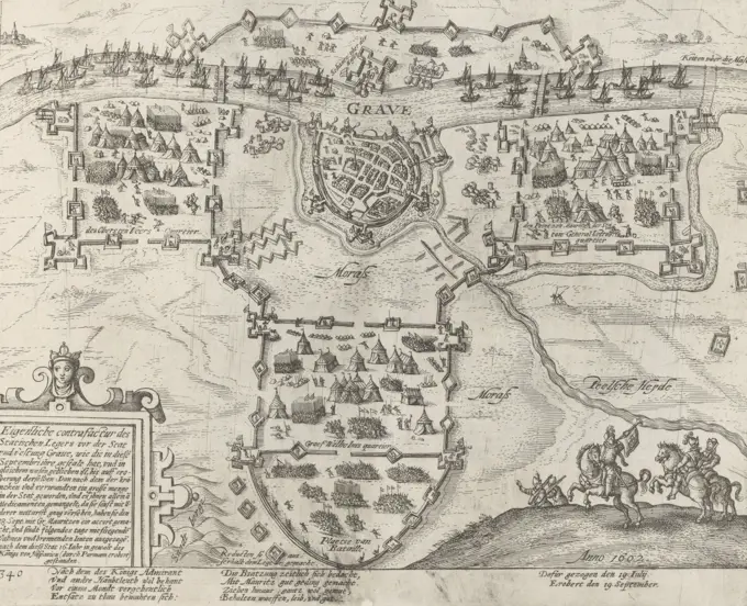
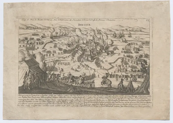
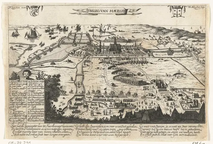
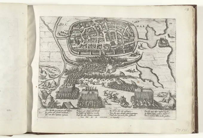
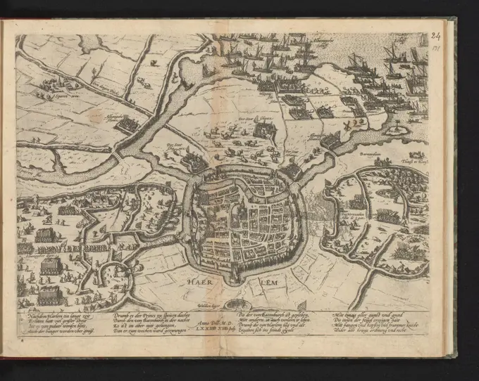
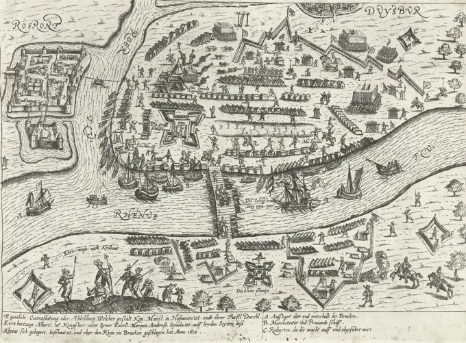
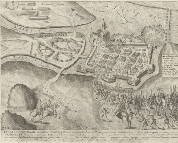
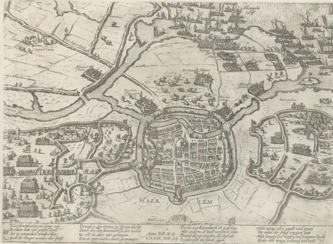
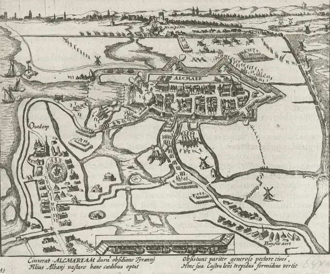
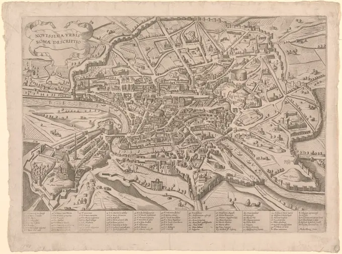
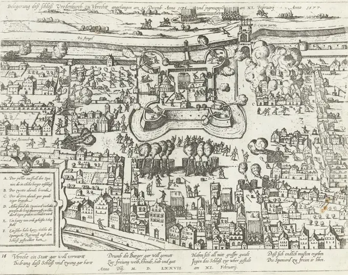
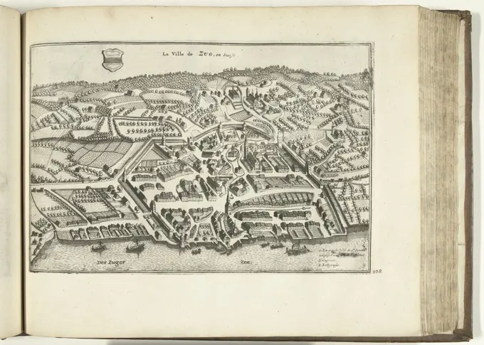
Siege Maps from 16th Century

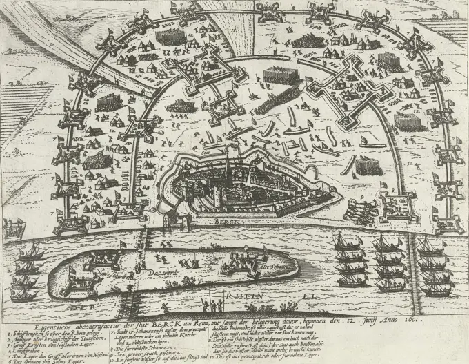
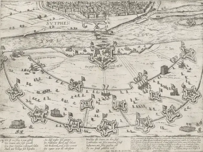
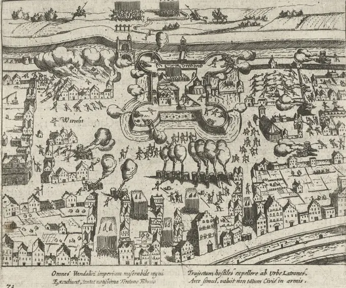
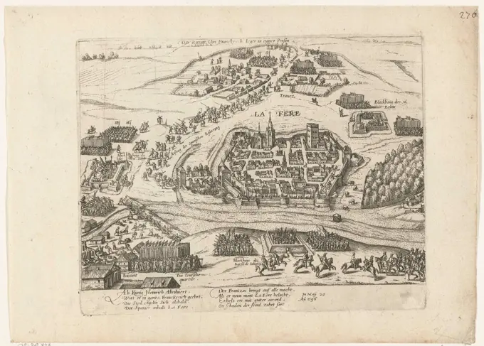
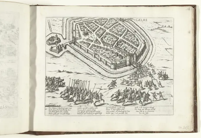
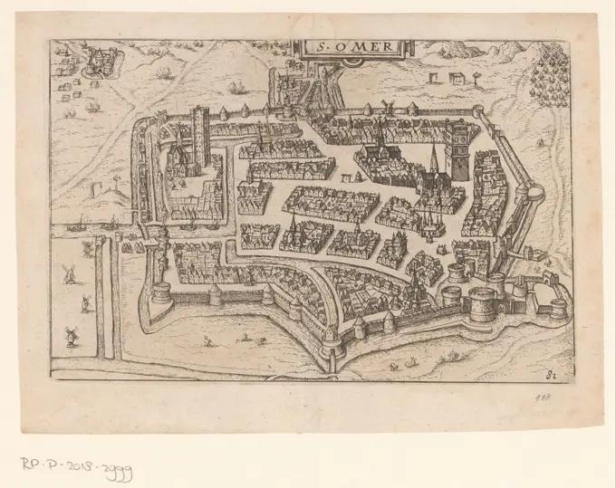
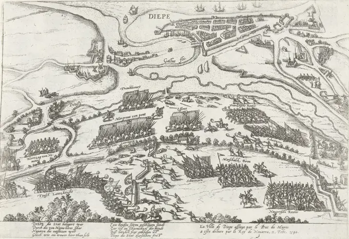
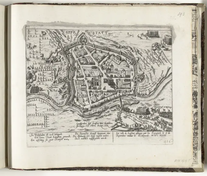
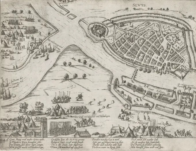
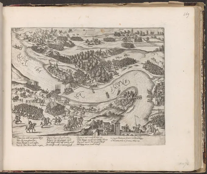
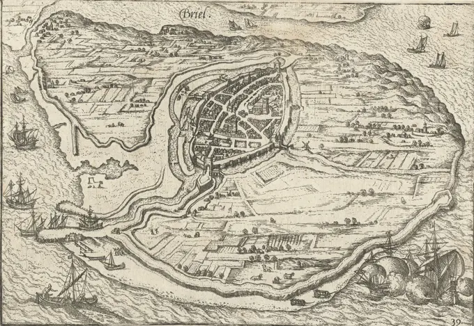
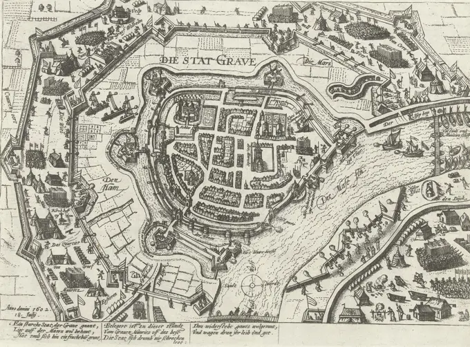
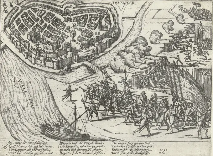
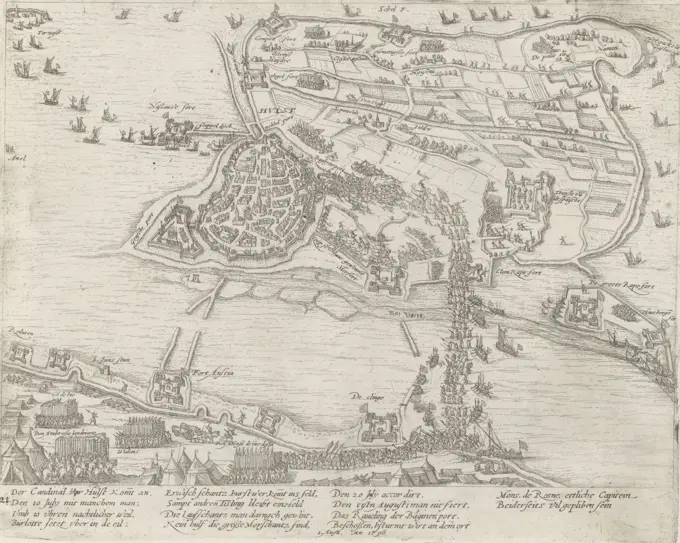
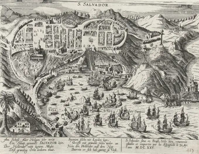
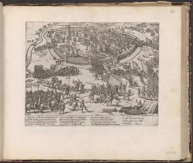
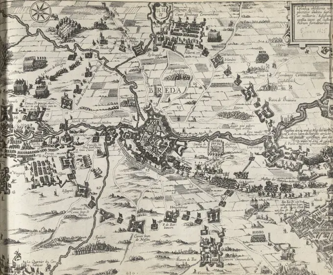
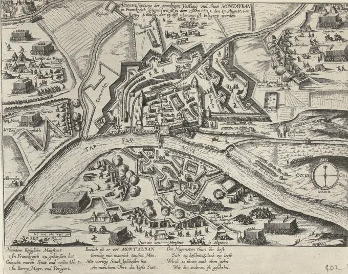
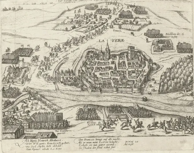
Detailed etchings depicting sieges and military engagements from the 16th century, showcasing city layouts, troop positions, and historical captions in German.

Cologne, Hogenberg, French, Series 4: French, German and English Events, 1576-1610, Henry IV takes La Fère, 1596, Troops of King Henry IV conquer La Fère from the Spanish, 20 May 1596. With 8-line caption in German. Unnumbered. Sheet from a dismantled album. Numbered (in pen) at top right: 276., print, prent, nieuwsprent, prints, Frederik Muller History plates, height 210 mm, width 280 mm, Dutch, German, 1540 - 1590, print maker, printmaker, 1596 - 1598, fourth quarter 16th century, paper, papier, etching