My Boards
View Pictures
  • My Boards
← Documents & Records

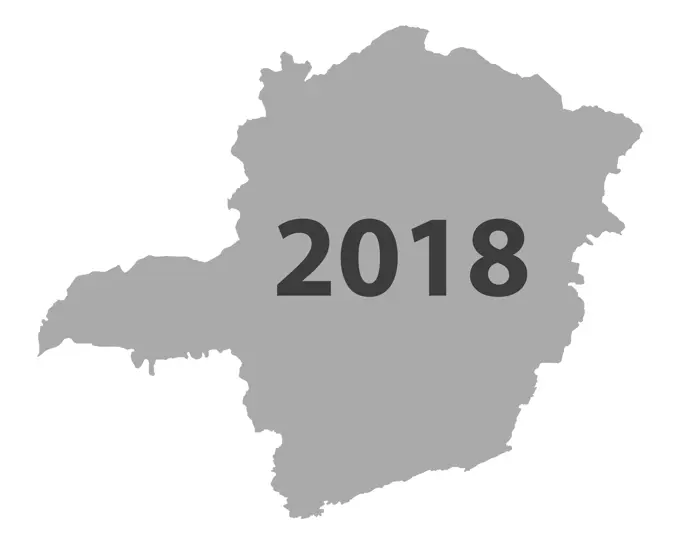
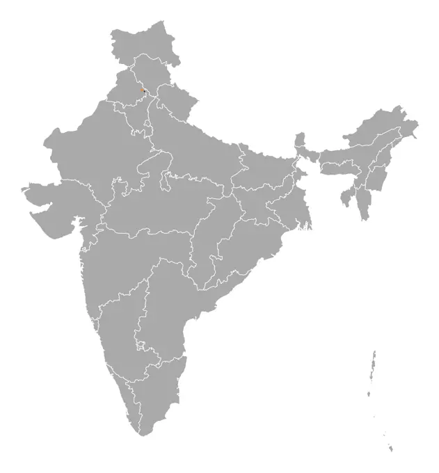
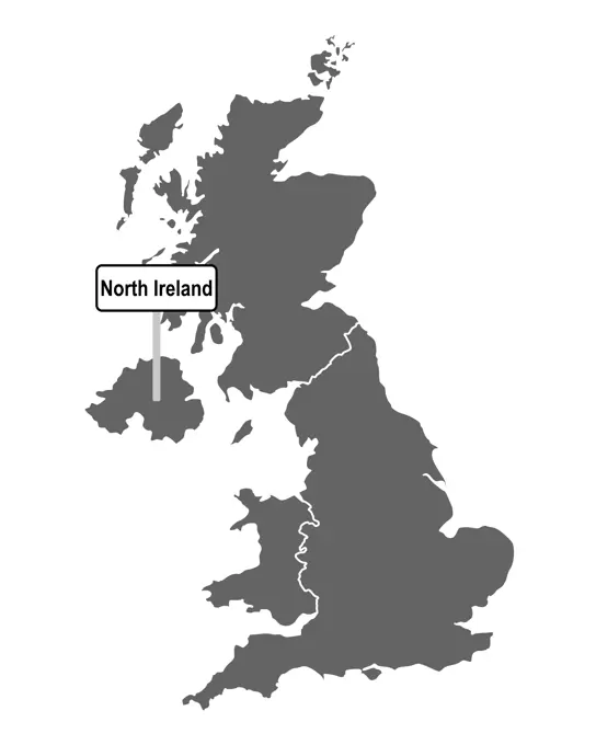
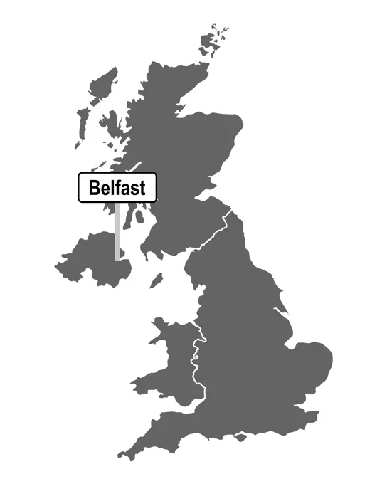
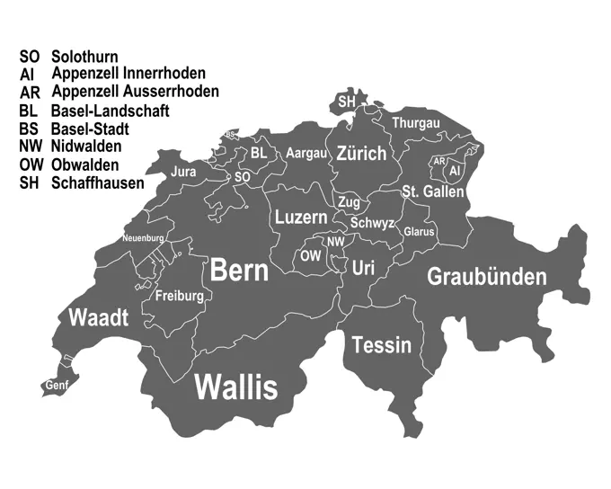
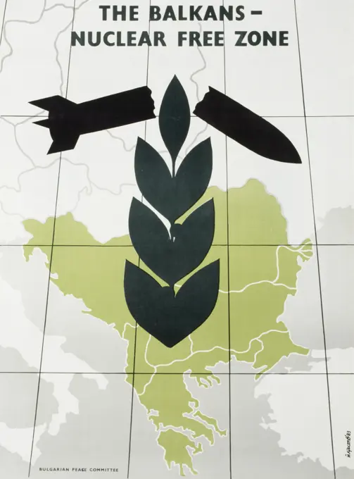
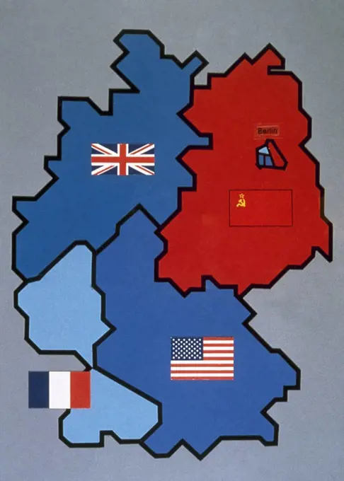
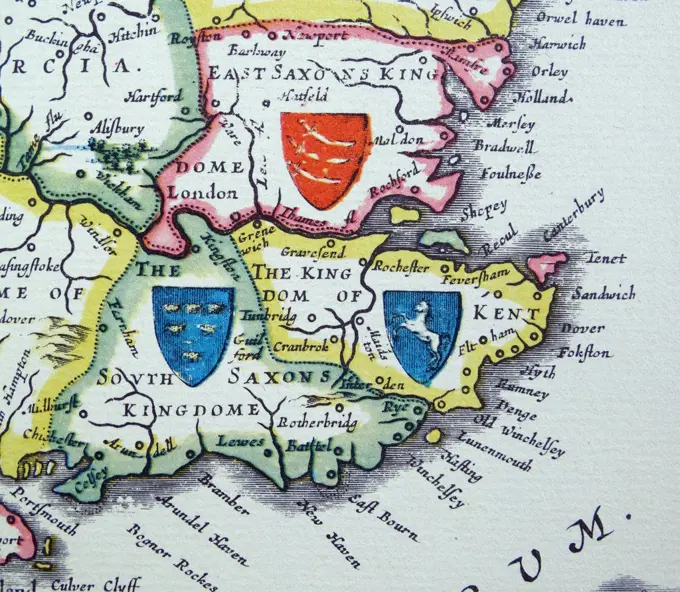
Silhouetted Maps of Regions

Stylized silhouettes of maps representing different regions and countries, focusing on their outlines for geographical context.

Map of Mecklenburg-Vorpommern Germany Map of the state Mecklenburg-Vorpommern in Germany. Copyright: xZoonar.com/SteffenxHammerx 3656409
350 assets in this story
6188-55684072
Karte von Minas Gerais 2018 - Map of Minas Gerais 2018 Karte von Minas Gerais 2018 - Map of Minas Gerais 2018 Copyright: xZoonar.com/RobertxBiedermannx 11622796
1525-22444217
Map of India, Lakshadweep highlighted. Political map of India with the several states where Lakshadweep is highlighted.
1525-25101861
Map of France, Nord-Pas-de-Calais highlighted. Political map of France with the several regions where Nord-Pas-de-Calais is highlighted.
6188-64555429
Karte und Fahne von Panama auf altem Leinen - Map and flag of Panama on old linen Karte und Fahne von Panama auf altem Leinen - Map and flag of Panama on old linen Copyright: xZoonar.com/lantapixx 9984683
6188-55679552
Karte von Tasmanien - Map of Tasmania Karte von Tasmanien - Map of Tasmania Copyright: xZoonar.com/RobertxBiedermannx 8833469
6188-55684348
Karte von Rondonia 2018 - Map of Rondonia 2018 Karte von Rondonia 2018 - Map of Rondonia 2018 Copyright: xZoonar.com/RobertxBiedermannx 11636052
6188-67138560
Map of India, Chandigarh highlighted Political map of India with the several states where Chandigarh is highlighted. Copyright: xZoonar.com/SteffenxHammerx 3030788
1525-22444210
Map of India, Chandigarh highlighted. Political map of India with the several states where Chandigarh is highlighted.
6188-67138556
Map of India, Puducherry highlighted Political map of India with the several states where Puducherry is highlighted. Copyright: xZoonar.com/SteffenxHammerx 3030782
6188-64572702
Landkarte von Großbritannien mit Ortsschild von London - Map of Great Britain with road sign of London Landkarte von Großbritannien mit Ortsschild von London - Map of Great Britain with road sign of London Copyright: xZoonar.com/lantapixx 15428147
6145-29632209
Poll photo collection. Population map of the Netherlands. 1934
6188-55684410
Map of Mecklenburg-Western Pomerania 2018-Map of Mecklenburg-Western Pomerania 2018 Map of Mecklenburg-Western Pomerania 2018-Map of Mecklenburg-Western Pomerania 2018
6188-55677363
Map of Hessen - Map of Hesse Map by Hessen - Map of Hesse
6188-64572445
Landkarte von Österreich mit Ortsschild Steiermark - Map of Austria with road sign of Steiermark Landkarte von Österreich mit Ortsschild Steiermark - Map of Austria with road sign of Steiermark Copyright: xZoonar.com/lantapixx 15341109
6188-64572658
Landkarte von Großbritannien mit Ortsschild von North Ireland - Map of Great Britain with road sign of North Ireland Landkarte von Großbritannien mit Ortsschild von North Ireland - Map of Great Britain with road sign of North Ireland Copyright: xZoonar.com/lantapixx 15428065
6188-67139960
Map of India Political map of India with the several states. Copyright: xZoonar.com/SteffenxHammerx 3064185
6188-55684394
Karte von Pernambuco 2018 - Map of Pernambuco 2018 Karte von Pernambuco 2018 - Map of Pernambuco 2018 Copyright: xZoonar.com/RobertxBiedermannx 11642627
6188-55683899
Karte von Thüringen 2018 - Map of Thuringia 2018 Karte von Thüringen 2018 - Map of Thuringia 2018 Copyright: xZoonar.com/RobertxBiedermannx 11615885
6188-64571133
Karten von Bayern auf einfachem Kreuzstich - Maps of Bavaria on simple cross stitch Karten von Bayern auf einfachem Kreuzstich - Maps of Bavaria on simple cross stitch Copyright: xZoonar.com/lantapixx 14838406
6188-55679993
Karte von Griechenland - Map of Greece Karte von Griechenland - Map of Greece Copyright: xZoonar.com/RobertxBiedermannx 8915107
6188-67140471
Map of India Political map of India with the several states. Copyright: xZoonar.com/SteffenxHammerx 3625409
6188-67140466
Map of India, Dadra and Nagar Haveli highlighted Political map of India with the several states where Dadra and Nagar Haveli is highlighted. Copyright: xZoonar.com/SteffenxHammerx 3625398
6188-64554755
Map of Great Britain on Leinen - Map of Great Britain on Linen Map from Great Britain on Leinen - Map of Great Britain on Linen
6188-64572472
Landkarte von Großbritannien mit Ortsschild von Belfast - Map of Great Britain with road sign of Belfast Landkarte von Großbritannien mit Ortsschild von Belfast - Map of Great Britain with road sign of Belfast Copyright: xZoonar.com/lantapixx 15341145
6188-64570207
Karte von Grossbritannien in rechten Maschen - Plain map of the United Kingdom Karte von Grossbritannien in rechten Maschen - Plain map of the United Kingdom Copyright: xZoonar.com/lantapixx 14295814
6188-64572641
Landkarte der Schweiz allen Kantonen - Map of Switzerland with all cantons Landkarte der Schweiz allen Kantonen - Map of Switzerland with all cantons Copyright: xZoonar.com/lantapixx 15428031
6188-55678981
Karte von Schottland - Map of Scotland Karte von Schottland - Map of Scotland Copyright: xZoonar.com/RobertxBiedermannx 8533180
6188-64570133
Karte von Frankreich in rechten Maschen - Plain map of France Karte von Frankreich in rechten Maschen - Plain map of France Copyright: xZoonar.com/lantapixx 14213579
6188-67140023
Map of China Political map of China with the several provinces. Copyright: xZoonar.com/SteffenxHammerx 3587663
1746-29012658
Greek, anti-nuclear weapons, anti-war, Peace campaign poster, during the Cold war 1983
6188-64556583
Karte von Großbritannien auf Leinen - Map of Great Britain on linen Karte von Großbritannien auf Leinen - Map of Great Britain on linen Copyright: xZoonar.com/lantapix,x 10569494
6188-64572598
Landkarte von Österreich mit Ortsschild von Tirol - Map of Austria with road sign of Tirol Landkarte von Österreich mit Ortsschild von Tirol - Map of Austria with road sign of Tirol Copyright: xZoonar.com/lantapixx 15368672
7003-69662243
KOSOVO, Pec. Roadside Souvenir stall selling rug with Albanian Map. Kosovo is primarily settled by ethnic Albanians
4409-41405
Map of Allied-occupied Germany. 1945-1949.
6188-71809983
Laos Country Map A detailed map showcasing the geography and boundaries of Laos. This map is perfect for exploring the country s landscape and political divisions. Copyright: xrusakx
6188-71719625
Tajikistan Map - Administrative Regions A detailed map showcasing the administrative divisions and regions of Tajikistan. This map clearly depicts the country s geographical layout and its sub-divisions. Copyright: xVolinax
6188-64556332
Karte der EU auf altem Leinen - Map of the EU on old linen Karte der EU auf altem Leinen - Map of the EU on old linen Copyright: xZoonar.com/lantapixx 10446212
6188-55769657
Karte der Europäischen Union in Europa - Map of the European Union in Europe Karte der Europäischen Union in Europa - Map of the European Union in Europe Copyright: xZoonar.com/RobertxBiedermannx 17414815
1746-19699897
Shields of Sussex, Kent and Essex from the Heptarchy; a collective name applied to the Anglo-Saxon kingdoms of south, east, and central England during late antiquity and the early Middle Ages, Detail from an antique map of Britain, by the Dutch cartographer Willem Blaeu in Atlas Novus (Amsterdam 1635)
6188-55683489
Karte von Südafrika - Map of South Africa Karte von Südafrika - Map of South Africa Copyright: xZoonar.com/RobertxBiedermannx 11533175
1525-26102048
Map of Great Britain on linen. Map of Great Britain on linen
6176-67042016
'The British Isles and France, Belgium and Holland at Noon in mid-summer', 1935. Artist: Unknown.
1746-29017765
Illustration depicting the Royal Standard of Sweden. Dated 20th Century
1746-21121883
Map depicting the Williamite War in Ireland (1688ñ1691). A conflict between Jacobite's (supporters of the English Catholic King James II) and Williamites (supporters of the Dutch Protestant Prince William of Orange) over who would be King of England; Scotland and Ireland. It is also called the Jacobite War in Ireland
6145-54267471
Dublin. Relief shown by contours, altitude tints, and spot heights. Heights are in meters. "Refer to this map as: Sheet NN 29 & PTS N 30, M 29 & 30, series 1301." Exhibited in Faces and Places, at the Boston Public Library, Boston, MA, October 2003 - September 2004. MB (BRL). Published by the U.S. Army Map Service, the map series of which this map of Ireland is a part, had its origins in an ambitious project called the International Map of the World. The idea, conceived by German geographer Albrecht Penck, was to create a series of 2,500 topographic map sheets that would cover the planet, all in the same scale of 1 centimeter equals 10 kilometers (or 1:1,000,000). In 1913, an international conference established standards and practices for the project, giving each participating country responsibility for creating its own maps. Although the project was eventually taken over by the United Nations, funding and international enthusiasm soon waned. After World War II, several countries (inc
6145-53178853
Information board "State Railways Direct Freight Traffic".
4443-73195493
Netherlands, Sheet from a flag book with flags from Europe, North Africa, Near and Far East, depicting the flag of, drawing, teken, paper, papier, drawings, tekeningen, height 265 mm, width 190 mm, draughtsman, tekenaar, 1669 - 1670, ink, inkt, watercolor (paint), waterverf
6188-64689924
Made In Europe Stamps Set of red rubber stamps of Made In symbols for Europe and surrounds Copyright: xZoonar.com/GemmaxHesterx 4393002
6176-67058417
'How the Union Jack was made', 1905.Artist: A S Forrest
4409-17357575
"Objetivos sobre Inglaterra. Este mapa de Inglaterra muestra los objetivos que día y noche han sido bombardeados y todavía lo serán por los aviones alemanes de combate: puertos militares, astilleros, guarniciones, depósitos de petróleo y cereales, fábricas de armamento, minas de carbón, hierro, fábricas de acero y aluminio". Texto íntegro de una de las páginas interiores de la revista "Signal", ejemplar número 3 (febrero de 1941) de la versión española (SP 3). Esta revista se publicó entre abril de 1940 y abril de 1945, siendo el principal órgano de propaganda del ejército alemán durante la Segunda Guerra Mundial. A partir del número 8 de 1941 se publicó una versión íntegra en español, identificada con el código SP.
PREVIOUS
of 4
NEXT
2401 S. Ervay, Suite 206
Dallas, Texas 75215
United States
Get Started
Free ResearchMy BoardsMy Cart
For Creators
How To License Your ContentContributor PortalFrame of Mind
Resources
API accessPricing
Contact
+1 866 236 0087help@viewpictures.co.uk Contact form
©2026 View Pictures. All Rights Reserved. -A
This site is protected by reCAPTCHA and Google Privacy Policy and Terms of Service apply.