My Boards
View Pictures
  • My Boards

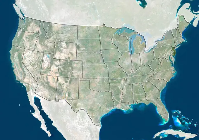
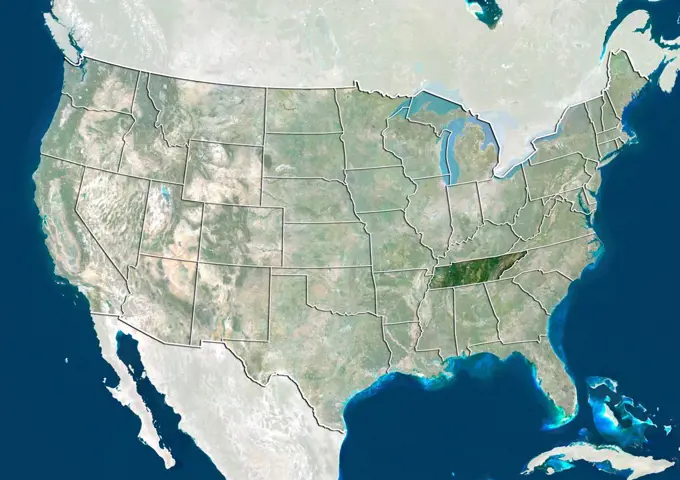
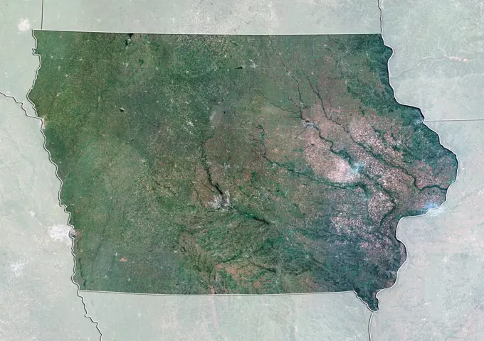
United States Satellite Imagery

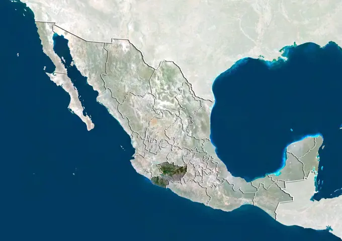
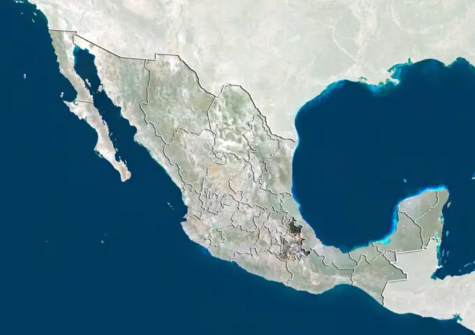
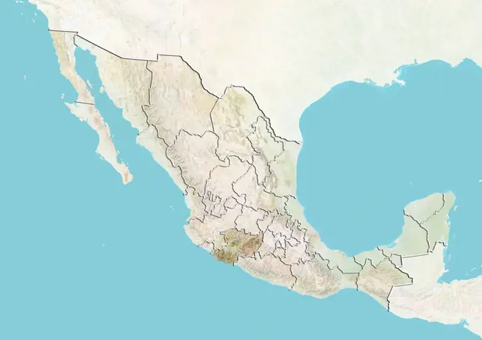
Satellite views of the United States focusing on various states, showcasing terrain and geographical features in detailed imagery.

Satellite view of the United States showing the State of Minnesota. This image was compiled from data acquired by LANDSAT 5 & 7 satellites.
126 assets in this story
1899-81312
Satellite view of the United States showing the State of Mississippi. This image was compiled from data acquired by LANDSAT 5 & 7 satellites.
1899-81273
Satellite view of the United States showing the State of New Jersey. This image was compiled from data acquired by LANDSAT 5 & 7 satellites.
1899-81258
Satellite view of the United States showing the State of Minnesota. This image was compiled from data acquired by LANDSAT 5 & 7 satellites.
1899-81279
Satellite view of the United States showing the State of New York. This image was compiled from data acquired by LANDSAT 5 & 7 satellites.
1899-81306
Satellite view of the United States showing the State of Tennessee. This image was compiled from data acquired by LANDSAT 5 & 7 satellites.
1899-81281
Satellite view of the United States with bump effect, showing the State of North Carolina. This image was compiled from data acquired by LANDSAT 5 & 7 satellites combined with elevation data.
1899-81284
Satellite view of the United States with bump effect, showing the State of North Dakota. This image was compiled from data acquired by LANDSAT 5 & 7 satellites combined with elevation data.
1899-81248
Satellite view of the United States with bump effect, showing the State of Maryland. This image was compiled from data acquired by LANDSAT 5 & 7 satellites combined with elevation data.
1899-81242
Satellite view of the United States with bump effect, showing the State of Louisiana. This image was compiled from data acquired by LANDSAT 5 & 7 satellites combined with elevation data.
1899-81336
Satellite view of the United States showing the State of Wyoming. This image was compiled from data acquired by LANDSAT 5 & 7 satellites.
1899-81245
Satellite view of the United States with bump effect, showing the State of Maine. This image was compiled from data acquired by LANDSAT 5 & 7 satellites combined with elevation data.
1899-81386
Satellite view of the United States with bump effect, showing the State of Maine. This image was compiled from data acquired by LANDSAT 5 & 7 satellites combined with elevation data.
1899-81463
Relief map of the United States with state boundaries. This image was compiled from data acquired by LANDSAT 5 & 7 satellites combined with elevation data.
1899-81377
Satellite view of the United States with bump effect, showing the State of Kansas. This image was compiled from data acquired by LANDSAT 5 & 7 satellites combined with elevation data.
1899-81230
Satellite view of the United States with bump effect, showing the State of Indiana. This image was compiled from data acquired by LANDSAT 5 & 7 satellites combined with elevation data.
1899-81339
Satellite view of the United States. This image was compiled from data acquired by LANDSAT 5 & 7 satellites.
1899-81416
Satellite view of the United States with bump effect, showing the State of Ohio. This image was compiled from data acquired by LANDSAT 5 & 7 satellites combined with elevation data.
1899-81420
Satellite view of the United States showing the State of Oklahoma. This image was compiled from data acquired by LANDSAT 5 & 7 satellites.
1899-81462
Satellite view of the United States showing the State of Wyoming. This image was compiled from data acquired by LANDSAT 5 & 7 satellites.
1899-81298
Relief map of the United States showing the State of South Carolina. This image was compiled from data acquired by LANDSAT 5 & 7 satellites combined with elevation data.
1899-81411
Satellite view of the United States showing the State of North Carolina. This image was compiled from data acquired by LANDSAT 5 & 7 satellites.
1899-81379
Relief map of the United States showing the State of Kentucky. This image was compiled from data acquired by LANDSAT 5 & 7 satellites combined with elevation data.
1899-81441
Satellite view of the United States showing the State of Mississippi. This image was compiled from data acquired by LANDSAT 5 & 7 satellites.
1899-81360
Satellite view of the United States showing the State of Florida. This image was compiled from data acquired by LANDSAT 5 & 7 satellites.
1899-81390
Satellite view of the United States showing the State of Michigan. This image was compiled from data acquired by LANDSAT 5 & 7 satellites.
1899-81280
Relief map of the United States showing the State of North Carolina. This image was compiled from data acquired by LANDSAT 5 & 7 satellites combined with elevation data.
1899-81372
Satellite view of the United States showing the State of Indiana. This image was compiled from data acquired by LANDSAT 5 & 7 satellites.
1899-81414
Satellite view of the United States showing the State of North Dakota. This image was compiled from data acquired by LANDSAT 5 & 7 satellites.
1899-81286
Relief map of the United States showing the State of Ohio. This image was compiled from data acquired by LANDSAT 5 & 7 satellites combined with elevation data.
1899-81310
Relief map of the United States showing the State of Mississippi. This image was compiled from data acquired by LANDSAT 5 & 7 satellites combined with elevation data.
1899-81427
Relief map of the United States showing the State of South Carolina. This image was compiled from data acquired by LANDSAT 5 & 7 satellites combined with elevation data.
1899-81459
Satellite view of the United States showing the State of Wisconsin. This image was compiled from data acquired by LANDSAT 5 & 7 satellites.
1899-81265
Relief map of the United States showing the State of Nevada. This image was compiled from data acquired by LANDSAT 5 & 7 satellites combined with elevation data.
1899-81393
Satellite view of the United States showing the State of Minnesota. This image was compiled from data acquired by LANDSAT 5 & 7 satellites.
1899-81206
Satellite view of the United States with bump effect, showing the State of Arkansas. This image was compiled from data acquired by LANDSAT 5 & 7 satellites combined with elevation data.
1899-81229
Relief map of the United States showing the State of Indiana. This image was compiled from data acquired by LANDSAT 5 & 7 satellites combined with elevation data.
1899-81394
Relief map of the United States showing the State of Montana. This image was compiled from data acquired by LANDSAT 5 & 7 satellites combined with elevation data.
1899-81376
Relief map of the United States showing the State of Kansas. This image was compiled from data acquired by LANDSAT 5 & 7 satellites combined with elevation data.
1899-81451
Relief map of the United States showing the State of Washington. This image was compiled from data acquired by LANDSAT 5 & 7 satellites combined with elevation data.
1899-81458
Satellite view of the United States with bump effect, showing the State of Wisconsin. This image was compiled from data acquired by LANDSAT 5 & 7 satellites combined with elevation data.
1899-53518079
Color satellite image of Myanmar and neighbouring countries.
1899-81345
Satellite view of the United States showing the State of Alaska. This image was compiled from data acquired by LANDSAT 5 & 7 satellites.
1899-81212
Satellite view of the United States with bump effect, showing the State of Colorado. This image was compiled from data acquired by LANDSAT 5 & 7 satellites combined with elevation data.
1899-35884
United States (Alaska Incl.), True Colour Satellite Image With Border And Mask. USA (Alaska incl.), true colour satellite image with border and mask. This image was compiled from data acquired by LANDSAT 5 & 7 satellites.
1899-80588
Relief map of Canada showing the province of British Columbia. This image was compiled from data acquired by LANDSAT 5 & 7 satellites combined with elevation data.
1899-35467
North America With Country Borders And Major Rivers, True Colour Satellite Image. True colour satellite image of North America with country borders and major rivers. This image in Lambert Conformal Conic projection was compiled from data acquired by LANDSAT 5 & 7 satellites.
1899-80586
Satellite view of Canada with bump effect, showing the province of Alberta. This image was compiled from data acquired by LANDSAT 5 & 7 satellites combined with elevation data.
1899-35466
North America With Country Borders, True Colour Satellite Image. True colour satellite image of North America with country borders. This image in Lambert Conformal Conic projection was compiled from data acquired by LANDSAT 5 & 7 satellites.
4128R-13763329
Earth from space. Computer illustration showing the Earth as viewed from space, centred over North America.
1899-80600
Relief map of Canada showing the Northwest Territories. This image was compiled from data acquired by LANDSAT 5 & 7 satellites combined with elevation data.
1899-79697
Relief map of Canada (with border and mask). This image was compiled from data acquired by landsat 5 & 7 satellites combined with elevation data.
1899-80616
Satellite view of Canada with bump effect, showing the province of Saskatchewan. This image was compiled from data acquired by LANDSAT 5 & 7 satellites combined with elevation data.
6145-44617640
An astonishing diversity of geological features, ecological systems and human landscapes across North America is indicated within this image from NASA's Terra spacecraft.
1746-19661881
North America, satellite image
1899-21290011
Satellite view of Southern United States (with administrative boundaries). This image was compiled from data acquired by Landsat satellites.
1899-35374
Canada, North America, True Colour Satellite Image With Mask. Satellite view of Canada (with mask). This image was compiled from data acquired by LANDSAT 5 & 7 satellites.
1899-80063
Relief map of Mexico (with border). This image was compiled from data acquired by LANDSAT 5 & 7 satellites combined with elevation data.
1899-81492
Relief map of Northeastern United States. This image was compiled from data acquired by LANDSAT 5 & 7 satellites combined with elevation data.
1899-82314
Relief map of the State of Pennsylvania, United States. This image was compiled from data acquired by LANDSAT 5 & 7 satellites combined with elevation data.
1899-66973
Relief map of the State of Nebraska, United States. This image was compiled from data acquired by LANDSAT 5 & 7 satellites combined with elevation data.
1899-80939
Relief map of Mexico showing the State of Guerrero. This image was compiled from data acquired by LANDSAT 5 & 7 satellites combined with elevation data.
1899-81730
Relief map of the State of Mato Grosso, Brazil. This image was compiled from data acquired by LANDSAT 5 & 7 satellites combined with elevation data.
1899-66962
Relief map of the State of Iowa, United States. This image was compiled from data acquired by LANDSAT 5 & 7 satellites combined with elevation data.
1899-80924
Satellite view of Mexico showing the State of Baja California. This image was compiled from data acquired by LANDSAT 5 & 7 satellites.
1899-80620
Satellite view of Canada showing the territory of Yukon. This image was compiled from data acquired by LANDSAT 5 & 7 satellites.
1899-80602
Satellite view of Canada showing the Northwest Territories. This image was compiled from data acquired by LANDSAT 5 & 7 satellites.
1899-80966
Satellite view of Mexico showing the State of Sonora. This image was compiled from data acquired by LANDSAT 5 & 7 satellites.
1899-80065
Satellite view of Mexico with Bump Effect (with border). This image was compiled from data acquired by LANDSAT 5 & 7 satellites.
1899-82249
Relief map of the State of Kansas, United States. This image was compiled from data acquired by LANDSAT 5 & 7 satellites combined with elevation data.
1899-80960
Satellite view of Mexico showing the State of Quintana Roo. This image was compiled from data acquired by LANDSAT 5 & 7 satellites.
1899-80953
Relief map of Mexico showing the State of Oaxaca. This image was compiled from data acquired by LANDSAT 5 & 7 satellites combined with elevation data.
1899-80963
Relief map of Mexico showing the State of Sinaloa. This image was compiled from data acquired by LANDSAT 5 & 7 satellites combined with elevation data.
1899-80948
Satellite view of Mexico showing the State of Michoacan. This image was compiled from data acquired by LANDSAT 5 & 7 satellites.
1899-80971
Relief map of Mexico showing the State of Veracruz. This image was compiled from data acquired by LANDSAT 5 & 7 satellites combined with elevation data.
1899-80956
Satellite view of Mexico showing the State of Puebla. This image was compiled from data acquired by LANDSAT 5 & 7 satellites.
1899-80957
Relief map of Mexico showing the State of Queretaro. This image was compiled from data acquired by LANDSAT 5 & 7 satellites combined with elevation data.
6177-V53655421
1899-66873
Relief map of Nunavut, Canada. This image was compiled from data acquired by LANDSAT 5 & 7 satellites combined with elevation data.
1899-81487
Satellite view of the State of Vermont and Northeastern United States. This image was compiled from data acquired by LANDSAT 5 & 7 satellites.
1899-82262
Satellite view of the State of Maryland, United States. This image was compiled from data acquired by LANDSAT 5 & 7 satellites.
1899-80945
Relief map of Mexico showing the State of Mexico. This image was compiled from data acquired by LANDSAT 5 & 7 satellites combined with elevation data.
1899-81786
Relief map of Nunavut, Canada. This image was compiled from data acquired by LANDSAT 5 & 7 satellites combined with elevation data.
1899-66955
Relief map of the State of Connecticut, United States. This image was compiled from data acquired by LANDSAT 5 & 7 satellites combined with elevation data.
1899-80947
Relief map of Mexico showing the State of Michoacan. This image was compiled from data acquired by LANDSAT 5 & 7 satellites combined with elevation data.
1899-80921
Relief map of Mexico showing the State of Aguascalientes. This image was compiled from data acquired by LANDSAT 5 & 7 satellites combined with elevation data.
1899-81466
Relief map of the State of Connecticut and Northeastern United States. This image was compiled from data acquired by LANDSAT 5 & 7 satellites combined with elevation data.
1899-81482
Relief map of the State of Pennsylvania and part of the US East coast. This image was compiled from data acquired by LANDSAT 5 & 7 satellites combined with elevation data.
1899-80969
Relief map of Mexico showing the State of Tamaulipas. This image was compiled from data acquired by LANDSAT 5 & 7 satellites combined with elevation data.
1899-82247
Satellite view of the State of Iowa, United States. This image was compiled from data acquired by LANDSAT 5 & 7 satellites.
1899-81474
Relief map of the State of Massachusetts and Northeastern United States. This image was compiled from data acquired by LANDSAT 5 & 7 satellites combined with elevation data.
1899-21989812
Color satellite image of Los Angeles to San Bernarnido, California, United States. Image collected on June 13, 2017 by Sentinel-2 satellites.
1899-21290149
United States at night in 2012. This satellite image shows urban and industrial lights.
1899-81667
Relief map of the State of New South Wales, Australia. This image was compiled from data acquired by LANDSAT 5 & 7 satellites combined with elevation data.
1899-82270
Relief map of the State of Minnesota, United States. This image was compiled from data acquired by LANDSAT 5 & 7 satellites combined with elevation data.
6145-54370796
Tree Identification - Willow: Black. Photographs Relating to National Forests, Resource Management Practices, Personnel, and Cultural and Economic History
6176-62025576
Satellite image of Canada with Ottawa Shown
1899-80477
Relief map of Australia showing the State of New South Wales. This image was compiled from data acquired by LANDSAT 5 & 7 satellites combined with elevation data.
1899-80479
Relief map of Australia showing the Northern Territory. This image was compiled from data acquired by LANDSAT 5 & 7 satellites combined with elevation data.
1899-82291
Relief map of the State of New Jersey, United States. This image was compiled from data acquired by LANDSAT 5 & 7 satellites combined with elevation data.
4297-1209
Satellite view of the Baja California peninsula of Mexico
PREVIOUS
of 2
NEXT
2401 S. Ervay, Suite 206
Dallas, Texas 75215
United States
Get Started
Free ResearchMy BoardsMy Cart
For Creators
How To License Your ContentContributor PortalFrame of Mind
Resources
API accessPricing
Contact
+1 866 236 0087help@viewpictures.co.uk Contact form
©2026 View Pictures. All Rights Reserved. -A
This site is protected by reCAPTCHA and Google Privacy Policy and Terms of Service apply.