My Boards
View Pictures
  • My Boards

Urban Renewal Maps

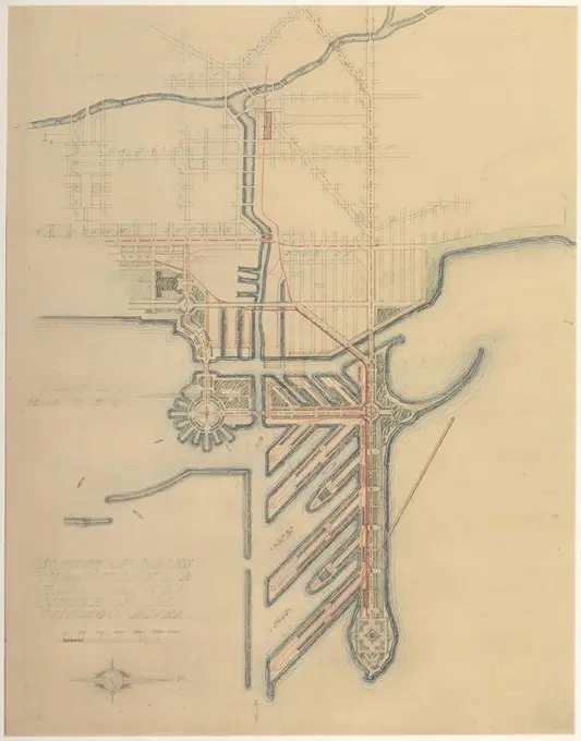
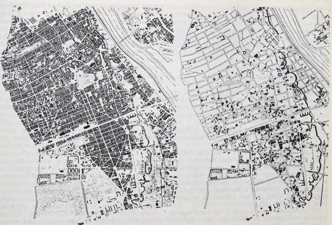
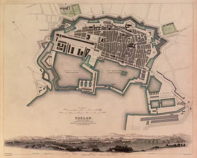
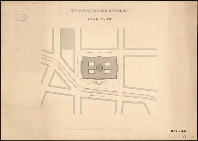
Historical property and urban development maps depicting various areas in Boston and Ankara, showcasing city planning and zoning proposals.

Property map, South Cove urban renewal area R-92 , Real property, Massachusetts, Boston, Maps, Bay Village Boston, Mass., Maps, City planning, Massachusetts, Boston, Maps
378 assets in this story
6145-48444906
Barth Erwin (1880-1933), Sachsenplatz in Berlin-Charlottenburg. Execution (01.1921): Plan of the system in the floor plan with altitude lines 1: 500, scale bar, designation of individual parts, legend. Print watercolor on the box, 50.8 x 56.9 cm (including scan edges) Barth Erwin  (1880-1933): Sachsenplatz, Berlin-Charlottenburg. Ausführung
6145-48486616
N.N., Oder-Spree Canal. Route Kersdorfer See to Friedrich-Wilhelm-Canal (06.1890): Stat. 46.6 - 48.3: site plan 1: 2500. Lithograph on paper, 47 x 65.3 cm (including scan edges) N.N. : Oder-Spree-Kanal. Strecke Kersdorfer See bis Friedrich-Wilhelm-Kanal
6145-50661851
Cadastral map (minute plan) of the municipality of Catharijne, Section A, second sheet with the boundaries of land ownership and the relevant plot numbers in the northern area of the Polder Lage Weide between Vleutense Wetering and the Lageweidsedijk
6145-48453035
Blum Otto, Silesian mountain railway (April 1st, 1900): Scheidegg stop, Waldfrieden train station. Location plans 1: 1000. Ink, ink colored watercolor on the box, 44.6 x 67.5 cm (including scan edges) Blum Otto : Schlesische Gebirgsbahn. Schinkelwettbewerb 1900
6145-48446937
Jansen Hermann (1869-1945), Hagen development plan (1931-1931): Worksheet basic map with altitude lines, department 232, sheet 11 1: 2000. Lithograph on paper, 76.2 x 109.2 cm (including scan edges) Jansen Hermann  (1869-1945): Hagen Bebauungsplan
6145-48982559
Gem.te Utrecht - Section C.
6145-45764909
Map of the Dijkvrachschap Drechterland (third part of above); New map of Dyck Grafschap van Dregterlandt. MDCCXXIII .. Part (third from above) from a map of the Dijkervapchap Drechterland.
6145-48448535
Jansen Hermann (1869-1945), settlement plan of the Plessow Gut: site plan 1: 2500, 1: 25000. Ink and pencil on transparent, 76.50 x 162.50 cm (including scan edge). Architecture Museum of the Technical University of Berlin Inv. No. 21695. Jansen Hermann  (1869-1945): Siedlungsplan des Gutes Plessow
6145-48487511
N.N., Bankalized Fulda from Kassel to Hannoversch Münden: Power map of the Fulda from KM 17.0 to 18.8: Depending plan 1: 2000. Lithograph colored on paper, 65.7 x 95.4 cm (including scan edges) N.N. : Kanalisierte Fulda von Kassel bis Hann. Münden
6145-48482146
N.N., Settlement of the Maxqueller, Kaiser-Wilhelm-Koog. (From: Atlas to the magazine for Building, ed. V. G. Erbkam, Jg. 25, 1875.) (1875-1875): Grundriss. Lithograph on breadcrumbs, 29.6 x 45.3 cm (including scan edges) N.N. : Bedeichung der Maxqueller, Kaiser-Wilhelm-Koog. (Aus: Atlas zur Zeitschrift für Bauwesen, hrsg. v. G. Erbkam, Jg. 25, 1875)
4409-17585240
Plate 71 from The Plan of Chicago, 1909: Chicago. Sketch Diagram of Docks Suggested at the Mouth of the Chicago River for Package Freight Steamers. Daniel Hudson Burnham, American, 1846-1912; Edward Herbert Bennett, American, born England, 1874-1954. Date: 1909. Dimensions: 107.6 × 85.4 cm (42 1/2 × 33 3/4 in.). Graphite and colored pencil on paper. Origin: United States. Museum: The Chicago Art Institute, Chicago, USA.
6145-29620482
Collection of the Dutch Heidematschappij. new condition. undated. Exloo
6145-50661567
3rd quarter (district H).
6145-44234457
Great line, map of castle and garden
4409-17299497
EMPLAZAMIENTO DEL SENADO EN PLANO DE MADRID - 1846. Author: MERLO JUAN / GUTIERREZ FERNANDO / RIBERA JUAN. Location: INSTITUTO GEOGRAFICO Y CATASTRAL. MADRID. SPAIN.
6145-48434326
Plüddemann Richard (1846-1910), slaughterhouse and cattle market, Breslau (1894-1896): Department 1: 500. Lithograph, 101.5 x 203.8 cm (including scan edges)
6145-29658480
Collection of the Dutch Heidematschappij. Land resentment, overview cards, Noordlander Made. undated
1746-21126382
Map showing the central parts of Warsaw, Poland, before The Great War. Dated 20th Century
6145-55957207
Map of Manhattan and part of the Bronx Cartographic. Maps. 1907. Lionel Pincus and Princess Firyal Map Division. Manhattan (New York, N.Y.), New York (N.Y.)
6145-29929310
Plan of the Hospice of Salpestriere.
6145-48446853
Jansen Hermann (1869-1945), traffic and settlement planning of the expansion of the cities of Neukirchen and Vluyn (November 13, 1925): bypass, proposal III: Basic plan 1: 5000, scale bar. Pencil, colored pencil on transparent, 41.1 x 56 cm (including scan edges) Jansen Hermann  (1869-1945): Verkehrs- und Siedlungsplanung der Erweiterung der Städte Neukirchen und Vluyn
6145-48455182
N.N., cemetery systems and chapels (without date): Plan content N.N. detected. Material/technology N.N. recorded, 62.6 x 39.6 cm (including scan edges) N.N. : Friedhof am Seelhorst, Hannover
6145-55913853
Ground plan of the Zoological Garden of Cincinnati, O. Includes key to points of interest.... , Ohio  , Hamilton  ,county   , Cincinnati Cincinnati Zoo and Botanical Garden
1899-20226790
Map of Toulon, France 1840.
6145-48931945
EFFECT OF ALLIED BOMBING ON RENAULT PRODUCTION FOR THE NAZIS. The black dots on this map show where bombs of the U.S. Army 8th Air Force fell on and around the Renault Motor Works in a suburb of Paris on April 4, 1943.
6145-48437650
Vischer & Fueter, Reichsgericht in Leipzig (1884): site plan. Ink on cardboard, 48.6 x 68.1 cm (including scan edges) Vischer & Fueter : Reichsgericht, Leipzig
6145-55917748
Washington Park urban renewal area r-24 : proposed zoning plan. Part of a set of 11 maps (Boston Public Library lacking map 2 showing proposed land use and map 7 showing existing land use) accompanying a loan/grant application submitted to the US Urban Renewal Administration seeking funds for an urban renewal project in the Washington Park area of Boston's Roxbury neighborhood. Shows zone type and height restrictions. Inset: Location map.... , Massachusetts  , Suffolk  ,county   , Boston  , Roxbury
6145-48444961
Jansen Hermann (1869-1945), competition plan for Heiligkreuz, Trier (1925-1925): basic and site plan via land map from six parts, reproduced in two parts, part B, 1: 1000, scale bar. Pencil, colored pencil, chalk via photo on cardboard, 125.7 x 60.5 cm (including scan edges) Jansen Hermann  (1869-1945): Wettbewerb Bebauungsplan für Heiligkreuz, Trier
6145-50444028
Jansen Hermann (1869-1945), competition for the development of the inner Rayon, Cologne (1919-1919): basic plan in 5 parts 1: 2500. Ink over pressure on transparent, 87 x 73.7 cm (including scan edges) Jansen Hermann  (1869-1945): Wettbewerb zur Bebauung des Inneren Rayons, Köln
6145-48447635
Jansen Hermann (1869-1945), total development plan Ankara. Partial development plan inner city (03.03.1938): Depending plan 1: 500, partial development plan for Ulus Meydani, variant 3,. Light break on transparent, 66.3 x 56.1 cm (including scan edges) Jansen Hermann  (1869-1945): Gesamtbebauungsplan Ankara. Teilbebauungsplan innere Stadt
6145-29606771
Collection Dutch Heidematschappij. Card / System Vierlingh. undated
6145-29656969
Collection of the Dutch Heidematschappij. New condition. undated. Nieuwleusen
6145-51435927
Aerial view of the athletic grounds at Selfridge Field in Mt. Clemens, Michigan. The photograph was taken at 4,000 feet. It was received from the DMA photographer on November 23, 1916. The image was passed by the M.I.D. censor on November 30, 1918. Noted for official use only.
6145-51386381
Plan of the Norwood Headland in Rockport, Mass. ,
6145-52306663
Plan Bakchisaraiskago sada dvortsa. Timm, Vasili Fëdorovich, 1820-1895. still image. Prints. 1851 - 1862. Rare Book Division. Russia , Social life and customs, Russia , History, Arts, Russian
6145-52831714
Pencil and black ink drawing on paper showing the inventory and garden plan of Burggarten at Hofburg, Vienna I, with multicolored washes, by Franz Antoine d. J., 1847.
6145-43861815
Suggestion for the improvement of Muddy River and for completing a continuous promenade from the Common to Jamaica Pond , Parks, Massachusetts, Boston, Maps, City planning, Massachusetts, Boston, Maps, Landscape architecture, Massachusetts, Boston, Maps, Muddy River Norfolk County and Suffolk County, Mass. : River, Maps, Boston Mass., Maps Norman B. Leventhal Map Center Collection
6145-42603635
Jansen Hermann (1869-1945), total development plan Ankara. Partial development plan inner city (21.06.1933): site plan 1: 500, Saman Pazari Meydani. Coal, ink and pencil on transparent, 24.6 x 50 cm (including scan edges) Jansen Hermann  (1869-1945): Gesamtbebauungsplan Ankara. Teilbebauungsplan innere Stadt
6145-48672943
Map of Malden, 1795 ,. Lucius Beebe Memorial Library Historic Maps
4409-21522310
Manhattan, V. 12, Plate No. 36 Map bounded by Riverside Drive, Broadway.
4220-21928524
Map of the Charing Cross, Pall Mall and Pimlico area of central London showing, the famous thoroughfare of Pall Mall with its numerous club houses.  To the left of that is a verdant Mall, before its conversion into the pink tarmac ceremonial route we know today, and St. James's Park to the left of that.  Buckingham Palace can be seen at the end with Grosvenor Place behind it, and Victoria train station in the distance.  In the foreground is Nelson's Column in Trafalgar Square and the National Ga
6145-48447794
Jansen Hermann (1869-1945), total development plan Ankara. Settlement of the professors of the agricultural university. Ziraat Mektebi Cooperifi (25.05.1938): Grund and site plan 1: 2000 Agricultural University of Southeastern area with sports, parking and residential complexes. Coal, ink and pencil on transparent, 52.8 x 44.2 cm (including scan edges) Jansen Hermann  (1869-1945): Gesamtbebauungsplan Ankara. Siedlung der Professoren der Landwirtschaftlichen Hochschule. Ziraat Mektebi Kooperatifi
6145-48447709
Jansen Hermann (1869-1945), total development plan Ankara. Partial development plan for government district (05.04.1934): Perspective (bird's show) Ministry of the Interior of the north. Coal and ink on transparent, 36.8 x 60 cm (including scan edges) Jansen Hermann  (1869-1945): Gesamtbebauungsplan Ankara. Teilbebauungsplan Regierungsviertel
6145-29620471
Collection of the Dutch Heidematschappij. Old condition. undated. Exloo
6145-48439383
Jansen Hermann (1869-1945), urban planning in Adana. Development plan for the area between the train station and the old city (01.08.1935): Basic plan 1: 5000, scale bar. Pencil and ink on transparent, 52.7 x 60.7 cm (including scan edges) Jansen Hermann  (1869-1945): Stadtplanung, Adana. Bebauungsplan für das Gebiet zwischen Bahnhof und alter Stadt
6145-55914457
Back Bay Fens master plan. Shows trees, paths, river, roads and building outlines. Oriented with north to the upper right. Includes notes about areas and key map.... , Massachusetts  , Suffolk  ,county   , Boston  , Fens Back Bay Fens
6145-50515072
Revere, Sales Creek - flood control study , Sales Creek Mass., Maps, Sales Creek Mass., Aerial views, Flood control, Massachusetts, Revere, Maps, City planning, Massachusetts, Revere, Maps
6145-50527545
Washington Street boulevard study : proposed fabric , City planning, Massachusetts, Boston, Maps, Urban renewal, Massachusetts, Boston, Maps, Washington Street Boston, Mass., Maps Norman B. Leventhal Map Center Collection
6145-59430289
Fortress map of Brielle, Anonymous, After François Van Bleyswijck, 1729 print At the bottom right a legend a-o. print maker: Netherlandspublisher: Rotterdam paper etching maps of cities. fortified city Brielle
6145-48446447
Jansen Hermann (1869-1945), Groß-Berlin 1910 competition. Development plan for the Tempelhofer Feld (1909): Overview plan 1: 6000. Print colored on paper, 45.9 x 36.8 cm (including scan edges) Jansen Hermann  (1869-1945): Wettbewerb Groß-Berlin 1910. Bebauungsplan für das Tempelhofer Feld
6145-48502174
test111
6145-44067292
City plans of Saxon cities with statistical information on the cholera victims of 1865, before 1866
6145-54412878
A grid map of Naval Air Station, North Island, California, including anchorage areas. Country: Unknown
6145-59017888
Contest of the 1900 Universal Exhibition: award-winning project by Charles Albert Gautier (1846-1915), architect. General plan. Anonymous photography. Draw on albumin paper, around 1896. Paris, Carnavalet museum. 123085-17
6145-50443892
Barth Erwin (1880-1933), Volkspark Rehberge in Berlin-Wedding (05.1928): Overall system in the floor plan 1: 2000, scale bar, stamp. Light break on paper, 62.2 x 71.1 cm (including scan edges) Barth Erwin  (1880-1933): Volkspark Rehberge, Berlin-Wedding
6145-54269528
Ward 1 of Boston. Shows precincts. Oriented with north to the upper right. Inset: Boston Airport. "Precinct 3 includes all islands in the Boston Harbor.".. Ward one of Boston. Ward one of Boston, Massachusetts  , Suffolk  ,county   , Boston
6145-48447169
Jansen Hermann (1869-1945), street regulation in Melk (October 31, 1932): Merging of the Kremser- und Wiener Straße into Linzer Strasse: Deport plan 1: 1000. Light break on paper, 42.8 x 73.3 cm (including scan edges) Jansen Hermann  (1869-1945): Straßenregulierung, Melk
6145-48446643
Jansen Hermann (1869-1945), development plan of the city expansion, Neuruppin. 1. Project. Northern half (11.1923): basic and site plan 1: 2500, between the railway embankment and Schneidemühle. Ink on transparent, 24.6 x 36.7 cm (including scan edges) Jansen Hermann  (1869-1945): Bebauungsplan der Stadterweiterung, Neuruppin. 1. Projekt. Nördliche Hälfte
6145-48447805
Jansen Hermann (1869-1945), total development plan Ankara. Settlement Bahceli Evler Yapi Cooperifi (12.11.1935): (Light break from Inv.No. 23047), basic and location plan 1: 2000, revised preliminary draft. Coal over a break on paper, 73.3 x 69.7 cm (including scan edges) Jansen Hermann  (1869-1945): Gesamtbebauungsplan Ankara. Siedlung Bahceli Evler Yapi Kooperatifi
6145-42603496
Jansen Hermann (1869-1945), Hagen development plan (1931-1931): Worksheet basic map without altitude lines, department 232, sheet 23 1: 2000. Lithograph on paper, 77.4 x 52.6 cm (including scan edges) Jansen Hermann  (1869-1945): Hagen Bebauungsplan
6176-67041478
Newmarket Race Course, 1940. Artist: Unknown
6145-48446738
Jansen Hermann (1869-1945), construction of a settlement for the non-profit small house construction company in Berlin-Heiligensee (November 8, 1921): Grund- und Dialtplan 1: 2500. Ink on transparent, 34.7 x 46.8 cm (including scan edges) Jansen Hermann  (1869-1945): Bau einer Siedlung für die gemeinnützige Kleinhausbaugesellschaft, Berlin-Heiligensee
6145-48447712
Jansen Hermann (1869-1945), total development plan Ankara. Partial development plan stadium and racetrack (February 8th, 1930): Grund- and site plan 1: 4000. Pencil on transparent, 40 x 55.1 cm (including scan edges) Jansen Hermann  (1869-1945): Gesamtbebauungsplan Ankara. Teilbebauungsplan Stadion und Rennbahn
6145-51391188
Atlas of the county of Suffolk, Massachusetts : vol. 6th including the late city of Charlestown, now wards 20,21 and 22, city of Boston : from actual survey & official records : plate E , Real property, Massachusetts, Boston, Maps, Landowners, Massachusetts, Boston, Maps, Charlestown Boston, Mass., Maps Norman B. Leventhal Map Center Collection
6145-55957156
City Hall Park showing Court House site 1914 - 1915. Cartographic. Maps. Lionel Pincus and Princess Firyal Map Division
6145-48446902
Jansen Hermann (1869-1945), Bielsko (June 29, 1929): Department 1: 200 Traffic Regulation Josephyplatz. Ink on transparent, 64.1 x 82.2 cm (including scan edges) Jansen Hermann  (1869-1945): Bielsko
6145-29605471
Collection Dutch Heidematschappij. condition. undated
6145-54300902
Nuremberg. Original caption: Nuremberg - copied by H. W. Hendley of the BPR, from "Nuremburg Chronicle" 1493.
6145-59504928
Launch place V2, 1944 - 1945 photograph Map of the launch site of V2 missiles near The Hague/ Wassenaar, The Hague paper. plastic (organic material)   Netherlands
6145-48448545
Jansen Hermann (1869-1945), revision of the Wenningstedt development plan on Sylt: Department plan 1: 1000. Ink and coal on transparent, 60.50 x 176.50 cm (including scan edge). Architecture Museum of the Technical University of Berlin Inv. No. 22134. Jansen Hermann  (1869-1945): Revision des Bebauungsplans Wenningstedt auf Sylt
6145-48447203
Jansen Hermann (1869-1945), settlement for war-damaged people in Potsdam (1933-1933): Department 1: 500. Light break on the cardboard, 54.4 x 80.1 cm (including scan edges) Jansen Hermann  (1869-1945): Siedlung für Kriegsbeschädigte, Potsdam
6145-50444080
Jansen Hermann (1869-1945), development plan of the city expansion, Neuruppin. 1st project (10.10.1924): Overview plan 1: 10000. Ink on transparent, 60.6 x 64 cm (including scan edges) Jansen Hermann  (1869-1945): Bebauungsplan der Stadterweiterung, Neuruppin. 1. Projekt
6145-48469072
Jansen Hermann (1869-1945), development plan of the city expansion, Nörenberg/Pomerania (August 15, 1927): General development plan: basic plan and site plan 1: 1000, consisting of four leaves: Inv.No. 21400a, 21401b, 21402c, 21403d, here sheet 1. Colored sturies about pressure on cardboard, 74.6 x 102.8 cm (including scan edges)
6145-29670537
Photo collection Government information service. Places of interest, exhibition "De Stijl", Wils Jan / Bonset l k. undated
6145-48469116
Jansen Hermann (1869-1945), development plan of the city expansion, Nörenberg/Pomerania (August 15, 1927): General development plan: basic plan and site plan 1: 1000, consisting of four leaves: Inv.No. 21404a, 21405b, 21406c, 21407d, here sheet 1. Pressure on cardboard, 74.2 x 102.6 cm (including scan edges)
6145-50444205
Jansen Hermann (1869-1945), redesign of the Horst-Wessel-Platz in Neustrelitz (28.02.1937): Department 1: 500, proposal 2nd ink, coal on transparent, 44.9 x 50.1 cm (including scan edges)  Jansen Hermann  (1869-1945): Umgestaltung des Horst-Wessel-Platzes, Neustrelitz
6145-29605478
Collection Dutch Heidematschappij. "BOLLINGEN BÖTTINGEN" (Wurtemburg) land consolidation. undated
6145-48447715
Jansen Hermann (1869-1945), total development plan Ankara. Partial development plan stadium and racetrack (05.03.1934): site plan 1: 2000, site between the racetrack and stadium, extended project with Aufmarschplatz. Ink on transparent, 47 x 56.2 cm (including scan edges) Jansen Hermann  (1869-1945): Gesamtbebauungsplan Ankara. Teilbebauungsplan Stadion und Rennbahn
PREVIOUS
of 4
NEXT
2401 S. Ervay, Suite 206
Dallas, Texas 75215
United States
Get Started
Free ResearchMy BoardsMy Cart
For Creators
How To License Your ContentContributor PortalFrame of Mind
Resources
API accessPricing
Contact
+1 866 236 0087help@viewpictures.co.uk Contact form
©2026 View Pictures. All Rights Reserved. -A
This site is protected by reCAPTCHA and Google Privacy Policy and Terms of Service apply.