My Boards
View Pictures
  • My Boards
← Documents & Records

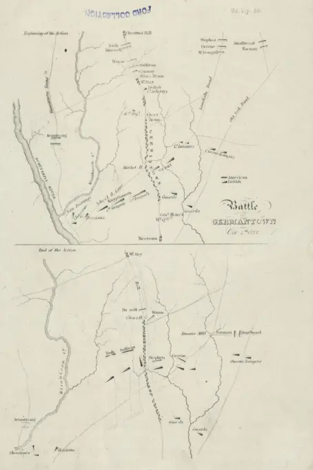
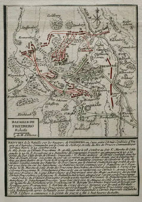
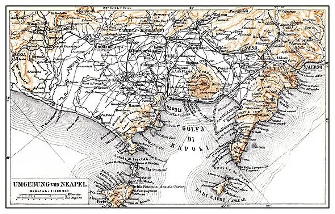
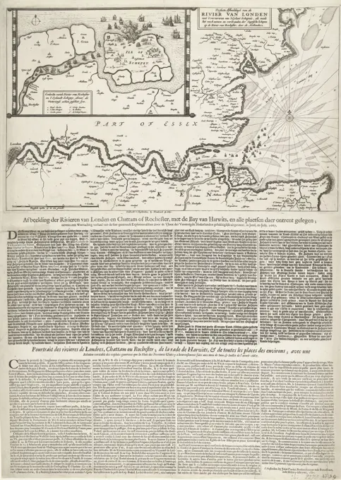
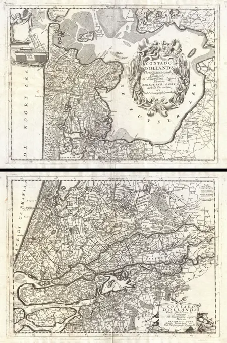
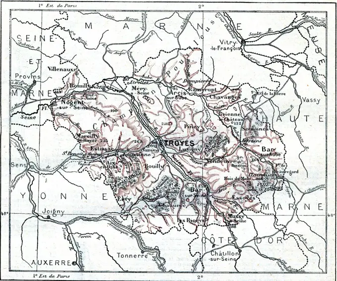
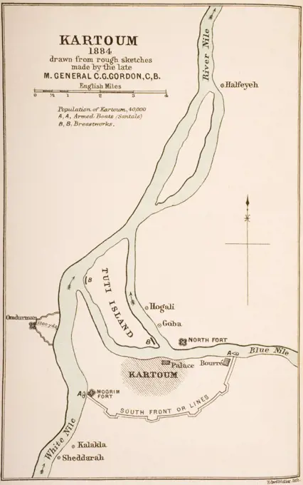
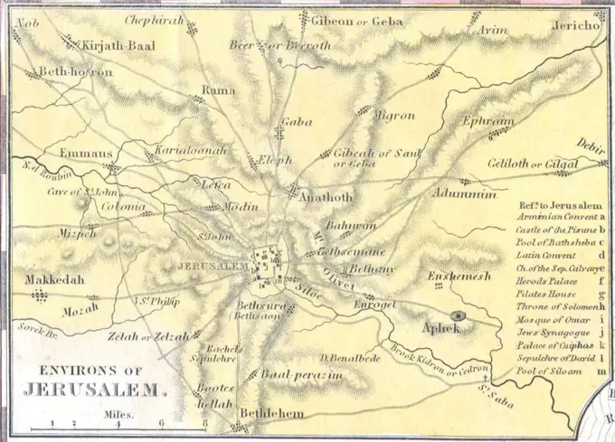
Vintage Maps of Historical Regions

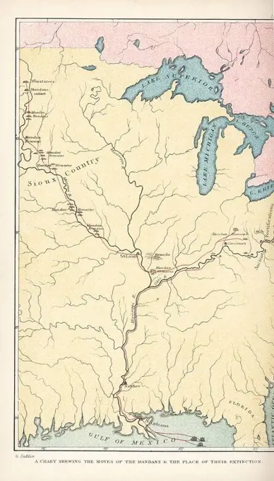
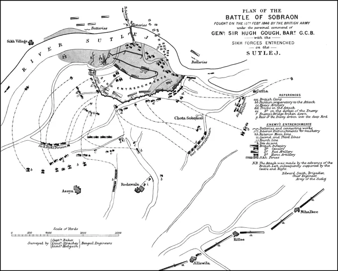
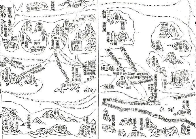
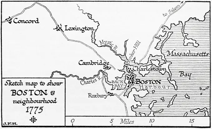
Collection of engraved vintage maps depicting various historical regions, including Rajasthan, Indo-China, West Africa, and the UK highlands.

'Map to Illustrate the Operations Round Colesberg', 1902. Artist: Unknown.
172 assets in this story
1848-49519713
100.000, ground plan, district, railway line, cartography, historical illustration 1896, Stockholm and surroundings, Baltic Sea, Sweden, waterways, islands, royal castle, Skeppsholmen, Djurgarden, Europe
6176-66085654
Map of Camp Fort Bodo. Africa. Emin Pasha Relief Expedition 1886-1889 by Henry Morton Stanley (1841 - 1904) Old 19th century engraving from Le Tour du Monde 1890
6176-65989516
Black and White Illustration; Map of St Andrew's, Fife, Scotland. Circa 1880
4443-75474640
Battle of Germantown, Oct. 4th, 1777. Issued in 1839 by Ferdinand Andrews in Boston. The depiction includes two maps on one sheet, with dimensions of 11 x 14 cm and 10 x 14 cm, and an overall sheet size of 20 x 14 cm. The maps illustrate the historical context of the Battle of Germantown in Philadelphia, Pennsylvania, in 1777
1899-67417016
This map dates to 1922 and shows Boston and its vicinity at the time.
4409-17551852
Seven Years War (1756-1763). Third Silesian War. Map of the Battle of Freiberg (29 October 1762). The Prussian army led by Prince Henry of Prussia, defeated an Austrian army under Frederick Charles of Stolberg-Gedern and Andras Hadik. Published in 1765 by the cartographer Jean de Beaurain (1696-1771) as an illustration of his Great Map of Germany, with the events that took place during the Seven Years War. Etching and engraving. French edition, 1765. Military Historical Library of Barcelona (Biblioteca Histórico Militar de Barcelona). Catalonia. Spain. Author: Jean de Beaurain (1696-1771). French geographer.
6176-66088020
Exploration in South America by Edward Andre, map of the Magdalena river from Simiti at its mouth. Colombia. South America. Old 19th century engraved illustration from Journey to Colombia by Edward Francois Andre, Le Tour du Monde 1877
1848-19328814
Plan of the Battle of Klissow on 19 July 1702, Poland, In the Battle of Klissow the armies of Charles XII and August II faced each other on 19 July 17...
6145-29605508
Collection Dutch Heidematschappij. Map. undated
1746-29015734
Map depicting the current and proposed lines of the Paris Metro. Dated 19th century
6145-29670260
Photo collection Government information service. Lauwerszeewerken, map. undated
6188-55551875
Map from Loire Department, France Map from Loire Department, France Copyright: xZoonar.com/PatrickxGuenettex 10656628
1848-54752956
Historical map of Naples and surroundings, Italy, 19th Century, from Meyers Konversations-Lexikon encyclopaedia, 1889, Europe
1848-78941873
Map of Des Landes department, vintage engraved illustration. Journal des Voyages, Travel Journal, (1879-80)
6188-64601636
Bombay map  Niebuhr s map 1764  Mumbai  Maharashtra  India
4443-73237117
Amsterdam, Vinckel, Jacob, Wit, Frederik de, Noordelijke Nederlanden, Pourtraict des rivieres de Londres, Chattam ou Rochester; de la rade de Harwits, & de toutes les places des environs, Illustratie der Rivieren van Londen en Chattam of Rochester, met de Bay van Harwits, en alle Plaatsen in de omgeving, Perfecte Image of the River of London with the conquest of the Isle of Sheep, Map of the mouth of the Thames with the Raid on the Medway, 1667, Northern Netherlands, Map of the mouth of the Thames showing the Raid on the Medway by the Dutch fleet under Admiral De Ruyter, 20-23 June 1667. Top left an inset with a detailed map of the mouth of the River Medway and the Isle of Sheppey. Glued under the plate is a sheet with 2 descriptions printed in 4 columns in Dutch and French., print, map, news print, prints, Frederik Muller Historieplaten, height 463 mm, width 350 mm, print maker, printmaker, 1667 - 1667, third quarter 17th century, paper, papier, etching, etchings, letterpress printing
6176-67045631
'Map Illustrating the Operations on the South of the Orange River', 1900. From "South Africa and the Transvaal War, Vol. II", by Louis Creswicke. T. C. & E. C. Jack, Edinburgh, 1900
1525-27818235
Map of the department of Saone-et-Loire, vintage engraved illustration. Journal des Voyage, Travel Journal, (1880-81).
6188-55551901
Map of the department of Lot-et-Garonne, vintage engraving. Map of the department of Lot-et-Garonne, vintage engraved illustration. Journal des Voyages, Travel Journal, 1879-80. Copyright: xZoonar.com/PatrickxGuenettex 10656668
1848-49519599
75.000, districts, river Svratka, mountains, cartography, hatching, railway line, city of Brno, Brno, Czech Republic, city map and surroundings, Koenigsfeld, Europe
6145-29096537
1690 Coronelli Map of Holland or the Netherlands (2 sheets)
6145-29657391
Collection of the Dutch Heidematschappij. Maps, maps, road layout, pigeon pants. undated. Pigeon pants
1525-28036749
The department of Aube, vintage engraved illustration. Dictionary of words and things - Larive and Fleury - 1895.
6176-66915386
Siege of Quebec, Map of the Quebec City area showing disposition of French and British forces. The Plains of Abraham are to the left. 1759
1899-39004
Kartoum Sudan in 1884 drawn from rough sketches made by General Gordon from The Journals of Major-Gen. C.G. Gordon C.B. at Kartoum published by Kegan Paul Trench & Co London 1885
6145-51411018
Copy of map of Tararua Ranges, circa 1920, Horowhenua, by Leslie Adkin. Gift of G. L. Adkin family estate, 1964.
1848-50242359
Stadtplan, city map from the year 1892: Cairo and the Pyramids, Egypt, digitally restored reproduction of an original 19th century map, Africa
6145-29095890
Environs of Jerusalem. 1836 Tanner Map of Palestine - Israel - Holy Land
4409-17368432
Guerra civil española (1936-1939). Perspectiva de la zona de batalla de la llanura madrileña y las sierras adyacentes. Año 1937.
1525-28036753
The department of Aveyron, vintage engraved illustration. Dictionary of words and things - Larive and Fleury - 1895.
4409-20995609
Map of the migration of the Mandan nation and their extinction by smallpox, enslavement by the Arikara, and massacre by the Sioux in 1838. Handcoloured lithograph from George Catlin's Manners, Customs and Condition of the North American Indians, London, 1841.
6176-67070356
''Region de Pretoria et de Johannesburg; Afrique Australe', 1914. From "Grande Geographie Bong Illustree", 1914.
6176-66077118
Old map of Dauphine, Isere and Alpes. France. Drawing by Leon Sabatier (1827-1887) Excursions in the Dauphiné, 1850-1860 by Adolphe Joanne (1813-1881) Le Tour du Monde 1860
1525-28031456
Topographical Map of the Administrative Department of Loire in Rhone-Alpes, France, vintage engraved illustration. Dictionary of Words and Things - Larive and Fleury - 1895
1525-24684101
Red Sea map, vintage engraved illustration. Dictionary of words and things - Larive and Fleury - 1895.
6188-60986846
Plan of the Battle of Sobraon, First Anglo-Sikh War, 10 February 1846 Plan of the Battle of Sobraon, First Anglo-Sikh War, 10 February 1846 Copyright: xZoonar.com/Heinz-DieterxFalkensteinx 21664880
1848-19342036
Plan of the Battle of Belgrade of 16 August 1717, Historical, digitally restored reproduction of a 19th century original, exact date unknown
1525-28036122
Map of Department of Aisne, vintage engraved illustration. Dictionary of words and things - Larive and Fleury - 1895.
6176-66091993
Map with the route made by the British explorer Sir Samuel White Baker to Abyssinia. Africa. Old 19th century engraved illustration from Exploration of the Nile tributaries of Abyssinia, 1861-1862 by Samuel Baker, Le Tour du Monde 1870
1746-19661445
Zheng He (1371-1435) Chinese mariner, explorer and naval commander. His sailing charts were published in in 1628 in Wubei Zhi (Treatise on Armament Technology). Chart showing India, top, Ceylon and Africa, bottom. Cartography
4443-11105
MAP OF PARIS IN 60 B.C., IN THE 4TH CENTURY AND IN THE 12TH CENTURY, FRANCE
1746-28995620
Map illustrating an Expedition of Captain Robert Falcon Scott (1868-1912) a British Royal Navy officer and explorer of the Antarctic regions. Dated 20th Century
1889-60423440
Map showing early Latium, the region of central western Italy in which the city of Rome was founded.  From the book Outline of History by H.G. Wells, published 1920.
6176-67051102
'Territory of Calcutta When Attacked by Surajah Dowlah, 1756', c1891. From "Cassell's Illustrated History of India Vol. I.", by James Grant. Cassell Petter & Galpin, London, Paris and New York
6145-48640711
Boston Elevated Railway system , Local transit, Massachusetts, Boston, Maps, Railroads, elevated, Massachusetts, Boston, Maps, Subways, Massachusetts, Boston, Maps, Boston Mass., Maps, Boston Elevated Railway Company Norman B. Leventhal Map Center Collection
1889-60422294
Sketch map showing Boston and neighbourhood, 1775.  From the book Outline of History by H.G. Wells, published 1920.
1889-60416969
Layout of the ancient Gallo-Roman town Massilia, (Marseilles) showing the old Phocaean harbour, the Lacydon.  After an illustration by Edgar Holloway.
6176-66077536
Bay of Tourane occupied by the Hispano French expedition in 1859, Tourane. Vietnam. Indochina. Old 19th century engraving from Le Tour du Monde 1860
4443-21819094
Plans of four fortresses. The two upper forts are designated as Creveceur Fort and S. Anderies Schans. The two lower forts are located in Tiel and Arnhem. This print is part of a group of twelve prints, mostly etched and published by Gaspar Bouttats, with views of fortresses and towns conquered by the French and the Bishop of Munster in 1672. , Sheet showing the fortresses at Crevecoeur, Saint Andries, Tiel and Arnhem, captured by the French or Munster, 1672 Twelve views of fortresses and cities captured by the French and the Bishop of Munster in 1672 Picture of some cities and fortifications of which differente soo ghe won and surrendered to his Majesty the Prince of France Lodovicus XIV and to his Serene Highness the Bishop of Munster Christophori Bernardus van Galen. Anno 1672 , print maker: Gaspar Bouttats, (mentioned on object), publisher: Gaspar Bouttats, (mentioned on object), Antwerp, 1672, paper, etching, h 192 mm × w 264 mm
1848-49519598
100, 000, districts, Karoline Valley, Vltava, mountains, cartography, hatching, railway line, city of Prague, Praha, city map and surroundings, Czech Republic, Europe
5513-111856131
Routes To Freedom -- Map locates routes POWs will taka following their scheduled release Wednesday from anti-Red prison camp southeast of Panmunjom. Chinese anti-Communist POWs will move in trucks through Seoul to Ascom City near Inchon for Formosa bound ships. Koreans will use railroad, dotted line, enroute to South Korean army induction centers at Pohang and Kunsan where they will he processed and restored to civilian status. Any sick Korean prisoners will probably go to convalescent hospital
6145-29677723
Anefo / London photo collection. Oh Occupied Holland / Anefo London series. Map with Display of the German Refinition 10-15 May 1940. May 1940
6145-29095164
1862 Johnson Map of Ontario and Quebec, Canada
6176-66915582
La Salle's Colony on the Illinois, from the Map of the Franquelin, 1684
6176-66917945
Plan of the Battle of Telissu, June 14th and 15th, 1904
1848-49321491
Oldest map of the voyage of Fernando Magellan, Portuguese navigator and explorer, Pacific Ocean, coast of South America, Strait of Magellan, Tierra del Fuego, Argentina, sailing ship, coat of arms, historical map from 1529 to Bibeiro, South America
1746-29973234
A map of American in the first half of the eighteenth-century. Dated 19th century
6176-67052294
Map of the London Postal District with its Subdivisions, 1857. Districts shown: North Western, Northern, North Eastern, Eastern, South Eastern, Southern, South Western, Western, Western Centre, Eastern Centre. From "Illustrated London News", 1857.
6176-66097603
This contemporary map shows approximately the extent of the German advance to September 6, 1914.
6176-67056938
'Map illustrating the Operations in the Persian Gulf', First World War, 1915, (c1920). '...showing the British oil pipe guarded against the Turkish attacks and the advance up the Tigris to Amara, January - June 1915'. From "The Great World War - A History" Volume III, edited by Frank A Mumby. The Gresham Publishing Company Ltd, London, c1920
1788-21799409
Map of the canal through the Isthmus of Suez, Egypt, Krautz illustration from L'Illustration, Journal Universel, No 1382, Volume LIV, August 21, 1869.
4408-13958
Plan of the Battle of Fredericksburg, Civil War - USA
6176-66083987
Tancarville Canal, Seine Maritime. France. Europe. Old 19th century engraved illustration from La Nature 1888
1848-49519720
100.000, ground plan, St. Isidra, district, paper factory, park, garden, Buen Retiro, railway line, dead-end station, cartography, historical illustration 1896, Madrid and surroundings, river Mazanares, Spain, Europe
6176-66100127
This illustrations dates to the 1870s and shows the route of the Pacific railway. The distance by rail from New York to San Francisco is 3,215 miles, and the journey occupies about a week (in the 1870s), the trains travelling night and day. The traveller proceeding from the Eastern States to the far west has the choice of many routes, but these all converge to Omaha. From this point the Pacific Railroad will convey him towards the land of the setting sun. This map, shows the course of this railway, which is the longest in the world (in the 1870s). It traverses broader plains and crosses higher
4409-18585491
MAPA DE LOS ASENTAMIENTOS DE COLONOS EN 1780 - (LAS RUTAS EN NEGRO).
1848-49519721
100.000, plan, district, Almada, Belem, railway line, historical illustration 1896, Lisbon and surroundings, Portugal, Rio Tejo, Europe
6176-66086602
Old map of Salina Turda salt mine located in the Durgau-Valea Sarata area of Turda city, Cluj County in Romania. Europe. Travel to the mining regions of western Transylvania by Jacques Elisee Reclus, 1873
6145-52359138
Saint - Louis en 1854 Faidherbe, Louis Léon César, 1818-1889. Cartographic. Illustrations, Maps. 1889. Schomburg Center for Research in Black Culture, Jean Blackwell Hutson Research and Reference Division. Senegal, Saint-Louis (Senegal)
5513-78876906
The Queen's Coronation Naval Review ChartFor the personal use of her Majesty Queen Elizabeth II on the bridge of H.M.S. Surprise, a manuscript chart in colour showing the assembly of the Fleet at the Coronation naval Review at Spithead today June 15th was prepared by the Hydrographic Department of the Admiralty under the superintendence of Vice-Admiral A. Day, C.B., C.B.E. (Hydrographer).Drawn by Mr. Leonard J. Newell and Miss I. F. Mills, it is emblazoned with the Royal Coat of Arms and the departmental seal contained in a floral design. June 15, 1953. (Photo by Associated Press Photo).
1899-29980903
Plan of Lake Sarez and Usoy dam, made by the head of the Pamir detachment in October 1913
1838-19960909
Outline Plan, showing the extent of London in the Reigns of King Henry VIII and Queen Victoria, 16th century, Illustration from the Book, "John Cassels Illustrated History of England, Volume II", text by William Howitt, Cassell, Petter, and Galpin, London, 1858
PREVIOUS
of 2
NEXT
2401 S. Ervay, Suite 206
Dallas, Texas 75215
United States
Get Started
Free ResearchMy BoardsMy Cart
For Creators
How To License Your ContentContributor PortalFrame of Mind
Resources
API accessPricing
Contact
+1 866 236 0087help@viewpictures.co.uk Contact form
©2026 View Pictures. All Rights Reserved. -A
This site is protected by reCAPTCHA and Google Privacy Policy and Terms of Service apply.