My Boards
View Pictures
  • My Boards

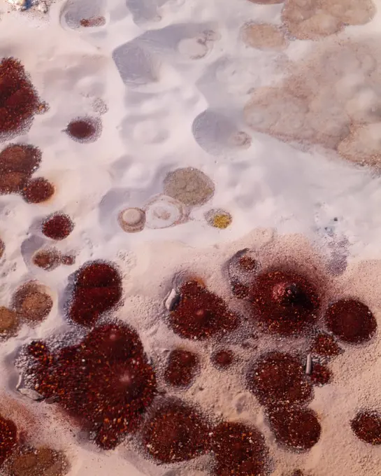
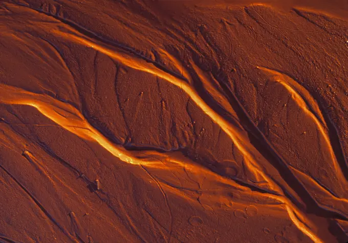
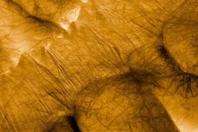
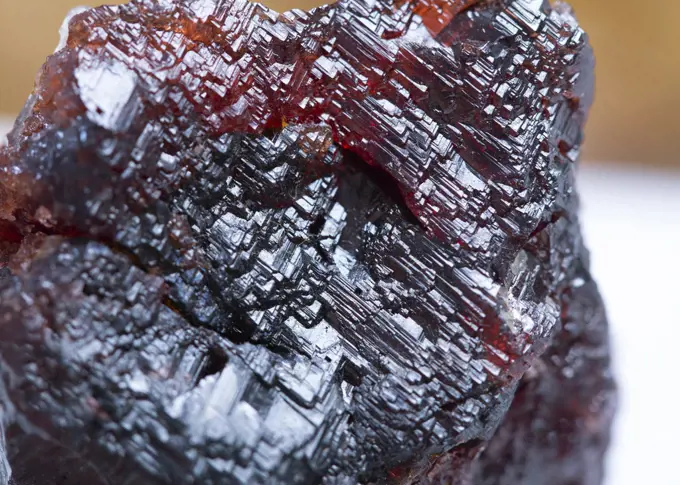
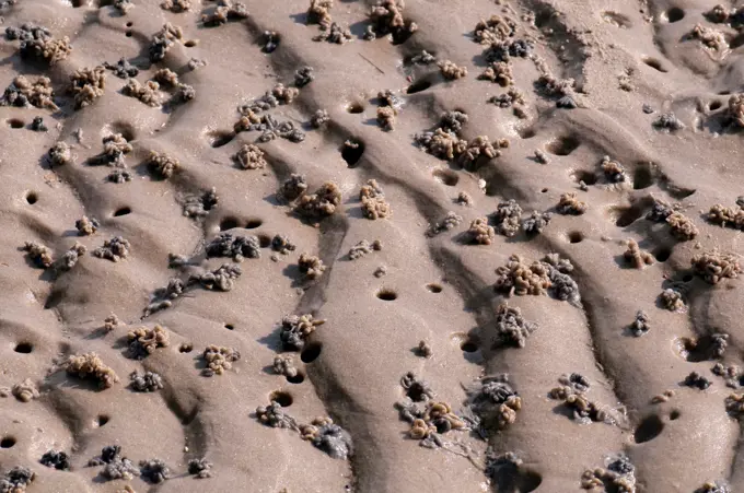
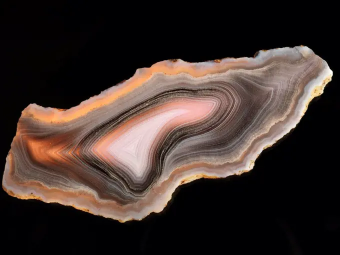
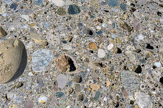
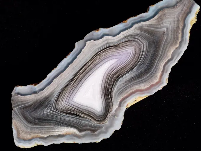
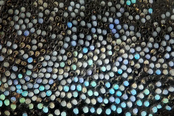
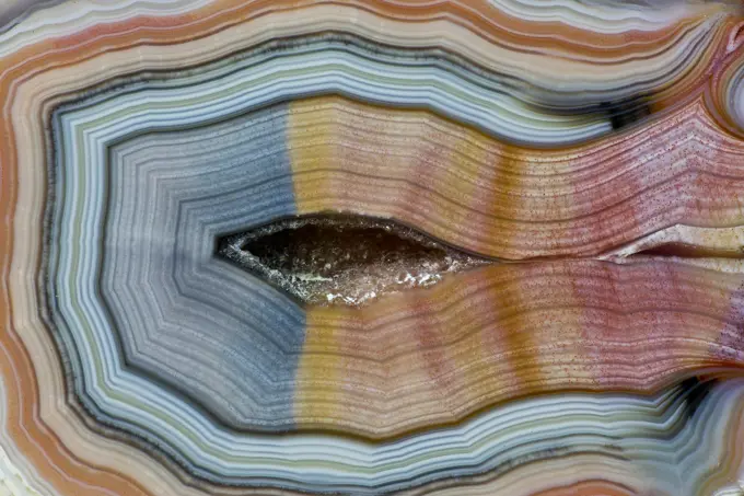
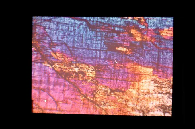
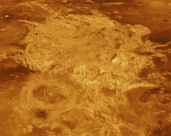
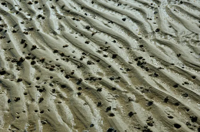
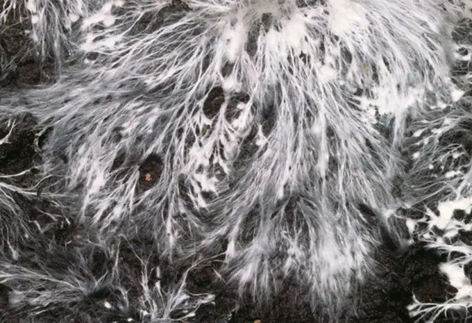
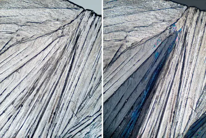
Geological Textures and Colors

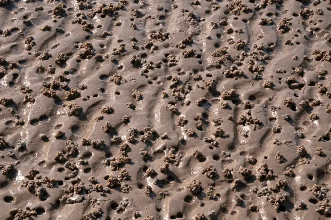
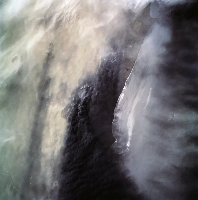
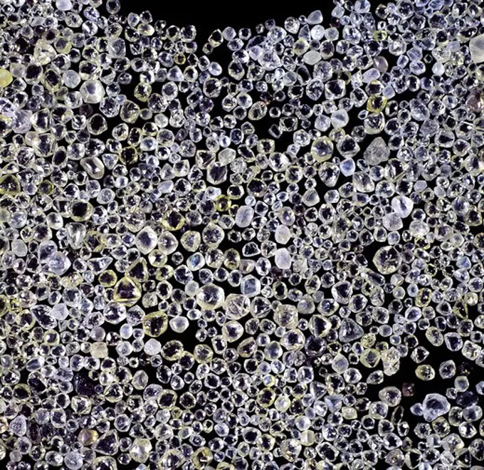
Images depicting unique geological formations with vibrant colors, including salt crusts, cracked earth, and mineral-rich surfaces from different locations.

display of uncut diamonds,part of one day's production at the namdeb diamond mine, southern namibia.
194 assets in this story
5514-67121613
Riotinto Mines, Huelva Mineral findings in the Riotinto Mines
4128-48285228
Healthy bone tissue, illustration
1848-53782721
Deposits of sand and clay coloured by different minerals, Tepees area, Petrified Forest National Park, Painted Desert, Arizona, United States, North America
4332-3744
USA, Wyoming, Yellowstone National Park, Norris Geyser Basin, Milky Way Spring with unusual precipitates and volatile gasses of arsenic compounds
7099-70354580
USA, Utah. A dendritic mud pattern resembles an aerial of canyons on the Colorado Plateau, Utah.
1848-49277847
Hot Boiling Water in a saucepan
6145-44967645
These craters on Tharsis are first visible as new dark spots observed by NASA's Mars Reconnaissance Orbiter's Context Camera (CTX), which can view much larger areas, and then imaged by HiRISE for a close-up look.
4389-1100
Russel Crater Dunes Defrosting as Seen by Mars Reconnaissance Orbiter
6204-56614293
Excavation spoil heap & ants (Atta cephalotes) Costa Rica, Central America
4269-24822
Enterocyst. Enterocysts are epithelial cells of the small intestine lining having important role in the absorbtion of the alimentary bolus. Coloured Scanning Electron Micrograph (SEM) through a cryofracture of the lining.
4141-39044
commensal shrimp, periclimenes brevicarpalis, on sea anemone, arco point, alona beach, panglao island, south bohol, central visayas, philippines, pacific ocean date: 24.06.08 ref: zb777_115627_0022 compulsory credit: oceans-image/photoshot
1525-25701227
Embedded digit 3 on sim card under the microscope. Closeup macro photography.
6145-45264635
Mars' north polar layered deposits comprise a thick stack of icy layers. Part of this image from NASA's Mars Reconnaissance Orbiter (MRO) has lingering seasonal frost, which serves to accentuate those layers. An additional rationale for this observation is to document new activity in scarp erosion. More information is available at
6019-19394996
garnet  mineral specimen stone rock geology gem crystal
6145-44575416
A hole, created by recent hail storms, is identified as number two on the surface of the external tank (ET) mated to Space Shuttle Discovery at Launch Pad 39B. Workers are investigating the damage and potential problems for launch posed by ice forming in the holes, which may number as many as 150 over the entire tank. The average size of the holes is one-half inch in diameter and one-tenth inch deep. The external tank contains the liquid hydrogen fuel and liquid oxygen oxidizer and supplies them under pressure to the three space shuttle main engines in the orbiter during liftoff and ascent. The ET thermal protection system consists of sprayed-on foam insulation. The Shuttle Discovery is targeted for launch of mission STS-96 on May 20 at 9:32 a.m
6145-52930746
NASA's Juno Views Northern Cyclones on Jupiter. Jupiter's northernmost cyclone, perched near the gas giant's north pole, is visible to the right along the bottom edge of this image, which was taken Sept. 29, 2022, by the JunoCam public engagement camera aboard NASA's Juno spacecraft. Jupiter has eight circumpolar cyclones, and four are visible in this image, framing the northernmost cyclone. A small anticyclone (which spins counterclockwise) has wedged its way in just above the northernmost cyclone. This image was acquired on Juno's 45th pass of Jupiter from an altitude of 17,248 miles (27,758 kilometers) and shows features as small as 11.6 miles (18.7 kilometers) across. Citizen scientist Navaneeth Krishnan S processed the images to enhance the color and contrast. https //photojournal.jpl.nasa.gov/catalog/PIA25692
4389-1577
Perspective View, San Andreas Fault
1788-20759767
Concretioned malachite, carbonate.
1746-21113228
The minerals are lit by ultraviolet light, which coverts a small amount of light into heat, and return the rest as visible light causing them to glow.
1848-51535565
Branched threads of fungal mycelium in organic soil
7008-69757039
Pietersite from Namibia
5514-67121618
Riotinto Mines, Huelva Mineral findings in the Riotinto Mines
1788-56892
Sillimanitic Gneiss, metamorphic rock, section.
1525-28166660
Jeans soak in powder detergent water dissolution, washing  cloth. Laundry concept
6019-28588177
Dinosaur Tracks on Navajo Nation Lands in Moenkopi Arizona
4389-189
Drill Holes and Rover Tracks, Endurance Crater, Mars, Seen From Rover Opportunity
6177-V53393563
5514-67121614
Riotinto Mines, Huelva Mineral findings in the Riotinto Mines
4128R-14370
Organ of Corti. Coloured scanning electron micrograph SEM view of the top surface of the organ of Corti in the cochlea of the inner ear. There is a ro...
4070-15116
Cave hand paintings, dated to around 550 BC. Cueva de las Manos, Argentina, March 2010.
1525-25993092
Polished magmatic or metamorphic rock cross section as background
4389-1523
Layers of Material on Mars Seen by Mars Global Surveyor
7005-69746730
Fossilized dinosaur track on display in St George, Utah, USA
4389-2439
Spider Crater in Kimberly Region
6145-45105987
The North Polar layered deposits provide a record of recent climate changes on Mars as seen by NASA's Mars Reconnaissance Orbiter spacecraft. Color variations between layers are due to differences in composition of the dust.
7008-69762785
Mexican Banded Agate Quartzsite, Arizona
6145-45298483
The Anti-Atlas Mountains of Morocco formed as a result of the collision of the African and Eurasian tectonic plates about 80 million years ago. This collision destroyed the Tethys Ocean; the limestone, sandstone, claystone, and gypsum layers that formed the ocean bed were folded and crumpled to create the Anti-Atlas Mountains. In this ASTER image of southwest Morocco, visible, near infrared, and short wavelength infrared bands are combined to dramatically highlight the different rock types, and illustrate the complex folding. The ability to map geology using ASTER data is enhanced by bands that are sensitive to differences in rock mineralogy. The image was acquired on November 5, 2007, covers an area of 51.9 by 60.8 km, and is located at 28.1 degrees north and 10.7 degrees west. With its 14 spectral bands from the visible to the thermal infrared wavelength region and its high spatial resolution of about 50 to 300 feet (15 to 90 meters), ASTER images Earth to map and monitor the changin
4279-66260
DEU, 2009: European Lug Worm, Blow Lug (Arenicola marina). Characteristic depressions at the head end (the blow hole) and a cast of defaected sediment at the tail end.
4279-66262
DEU, 2009: European Lug Worm, Blow Lug (Arenicola marina). Characteristic depressions at the head end (the blow hole) and a cast of defaected sediment at the tail end.
1525-25993126
Polished magmatic or metamorphic rock cross section as background
4413-27418
Detail of scales and lateral line of a tench Germany
4332-2484
Extremely fine fortification banding pattern with tiny white dots in classic Parcelas Agate from Cerro El Oregano near Le Baron, Chihuahua, Mexico.
1848-49877977
Section through Nagelfluh conglomerate, Allgaeu, Bavaria, Germany, Europe
1848-53264808
The Nuraghe Santu Ballantine from the Bronze Age, vaults, Torralba, Province of Sassari, Sardinia, Italy, Europe
6145-44687760
This is a composite of several images taken in several colors by the New Horizons Multispectral Visual Imaging Camera, or MVIC.
1848-55040159
Painted upper body of a Karo man, Omo river valley, Southern Ethiopia, Africa
1788-21796197
The Theophilus crater after the first quarter, the appearance of the full Moon, illustration from L'Illustration, Journal Universel, No 737, Volume XXIX, April 11, 1857.
4389-1558
Traces Left Behind by Rover Opportunity
6145-44493256
Curiosity's 36 Drill Holes. NASA's Curiosity Mars rover has collected 36 powderized rock samples with the drill on the end of its robotic arm. This grid shows all 36 holes to date. The images in the grid were captured by the Mars Hand Lens Imager (MAHLI) on the end of Curiosity's arm.
4332-2457
Extremely fine fortification banding pattern with tiny white dots in classic Parcelas Agate from Cerro El Oregano near Le Baron, Chihuahua, Mexico.
1916-7648
These weevils are among  most colorfull ones in  world; high magnification detail of  scales in  thorax
1848-20178379
Network of channels and streams at low tide, in the marshland of the Bahía de Cádiz, aerial view, drone shot, Cádiz province, Andalusia, Spain, Europe
1525-27164292
Concept with Moon from Pint Of Beer on Night
6145-44592360
A Mid-Northern Summer/Southern Winter's Mars
7008-69762780
Mexican Banded Agate Quartzsite, Arizona
7008-69762903
Banded Agate, Quartzsite, AZ.
1848-49277855
Hot Boiling Water in a saucepan
1788-20759968
Aerolite, stony meteorite.
6145-50603641
A740711 U12G HYDRA FRAC BILL VOLLENDORF (Project Engineer) SEP 6 74EG&G/NTS PHOTO LAB Publication Date: 9/6/1974  EDGERTON, GERMESHAUSEN & GRIER; EG&G; HYDRA FRAC; MARKED; MARKINGS; MEASURED; MEASUREMENT & RELATIONSHIP; NEVADA; NEVADA TEST SITE; NTS; NUCLEAR ENERGY TECHNOLOGY; NUCLEAR TESTING; NUCLEAR TESTS; PICKAXES; ROCK FORMATIONS; ROCK STRUCTURES; TAPE MEASURES; TEST SITES; TUNNELS; UGT; UNDERGROUND TESTING; VOLLENDORF, BILL  historical images. 1972 - 2012. Department of Energy. National Nuclear Security Administration. Photographs Related to Nuclear Weapons Testing at the Nevada Test Site.
6145-52890364
Autochrome photograph by Eduard Valenta of hypersthene thin section in polarized light from 1908, showing mineral texture, grain boundaries, and crystalline structure.
1848-55326303
Boiling water, close-up of a bubble in the water
6145-44549972
A portion of Alpha Regio is displayed in this three-dimensional perspective view of the surface of Venus from NASA's Magellan spacecraft. In 1963, Alpha Regio was the first feature on Venus to be identified from Earth-based radar.
4279-66258
DEU, 2009: European Lug Worm, Blow Lug (Arenicola marina). Characteristic depressions at the head end (the blow hole) and a cast of defaected sediment at the tail end.
7008-69762767
Banded Agate, Quartzsite, AZ.
4413-28972437
Colobodus sp. Middle Triassic (240 million years). Moselle. 35cm long. Detail of skin and scales. - Blouet brothers collection
4141-50103
cultivated mushroom, agaricus bisporus(=brunnescens), mycelium (undergound system)
6145-50607600
A851400 AREA 24 GEOLOGY AERIALS JIM NEAL (Project Engineer) SEP 13 85 EG&G/NTS PHOTO LAB Publication Date: 9/13/1985  AERIAL; AERIAL PHOTOGRAPHY; AERIAL PHOTOS; AERIAL SITE PHOTO; AERIAL SURVEYS; AERIAL VIEW; AERIAL VIEWS; AERIALS; AREA 25; AREA 25 GEOLOGY AERIALS; EDGERTON, GERMESHAUSEN & GRIER; EG&G; GEOLOGICAL SURVEYS; GEOLOGY AERIALS; NEVADA; NEVADA TEST SITE; NTS; NUCLEAR ENERGY TECHNOLOGY; NUCLEAR TESTING; SITE PHOTOS; SITE SURVEYS; TEST SITES; TOPOGRAPHICAL LAND FORMS; TOPOGRAPHICAL SITE SURVEYS; UGT; UNDERGROUND TESTING  historical images. 1972 - 2012. Department of Energy. National Nuclear Security Administration. Photographs Related to Nuclear Weapons Testing at the Nevada Test Site.
4298-1056
Two views of the same field; the left being illuminated by ordinary light and the right by polarized light.  Crystal shape and the polarization characteristics of minerals tend to be highly specific.
1788-56893
Amphibolite, metamorphic rock, section.
1525-22452335
a large rendered illustration of close up brains. brains
1848-51000557
Vereiste Baumwurzel
4128-18183810
Woody stem section, SEM
1788-29523
Anthill cross section, illustration
1525-25211084
Cross section of dried wood core
6145-45298482
It's spring in the Northern Hemisphere of Mars, and the polar region is still blanketed by seasonal carbon dioxide frost (dry ice). This image shows an area near the sand sea (called an erg ) that is surrounding the water ice-rich layered deposits. The many bumps are sand dunes less than 100 meters across that are mostly covered by seasonal frost, appearing in a manner that looks artificial but is a natural consequence of the wind patterns in this region. The smaller, darker spots are places where the seasonal frost has sublimed away, exposing the dark surface below. The combination of these features makes for an unearthly scene!
1899-18984868
(28 April-6 May 1991) --- A handheld 70mm camera onboard the Space Shuttle Discovery exposed this infrared frame showing oil fires near the Kuwait coast as well as south-bound oil slicks in the Gulf. Pools of oil on the land are recognized as white objects near the burning wells..
5514-67121622
Riotinto Mines, Huelva Mineral findings in the Riotinto Mines
1848-54930113
Cross-section through pine trunk, annual rings, Lower Saxony, Germany, Europe
4409-20138723
dinosaur footprints, middle to upper jurassic, geo park Iouaridene, Beni Mellal-Khenifra, Atlas mountain range, morocco, africa.
6145-45021103
Investigation of exposed clay minerals at thousands of Martian sites by NASA's Mars Reconnaissance Orbiter suggests a long period of wet, warm conditions, mostly underground.
5514-48136764
Hematite concretions and Moqui marbles, an unusual rock formation in Grand Staircase Escalente National Monument
4389-2048
Model of Impact
1848-65796245
Oil bubbles inside water base form patterns
6145-44558867
Turbulent Region Near Jupiter's Great Red Spot
7008-69757141
Laguna agate from Mexico
1848-49278023
Turmeric (curcuma longa), Powder falling against Black Background, Indian Spice
6145-44686984
The Naica mine in Chihuahua, Mexico, with its enormous gypsum crystals, may well be called the 'Queen of the Giant Crystals localities.' This image was acquired by NASA's Terra satellite on February 16, 2004.
1525-26790555
Beekeeper working in apiary. Drawing out the honeycomb from the hive with bees and honey on comb. Real people, authentic situations
4128-18631883
Exoplanet with two suns, illustration
1848-50858609
Insect mortality due to road traffic, insects killed by impact on car number plates, traffic reduces insect populations by up to 23, 5%, Brandenburg, Germany, Europe
6145-45264325
This computer-generated image is based on an infrared image of Jupiter's north polar region that was acquired on February 2, 2017, by the Jovian Infrared Auroral Mapper (JIRAM) instrument aboard Juno during the spacecraft's fourth pass over Jupiter. The image shows the structure of the cyclonic pattern observed over Jupiter's North pole a central cyclone surrounded by eight circumpolar cyclones with diameters ranging from 2,500 to 2,900 miles (4,000 to 4,600 kilometers) across. JIRAM is able to collect images in the infrared wavelengths around 5 micrometers (µm) by measuring the intensity of the heat coming out of the planet. The heat from a planet that is radiated into space is called the radiance. This image is an enhancement of the original JIRAM image. In order to give the picture a 3-D shape, the enhancement starts from the idea that where the radiance has its highest value, there are no clouds and JIRAM can see deeper into the atmosphere. Consequently, all the other areas of the
6145-48770878
Fluorite. minerals
4389-2041
Simulating the Surface of Mars
6176-67081908
'The Inside of an Active Volcano', 1935 . Artist: Unknown.
PREVIOUS
of 2
NEXT
2401 S. Ervay, Suite 206
Dallas, Texas 75215
United States
Get Started
Free ResearchMy BoardsMy Cart
For Creators
How To License Your ContentContributor PortalFrame of Mind
Resources
API accessPricing
Contact
+1 866 236 0087help@viewpictures.co.uk Contact form
©2026 View Pictures. All Rights Reserved. -B
This site is protected by reCAPTCHA and Google Privacy Policy and Terms of Service apply.