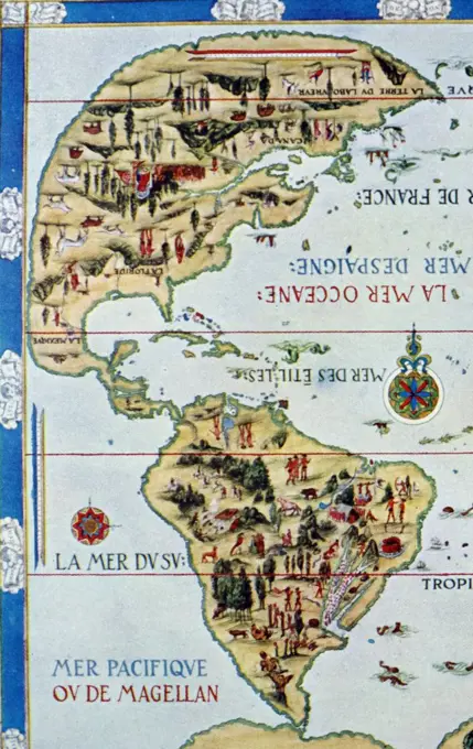
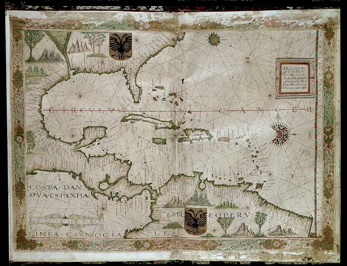
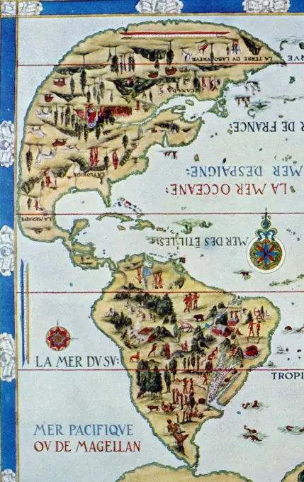
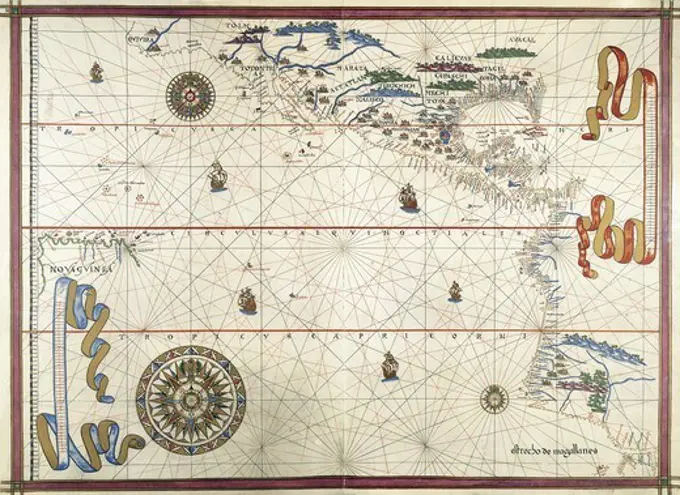
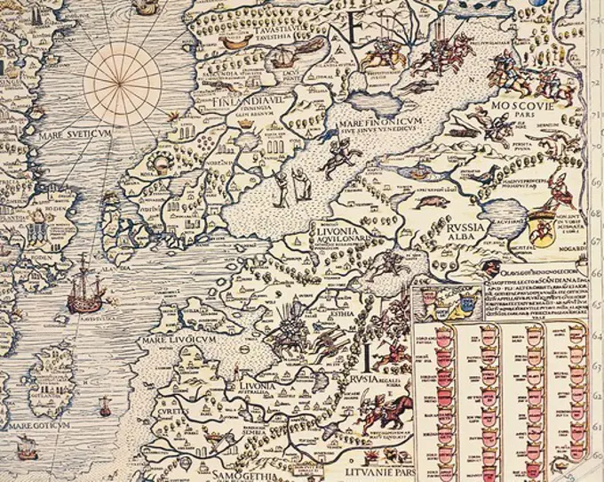
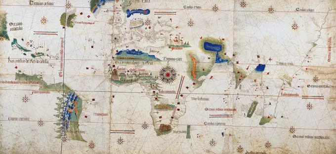
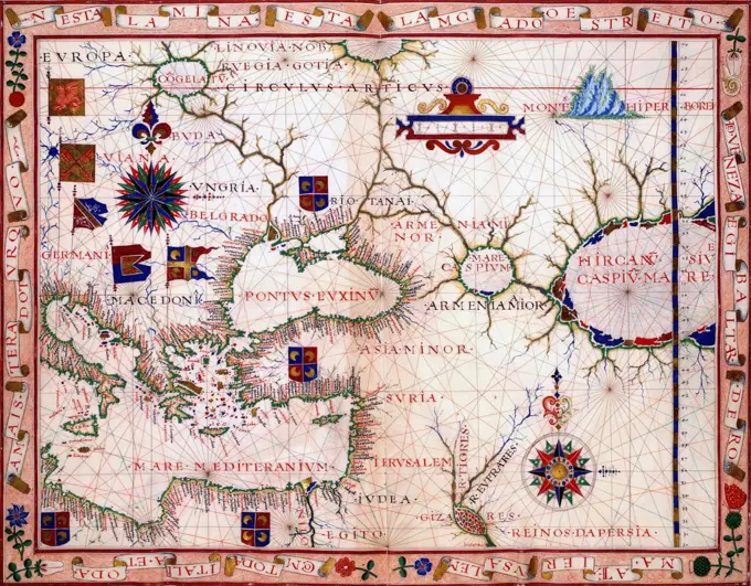
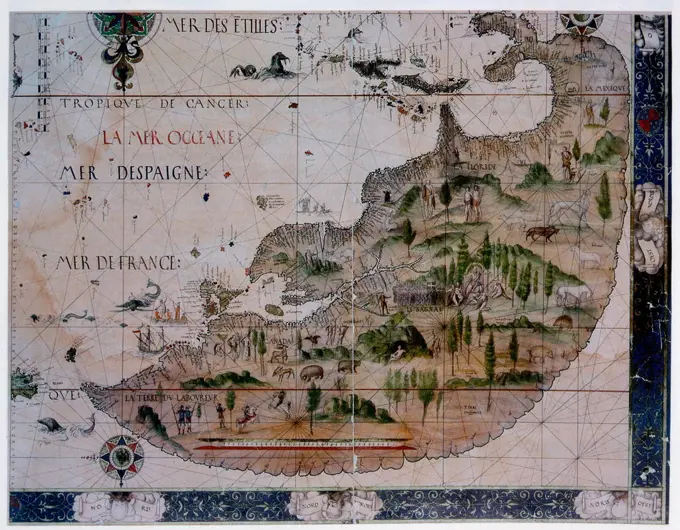
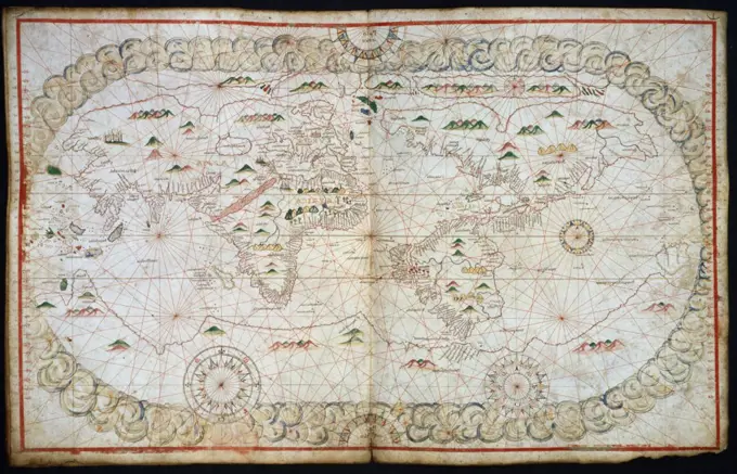
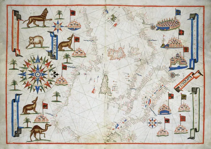
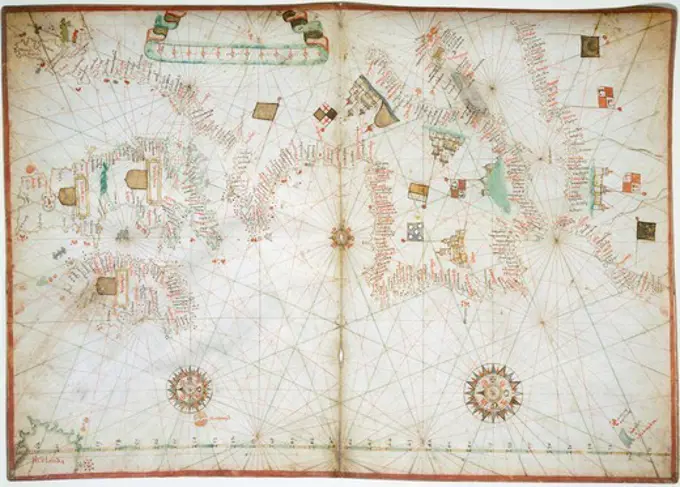
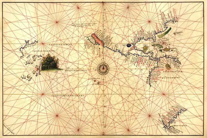
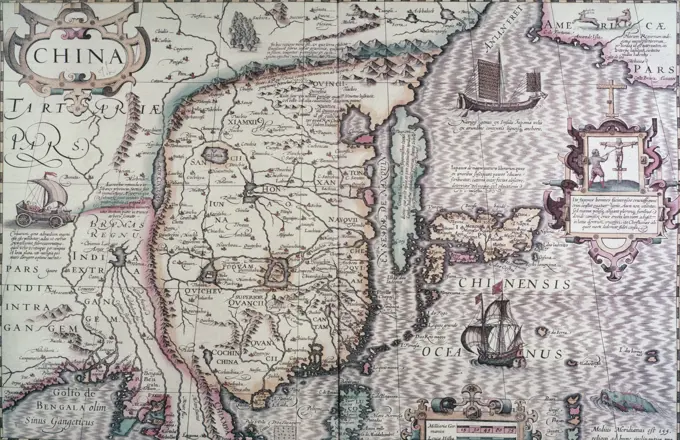
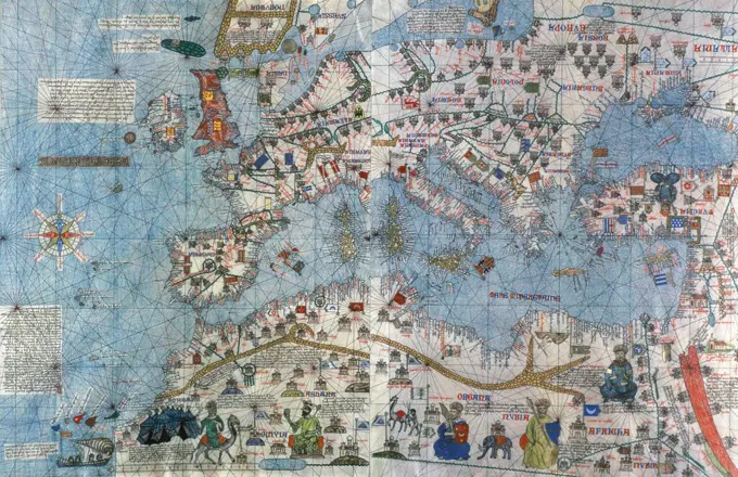
My Boards
View Pictures
  • My Boards

Historical Maps of Various Regions

Detailed pictorial maps and portolan charts from the 16th and 17th centuries, showcasing intricate cartography and illustrations of geographical features.

Detail from the 'Dauphin' map by Desceliers, 1546, for Henri II, by order of Francis I
184 assets in this story
6145-55916325
Boston (Massachusetts) and vicinity : a pictorial map. Pictorial map. Includes illustrations.... , Massachusetts  , Suffolk  ,county   , Boston
4435-3273
Portolan chart, 1587. Map of South America. Made in Messina. Renaissance art. Miniature Painting. SPAIN. MADRID (AUTONOMOUS COMMUNITY). Madrid. National Library.
1788-35146
Cartography, 16th century. Map of Nordic countries and Lapland. From Carta Marina (Sea Map) by Olaus Magnus, 1539.
4409-159316
Map of Germany and current Netherlands. Theatrum Orbis Terrarum by Abraham Ortelius (1527-1598). First Edition. Antwerp, 1574. Library of Catalonia. Barcelona. Spain.
4409-20881905
CARTOGRAFIA. MAPA. ALONSO DE SANTA CRUZ. NAVEGANTE , CRONISTA Y COSMOGRAFO ESPAÑOL.SEVILLA 1505-1567. " ISLARIO DE SANTA CRUZ ". PENINSULA IBERICA. DFETALLE DE SU ISLARIO GENERAL DELMUNDO , AÑO 1560. BIBLIOTECA NACIONAL. MADRID.
1899-20225128
Map of New World 1570, Ortelius, Abraham.
4435-3066
The Invincible Armada. Map of Robert Adams. Engraving by Augustine Ryther in 'Expeditions in Anglian, Vera Descriptio' (1588). SPAIN. MADRID (AUTONOMOUS COMMUNITY). San Lorenzo de El Escorial. Royal Library of the Monastery of El Escorial.
4408-6483
Plan of the City of New York, Antique World Maps
1746-21102133
Detail from the 'Dauphin' map by Desceliers, 1546, for Henri II, by order of Francis I
4443-75465384
A map of Siberia (Tartaria), published by Ortelius in 1899. It is found on page 22 of the publication. The map was printed in Kiev by Tip. S.V. Kulʹzhenko and relates to the cartography and history of Russia
4409-21355991
ATLAS PORTULANO 1568 - GOLFO DE MEXICO. Author: FERNAO VAZ DOURADO (1520-1580). Location: PRIVATE COLLECTION. MADRID. SPAIN.
1746-19700373
Detail from the 'Dauphin' map by Desceliers, 1546, for Henri II, by order of Francis I
4435-3173
Portolan chart, 1591. Map of the Pacific Ocean. It depicts the western coast of Central and South America, from Mexico to the Strait of Magellan. Renaissance art. Miniature Painting.
1788-35499
Cartography, 16th century. Finland and Russian territories. From Carta Marina (Sea Map) by Olaus Magnus, Venice, 1539. Detail.
6145-51391820
Carta universal en que se contiene todo lo que del mundo se ha descubierto fasta agora , World maps, Early works to 1800, Early maps, Facsimiles Norman B. Leventhal Map Center Collection
6145-51388214
Tabula Frisiae, Groninghae, et Territory Embdensis nec non circum jacentium regionum puta Transisalaniae, Benthemiae, Westphaliae, et Oldenburgi, noviter summa cura et stidio edita , Friesland Netherlands, Maps, Early works to 1800, Groningen Netherlands : Province, Maps, Early works to 1800, Lower Saxony Germany, Maps, Early works to 1800 Norman B. Leventhal Map Center Collection
6145-55917283
Tabula Frisiae, Groninghae, et Territory Embdensis nec non circum jacentium regionum puta Transisalaniae, Benthemiae, Westphaliae, et Oldenburgi, noviter summa cura et stidio edita. Map of the Friesland and Groningen Provinces of the Netherlands, and the province of Lower Saxony in western Germany. Includes thirteen city views and four illustrations of people in local costume. Abraham Goos Amstelodamensis sculpsit. Variant of maps described in Koeman, C. Atlantes Neerlandici, v. III, p. 176, no. 26. Cataloging, conservation, and digitization made possible in part by The National Endowment for the Humanities: Exploring the human endeavor. Part of composite portfolio atlas with title "Collection of old maps."... , Netherlands  , Friesland  ,province  Germany  , Lower Saxony
4409-154521
MAP OF THE ANTILLES - 1579 - 16TH CENTURY. Location: MUSEO DE AMERICA-COLECCION. MADRID. SPAIN.
1788-35514
Cartography, Italy, 17th century. The territory under Veneto dominion. From Regionum Italiae by Willem Blaeu.
6145-59587421
Map of the Graafschap Holland, Pieter van der Keere (Possible), 1622 print Map of the Graafschap Holland and surrounding areas. At the top in the middle two putti with the coat of arms of the county in a laurel wreath, underneath a banderole with the title. At the top right a cartouche with a description and weapons of Dutch cities. On the map at the Veluwe Het Wapen van Gelderland. On the right in the Zuiderzee the weapon of Friesland. At the bottom right two scale sticks: Miliarie Germanica Quorum 15.Uni Gradui respondent / Duytsche Mylen 15. In a Graedt; Horae Itineris / Hours Gaens. Degree distribution along the bottom. Orientation: north on the right. On Verso Latin text.  paper engraving / letterpress printing maps of separate countries or regions. coat of arms (as symbol of the state, etc.) Holland
4409-21505033
Europe. Map. 15th century. Conde Museum. Chantilly. France.
1746-19658814
World map of 1502 showing the continent of Africa in the centre. Named after Alberto Cantino, Italian diplomatic agent in Lisbon, who obtained it for the Duke of Ferrara. The rivalry between Spain and Portugal over trade and conquest was regulated by the Reaty of Tordesillas 1494. The blue line on left shows the Papal demarcation of territory, Spain to the West, Portugal to the East.
6188-63276060
Ancient cartography. Authentic old map. Exploration, geography, vintage background. Genoa, Italy - 28 December 2023: ancient cartography located in Spinola Palace. Authentic old map showing the world known to Europeans in the mid 17-th Century. Exploration, geography, vintage background. Copyright: xZoonar.com/PaoloxGallox 22206502
1746-21112988
map of the near east by Fernío Vaz Dourado (c. 1520 - c. 1580), a Portuguese cartographer of the sixteenth century. He belonged to the third period of the old Portuguese nautical cartography, which is characterised by the abandonment of Ptolemaic influence in the representation of the Orient and introduction of better accuracy in the depiction of lands and continents. Little is known about this historical figure. 1570
4409-19709
ATLAS PORTULANO - 1568 - MAPA DE JAPON - FOL 9- S XVI CARTOGRAFIA. Author: FERNAO VAZ DOURADO (1520-1580). Location: PRIVATE COLLECTION. MADRID. SPAIN.
1746-111942565
Map of Canada 1546 by Pierre Desceliers, (fl. 1537-1553) was a French cartographer of the Renaissance and an eminent member of the Dieppe School of Cartography. He is considered the father of French hydrography.
6145-51392542
Daniae regni typum potentissimo Invictissimoque D. Christiano, Daniae, Norvegiae, Gotthorum Vandalorum Regi lubens offert , Denmark, Maps, Early works to 1800 Norman B. Leventhal Map Center Collection
1788-34530
Cartography, 16th century. Map of India and Indian Ocean by Pedro and Jorge Reinel, Lopo Homen (cartographers) and Antonio de Holanda (miniaturist). From Miller Atlas, 1519.
1899-20225123
Map of North Africa 1513, Ptolemy, Claudius.
1746-57661907
Portolan atlas of nine charts and a world map, etc. Dedicated to Hieronymus Ruffault, Abbot of St. Vaast. Battista Agnese, active 16th century. Published c1544
866-3876
Portolan Atlas Joan Martines Illuminated Manuscript Christie's Images, London, England
4430-9531
cartography world maps coloured woodcut by Michael Wohlgemut or Wilhelm Pleydenwurff ""Chronicle"" of Hartmann Schedel Nuremberg 1493,
1848-49453887
Atlas, map from 1623, Japan, digitally restored reproduction from an engraving by Gerhard Mercator, born as Gheert Cremer, 5 March 1512, 2 December 1594, geographer and cartographer, Asia
1788-34685
Cartography, 16th century. Portolan chart of the Ottoman Empire by Ioannes Superantius.
1788-38567
Cartography, 17th century. Nautical chart of the Central-Eastern Mediterranean Sea and wind roses. Second chart, from a nautical atlas of the Mediterranean Sea in three charts, by Pietro Giovanni Prunus, 1651. Cm 41.6x28.
1095-270
Africa And Europa From Portolan Atlas Of Four Charts 1612 Maps(- ) Newberry Library, Chicago, Illinois, USA
1746-19674264
Detail from an illustrated navigational map of Europe, from 1528. Made by Jacopo Russo. In Messina, Sicily.
4409-19708
MAP OF THE STRAIT OF MAGELLAN - FOL 7 - CARTOGRAPHY - ATLAS 1568. Author: FERNAO VAZ DOURADO (1520-1580). Location: PRIVATE COLLECTION. MADRID. SPAIN.
6145-55913709
Frantia. Title supplied by cataloger. Map of France. Engraved on wood with place names in moveable type. Includes names of places and natural features. In margin: notes on latitude. Appears in the author's Geographia. Ulm : Lienhart Hol, 16 July 1482. Text in Latin. Cataloging, conservation, and digitization made possible in part by The National Endowment for the Humanities: Exploring the human endeavor... France. France, France
1788-38510
Cartography, 16th century. The Indian Ocean and part of Asia and Africa, from Atlas of the World in thirty-three Maps, by Battista Agnese, 1553
1788-38196
The Aegean Sea, by Joan Martines taken from a nautical atlas, 1571. Detail.
4266-20011014
Europe Map (From: Atlas Maior) by Blaeu, Joan (1596-1673) / Private Collection / 1640 / The Netherlands / Etching, watercolour / History / 41x55 / Cartography
6145-51398064
Peace map of the world united : a pictorial history of transportation and communications from Jonah to the jet plane as paths to permanent peace , World maps, Transportation Norman B. Leventhal Map Center Collection
4408-14198
Portolan Map of the Western Hemisphere showing what will become the United States, Panama & a portion of South America, Portolan Maps
4409-20919046
PLANO DE SUIZA 1670. Location: BIBLIOTECA REAL ALBERTO I. Brüssel. Belgien.
1746-19700376
Detail from the 'Dauphin' map by Desceliers, 1546, for Henri II, by order of Francis I
4409-3948
ATLAS PORTULANO - INDONESIA,FILIPINAS,CHINA E INDIA -VIT20 - SIGLO XVI. Author: JUAN MARTINEZ (-1591) CARTOGRAFO. Location: BIBLIOTECA NACIONAL-COLECCION. MADRID. SPAIN.
260-530
Map of China 17th Century
4435-7890
ORTELIUS, Abraham (1527-1598). Theatrum Orbis Terrarum. 1570. It is considered to be the first modern atlas. Map of the Pacific Ocean depicting China, Japan, Alaska, India and Southeast Asia. Printed in Antwerp by Christophe Plantin (1588). Etching. SPAIN. CASTILE AND LEON. Salamanca. Salamanca University Library.
1899-18855233
Portuguese explorer Prince Henry, known as the Navigator, was the first European to methodically explore Africa and the oceanic route to the Indies. From his residence in the Algarve region of southern Portugal, he directed successive expeditions to circumnavigate Africa and reach India. In 1420, Henry sent an expedition to secure the uninhabited but strategic island of Madeira. In 1425, he tried to secure the Canary Islands as well, but these were already under firm Castilian control. In 1431, another Portuguese expedition reached and annexed the Azores.
4409-20917149
ISLARIO GENERAL DE TODAS LAS ISLAS DEL MUNDO - CENTRO AMERICA E ISLAS - S XVI. Author: ALONSO SANTA CRUZ (1505-1572). Location: BIBLIOTECA NACIONAL-COLECCION. MADRID. SPAIN.
4435-3044
CRESQUES, Jafuda (1350-1410). Catalan Atlas. 1375. Third and Fourth Leaves. Map of the world known in the 14th c. (Finisterre and the Mediterranean). Detail of the Canaries (Canary Islands) and the African coast. Reproduction of the original, which is in the National library of Paris. Miniature Painting. SPAIN. CATALONIA. Barcelona. Barcelona Maritime Museum.
1899-18855238
The Cantino planisphere (or Cantino World Map) is the earliest surviving map showing Portuguese geographic discoveries in the east and west. It is named after Alberto Cantino, an agent for the Duke of Ferrara, who successfully smuggled it from Portugal to Italy in 1502. The map is particularly notable for portraying a fragmentary record of the Brazilian coast, discovered in 1500 by the Portuguese explorer Pedro Álvares Cabral, and for depicting the African coast of the Atlantic and Indian Oceans with a remarkable accuracy and detail. It was valuable at the beginning of the sixteenth century because it showed detailed and up-to-date strategic information in a time when geographic knowledge of the world was growing at a fast pace. It is important in our days because it contains unique historical information about the maritime exploration and the evolution of nautical cartography in a particularly interesting period. The Cantino planisphere is the earliest extant nautical chart where plac
4435-3427
CRESQUES, Jafuda (1350-1410). Catalan Atlas. 1375. Third and Fourth Leaves. Map of the world known in the 14th c. (Finisterre and the Mediterranean). The first representation of the compass rose. Reproduction of the original, which is in the National library of Paris. Miniature Painting. SPAIN. MADRID (AUTONOMOUS COMMUNITY). Madrid. Navy Museum.
6145-29096734
1849 Tallis Map of Canada or British America w- Oregon
6176-66095877
Abraham Orteliuss map of the Americas  Americae sive Novi Orbis, Nova Descriptio.   Originally published in 1570, the first plate of this map was based off of Gerard Mercators multi-sheet map of the world from 1569. Engraved by Frans Hogenberg, this became one of the most famous influential maps of the New World and the basis for a great deal of future cartography of the Americas.  Abraham Ortelius (1527-1598) was a Dutch cartographer, geographer, and cosmographer, conventionally recognized as the creator of the first modern atlas, the Theatrum Orbis Terrarum.
6145-51382732
Print, Map of China; England; engraving and brush and wash on paper; 41.8 × 54.1 cm (16 7/16 × 21 5/16 in.) Platemark: 29.8 × 51.8 cm (11 3/4 × 20 3/8 in.)
4409-24290
DETALLE CENTRAL DEL MAPA DE LA ANTIGUA VENEZUELA (CUMANA) QUE TENIA 2 PROVINCIAS BARCELONA Y GUAYANA - 1762 - Conj 73803. Author: JUAN APARICIO (S XVIII). Location: MUSEO NAVAL / MINISTERIO DE MARINA. MADRID. SPAIN.
1746-19628982
Map of Brazil by Pedro Reinel and Lopo Homen c1525.
4409-156638
ISLARIO GENERAL DE TODAS LAS ISLAS DEL MUNDO -SUDESTE ASIATICO - SIGLO XVI. Author: ALONSO SANTA CRUZ (1505-1572). Location: BIBLIOTECA NACIONAL-COLECCION. MADRID. SPAIN.
1788-37987
Cartography, 15th century. Africa and unknown southern land, from Claudius Ptolemy's ""Cosmographia."" Ulm Edition, 1482.
4408-6487
America, Antique World Maps
1899-20225310
Map of North Pole 1595.
4408-14202
Portolan Map of Spain, England, Ireland & France, Portolan Maps
1746-19674251
Detail from an illustrated navigational map of Europe, from 1528. Made by Jacopo Russo. In Messina, Sicily.
4409-21505070
The Catalan Atlas, 1375. Attributed to the Majorcan Jewish cartographers Abraham and Jehuda Cresques, was service of King of Aragon. National Library of France, Paris.
4408-7964
Map of Prussia, Theatro D'el Orbe La Tierra - Ortelius
6145-51394565
A map of Cape Cod wherin is shown ye discovery and settlement of the same; with the tracks of ye pilgrims carefully prepared according to Mourts relation , Cape Cod Mass., Maps Norman B. Leventhal Map Center Collection
6176-66914765
Map of Corea sic and Japan 1815
4409-20997887
Island of Sicily. Portolan chart by Joan Martines, Spanish cartographer of the Majorcan cartographic school (16th century). Manuscript of 19 double-folio maps. Messina, Sicily, 1587. National Library, Madrid, Spain.
4048-5321
Portuguese map showing detailed views of the South Eastern tip of Africa (present day South Africa)from a 1630 atlas.
6176-66094412
Vintage historic Map. Eastern part of New France or Canada with the Island of Newfoundland and various Colonial holdings by France and England.  with St. Lawrence River.  by Albrecht Seutter 1750
6145-50552989
Mappa æstivarum insularum alias Bermudas dictarum, ad ostia Mexicani æstuary iacentium in latitudine graduum 32 minutorum 25 ab Anglia, londino scilicet versus libonotum 3300 miliaribus anglicanis, et a Roanoack (qui locus est in Virginia) versus Euronotum 500 mil. accurate descr. - A mapp of the Sommer Ilands once called the Bermudas lying at the mouth of the bay of Mexico in the lattitude of 32 degr. 25 mi. distant from England viz. from London towards the west south-west 3300 miles and from Roanoack in Virginia toward the est south east 500 miles exactlie surveyed , Landowners, Bermuda Islands, Maps, Early works to 1800, Real property, Bermuda Islands, Maps, Early works to 1800, Bermuda Islands, Maps, Early works to 1800 Norman B. Leventhal Map Center Collection
1788-38497
Cartography, 17th century. Aegean Sea, from a portolan atlas consisting of six charts, by Placido Caloiro and Francesco Oliva, 1646. Parchment.
1746-30021031
Choson, Map of Joseon Era Korea. Circa 1750 - 1800
6145-50568761
Map of Massachusetts, Rhode-Island & Connecticut : compiled from the latest authorities , Massachusetts, Maps, Rhode Island, Maps, Connecticut, Maps, New England, Maps Norman B. Leventhal Map Center Collection
1746-21115834
Renaissance map of Europe, Jacopo Russo, 1528, North, and eastern Spain with south west France. (detail)
1095-133
Portuguese Portolan Atlas by Sebastiano Lopes,  1546,  USA,  Chicago,  Newberry Library
1788-38592
Cartography, 15th century. The Middle East: Iraq, Iran, Black Sea and Caspian Sea, detail from a planisphere, 1457. Engraving.
6145-55917792
West-Indische paskaert : waer in de graden der breedde over weder zyden vande middellyn wassende soo vergroten dat die geproportioneert syn tegen hunne nevenstaende graden der lengde ... Zyud-Zee. Includes elaborate illustration and cartouches. Includes insets of the southern tip of South America, the British Isles and the eastern Mediterranean Sea. Depths shown by soundings.... , West Indies Atlantic Ocean
4409-17267949
GRABADO-GUIANA DEL AMAZONAS-LAGO DEL PARAMO-S XVII. Location: BIBLIOTECA NACIONAL-COLECCION. MADRID. SPAIN.
4409-20917124
ATLAS PORTULANO OCEANO ATLANTICO VIT 20. Author: JUAN MARTINEZ (-1591) CARTOGRAFO. Location: BIBLIOTECA NACIONAL-COLECCION. MADRID. SPAIN.
1899-48156322
Atlas, map from 1623, Arctic, North Pole and surrounding countries, digitally restored reproduction from an engraving by Gerhard Mercator, born as Gheert Cremer, March 5, 1512 - December 2, 1594, geographer and cartographer.
1788-38511
Cartography, 16th century. The Indian Ocean and part of Asia and Africa: the course of the Nile river, from Atlas of the World in thirty-three Maps, by Battista Agnese, 1553
4409-17278643
MAPA DEL REINO DE VALENCIA - SIGLO XVII. Location: BIBLIOTECA NACIONAL-COLECCION. MADRID. SPAIN.
6145-48719112
A map of North America, & the West India Islands, with part of South America, Europe, Africa & the Atlantic Ocean with it's islands , North America, Maps, Early works to 1800, West Indies, Maps, Early works to 1800, Europe, Western, Maps, Early works to 1800, Africa, Northwest, Maps, Early works to 1800 Norman B. Leventhal Map Center Collection
6145-55956403
A new map of Great Tartary, and China, with the adjoyning part of Asia, taken from Mr. de Fer's map of Asia. Great Tartary, China, &c. Cartographic. Maps, Atlases. 1700. Lionel Pincus and Princess Firyal Map Division. Atlases, British, Geography, Ancient, Maps in education , England, Maps
4409-28670000
Portuguese maritime discoveries and explorations. 15th-16th centuries. Large planisphere, made by the workshops of the Museu de Marinha, similar to the old charts and maps of the 15th and 16th centuries, showing the new lands, plants, animals and populations contacted by the Portuguese navigators. It is located at the end of the entrance hall. Detail. Maritime Museum. Lisbon, Portugal. Author: Portugal. Workshops of the Museu de Marinha. Lisbon.
1788-38514
Cartography, 16th century. The Indian Ocean and part of Asia and Africa: Malaysia and islands of Java and Sumatra, from Atlas of the World in thirty-three Maps, by Battista Agnese, 1553
4409-21348001
MAPA DE ESPAA - 1579. Author: Abraham Ortelius (1527-1598). Location: SERVICIO GEOGRAFICO DEL EJERCITO, MADRID.
6188-56084600
Authentic antique map shows Africa known to Europeans in the mid 17-th Century. Exploration, cartography, vintage background. Genova, Italy - 8 August 2023: Spinola Palace. Antique map shows Africa known to Europeans in the mid 17-th Century. Exploration, cartography, vintage background. Copyright: xZoonar.com/PaoloxGallox 21270768
6145-55180802
Map of the country thirty three miles around the city of New York Cartographic. Maps. 1850. Lionel Pincus and Princess Firyal Map Division. New York (N.Y.), New York (N.Y.) , Administrative and political divisions , Maps, New York Metropolitan Area , Maps
1899-20225097
Ancient Map of Japan 1606, Hondius, Jodocus.
6145-29096148
1635 Blaeu Map Guiana, Venezuela, and El Dorado
1788-36520
Cartography, 16th century. Map of Flanders, from Theatrum Orbis Terrarum by Abraham Ortelius (1528-1598), Antwerp, 1570.
6145-52359568
First map of Asia (Asia minor), in full gold border 1460. Ptolemy, 2nd cent.. Cartographic. Religious books, Manuscripts, Maps. Manuscripts and Archives Division. Turkey
4443-73256600
Nederlanden, Harrewijn, Jacobus, Fortresses and fortified places conquered by the French in 1672, Sheet with 8 large and 23 smaller maps of the fortresses and fortified places conquered by the French in 1672., print, picture, map, history print, prints, pictures, Frederik Muller History Plates, height 306 mm, width 378 mm, South Netherlands, 1660 - 1740, print maker, printmaker, 1684 - 1684, fourth quarter 17th century, paper, papier, etching, etchings
4435-3199
Chart by Juan de la Cosa (1500). SPAIN. MADRID (AUTONOMOUS COMMUNITY). Madrid. Navy Museum.
4409-28658645
Mapa del Camino que de Quito baxa hasta el Pueblo de las Esmeraldas en el Mar del Sur; de Tierra y agua, con toda la costa desde Cabo Blanco y navegación hasta Panamá. 1875, Panamá. Archivo General de las Indias (Sevilla).
4409-19346
PLANO DE CARTAGENA Y MAPA DE SU PUERTO - 1721. Location: SERVICIO GEOGRAFICO DEL EJERCITO. MADRID. SPAIN.
PREVIOUS
of 2
NEXT
2401 S. Ervay, Suite 206
Dallas, Texas 75215
United States
Get Started
Free ResearchMy BoardsMy Cart
For Creators
How To License Your ContentContributor PortalFrame of Mind
Resources
API accessPricing
Contact
+1 866 236 0087help@viewpictures.co.uk Contact form
©2026 View Pictures. All Rights Reserved. -B
This site is protected by reCAPTCHA and Google Privacy Policy and Terms of Service apply.