My Boards
View Pictures
  • My Boards
← Documents & Records

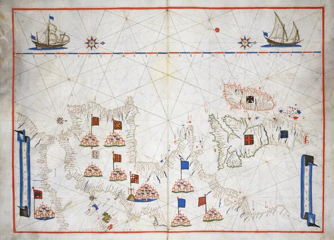
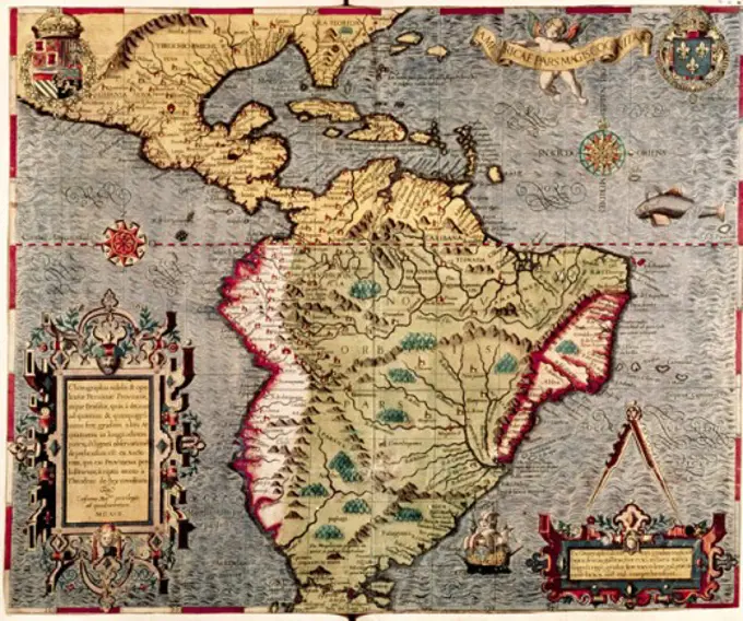
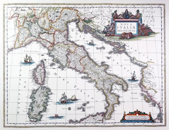
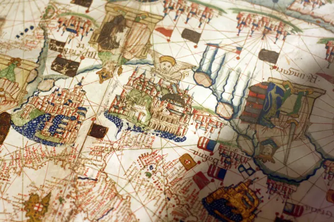
Historical Maps of Various Regions

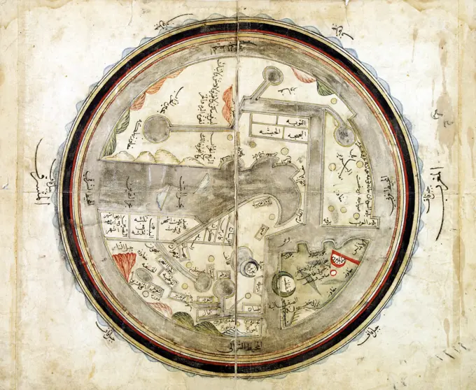
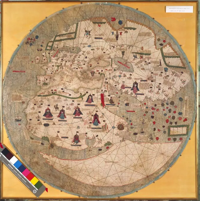
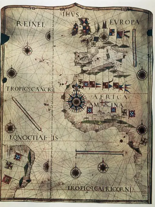
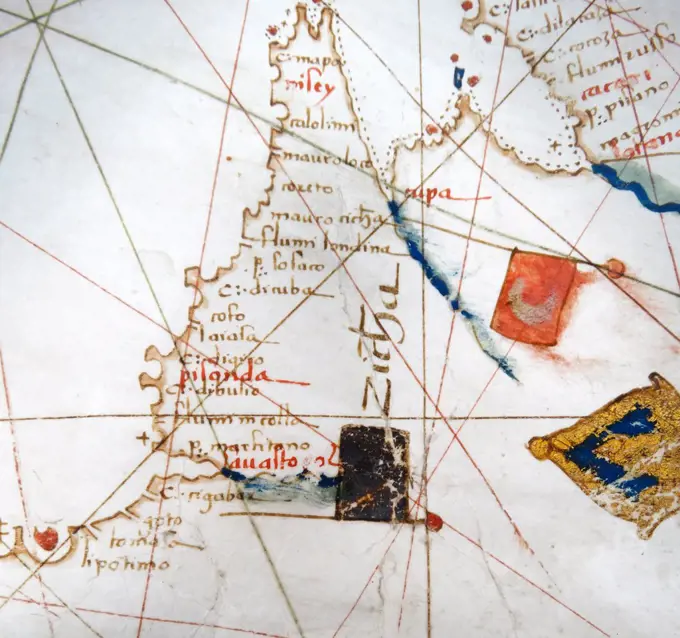
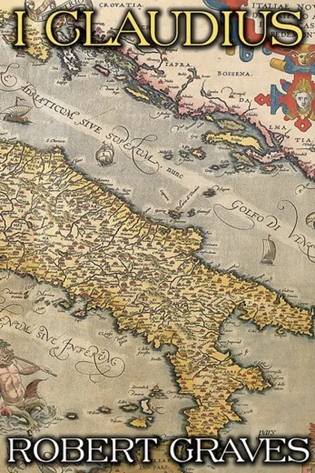
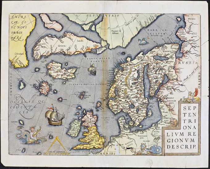
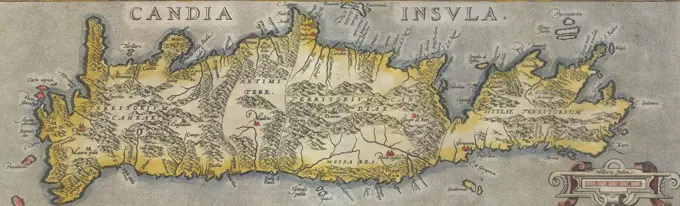
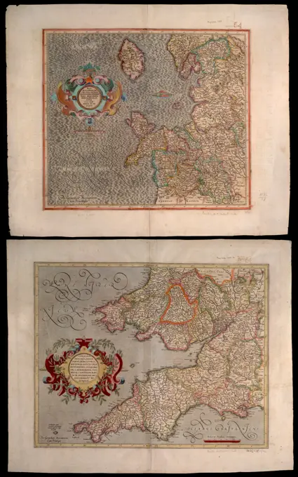
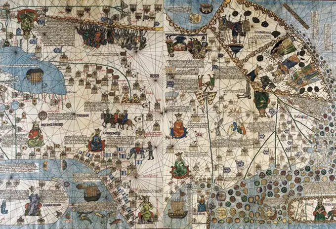
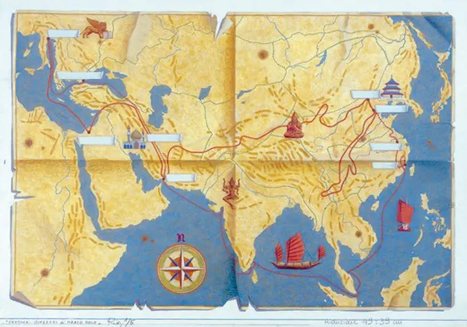
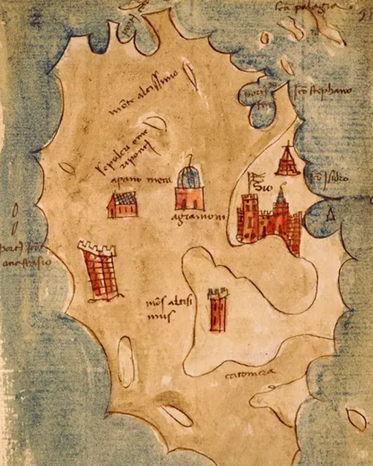
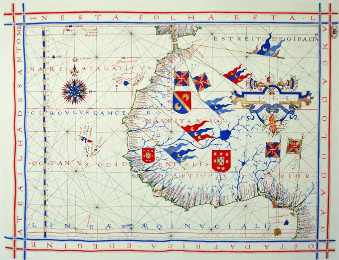
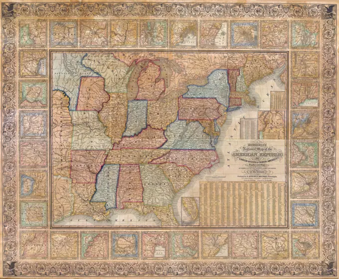
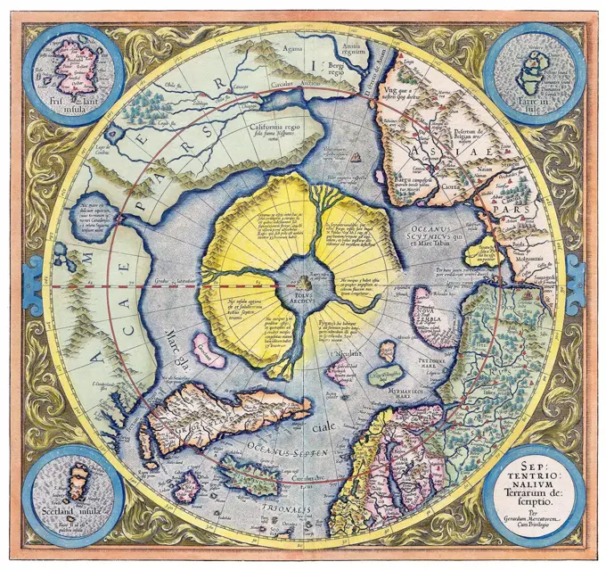
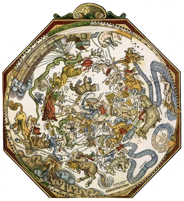
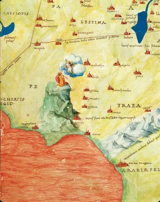
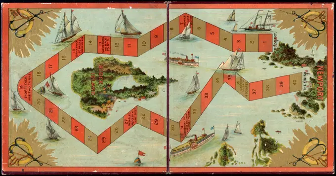
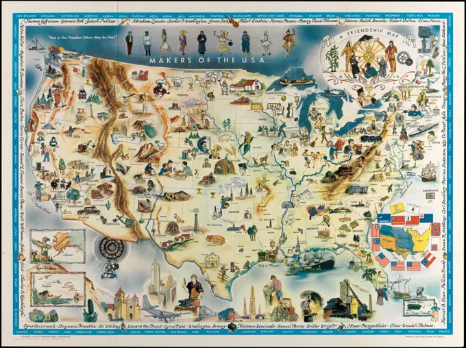
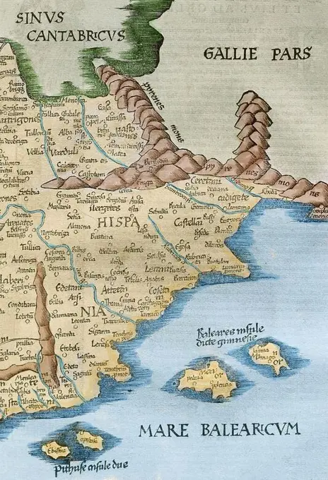
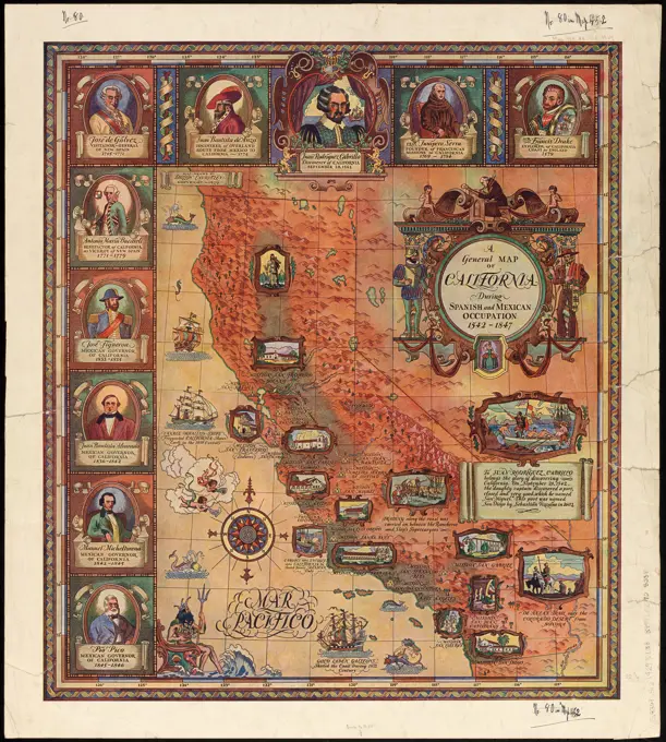
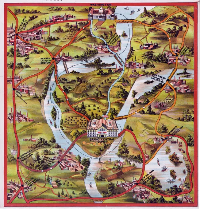
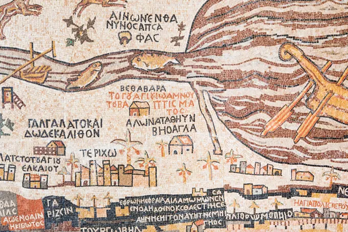
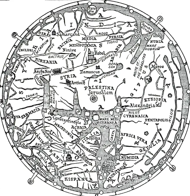
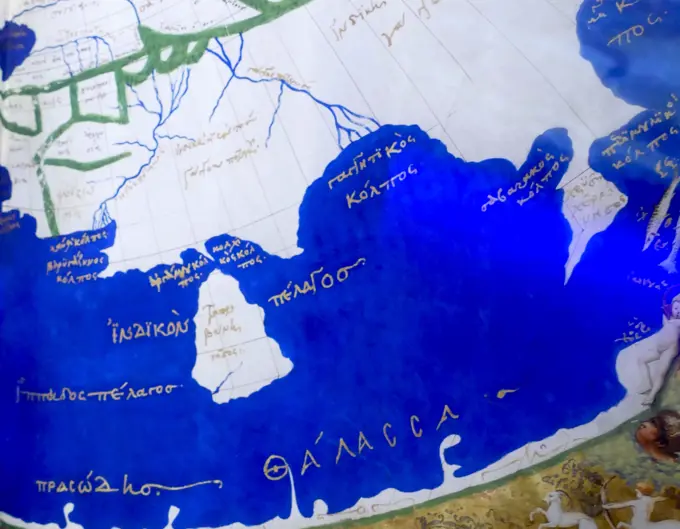
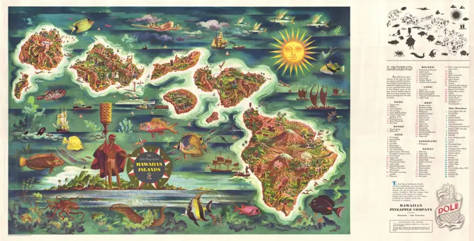
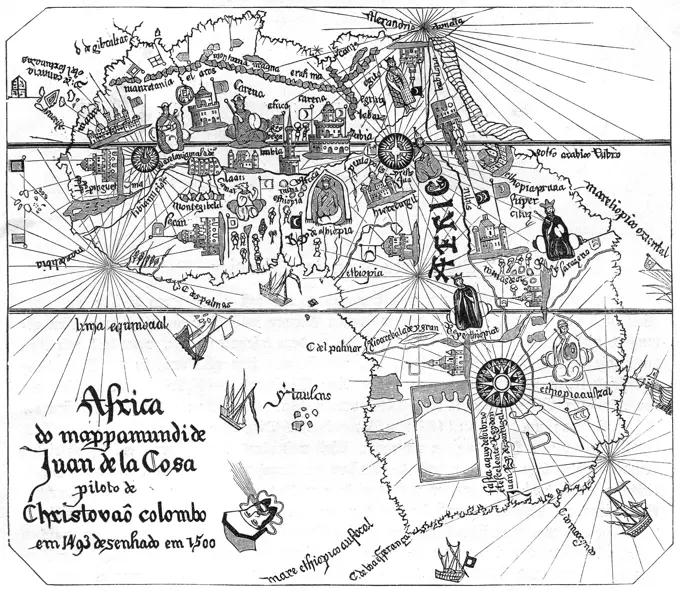
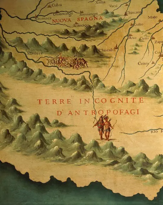
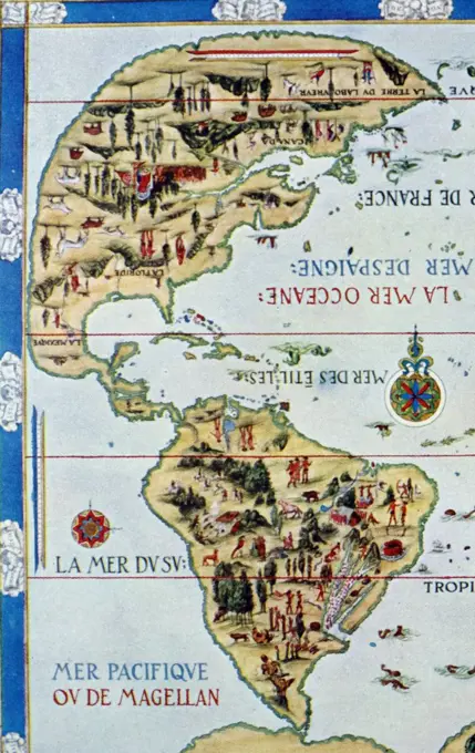
Detailed pictorial maps and portolan charts from the 16th and 17th centuries, showcasing intricate cartography and illustrations of geographical features.

Detail from the 'Dauphin' map by Desceliers, 1546, for Henri II, by order of Francis I
184 assets in this story
6145-50573304
A pictorial map of Germany , Germany, Maps Norman B. Leventhal Map Center Collection
6145-55916051
A pictorial map of Germany. Relief shown pictorially. Pictorial map. Includes illustrations of towns and geographic features. Illustration of a left-facing swastika in center of top border.... , Germany
1788-35850
Cartography, 14th century. Map of New Spain with the Florida coast. From Lazaro Luis Atlas.
1095-271
British Isles, Western Europe, And Northwest Africa - From "Portolan Atlas Of Four Charts" 1612 Maps(- ) Newberry Library, Chicago, Illinois, USA
4409-9666
Map of the Old and New Worlds - ca. 1500. Author: JUAN DE LA COSA (1449-1510). Location: MUSEO NAVAL / MINISTERIO DE MARINA. MADRID. SPAIN.
1443-739
Map of Central & South America 1792 Theodor de Bry (1528-1598 Netherlandish) Copper engraving New York Public Library, New York, USA
1746-19699905
Map of Italy, 1631, by Johannes Blaeu based on a map by Giovanni Antonio Magini (d. 1617). Nova Italia Delineatio, 1631, by J. Blaeu (1598-1673)
1606-140857
Antique Map / Africa 1630 / by Joan Blaeu
1746-19666752
North (Top) view of a navigational map of Europe and the Middle East by Jacopo Russo 1528, Messina. Sicily. Showing Switzerland, Italy ;Balkans and Hungary
1746-28998569
Medieval 10th century World map by Abu Ishaq Ibrahim ibn Muhammad al-Farisi al Istakhri (Estakhri), A Persian: geographer and cartographer circa 957 AD
1788-35591
Cartography, 16th century. Map of Northern Europe, from the Portolan Atlas by Battista Agnese, 1553.
6239-70845513
Map of the Far East and adjacent Pacific. - Recto | Library of Congress
1788-38488
Cartography, 16th century. Nautical chart of the Central-Eastern Mediterranean Sea, detail with Genoa and Venice, by Giorgio Sideri called Callapoda or Calopodio da Candia (Crete).
4409-17327143
CIVITATES ORBIS TERRARUM - CIUDADES DE CANDIA Y CORFU (GRECIA) - GRABADO - SIGLO XVI. Author: GEORG BRAUN 1541-1622 / FRANS HOGENBERG. Location: BIBLIOTECA NACIONAL-COLECCION. MADRID. SPAIN.
1788-34526
Cartography, 15th century. Catalan world map, around 1450. Parchment.
1746-21114134
Surviving fragment of the first World Map of Piri Reis. Dated 1513
1788-35367
Cartography, 16th century. Map of the Mediterranean Sea, from a portolan chart by Pietro Russo, Messina, 1508.
4435-2999
Nautical chart depicting the West Coast of Africa, Brazil, the North Atlantic Ocean and the South Atlantic Ocean, by Jorge Reinel. 1535. This was an interest area to both Portuguese and Spanish sailors. Miniature Painting. ITALY. TUSCANY. Florence. Ricasoli Firidolfi Library.
1788-35427
Cartography, Italy, 16th century. Sicily Region, detail from a portolan chart.
1746-21115842
Renaissance map of Europe, Jacopo Russo, 1528, detail of north African coast
4408-13445
I Claudius, Book Cover
6145-50571544
The United States as viewed by California (very unofficial) , United States, Maps Norman B. Leventhal Map Center Collection
1899-18668687
Abraham Ortelius nordenkart, 1601 - Map of Northern Countries.
6145-29096060
1584 Ortelius Map of Crete (Candia) and 10 Greek Islands
6145-51395219
A map of the West Indies and the Spanish Main , West Indies, Maps Norman B. Leventhal Map Center Collection
4408-8000
Map of Japan, Theatro D'el Orbe La Tierra - Ortelius
6145-55917780
West Morlandia, Lancastria, Cestria, Caernarvan, Denbigh, Flint, Meridionidh, Montgomery, Salpia, cum Insulis Mania et Anglesey ; Cornubia, Davonia, Somersetus, Dorcestria, Wiltonia, Glocestria, Monumetha, Glamorgan, Caermarden, Pembroke, Cardigan, Radnor. Relief shown pictorially. Appears in Mercator's Gerardi Mercatoris et I. Hondii Atlas. 1633.. These two maps, portraying portions of Cornwall and Wales, were originally prepared by Gerard Mercator, one of the greatest of early Dutch map makers. These two atlas sheets were published in either the 1628 or 1633 French edition of Mercator and Jodocus Hondius's ''Atlas''. Originally published in 1595, this book of maps was the first such publication to use the term atlas to describe a collection of published maps. The use of this term is often associated with the Greek Titan, Atlas, who was condemned by Zeus to carry the heavens and earth on his shoulders for all time.. West Morlandia, Lancastria, Cestria, Caernarvan, Denbigh, Flint, Meri
1788-34996
Italy - Veneto region - Venice. Doge's Palace (Palazzo Ducale). Interior, Hall of the Maps (Sala delle Mappe). Detail, map of Turkey.
6176-66092835
Vintage Illustrated Map of Portland, Maine and Some Places Thereabout . . . Published by Portland Baby Hygiene & Child Welfare Association. 1928
6145-50568917
Nantucket in the state of Massachusetts , Nantucket Island Mass., Maps Norman B. Leventhal Map Center Collection
4435-3426
CRESQUES, Jafuda (1350-1410). Catalan Atlas. 1375. Fifth and Sixth Leaves. Map of Delli and Map of Catai (China). Representation of the Asian continent. Reproduction of the original in the National library of Paris. Miniature Painting. SPAIN. MADRID (AUTONOMOUS COMMUNITY). Madrid. Navy Museum.
6145-55916333
Boston (Massachusetts) and vicinity : a pictorial map. Pictorial map. Includes illustrations.... , Massachusetts  , Suffolk  ,county   , Boston
1788-38505
Cartography, 16th century. Europe: Great Britain and Ireland, from Atlas of the World in thirty-three Maps, by Battista Agnese, 1553
1788-11358
Map with the route of the journey in Travels of Marco Polo (The Million or Le Livre des Merveilles), illustration
1788-36253
Cartography, Greece, 17th century. Chios Island ( Chio Scio). Drawing from the Latin manuscript, Insularium Arcipelagi.
1899-18855234
Portuguese explorer Prince Henry, known as the Navigator, was the first European to methodically explore Africa and the oceanic route to the Indies. From his residence in the Algarve region of southern Portugal, he directed successive expeditions to circumnavigate Africa and reach India. In 1420, Henry sent an expedition to secure the uninhabited but strategic island of Madeira. In 1425, he tried to secure the Canary Islands as well, but these were already under firm Castilian control. In 1431, another Portuguese expedition reached and annexed the Azores.
4409-17974
MAPA DEL RIO MISSISSIPI - 1688. Author: ARCE ARMANDO. Location: Archivo General de Indias. Sevilla. Seville. SPAIN.
6176-66096480
Map of the Southern Tip of America. After a map in Lisbon that dates to 1571 that was made by the Portuguese geographer Fernao Vaz Dourado. This map is attributed to Portuguese cartographer, navigator, and illuminator Fernão Vaz Dourado (circa 1520-80), based on similarities between other maps by Vaz and illustrations in this manuscript. Vaz produced seven brilliantly illuminated sea atlases between 1568 and 1580. This map, from his atlas dating to about 1576, shows the southern tip of South America. The atlas became part of the collections of the National Library of Portugal after 1910.
6176-66093269
1774 Vintage illustrated Map Plan of the City of Toulouse, included surrounding areas, France.   18th Century, by Chalmandriers
6145-55915397
Nantucket. Reproduction. Insets: Nantucket Town -- Location map. Decorative border includes text and illustrations.. Women in Cartography: Nantucket-based artist Ruth Haviland Sutton produced many prints and oil paintings while residing on the island for nearly forty years. Sutton designed this map of her home in 1946, and it was originally lithographed by her teacher, printmaker George Miller. The map highlights natural features such as plant, animal and bird species and documents favorite island locales, including landmarks and hotels, while the marginal vignettes detail Nantuckets Native American, agricultural, fishing, early industrial and urban history. This colorful and lively map of the "faraway land," as it was known by native inhabitants, depicts the island as a retreat for wildlife and leisure enthusiasts... , Massachusetts  , Nantucket  ,county   , Nantucket Island  ,island
4409-28659058
Winds of Change: Defeat of the Spanish Armada, 1588. Expeditionis Hispanorum in Angliam, Map 6.
6145-29096685
1845 Mitchell Wall Map of the United States (partial Republic of Texas)
6145-50567070
Boston (Massachusetts) and vicinity : a pictorial map , Boston Mass., Maps Norman B. Leventhal Map Center Collection
6145-55963729
Cape Ann and the North Shore : a map displaying the hardy maritime development of these historic parts
4409-15034
ATLAS CATALAN - MAPA DE ESPAÑA - AÑO 1375 -. Author: ABRAHAM CRESQUES (1325-1387). Location: NATIONAL LIBRARY. France.
6176-66920662
MAP Charleston Harbor South Carolina Bombardment of Fort Sumter. 1861 USA Civil War
1899-20225874
Map of Potosi, Peru 1758.
1899-19138014
Belgium/Germany: Septetrionalium Terrarum Descriptio ('A Description of the Northern Part of the World'), map of the Arctic Region, Gerardus Mercator (1512 - 1594), Copper engraving, Duisburg, 1595, 1623
6145-52359560
Seventh map of Europe (Sardinia and Sicily), in full gold border. 1460. Ptolemy, 2nd cent.. Cartographic. Religious books, Manuscripts, Maps. Manuscripts and Archives Division. Sicily (Italy), Sardinia (Italy)
1788-38492
Cartography, 16th century. Nautical chart of the Central-Eastern Mediterranean Sea, detail with Turkey, by Giorgio Sideri called Callapoda or Calopodio da Candia (Crete).
1899-20226754
Apian's Star Chart.
4435-3043
Carta marina (map of the sea). 1516. Facsimile. Sea map described by Carlos Sainz in his work 'The name of America'. Engraving. SPAIN. MADRID (AUTONOMOUS COMMUNITY). Madrid. America's Museum.
1788-38520
Cartography, 16th century. Nile river delta, Red Sea and Mount Sinai: Mount Sinai, from Atlas of the World in thirty-three Maps, by Battista Agnese, 1553
6145-48719081
The Newport yacht race : an exciting game , Newport R.I., Maps, Block Island R.I. : Island, Maps, Yacht racing, Miscellanea Norman B. Leventhal Map Center Collection
6145-51394384
Makers of the U.S.A. : a friendship map , United States, Maps, United States, Historical geography, Maps, Immigrants, United States, Maps Norman B. Leventhal Map Center Collection
6145-55916056
A pictorial map of North America. Shows capitols and other public buildings... North America. North America, North America  ,area
4409-20989729
Mapa de la provincia de Loja/1769. Museum: ARCHIVO DE INDIAS / SEVILLA / ESPAÑA.
1788-35016
Sardinia Region, Italy, sixteenth century navigational map.
6145-51393518
Historic Massachusetts : a travel map to help you feel at home in the Bay State , Massachusetts, Maps, North Shore Mass. : Coast, Maps, Boston Mass., History, Maps, Berkshire Hills Mass., Maps, Mohawk Trail Mass., Maps, Pioneer Valley Mass., Maps, South Shore Mass. : Coast, Maps, Cape Cod Mass., Maps, Martha's Vineyard Mass., Maps, Nantucket Mass., Maps, Beaches, Massachusetts, Maps Norman B. Leventhal Map Center Collection
6145-50567545
A map of the Maine coast from York Harbor to Saco Bay : reminiscent & actual , Coasts, Maine, Maps, Maine, Maps Norman B. Leventhal Map Center Collection
4409-21505204
Claudius Ptolemy (100-170 AD) Mathematician, astronomer, geographer and astrologer. Catalonia with the distribution of the original tribes. Engraving in "Geographiae e narrations", 1535. Colored.
6145-51387352
A Scott-Map of Boston, Massachusetts , Boston Mass., Aerial views, Boston Mass., Maps, Pictorial Norman B. Leventhal Map Center Collection
6145-51393191
A general map of California during Spanish and Mexican occupation, 1542-1847 , California, History, To 1846, Maps Norman B. Leventhal Map Center Collection
6145-50568715
Manhattan : first city of America , Manhattan New York, N.Y., Maps Norman B. Leventhal Map Center Collection
1746-21108382
chromolithograph titled 'The Road to Washington' game board for a game 'The road to Washington' with 'Washington' at the top and 'Grand Central Depot' near the bottom with connecting routes. Dated 1884
1788-35743
Cartography, Italy, 17th century. Map of Western Liguria Region, by Ludovico Della Spina de Mailly, 1697. Copper engraving.
6188-54912628
replica of antique Madaba map of Holy Land mosaic replica of antique Madaba map of Holy Land Copyright: xZoonar.com/VVxVoennyyx 5034468
6145-50569195
Mount Hope Bridge, Bristol, Rhode Island , Newport R.I., History, Maps, Rhode Island R.I. : Island, History, Maps, Newport County R.I., History, Maps Norman B. Leventhal Map Center Collection
1746-29972640
An engraving depicting the central section of the Hereford Mappa Mundi, a medieval map of the known world. Dated 14th century
4409-28604845
Francesc Oliva / Carta naútica del mediterráneo, 1658. Museu Marítim de Barcelona.
1746-30004789
The Ptolemy world map is a map of the world known to Hellenistic society in the 2nd century. It is based on the description contained in Ptolemy's book Geography, written c. 150. Based on an inscription in several of the earliest surviving manuscripts, it is traditionally credited to Agathodaemon of Alexandria.
6145-51395701
Mount Hope Bridge, Bristol, Rhode Island , Newport R.I., History, Maps, Rhode Island R.I. : Island, History, Maps, Newport County R.I., History, Maps Norman B. Leventhal Map Center Collection
6145-51396414
An anciente mappe of Fairyland : newly discovered and set forth , Fairyland Imaginary place, Aerial views, Literary landmarks, Maps Norman B. Leventhal Map Center Collection
1746-19665077
The swamp of Tibi and the garden of Alicante. Localsystems of irrigation transform agriculture making possible new cultivation. A regional map 16th Century showing local irrigation scheme.
1899-18857083
The Madaba Map (also known as the Madaba Mosaic Map) is part of a floor mosaic in the early Byzantine church of Saint George at Madaba, Jordan. The Madaba Map is a map of the Middle East. Part of it contains the oldest surviving original cartographic depiction of the Holy Land and especially Jerusalem. It dates to the 6th century CE.
1788-27955
Cartography - Ancient Rome, map of Roman Empire during the 2nd century, illustration
6145-29095870
1950 Joseph Feher Dole Map of Hawaii
1788-34898
Corsica, sixteenth century navigational map.
4220-21921164
The African continent as  mapped by Juan de la Costa,  one of Columbus's pilots.  The  coasts are reasonably defined  but inland regions owe more to  imagination than observation.     Date: 16th century
1848-54568220
Antique map of the Horn of Africa, interior in neo-renaissance, neo-baroque style, Miramare Castle, 1870, residence of Maximilian of Austria, princely living culture in the second half of the 19th century, Friuli, Italy, Trieste, Friuli, Italy, Europe
1788-35349
Italy - Veneto Region - Venice - Palazzo Ducale (Doge's Palace) - Hall of the Maps (Sala delle Mappe) - Florida people - Maps by Gian Battista Ramusio (1540) and Francesco Grisellini (1761). Detail.
6145-51387198
Route and pictorial map of Maine , Maine, Maps, Roads, Maine, Maps, Recreation, Maine, Maps Norman B. Leventhal Map Center Collection
6145-48719889
Innocence abroad , Norman B. Leventhal Map Center Collection
6176-67081396
Capitals of the British Empire, 1937. Artist: Charles E Turner
PREVIOUS
of 2
NEXT
2401 S. Ervay, Suite 206
Dallas, Texas 75215
United States
Get Started
Free ResearchMy BoardsMy Cart
For Creators
How To License Your ContentContributor PortalFrame of Mind
Resources
API accessPricing
Contact
+1 866 236 0087help@viewpictures.co.uk Contact form
©2026 View Pictures. All Rights Reserved. -A
This site is protected by reCAPTCHA and Google Privacy Policy and Terms of Service apply.