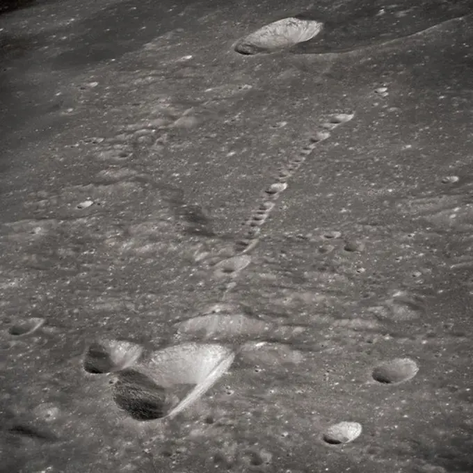
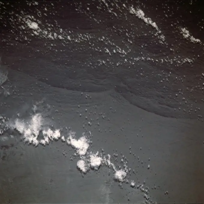
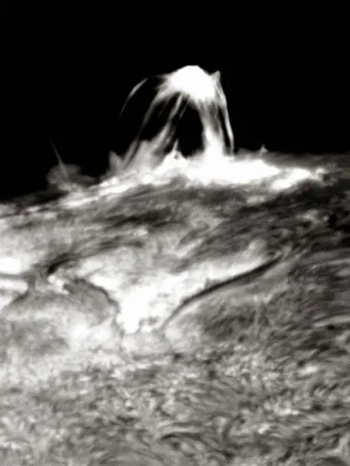
My Boards
View Pictures
  • My Boards
← Science

Lunar and Martian Landscapes

High-resolution images showcasing details of the lunar surface and Martian features, including craters, atmospheric observations, and geological formations.

Opportunity Passes 10-Kilometer Mark
195 assets in this story
6145-44535402
Ultraviolet View Shows Jupiter's Stratosphere
6145-44825255
This image is from an animation that glides along the shoreline of Ontario Lacus, the largest lake on the southern hemisphere of Saturn's moon Titan. The animation is based on overlapping radar images obtained by NASA's Cassini spacecraft.
6145-44658805
Something Old, Something New
6145-44647418
This MOC image shows neighboring networks of gullies in the northwest wall of a south middle-latitude crater west of Hellas Planitia
6176-55294346
Lake Vostok Sat Photo color
6145-50513141
Aerial view of the southwestern shoreline of Hickory Hills Lake and Private Road , Land subdivision, Lakes & ponds. Lunenburg Massachusetts 1950 Aerial Mapping
6145-51949027
Ymer (depicted - name).Ymer (depicted - name)
6145-44657903
NASA's Mars Exploration Rover Spirit recorded this 360-degree vista, dubbed the 'Seminole' panorama, from partway down the south side of 'Husband Hill' in November 2005. 3D glasses are necessary to view this image.
6177-V53838045
1899-61460848
This scanning electron microscope (SEM) image revealed some of the ultrastructural features observed on the surface of a number of Acanthamoeba polyphaga protozoa. Note the amorphous nature of the organisms exterior from which the pseudopodia can extend. These pseudopodia allow the amoeba to move and grasp objects in its environment. CDC/Catherine Armbruster Margaret Williams 2009
6145-44506695
MOC Looking
6145-45262486
During NASA's Cassini mission's final distant encounter with Saturn's giant moon Titan, the spacecraft captured this view of the enigmatic moon's north polar landscape of lakes and seas, which are filled with liquid methane and ethane. Punga Mare (240 miles, or 390 kilometers, across) is seen just above the center of the mosaic, with Ligeia Mare (300 miles, or 500 kilometers, wide) below center and vast Kraken Mare stretching off 730 miles (1,200 kilometers) to the left of the mosaic. Titan's numerous smaller lakes can be seen around the seas and scattered around the right side of the mosaic. Among the ongoing mysteries about Titan is how these lakes are formed. Another mystery at Titan has been the weather. With its dense atmosphere, Titan has a methane cycle much like Earth's water cycle of evaporation, cloud formation, rainfall, surface runoff into rivers, and collection in lakes and seas. During Titan's southern summer, Cassini observed cloud activity over the south pole (see PIA06
6145-52278274
Aerial view of a part of the area affected during the flood disaster of 1953. Note: The description of this photo is not yet complete and will be supplemented on the basis of the data available at a later stage. However, of many photos of the flood disaster 1953, the location is unknown.
6145-44624057
Spirit's View of 'Columbia Hills' (vertical)
6145-52298779
Aerial view of a part of the area affected during the flood disaster of 1953. Note: The description of this photo is not yet complete and will be supplemented on the basis of the data available at a later stage. However, of many photos of the flood disaster 1953, the location is unknown.
6145-45078591
This set of global, color mosaics of Saturn's moon Enceladus was produced from images taken by NASA's Cassini spacecraft during its first ten years exploring the Saturn system.
6145-44493540
The Geodesy Campaign
6145-50605599
A88320 U12P MISSION CYBER LOS INTERIOR WALL DAMAGE MIKE BURKE (PROJECT ENGINEER) JAN 28 88 EG&G/NTS PHOTO LAB Publication Date: 1/28/1988  DAMAGE ASSESSMENTS; EDGERTON, GERMESHAUSEN & GRIER; EG&G; EQUIPMENT; EQUIPMENT & INSTRUMENTS; INSTRUMENTS & EQUIPMENT; LOS INTERIOR WALL DAMAGE; MISSION CYBER; NEVADA; NEVADA TEST SITE; NTS; NUCLEAR ENERGY TECHNOLOGY; NUCLEAR TESTING; NUCLEAR TESTS; TEST SITES; UGT; UNDERGROUND; UNDERGROUND TESTING; U12P MISSION CYBER  historical images. 1972 - 2012. Department of Energy. National Nuclear Security Administration. Photographs Related to Nuclear Weapons Testing at the Nevada Test Site.
6145-44609122
Wind Streak and Crater
6145-44987817
The image is an excerpt from an observation from NASA's Mars Reconnaissance Orbiter showing a meteorite impact that excavated this crater on Mars exposed bright ice that had been hidden just beneath the surface at this location.
1525-28067265
Eruption of the Santorini crater on March 23, 1866, observed with a long view, vintage engraved illustration. From the Universe and Humanity, 1910.
6145-44953546
These images from NASA's Cassini spacecraft show one of the large seas and a bounty of smaller lakes on Saturn's moon Titan.
6145-44549210
Venus - Multiple-Floored, Irregular Impact Crater
6145-45072230
This image, taken NASA's Mars Reconnaissance Orbiter, shows distinct bands of alternating tone and brightness within the 'Murray Formation' on Mars. Outcrops like this are common throughout the formation.
6145-44555349
Diverse Rock Named Squash
4197-65961628
UFO, alien and viewfinder on a camera display to record a flying saucer in the sky over area 51. Camcorder, sighting and conspiracy with a spaceship on a recording device screen outdoor in nature
6145-44607790
Opportunity and Its Mother Ship
6145-52301663
Aerial view of a part of the area affected during the flood disaster of 1953. Note: The description of this photo is not yet complete and will be supplemented on the basis of the data available at a later stage. However, of many photos of the flood disaster 1953, the location is unknown.
6145-44790893
This image shows an updated map of Saturn's icy moon Enceladus, generated by NASA's Cassini imaging team. The map incorporates new images taken in 2008, with better image processing techniques.
6145-52296002
Aerial view of a part of the area affected during the flood disaster of 1953. Note: The description of this photo is not yet complete and will be supplemented on the basis of the data available at a later stage. However, of many photos of the flood disaster 1953, the location is unknown.
6145-44610169
Windows to Meridiani's Water-Soaked Past
6145-44634825
Dust Devils at Gusev, Sol 525
6145-54496564
Low light level, fish-eye lens view, showing A US Air Force (USAF) B-2 Spirit aircraft approaching a USAF KC-10 Extender aircraft during a nighttime refueling mission. Country: Unknown
6145-44625087
Zooming In On Titan
6145-44817844
NASA's Terra spacecraft captured this image of the growing oil spill in the Gulf of Mexico on May 1, 2010. On April 20, 2010, an explosion destroyed the Deepwater Horizon oil platform operating offshore in the Gulf of Mexico.
6145-52296612
Aerial view of a part of the area affected during the flood disaster of 1953. Note: The description of this photo is not yet complete and will be supplemented on the basis of the data available at a later stage. However, of many photos of the flood disaster 1953, the location is unknown.
6145-44627995
Opportunity's View on Sol 347(Vertical)
6145-44620443
Making Tracks on Mars (vertical)
1848-49323653
Chocolate Truffle Falling in Powdered Chocolate
6145-45266909
The rock in the center of this image was tossed about 3 feet (1 meter) by NASA's InSight spacecraft as it touched down on Mars on November 26, 2018. The rock was later nicknamed Rolling Stones Rock in honor of The Rolling Stones. A little larger than a golf ball, the rock is about 2.2 inches (5.5 centimeters) in diameter and 1 inch (2.4 centimeters) in height. A series of 10 or so divots marks the rock's course after being set in motion by the landing. It's the farthest NASA has seen a rock roll after landing a spacecraft on another planet. Though fitting, Rolling Stones Rock is not an official designation by the International Astronomical Union, which is responsible to approving the names given to geographical and geological features on other planets. This image, which has been cropped, was taken by the Instrument Deployment Camera (IDC) on InSight's robotic arm. The uncropped image is provided as well.
6145-44716514
S70-41982 (June 1970) --- Sequence photo from 16mm motion picture film of test at National Aeronautics and Space Administration's Langley Research Center which seeks to determine mechanism by which Apollo 13 panel was separated from the Service Module. Test used a 1/2 scale model with a honeycomb sandwich panel and was conducted in a vacuum. (First of three photographs in sequence).
6145-44628529
Opportunity Traverse Map, Sol 383
4389-1137
Avalanches on North Polar Scarps Caught by Mars Reconnaissance Orbiter
6145-45299291
One of two wind sensors springs out of the mast on NASA's Perseverance Mars rover. These sensors are part of the Mars Environmental Dynamics Analyzer (MEDA), the rover's set of weather instrumentation. MEDA was provided to NASA by the Centro de Astrobiología (CAB) at the Instituto Nacional de Técnica Aeroespacial in Madrid, Spain. A key objective for Perseverance's mission on Mars is astrobiology, including the search for signs of ancient microbial life. The rover will characterize the planet's geology and past climate, pave the way for human exploration of the Red Planet, and be the first mission to collect and cache Martian rock and regolith (broken rock and dust). Subsequent missions, currently under consideration by NASA in cooperation with ESA (the European Space Agency), would send spacecraft to Mars to collect these cached samples from the surface and return them to Earth for in-depth analysis. The Mars 2020 mission is part of a larger program that includes missions to the Moon
6145-44615194
Alcoves in a Xanthe Crater
6145-54031595
Hawaii - Kilauea Volcano, Aerial Photograph.
6177-V53847928
6145-44899802
This is the first image taken by NASA's Curiosity rover, which landed on Mars the evening of Aug. 5 PDT (morning of Aug. 6 EDT). It was taken through a fisheye wide-angle lens on one of the rover's rear right Hazard-Avoidance cameras.
6145-44514274
Light-toned Layered Outcrops in Valles Marineris Walls
4220-20400380
Illustration showing the route taken by Captain Scott's sledge party to climb the Beardmore Glacier, Antarctica, during the British Antarctic Expedition of 1910-12.     Date: 1912
6145-44624846
The highest point visible in this panoramic anaglyph from on NASA's Mars Exploration Rover Spirit is 'Husband Hill,' named for space shuttle Columbia Commander Rick Husband. 3D glasses are necessary to view this image.
4239-57496742
Cloudscape Aerial View. 3D rendering
4389-329
Apollo 14 - A Strange String of Moon Craters
1899-18984900
(24 Nov.-1 Dec. 1991) --- This photograph, captured from the Earth-orbiting Space Shuttle Atlantis, shows sunglint pattern in the western tropical Indian Ocean..
6145-44505346
MGS MOC Coverage of Mars Polar Lander Region
6145-52301567
Aerial view of a part of the area affected during the flood disaster of 1953. Note: The description of this photo is not yet complete and will be supplemented on the basis of the data available at a later stage. However, of many photos of the flood disaster 1953, the location is unknown.
6145-44967928
Do you see what I see This image captured by NASA's 2001 Mars Odyssey spacecraft shows polar dunes looking like T-rex, complete with his little arm.
4389-1243
Solar Flare
6177-V54019305
6145-44841546
This image from NASA's Cassini spacecraft shows the location of an area known as Sotra Facula on Saturn's moon Titan. Scientists believe the Sotra Facula region makes the best case for a cryovolcanic, or ice volcano, region on Titan.
6145-44576994
NASA's Terra satellite shows the shape and size of cellular patterns within marine stratocumulus cloud layers can change dramatically with the prevailing meteorological conditions.
6177-V53856262
6145-44712915
This view from NASA's Phoenix Mars Lander shows a portion of the trench informally named 'Snow White,' 3D glasses are necessary to view this image.
6145-44619625
Hilly Surroundings (vertical)
6145-44550009
The Collector Head Of Viking Lander 1's Surface Sampler
6177-V53617653
6177-V53850910
6145-52277341
Water shorts disaster 1953. Aerial photo from the left the Dintelpolder, on the right the cage and karolinapolder and an overview of the venture affected by the disaster.
1457R-917
Satellite view of a typhoon, Typhoon Yuri
1746-19671193
This color image from NASA's Curiosity rover looks south of the rover's landing site on Mars towards Mount Sharp.
6145-45264078
NASA's Multi-angle Imaging SpectroRadiometer (MISR) passed over Hurricane Florence as it approached the eastern coast of the United States on Thursday, September 13, 2018. At the time the image was acquired, Florence was a large Category 2 storm and coastal areas were already being hit with tropical-storm-force winds. The MISR instrument, flying onboard NASA's Terra satellite, carries nine cameras that observe Earth at different angles. It takes about seven minutes for all the cameras to observe the same location. This stereo anaglyph shows a 3D view of Florence. You will need red-blue 3D glasses, with the red lens placed over the left eye, to view the effect. The anaglyph shows the high clouds associated with strong thunderstorms in the eyewall of hurricane and individual strong thunderstorms in the outer rain bands. These smaller storms can sometimes spawn tornadoes.
6145-44554450
The two hills in the distance in this stereo image from NASA's Mars Pathfinder have been dubbed the 'Twin Peaks.' 3D glasses are necessary to identify surface detail.
6145-45239756
MSC 040A Space Shuttle 11ft. W.T. Test of Acoustic Environment (Configuration #5)
4368-167
Recovery of Mercury Atlas 9 capsule, seen from a helicopter.  Gordon Cooper was launched into space on May 15, 1963 aboard the Mercury-Atlas 9 (Faith 7) spacecraft, the last Mercury mission. He orbited the Earth 22 times and logged more time in space than all five previous Mercury astronauts combined  34 hours, 19 minutes and 49 seconds, traveling 546,167 miles (878,971 km) at 17,547 mph (28,239 km/h), pulling a maximum of 7.6 g's.
6145-44606773
This image shows a test rover in a near-final turned position on the lander in NASA's Jet Propulsion Laboratory's In-Situ Instruments Laboratory, or 'testbed.'
6145-52890206
Glass diapositive by Leopold Freund from 1898 showing congenital hip pattern, depicting skeletal structure and hip joints for medical study.
6145-45247015
TRAILBLAZER INLET TEST IN 1X1
6145-44764401
Opportunity Photographs Her Underbelly
6145-52889945
A photograph by Arthur von Hübl from 1916 showing an accommodation setup using a long-distance camera and a scissor removal device, preserved as a glass diapositive.
1525-26687025
Thermal image of apartment building
6145-43794765
Well at Sauer Place, Belchertown, Mass., close-up view showing location of cracks in concrete seal and underground water channel in back of casing at elevation 618.8, Sep. 7, 1944 , waterworks, reservoirs water distribution structures, engineering, water wells
6145-45259932
In several cities in the Middle East, city lights brighten during the Muslim holy month of Ramadan, as seen using a new analysis of daily data from the NASA-NOAA Suomi NPP satellite. Dark green pixels are areas where the lights are 50 percent brighter, or more, during Ramadan.
6145-54410335
Project 26 - Operation Dominic (Johnston Island/Christmas Island/Maui, Hawaii) Test Activities. Debris that fell on Johnston Island from the first STARFISH launch (19 June 62). Photographs of Atmospheric Nuclear Testing at Pacific Island and Nevada Test Sites.
6145-50598930
A790264 U12G HYDRA FRAC MINEBACK BILL VOLLENDORF (Project Engineer) APR 5 79EG&G/NTS PHOTO LAB Publication Date: 4/5/1979  EDGERTON, GERMESHAUSEN & GRIER; EG&G; G-TUNNEL; HYDRA FRAC; HYDRA FRAC MINEBACK; HYDRAULIC FRACTURE; MARKED; MARKINGS; MINEBACK; MINES, UNDERGROUND; NEVADA; NEVADA TEST SITE; NTS; NUCLEAR ENERGY TECHNOLOGY; PICKAXES; TAPE MEASURES; TEST SITES; TUNNELS; TUNNELS BY USAGE; UGT; UNDERGROUND TESTING; VOLLENDORF, BILL  historical images. 1972 - 2012. Department of Energy. National Nuclear Security Administration. Photographs Related to Nuclear Weapons Testing at the Nevada Test Site.
5513-48210704
Atomic & Hydrogen Bomb possible attacks. July 04, 1950.
6145-44705975
This animation zooms in on the area on Mars where NASA's Phoenix Mars Lander will touchdown on May 25, 2008. The image was taken by the High Resolution Imaging Science Experiment (HiRISE) camera on NASA's Mars Reconnaissance Orbiter.
6145-44936427
This frame from an animation of NASA's Curiosity rover shows the complicated suite of operations involved in conducting the rover's first rock sample drilling on Mars and transferring the sample to the rover's scoop for inspection.
1848-69292480
Man in the process of walking. Image from thermal imager device. Modified unrecognizable people. Medium infrared spectrum
6145-44651615
KENNEDY SPACE CENTER, FLA. -  Following the launch of Space Shuttle Discovery on mission STS-121 on July 4, images from onboard cameras capture very small pieces of external tank foam that were liberated during the ascent phase. Engineers are continuing to conduct analysis of these and other photos.
6145-45252852
ISS008-E-18534 (March 2004) --- A close-up view, taken by an Expedition 8 crewmember, shows the Russian BIO-5 Rasteniya-2/Lada-2 (Plants-2) plant growth experiment located in the Zvezda Service Module on the International Space Station (ISS).
4413-214515
Radiography mouse CDTA Orleans France
1899-21290339
Satellite view showing Agriculture in the Murzuq Desert, Libya in 1987, 2000 and 2005. This before and after image shows circular agricultural plots. The Murzuq Desert is an erg desert, part of the Sahara desert, in southwestern Libya.
6145-44648483
NASA's CloudSat first image, of a warm front storm over the Norwegian Sea, was obtained on May 20, 2006.
4128-V58559325
4197-65961649
UFO, spaceship and alien in nature or earth with breaking news or broadcast background and television recording. Spacecraft, sky and research or surveillance with warning sign, scifi and tv broadcast
PREVIOUS
of 2
NEXT
2401 S. Ervay, Suite 206
Dallas, Texas 75215
United States
Get Started
Free ResearchMy BoardsMy Cart
For Creators
How To License Your ContentContributor PortalFrame of Mind
Resources
API accessPricing
Contact
+1 866 236 0087help@viewpictures.co.uk Contact form
©2026 View Pictures. All Rights Reserved. -A
This site is protected by reCAPTCHA and Google Privacy Policy and Terms of Service apply.